Preview
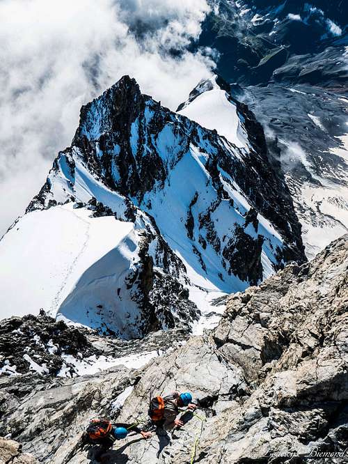
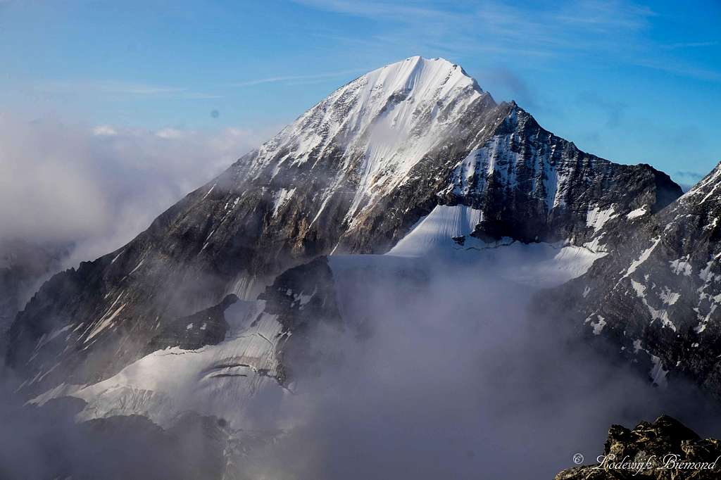
![Climbing on the Ortler Hintergrat]() Climbing the Ortler Hintergrat
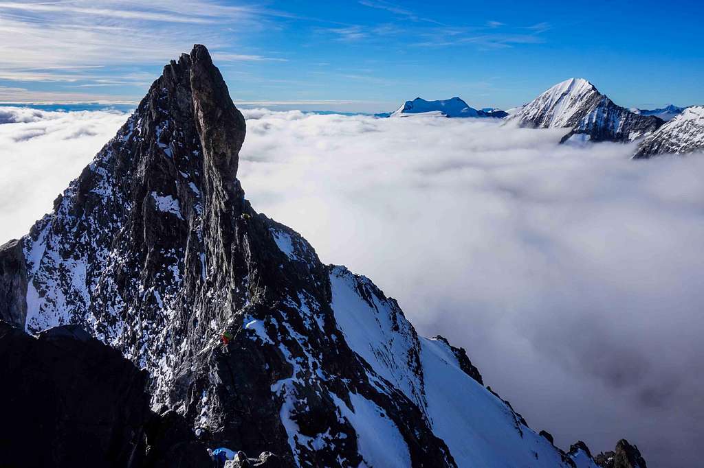
Climbing the Ortler Hintergrat![Climbers on the Signalkopf]() Climbers on the Signalkopf
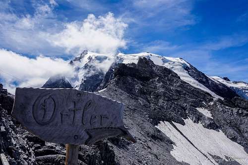
Climbers on the Signalkopf “King Ortler”… The highest mountain in (both Austrian and Italian) Tyrol is often referred to as the King. And as we would experience later, it truly is a king. The Ortler is a massive mountain and dwarfs all other mountains surrounding it. As Maarten and me were making plans for the summer it didn’t take long before our eye fell on the Ortler region. I wanted to go there already for quite some years, but until now it never came to it. The Hintergrat route was already on my mind for some years as well, so I showed Maarten some photos from SP and from my guidebook. Just looking at the dazzling photos we soon decided: This is it! Graded AD and with climbing up to grade IV (UIAA-scale) this route is quite challenging but awesome at the same time..We couldn’t wait to go the alps!
A traverse of King Ortler: Hintergrat & Normal route
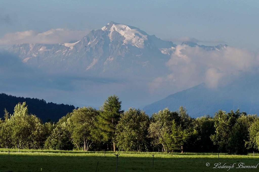
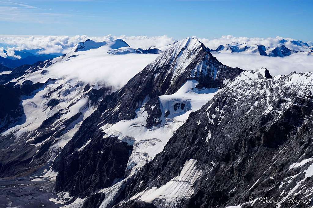
![Ortler (12812 ft / 3905 m )]() Our first view on Ortler from the Reschensee
Our first view on Ortler from the Reschensee
| ![The mighty Ortler]() And our second view from Monte Scorluzzo
And our second view from Monte Scorluzzo
|
After driving all night from the Netherlands we arrived at the Reschensee lake early in the morning and made a quick stop at the "drowned church" in the lake. Here we had our first view of our ultimate goal for the week: the mighty Ortler. (see photo above). After arriving in Trafoi am Ortler an hour later we first climbed Monte Scorluzzo (3089m) and Roetlspitz (3024m) to acclimatize a bit on our first day. There we had our second view on Ortler (photo above, right). After that we went to the Düsseldorfer Hut and climbed both Hoher Angelus (3527m) and Vertainspitze (3545m) (also see
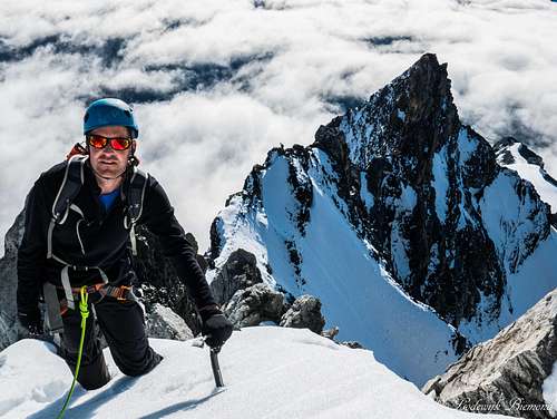
this Trip Report about that climb). We were now fully acclimatized and ready for the Hintergrat on Ortler (3905m). The plan was to climb the Hintergrat up to the summit and descend down along the normal route, creating a full traverse of the Ortler, the true king (and highest mountain) of Tirol/Tyrol. Since we didn’t climb any routes in the AD gradation yet, we decided to take a guide with us: Veit Bertagnolli, a local guide from South Tirol.
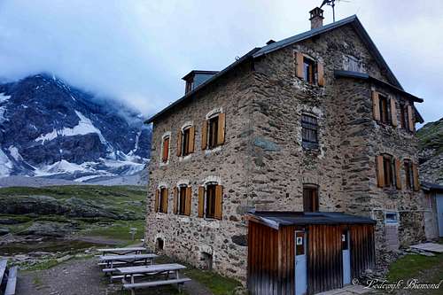
![the Hintergrat Hut (2661m)]() the Hintergrat Hut (2661m)
the Hintergrat Hut (2661m)
| ![Vertainspitze and Sulden]() Vertainspitze and Sulden from the Hut
Vertainspitze and Sulden from the Hut
|
![Hintergrat from Hintergrat Hut]() Hintergrat from the Hintergrat Hut
Hintergrat from the Hintergrat Hut | ![Konigspitze / Gran Zebru (3851m)]() Koenigspitze / Gran Zebru (3851m)
Koenigspitze / Gran Zebru (3851m)
|
On the first day late in the afternoon we met Veit in Sulden. He was a very nice guy, about the same age as us, and he spoke English fluently, which was great . We left Sulden and headed up to the Hintergrathuette, our destination for the day. The weather was not good, a thick and dark cloud cover was present all day. Fortunately, it was still dry. In about 2 hours we hiked towards the Hut. Wewere hiking fast and getting to know each other while hiking up. It turned out Veit had a Master’s degree in Law and works at an office during the winter months. In the summer season he is a fulltime mountain guide. The reason for it; following hisdream and passion: climbing in the mountains. Awesome!
In the Hintergrathuette we had a nice meal, a large plate full of baked potatoes witha cover of baked eggs and molten cheese. Enough calories to climb on to say the least. After dinner we went outside to look at the Hintergrat, the long ridge was looming above us and somewhere high up it disappeared in the thick cloud cover. It was also getting darker and the sight of this immense and steep ridge disappearing in the clouds gave me the shivers and a feeling of excitement at the same time. “Tomorrow we are going to climb this”, I thought. We went to bed early, since we had to get up at 3AM already. In the hut I slept really well and at 3AM, when I was awakened by my alarm, I was so excited, I couldn’t wait to go. After a quick breakfast consisting of some bread, cornflakes and coffee, we left the Hut at about 3.30AM.
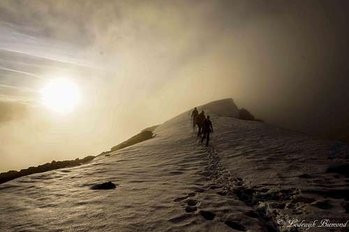
![Climbers approaching the 1st snowfield]() Climbers approaching the 1st snowfield
Climbers approaching the 1st snowfield
| ![Sunrise on the Hintergrat]() Sunrise on the 1st snowfield
Sunrise on the 1st snowfield
|
![On the 1st snowfield]() Ascending the 1st snowfield
Ascending the 1st snowfield | ![Climbers entering the 1st snowfield]() Climbers entering the 1st snowfield
Climbers entering the 1st snowfield |
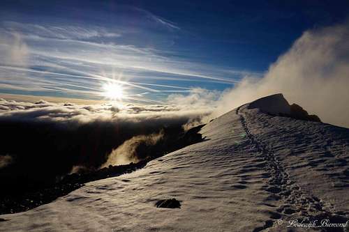
The first 1 to 2 hours we didn’t see much. It was completely dark as we headed up the mountain along a large moraine field. Steep hiking on loose scree/rocks. We were happy Veit knows every step on this mountain and he guided us up perfectly. Besides the darkness it was also cloudy, we couldn’t see more than 10 meters in front of us. The weather was supposed to be fine today, so we just hoped it would get better along the way. After the moraine field we entered the lower part of the Hintergrat. The real climbing started directly, mostly grade I and II along solid rock. It was still cloudy and dark, so we climbed fast without speaking too much and found our way up the first part of the Hintergrat ridge. At about 5.30 to 6AM it started to get light. We could now see where we were going and soon the continuous climbing stopped as we entered the so-called 1st snowfield: A large, not to steep snowfield and place for a quick rest. After drinking some water and having something to eat we noticed the weather was improving, the thick cloud layer was disappearing and the sun started to shine through. Maarten and me were stoked! We could see the mountains around us and were now able to enjoy the awesome views. Also the warmth that came from the sun, even at this hour, was nice. We soon decided to take off again.
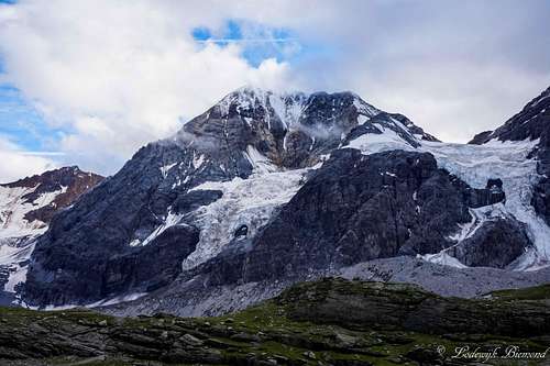
![Konigspitze / Gran Zebru (3851m)]() Koenigspitze / Gran Zebru (3851m)
Koenigspitze / Gran Zebru (3851m)
| ![Cevedale, Koenigspitze/ Gran Zebru from Ortler]() Cevedale & Koenigspitze/ Gran Zebru
Cevedale & Koenigspitze/ Gran Zebru
|
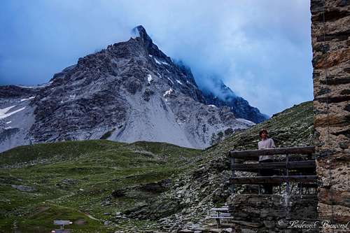
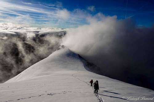
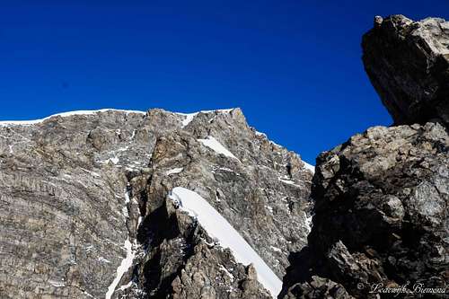
After crossing the snowfield the technical part of the route began. The first part after the snowfield was first, maybe second grade climbing along solid rock. After some time the Signalkopf came into sight, a sharp peak along the Hintergrat ridge. We passed underneath the tower along a small and airy passage. While carefully climbing, I tried to take in the fantastic views at the same time. Especially, Koenigspitze / GranZebru (3854m) looked massive, especially with the cloud carpet covering the lower part of this fine mountain. I already thought: Another time I have to climb Koenigspitze for sure…But for now I had to focus on the route ahead of us.
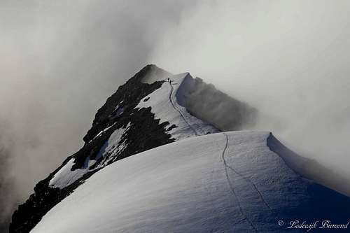
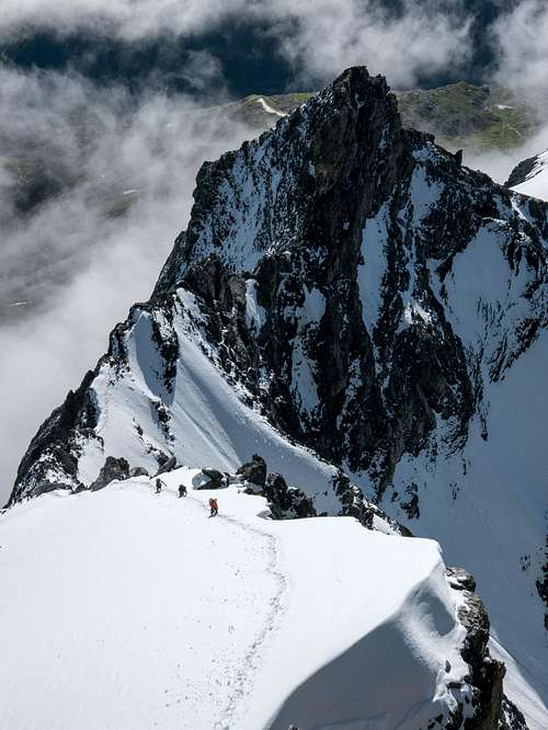
After climbing underneath the Signalkopf with a narrow grade-III passage we arrived at the first crux of the route. After passing underneath the Signalkopf we were back on the ridge itself and climbed up a grade IV-section followed by a grade III passage. The airy and difficult climbing was just pure fun and without too much problems we covered the first crux of the route and were now standing in front of the 2nd snowfield. Unlike the first one, this snowfield is quite steep (I would say 40 to 45 degrees). The view towards Signalkopf was amazing. From this higher angle it looked like a sharp standalone summit and I quickly got my camera and took this shot:
![Climbers on the Signalkopf]() Climbers on the Signalkopf
Climbers on the Signalkopf
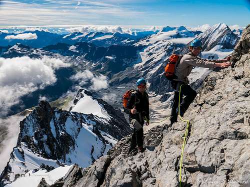
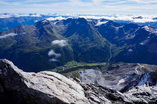
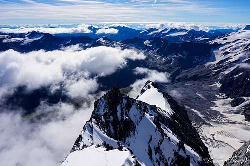
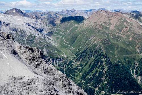
We climbed up using our ice axe and forcing steps into the icy snow. After covering this 2nd snowfield we arrived once again on the rocks of the Hintergrat ridge. The sun was getting higher in the sky and the views were phenomenal. The cloud carpet was slowly disappearing, offering even better views in all directions. We climbed up the ridge with multiple passages in the third and one in the fourth grade (2nd crux).The climbing was fine on the dry solid rock and we continued along the ridge. After some time we could spot the summit of Ortler, together with its fine summit cross reflecting in the sun, it wasn’t far anymore. Maarten and me were stoked and some 30 minutes later we were standing on top of Ortler: “BergHeil!” we said to each other and to Veit, and we celebrated our successful climb with a snickers bar and some water. We sat down just below the summit and looked down the Hintergrat ridge and way down also on the Hintergrat Hut, our starting point that morning. We could also spot Sulden down in the valley, as well as the Reschensee, the Stelvio passroad and many peaks including Weisskugel, Wildspitze and Vertainspitze.
![Ortler & Upper Hintergrat]() Ortler & Upper Hintergrat
Ortler & Upper Hintergrat
| ![Ortler Summit ridge]() Ortler's ridge from high on the Hintergrat
Ortler's ridge from high on the Hintergrat
|
![Climbing on the Ortler Hintergrat]() Climbing on the upper Ortler Hintergrat
Climbing on the upper Ortler Hintergrat | ![Climbers on the 2nd snowfield]() Climbers on the 2nd snowfield
Climbers on the 2nd snowfield |
![Me on the 2nd snowfield of the Hintergrat]() Me on the 2nd snowfield of the Hintergrat
Me on the 2nd snowfield of the Hintergrat | ![Climbing the upper Ortler hintergrat]() ME and Maarten on the upper Ortler Hintergrat
ME and Maarten on the upper Ortler Hintergrat |
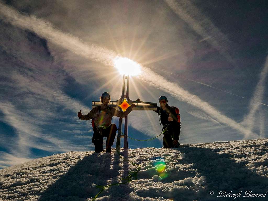
![Ortlers new Summit Cross]() On the summit with the new Summit Cross
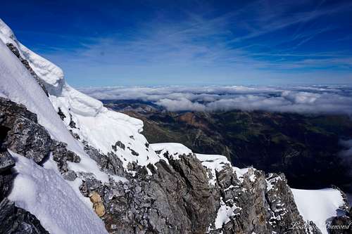
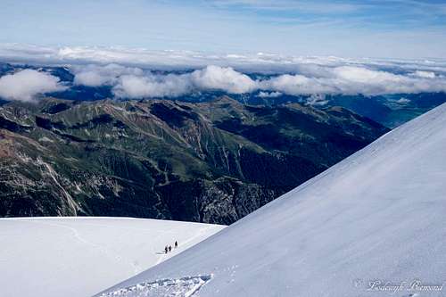
On the summit with the new Summit CrossThere were quite some people with us on the summit, I would say 90% ascended along the normal route and the rest along the Hintergrat. After gazing around from the summit for one last time we decided to leave and we started our descent along the normal route. Because of the flat looking summit block the normal route may appear an easy one from above, but it really is not. It involves some steep snow and climbing up to grade III UIAA. The normal route is therefore harder compared to other major mountains in the Eastern Alps, like Wildspitze and Grossglockner. The first part of our descent was easy. A mere glacier walk along the low-angle slope of the “Ortlerplatt”. The sun was high in the sky and while walking on the Ortlerplatt I was counting the curves ofthe famous Stelvio passway, one of the highest paved passroads in the Alps. But soon the Ortlerplatt and the route along it steepened (40 degree slope): Time to focus again! We downclimbed and passed the Lombardi Bivak (3316m) and entered the Barenloch glacier. After that we reached the “Scharte” were we entered the rocks again. It was now time to take of our crampons and climb further along the rocky ridge down to the Payer Hut.
![Summit view towards Sulden and Vertainspitze]() Summit view towards Sulden and Vertainspitze
Summit view towards Sulden and Vertainspitze | ![Hintergrat & Signalkopf]() Hintergrat & Signalkopf from the summit
Hintergrat & Signalkopf from the summit |
![A group on the upper part of the Normal Route]() A group on the upper part of the Normal Route
A group on the upper part of the Normal Route
| ![Ortler from Ortlerplatt]() Ortler from Ortlerplatt
Ortler from Ortlerplatt
|
After some fun and easy climbing (Grade I to II) we arrived on top of a small plateau we had to climb down. This part is graded III+ and the crux of the normal route. Like we already expected: Stau! (= Traffic). There were multiple groups trying to climb down the steep ridge. A local guide with 2 clients was shouting to them what to do, but instead of listening they just stood there, completely frozen and scared to come down. They were clearly not up for the job, but the screaming of the guide was kind of counter-productive to say the least. Besides them there was a father together with his son. The boy was about 12 years old I guess. The father tried to get his son down the tricky passage by letting him “abseil” while holding the rope. The rope wasn’t fixed correctly and to be honest I don’t know what the father was doing, but it was far from safe . We were relieved to see his son got down safely. “What a stupid way to get yourself and others in danger”, Veit said. We couldn’t agree more, downclimbed this part as well and left the circus behind. I’ve seen this multiple times now: People on serious climbing routes getting themselves (and others) in danger because they are not up for the job. After the crux of the route the climbing continued down the ridge. The climbing is really fun and easy here (grade I) and part of it is a secured with steel cables and chains.
![The endless curves of the Stelvio Pass]() The endless curves of the Stelvio Pass
The endless curves of the Stelvio Pass
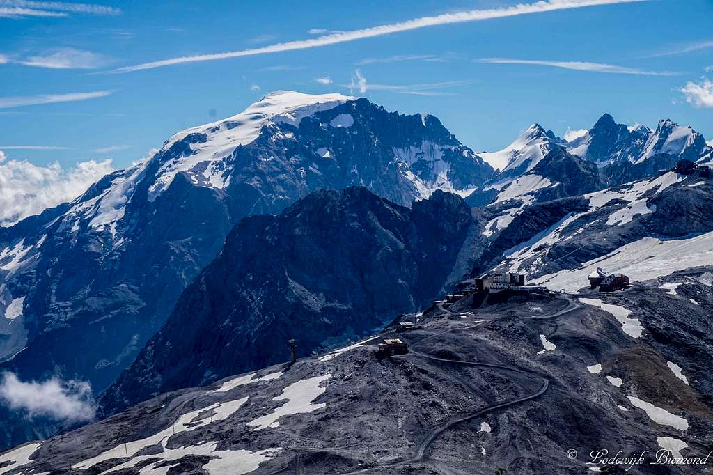
| ![Ortler as seen from Payer Hut (3029m)]() Ortler as seen from the Payer Hut (3029m)
Ortler as seen from the Payer Hut (3029m)
|
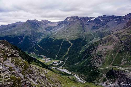
We enjoyed the climbing part and soon we arrived at the Payer Hut at just above 3000 meters. We did it, we traversed Ortler! We were really happy since the difficulties were all behind us now. What rested was the long journey back to Sulden. We ate another Snickers bar, drank a bottle of water, refilled it and went down again. The last part is a popular hiking trail and since the weather was great, there were many hikers on it. Many of them walked up with the Payer Hut as destination. We didn’t have time to slowly walk down though. Our plan was to drive from Sulden to Pontresina and take the last cablecar up to the Diavolezza Hut at 3000m in order to climb Piz Bernina the next day. To catch the last gondola we had to hurry down and so we did. We still had to overcome some 1100 vertical meters so we practically ran down the mountain.
Aftera tiring descent we arrived back in Sulden and immediately drove off. (When I think of it now, it was crazy, we should have taken a day extra, but it would also have costed us a day extra of guiding costs…) I think we drove for some 2,5 hours before reaching Diavolezza. It was a beautiful ride, but we couldn’t enjoy much of it because of all the hurrying. But in the end we were happy we made it and catched the last cablecar up the mountain. More about this part of the trip in another, yet to write report.. In the Diavolezza hut we celebrated our successful climb with a good meal and a large beer, we had a fantastic climb, one of the best so far!


Comments
Post a Comment