No Go Kawich
One of my favourite aspects of my vacations out west is the prospect of finding a nice little mom ‘n pop Mexican restaurant in any old hamlet, no matter how isolated or deserted. For a spoiled Northeasterner such as myself flyover country presents a marked absence of the foods I have been so well acquainted with over the years. I refer not to the fancy stuff (though good Italian pasta is hard to beat, even something simpler as cafeteria baked ziti suffices), but things as simple as a Chicken Parm Sub, or a Steak and Cheese, or a Roast Beef sandwich, staples of any of the ubiquitous sub and pizza shops that line the streets of every little town in New England, are hard to find out west. (Or I just don’t know where to look). And much less any sort of a fancier turkey sandwich, coupled perchance with some pesto mayo, or apple slices or sprinkles of cranberry sauce, on delicious, soft, moist and home-baked focaccia bread (or a generous portion of eggplant parm sandwiched between said focaccia), can be found in the desert towns that sprinkle themselves at arm’s length through the deserts of Nevada.
But for now, the simple pleasures of enchiladas smothered with green sauce accompanied by freshly cooked Spanish rice makes up for the lack of my usual lunch fare. I was enjoying just such a lunch in the small town of Alamo, Nevada, a few hours from Las Vegas. I would be in the Sin City for the commencement of 2011 Bachelor Party #1 by the end of the next day, but before heading down I contemplated the coming prospect of detouring north to climb one last desert peak.
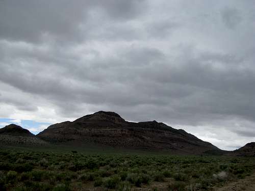
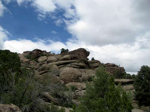
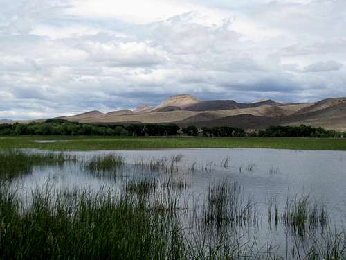
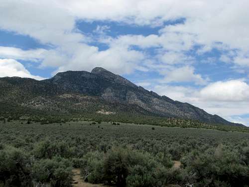
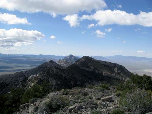
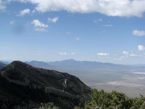
24 hours ago I had set out from Tonopah intending to climb Grapevine Peak. Accidentally hitting up Wahguyhe in cloudy weather instead, I returned to Tonopah and ate a quick dinner at its local Mexican restaurant before retiring for the night. I was up early Thursday morning, driving east under a partly cloudy sky. My target was Kawich Peak, a 9,000’+ 2K Prominence peak south of Saulsbury Summit.
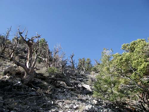
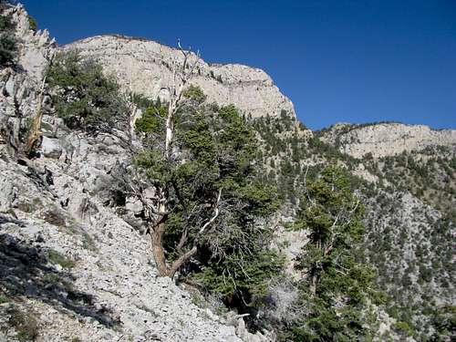
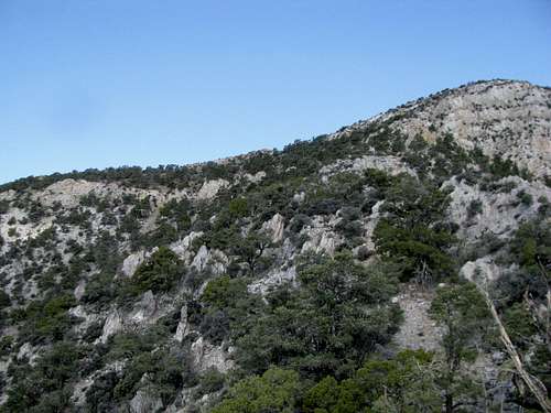
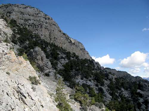
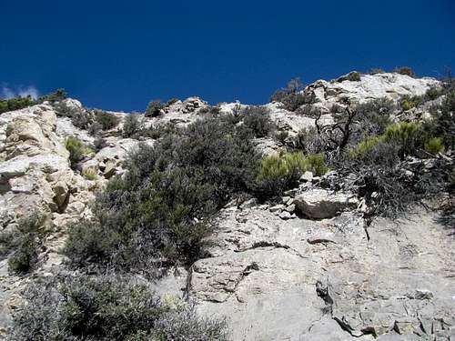
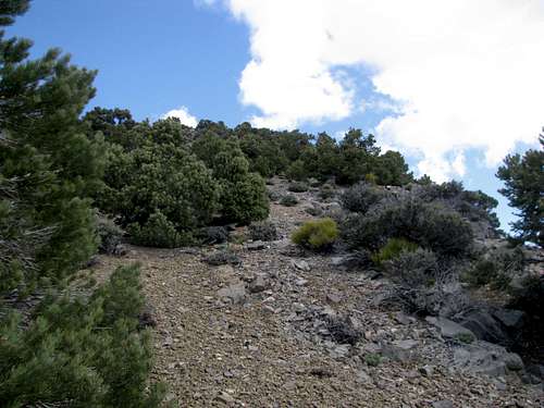
![Kawich Peak, NV]() Kawich Kawich |
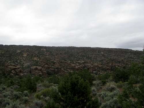
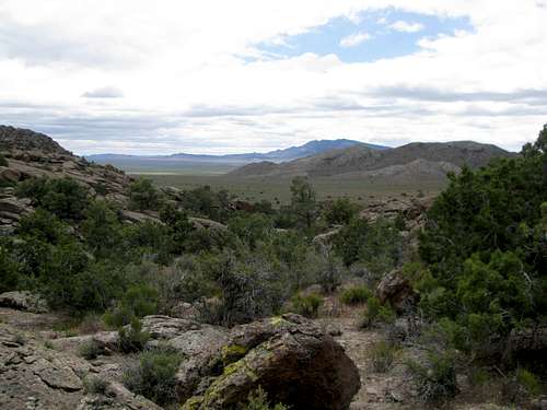
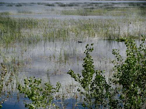
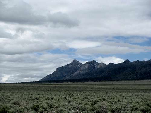
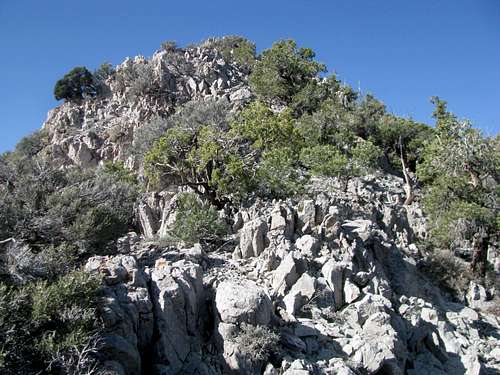
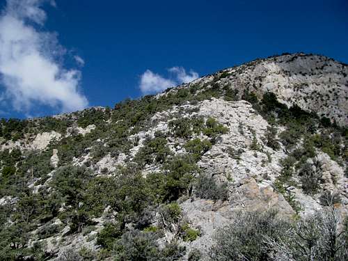
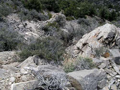
![Boggy Kawich Area]() Boggy area Boggy area |
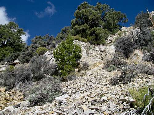
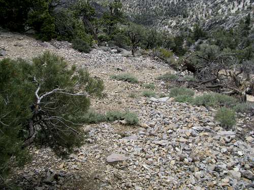
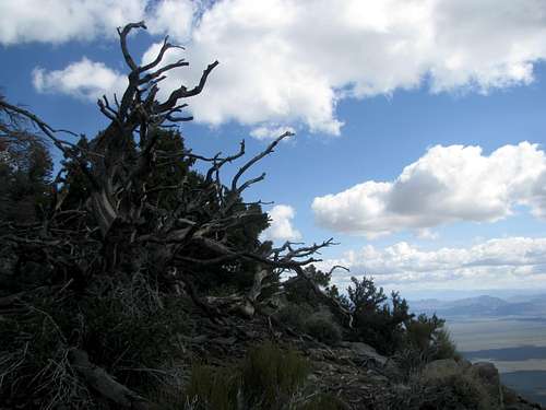
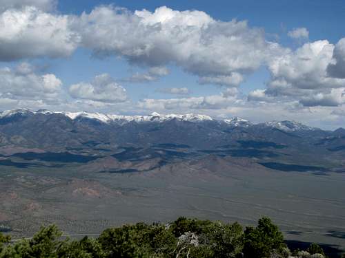
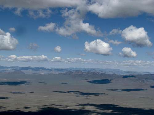
The drive in along the jeep track through Haws Canyon was excruciating. The road is narrow, rocky, brushy, and overgrown with three foot high willows in the best conditions. I lost track of the creek crossings after three or four, but they were not problematic for my rental. More bothersome were the marshy, boggy areas where the road disappears for short stretches. As the road climbed into the higher, evergreen forests of the Kawich foothills a thin sheet of snow for the previous day’s storms blanketed the entire landscape.
The entire area, really, is a wonder of topography. The dry, arid desert surrounding the Kawich Range conceals a drainage trap that somehow seals in the moisture coming down from the higher peaks and, despite the countless small streams flowing outward, prevents much of it from escaping to the larger trap of the Great Basin. The resulting vegetation and very thick brush familiar to the few who have climbed this range were less of a concern for me than the still unthawed layer of moisture surrounding me on all sides as I walked towards the lower flanks of Kawich Peak. The snow did not bother me. Less than an inch thick, coverage looked spotty on the higher slopes, and besides, it would all melt by the end of the day. That, however, was the problem. My rental was parked in a marsh. It had driven through bogs and swamps barely held together by the morning freeze. By the time me and my creaky knees got off the mountain all this virgin meltwater would be streaming through the canyons, mucking up the roads, and worst of all, drudging up the mud. I did not like the prospect of getting my rental stuck in muddy quicksand, miles and miles from any paved road, much less any semblance of civilization, in a wild and rugged landscape that saw probably at most one or two visitors a year (myself included) and that had still yet to escape the violent grasps of a worse than average winter. As I walked my internal risk scale tipped overwhelmingly from one side to the other, and I made a u-turn back to my rental and drove out of Dodge before it could melt on me.
Regrets accompanied me still as I drove through the desert, vowing to return in dryer times. Marooned with no backup plans for the day, I drifted east with vague thoughts of driving up roads leading to Highland or Wilson Peaks near Caliente and Pioche. The skies had turned mostly gray, with occasionally spots of blue. Ahead, a winter storm still continued to blanket the higher, unseen reaches of the Grant and Quinn Canyon Ranges.
As I drove south towards Rachel I saw an unsettling sight. The Reveille Range, not even reaching 9,000 ft in height, were entirely snow covered. This would not have been a problem on a gentler peak, but my destination for the next day, the Worthington Range, seemed far from gentle. With no beta to be found on this peak on the internets or any guidebooks and only a vague Google Earth imagine of a high, cliffed out buttress of a summit, its one saving grace in my mind was that its elevation, along with its slightly more southerly latitude, made it too low to still retain snow, even after the recent storm. But if Reveille, at a similar height and latitude, was still snowed, then what would I find on those possibly treacherous cliffs almost a mile above the surrounding desert?
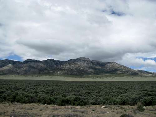
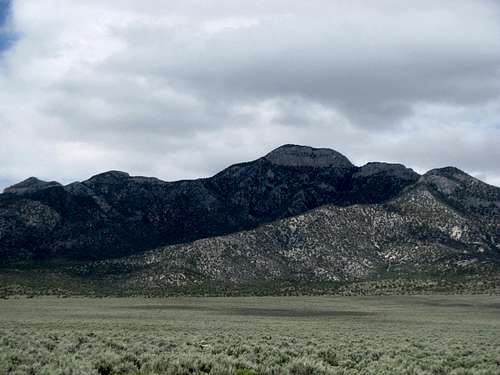
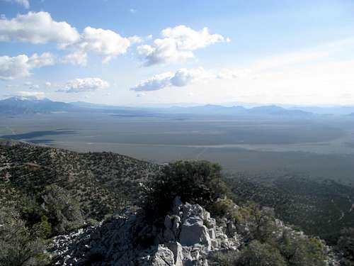
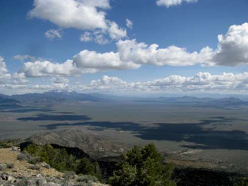
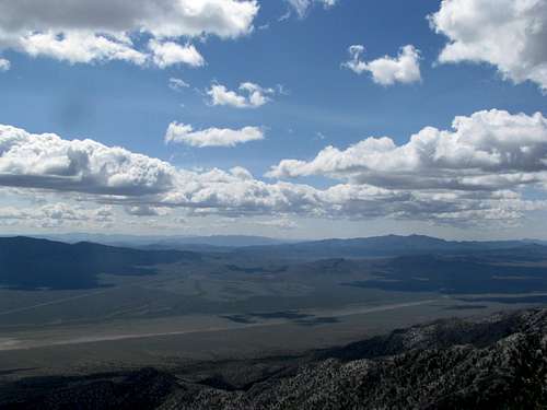
Fortunately I was in the area, and, possibly at the expense of Highland or Wilson, I decided to detour the hour plus up the dirt roads swinging around to the east side of the range where I had planned tomorrow’s attempt. The range looked dry from all directions, but the rocky challenge below the large summit block of Worthington Peak looked formidable. Seeing it in person, however, confirmed for me the possibility of a route I had scouted out on topo maps and Google Earth: ascending the east ridge to meet the main crest south of the summit block and gaining that crest at a point where it avoids the cliffs to its north and south. I took pictures of the range, zooms of my intended route, and a few hours later got myself a room in Alamo. The prospects of another hour plus of driving along with afternoon thunderstorms (only a day after a statewide snow storm) persuaded me to forego the roaded peaks near Pioche. With still a few hours to kill I explored gingerly the Big Rocks Wilderness a few miles north of town and relaxed at the reservoirs near Pahranagat NWR.
After a long week by myself in the desert I found myself trailing bemusedly a group of yuppied up hikers guided by a Fish and Wildlife Service Ranger who was very concerned by my presence and made sure to point out that I should be hiking by myself, and not as part of her group. Still anxious about the next day’s uncertainties, I wanted to tell her that I neither need nor desire to be guided around a lazy, dammed up lake; instead, to ease her mind I trailed behind the group and passed the time taking pictures of nearby peaks such as Mt. Irish, Badger Mountain, and the Sheep Range to the south, where I had ascended Hayford only five days before.
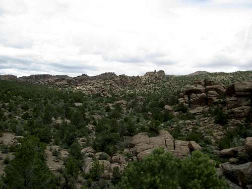
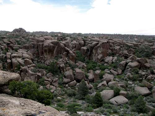
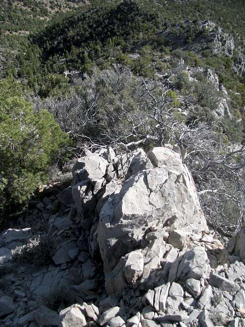
Big Rocks Wilderness:
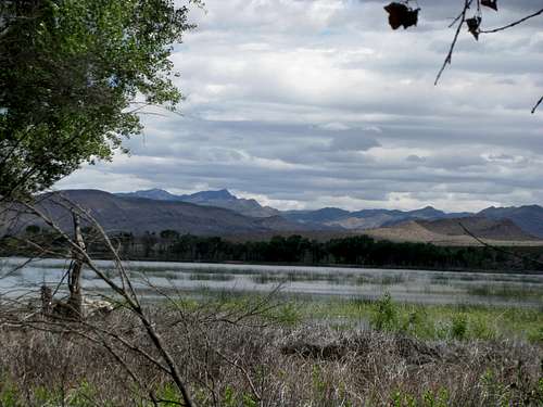
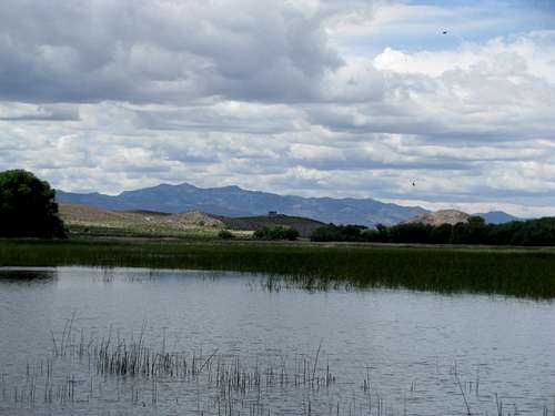
Pahranagat:
Exploring Worthington
Friday morning broke for the warmest and sunniest day in a week. I drove through an empty central Nevada. The massive, off-limits lump of Bald Mountain greeted me as I neared Rachel; beyond it, the secret going ons of Area Fifty-whatever that prevented honest and patriotic list tickers from climbing an almost 4K prominence peak. I retraced the same dirt roads before turning towards the old abandoned structures of the Freiburg Mine on the lower flanks of the range. I found the turnoff left without much difficulty and circumvented south down the range before turning in to the canyon below Worthington Peak. A felled tree blocked my progress, and I packed up and commenced the last hike of my vacation. The skies were bluebird clear, the air was comfortable, the temperature mild and about to get just tad milder for the day. After seeing traces of a drainage paralleling the road and the lower slopes of a steep ridge close on my left I turned off the dirt track and dove head first again into trailless territory.
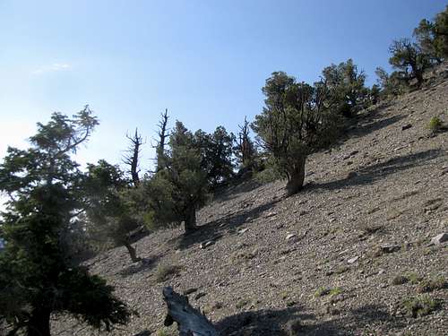
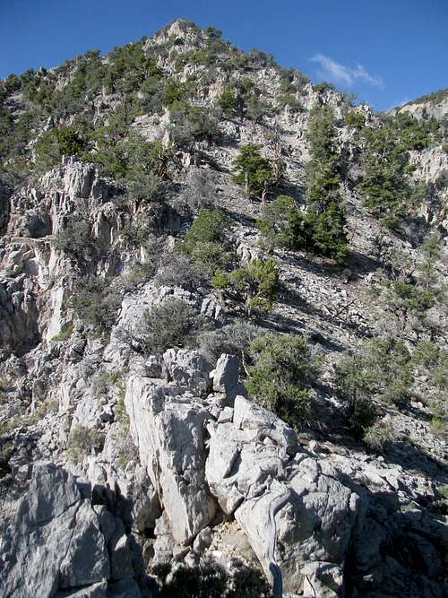
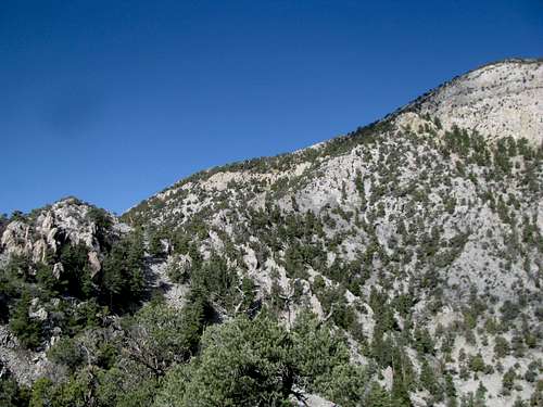
My plan was to ascend a ridge that shot up from the main road/canyon south then west to join the main north-south trending ridge crest of the Worthington Range. Though anticipating trouble further above I found myself scrambling around some rocky outcrops starting around 500 ft above the canyon. The ridge was steep scree right from the start and narrowed as it traversed southwest over several small rocky bumps to a minour saddle below its junction with the main N-S ridge. Oftentimes sharp, brushy plants held tight to block access to the best hand and footholds in the narrowest portions of the ridge, but overall the scrambling was basic and the exposure minimal; still, it never hurts to be cautious in such a remote area, and I took my time knowing that even a mild ankle sprain could have severe consequences. Always tempting me from behind, the spectacular scenery of the vast valleys to the east and snowed capped Quinn Canyon and Troy Peaks to the north served still as a constant reminder of said remoteness.
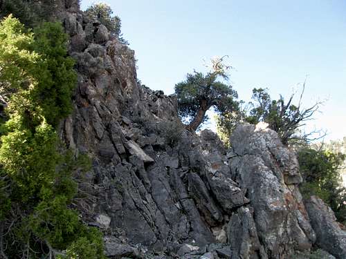
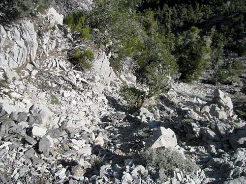
Talus began to overwhelm the surrounding terrain as I approached the last bump before the saddle, and more scrambling was inevitable. Arriving at the saddle near some rocky pinnacles, and looking down here at the seemingly endless talus I discerned a drainage route for the descent.
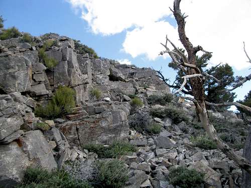
The ridge crest loomed ahead, a rock ringed garden of Eden sitting precociously high above the surrounding desert. A band of blue rocks blocked progress upwards. I contoured left along the talusy slopes and found a brushy opening and climbed through. Afterwards, more contouring left, and then through one or two more bands of rock. The last one before gaining the range crest was orange-ish. Overall the scrambling wasn’t bad, and I felt the rule of thumb was if the rocks looked too steep, one could keep going left to find easier terrain.
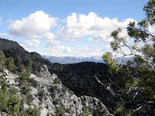
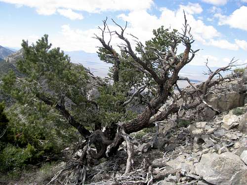
Only a few hundred feet to go now until the summit now. The trees bowed lower, among them the rare bristlecone pine, a unique tree clinging to perhaps an even more unique landscape. The grade of the slope was easy, exhilarating when one factors in now the views east and west as well as south down the spine of the range towards Meeker. The open, almost terraced summit was climatic in every sense. Standing atop with the wide expanses of the desert creating enough separation between distance, higher peaks, including snowy Quinn Canyon and Troy to the north, one feels a sensation aki to standing atop the tip of a pin, in relative terms. And though a week of Great Basin hiking had accustomed me to the usual view atop a narrow, north-south desert range, Worthington’s was something else; looking south towards spectacular, pyramidical, conical Meeker, one gazed upon row after row of precarious, symmetrical, rocky, perfect, nameless peaks. The temperature was almost balmy, with a breeze more comforting than biting, and the skies seemed as bright as the sun itself. Never mind that I still had to explore a new way down, or that a few hours hence would mark the beginning of another wild bachelor party. Now was a moment as perfect as any I’d ever experienced in the great American West.
Rummaging through the summit register I saw that I was only the 6th person atop Worthington since 1993. As usual John Vitz and Gordon MacCleod were among the summit signees. I was walking in their footsteps, and I pondered the thought of the rare visitor here, a hundred years from now, exploring a landscape that stood still unscathed, relatively, the last few hundred years.
The way down the drainage was pretty basic, though I lost track after awhile of the various side drainages and ravines branching their way in as I descended further down. I found my way back to the dirt road, and hours later a dirty, dusty, smelly hiker was brushing by the bachelorette parties, trophy wives, and urban cougars that roamed the glamourous halls of the Mirage Hotel. A shower and some unpacking and afterwards, I was all too ready to rejoin them and the rest of society for the duration of another memorable vacation.


Comments
Post a Comment