Previously in Four months in Peru: Is there a mutated strain of contagious summit fever on Huascarán?
Planning
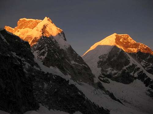
![Early morning on Huascarán Sur and Norte]() Morning light on the Huascarán twins, seen from high camp on my previous attempt at Chopicalqui
Morning light on the Huascarán twins, seen from high camp on my previous attempt at ChopicalquiYou would think that four months would be long enough, but it wasn't. There were still lots of interesting mountains I hadn't climbed, and now the end of my long trip to Peru was rapidly approaching. I had one week left before I would have to be in Lima to catch my flight home.
Time flies when you're having fun. And I sure had been having a whole lot of that. Now there was just enough time for one more short expedition. Without a partner, I was ready to hire a guide, and so I walked into the offices of Galaxia. While I was talking to Marco, who ran the place, something came up that suddenly required his attention. I don't know what it was, but I didn't see him again that night.
Earlier, I had been in contact with Mark, a climber from Scotland. While I climbed Huascarán Sur, he went to Alpamayo and Quitaraju with Skyline Adventures. We had agreed to keep in touch, but I hadn't heard from him yet since I got back in Huaraz earlier today. However, Lady Fortune was with us and he showed up right on time. He had successfully climbed both peaks, and was back longer than I was and ready for something interesting. Sorry Marco, nothing personal, but I won't be hiring a guide after all.
After tossing around a few ideas, Mark and I quickly settled on Chopicalqui.
Having tried it before, I already knew a large part of the route. I proposed to bring extra supplies, so we would have a few spare days on the mountain in case of any contingencies, and to hire a couple of porters to drag all of our stuff up and down the mountain. Mark was fine with that, and so we had a plan.
The Plan
For an acclimatized climber, with the route in good shape, the southwest ridge on Chopicalqui, the normal route, requires four days. A typical schedule:
Day 1: Drive to the trailhead (4200m), hike up to moraine camp (4900m)
Day 2: Climb the easy but crevassed glacier to high camp (5600m)
Day 3: Summit day (6345m) and back to moraine camp.
Day 4: A short hike out
There is a base camp area too, but that's only half an hour from the trailhead. If you’re already acclimatized, staying there means wasting a day.
For high camp, there are a couple of options. On my previous attempt, we had camped at around 5450 m, and that didn't turn out to be such a good idea. It had snowed on the days before our arrival. It wasn't much, far too little to be dangerous or even to sink away in it, but it had completely covered the old trail. Without it, finding a way up in the darkness of the night had proved to be too difficult.
This time we planned to camp higher, around 5600 m. Not only would that mean we would have daylight to get above the point where we couldn't find the route before, we would also have a shorter summit push.
The main thing about our plan that was not typical was that we brought additional supplies for two more days. That should increase our chances in case of sickness, bad weather or poor conditions on the route. A little bit of fresh snow wouldn't stop us this time!
Preparations
![Our mules near Musho]() Taylor with our mules near Musho
Taylor with our mules near MushoThe next day we spent preparing for our climb. As we had hoped, after collecting our climbing permit at the national park office and stocking up on supplies, there was plenty of time left to travel from Huaraz to Yungay. The only hurdle today was to get a hold of Taylor, the porter that I had hired in Musho for both of my trips to Huascarán, and I wanted him to come along again.
Finally, just before 10pm, I got him on the phone, and yes, he was available tomorrow. Unfortunately, when I asked him to bring along a second porter, I learned that there was nobody available anymore in Musho – with the climbing season winding down, most had already gone off to work elsewhere.
So much for an early start
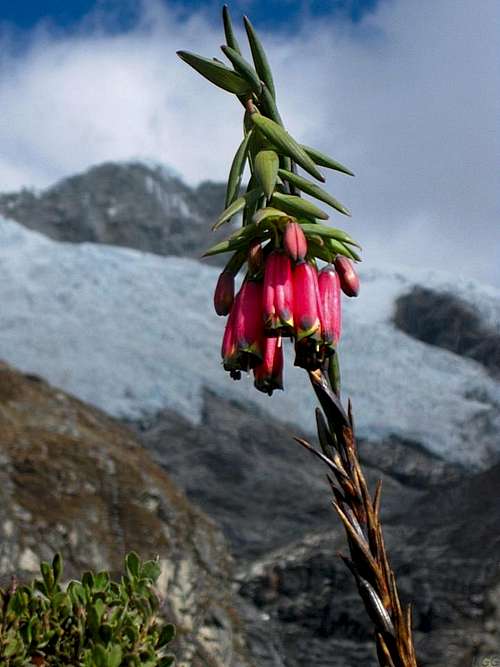
![Alpine flower in the Cordillera Blanca]() An alpine flower along the trail to moraine camp, with the glacier in the back
An alpine flower along the trail to moraine camp, with the glacier in the backTaylor was punctual and arrived early next morning, but we still didn't have a second porter. Taylor and Ursula, the lady running Hostal Gledel in Yungay, where we were staying, helped us out and started making calls. Eventually Ursula found someone in the Santa Cruz valley, up north in the Cordillera Blanca. Of course it would take a while before he could join us, but at least we had found our second porter. We finally set off at noon.
The taxi ride to the trailhead took two hours, leaving us four hours of daylight. That's not a whole lot to reach moraine camp, and so it was quite reasonable when Taylor suggested that we spend the first night at base camp instead. But since we were well acclimatized, I had no doubts that we could make good time and reach moraine camp before nightfall. Besides, I don't find Chopicalqui base camp a very attractive place: there are too many cows (and dung), which, in turn, attracts the unavoidable flies. I must admit that there is one clear point in favor of the place: just upwards along the stream running though camp, a waterfall comes straight off the mountains, making it impossible for the cows to pollute it. Nevertheless, we declined the idea to stay there. We would stick to our plan and go to moraine camp.
Mark and I both carried a day pack, and left the rest up to Taylor and Hector, our second porter, to divide between them. Right from the start, Hector was struggling a bit.
He wasn't quite as strong as Taylor, and I got the distinct impression that he had brought quite a lot of stuff himself already. Perhaps, not knowing us, he had brought a whole lot of food? I mean, Taylor I had hired before, and he would be confident that I knew what I was doing, but Hector, well, all he knew was that two climbers without a guide needed two porters to climb Chopicalqui. Sure, we had told Ursula and Taylor that we had supplies for everybody, group gear, and even an axe to spare that he could use, so all he really needed to bring were warm clothes, a warm sleeping bag and mattress, and his own glacier gear apart from the axe. But maybe that didn't come across, so, looking at it from his point of view, he could have thought there was a chance he was hired by a couple of ill-prepared idiots!
However, we were not. We were very well equipped, and had stocked up for four people. And so, Hector found himself with a heavy load to carry. Anyway, we left it to Taylor and Hector to distribute the weight between them any way they saw fit, confident that they would manage, and went ahead.
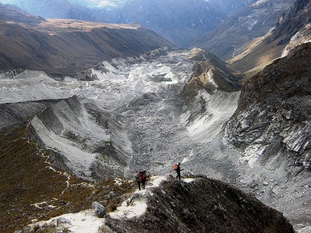
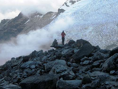
![There used to be a glacier here ...]() Looking down from just below Chopicalqui moraine camp. A few other climbers descended as we came up. The road is visible in the upper right corner.
Looking down from just below Chopicalqui moraine camp. A few other climbers descended as we came up. The road is visible in the upper right corner.
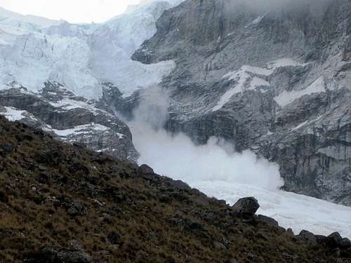
On the right is the glacier bed coming down from Chopicalqui, on the left another one coming down from Garganta, the high col between the two Huascarán summits.![An avalanche rolling down the east side of Garganta]() An avalanche rolling down a few hundred meters on the east side of Garganta. Does anybody still wonder why the normal route up there is on the other side?
An avalanche rolling down a few hundred meters on the east side of Garganta. Does anybody still wonder why the normal route up there is on the other side?It was a familiar route, but even without it, it's hard to get lost, as there is only one trail. We made excellent time getting to moraine camp. Almost there, we encountered a party of descending climbers. Given the time of day, they would probably spend the night at base camp.
Mark arrived first, I followed soon after. We had 45 minutes to spare before sunset. At that point I realized I had made a mistake though: although I had carried most of my tent, one of our porters had the poles! And so, instead of setting up camp right away, I had to wait for Taylor and Hector. Mark had energy to spare, so he went down to the glacier to get water. Soon our porters arrived, even before Mark was back. It looked as if Taylor had taken over some of the weight from Hector.
The three of us went about the business of putting up our two tents. Hector and Taylor must have been really surprised when they saw them, each big enough to sleep three people. From all the tents I had seen so far in the Cordillera Blanca, that's a rare luxury. Most people take a small light weight two-man tent for two people. Very cramped, and with two people in it, there is no room for gear. But I value a good night's sleep before climbing, and apparently, so did Mark – for me, too, this was the first time I saw his tent.
It was quite a contrast with my previous attempt at Chopi too. There I had hired a guide and a porter, and while I had my own big tent, Galaxia had provided a tent for the two of them –a small, two man thing, suffering from condensation problems.
After months of travelling and ample practice (and a few mistakes), I had gotten the hang of cooking at altitude, so I doubled as
cocinero on our small expedition. For tonight the menu offered a three course meal:
- Soup
- Tortilla wraps with a rich, thick sauce á la Rob
(for the culinary inclined: the main ingredients this time were bacon, mushrooms, peas and carrots, cashews, tomato concentrate and mashed potatoes)
- Tea with cookies and chocolate
Everything went down well, and there were no leftovers. I must have done something right. On a full tummy, we all turned in somewhere between eight and nine o'clock.
But now I almost forget something. I should mention a short but pretty important conversation I had with Taylor. He was surprised to learn that we didn't plan to go to the more usual high camp, but higher, to 5600m. I explained that we would have a better chance to make the summit from there. In fact, I continued, if things would go really well, it might not be impossible to go all the way down to the trailhead after summiting on the third day! He clearly had not expected that. But the biggest surprise for him was when I said that, even if we did the whole thing in three or four, they would still get paid for five days of work. That really fired him up. He gave me a bear hug right there and then!
As the next few days would show, this incentive turned out to be a great motivator. Even though they never had to carry as much as on the first day, our porters worked their socks off to help us in all sorts of ways, and were in high spirits all the way. But I'm getting ahead of myself now...
High Camp
![Mark looking at the glacier next to Chopicalqui moraine camp]() Early morning at moraine camp. Mark is looking at the glacier next to it. The normal route first goes to the right, outside this photo, ascending 100m or so over the moraine before getting on the glacier. Early morning at moraine camp. Mark is looking at the glacier next to it. The normal route first goes to the right, outside this photo, ascending 100m or so over the moraine before getting on the glacier. | ![A closer look at the impassable icefall near Chopicalqui moraine camp]() A closer look at the glacier near Chopicalqui moraine camp A closer look at the glacier near Chopicalqui moraine camp |
We didn't have a long day ahead of us, so we took our time for breakfast and packing up. Around 10 or so we were on our way.
Perhaps feeling a little guilty that our porters had to work so hard to carry our gear to moraine camp, Mark and I carried a bit more. Our total load was reduced a bit more because we had eaten some of our supplies. In addition, our porters hid some of their own belongings near moraine camp. I didn't watch to see what they stashed, or where. Frankly, apart from the hiking boots we had used so far, I wouldn't know what to leave behind – everything else I would want to have higher up anyway. And since other climbers had told me that things get stolen from that place, hidden or not, Mark and I didn't stash anything.
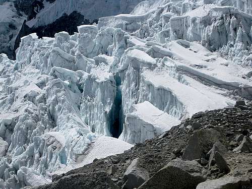
![A huge hole in the glacier on Chopicalqui]() The lower part of the glacier is heavily crevassed
The lower part of the glacier is heavily crevassedAfter a short passage, hiking and scrambling on the rocks next to the glacier, we geared up. The trail went around some big visible crevasses, and crossed a few small ones. Our porters showed a healthy respect even for a couple that where small enough to could just step over. Whether they had bad experiences or were just afraid of the unknown, I don't know. For me, it's the visible ones that I fear, not the ones I can see. And having four people on a rope helps a lot to mitigate the risk of a crevasse fall.
We made good time again. By early afternoon we already were at the site where I had camped before. It didn't look all too clean, actually, clear signs that quite a few climbers had camped there before in the not too distant past. Mark hesitated, wondering if we should perhaps camp here after all? However, he left the decision up to me, and I had no second thoughts whatsoever.
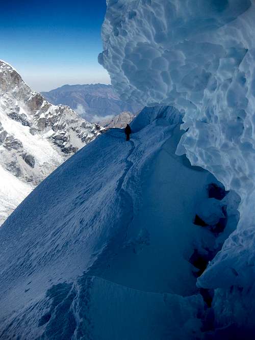
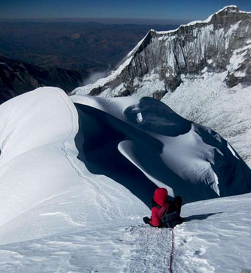
Not much higher, we reached a big crevasse blocking the route. We turned right, following the rim, then we actually went in it. It wasn't deep at all on our side, but the opposite one was a steep wall, about 10 meters high. A gaping bergschrund at the bottom further complicated things, but we had two different snow bridges to choose from to get across. There both looked all right, and there were signs of a trail on both. We chose the one that looked the strongest, and also had the clearest trail. Mark led the way over the schrund and up the wall. From the top, be belayed our porters and finally me as we all followed. This must have been what we couldn't find in darkness, on my previous attempt.
After that, it was plain sailing. Soon after, we reached a level area on the wide ridge, a bit sheltered by a steep ice wall. We had reached our camp site – and it had only taken us 4 hours. It looked clean too, pure white snow, and I was happy to be there instead of at the lower site.
Dinner was a lot simpler this time – for our main course we had freeze dried meals this time. Soon after the sun went down, we hit the sack.
![Huandoy from Chopicalqui high camp]() Huandoy at sunset from high camp
Huandoy at sunset from high campSummit Day
Around the time we got up, our porters shouted something from their tent, right next to us. Even though we were already awake, I appreciated their effort to make sure we wouldn't oversleep. That was in their own best interest too of course, because leaving late would not only diminish our chances, it would also make it impossible to descend all the way today.
We had planned to leave at 2:30 am. However, it was very cold – yes, we knew that in advance, but when the cold actually hits you it is still different and I can't seem to get used to that – and so the whole morning routine went as if in slow motion: we had a slow breakfast, got dressed slowly (even though I had already slept with most of my clothes on), and were slow putting on our climbing gear. Even as I write about it, I can again feel the cold in my fingers as I was fumbling with my crampons. Nevertheless, we didn't waste too much time. We were on our way a couple of minutes past 3.
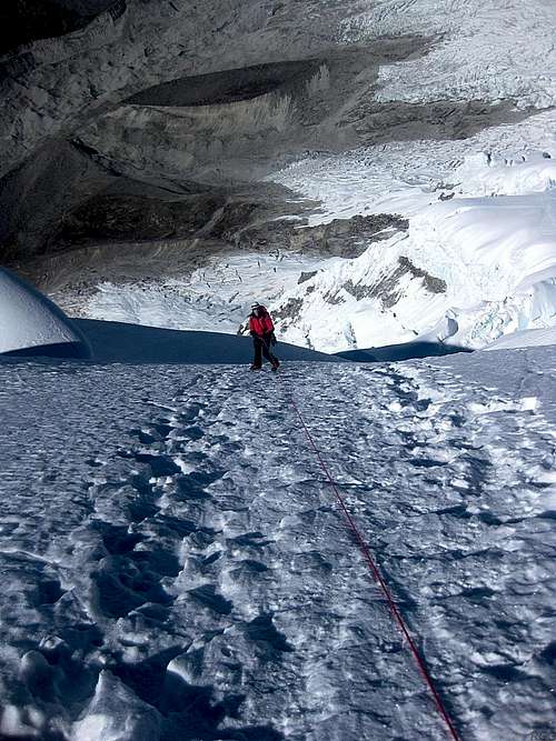
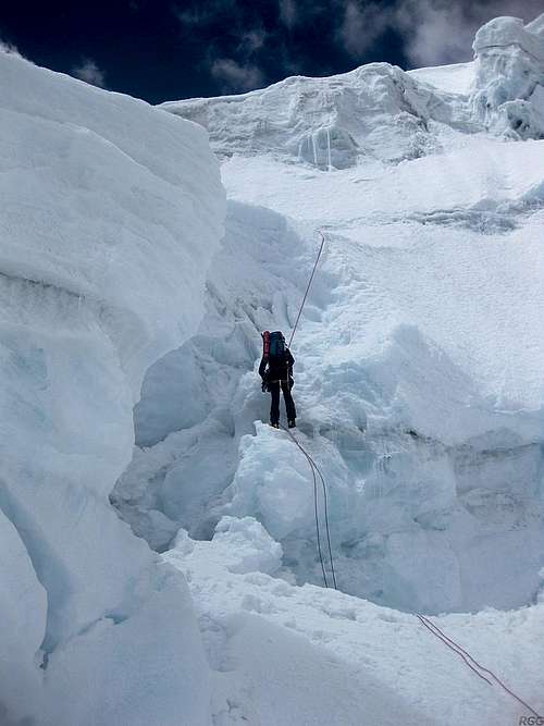
![A dangerous traverse high on Chopicalqui]() Only during the descent did we get a clear view of the route that we had climbed. This traverse is between the two steep sections.
Only during the descent did we get a clear view of the route that we had climbed. This traverse is between the two steep sections.From our camp site, the route was as clear as a highway. We just had to follow the ridge. It was wide at first, not so wide to be able to get lost, but no risk at all of falling off. Plenty of other climbers before us had left a big trail, and there even were orange route markers.
It was a clear night. It was cold, but not extreme, and there was virtually no wind. Still, pretty soon our hands and toes started feeling cold.
The first few hours we gradually gain altitude on the easy ridge. However, well over 6000m, the route gets steeper and more complicated. This is where the real fun begins!
We weave left and right, to avoid some big crevasses. At one point we are climbing a longer steep section, I estimate about 80m high. I'm in the lead as Mark shouts something at me – I gather that his fingers are suffering from the cold. My own fingers are very cold too, but there is nothing we can do about it right there, and it is far too steep a place to stop. We just have to cling to our axes as if our lives depend on it – which is actually the case of course. I keep climbing steadily, until we finally reach a safe ledge. I take off my mittens and stick my cold fingers under my armpits – and that helps. We spend the next 15 minutes getting some warmth back into our fingers, and eat and drink a little.
Not much higher we climb a second steep section, but for some reason we're not struggling as much this time. The short break has really helped. Soon after that, the first rays of the sun appear to illuminate the route.
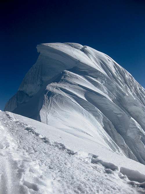
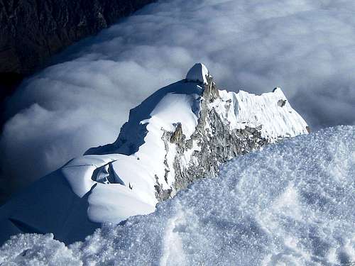
![Chopicalqui summit pyramid]() The summit pyramid
The summit pyramid
The summit pyramid isn't far off anymore - and it looks fantastic! Following a short but narrow ridge we get to its base. It turns out to be not nearly as steep as some of the previous sections, and without any problems we make our walk up. Well, perhaps I'm exaggerating here; it's not quite a walk just yet; and even on the easy parts, like two old men we are using our axes as walking poles while we ascend the final stretch to the small summit plateau.
There are no false summits this time, what you see is what you get here. As we reach the top, I check my watch: it's almost 8 o'clock. We're fast, we haven't even been climbing for 5 full hours.
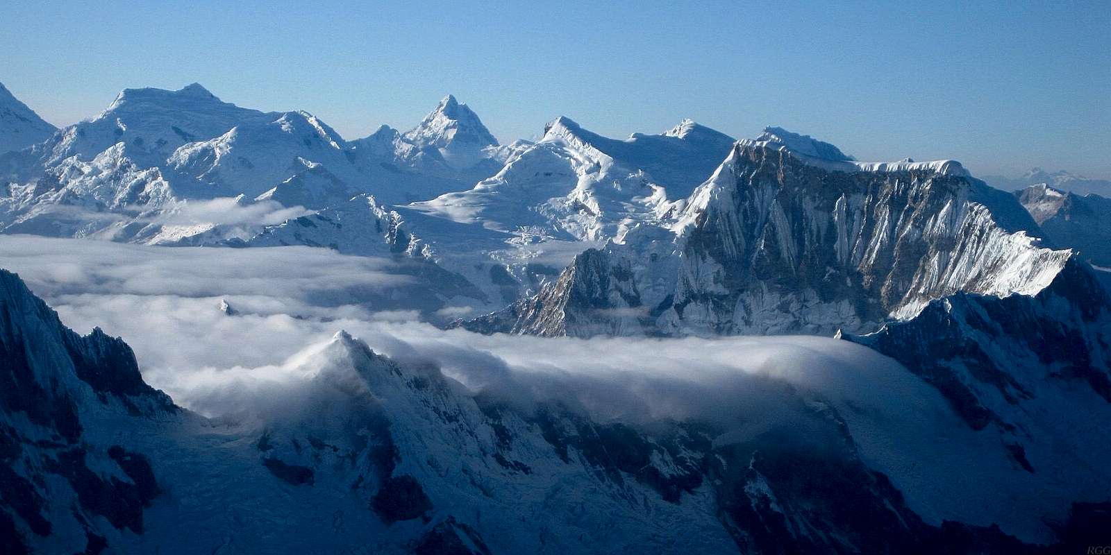
It's a beautiful place to be, with great views over the Cordillera Blanca, and we have the weather to match. The sun is shining brightly, there is hardly any wind and there are no clouds in the deep blue sky above us. However, further south and east, we look down on a slowly growing blanket of fluffy clouds, rolling in from the east, laden with moisture from the Amazon basin I presume. It doesn't look threatening at all though, just beautiful. But if there happen to be climbers on Copa today, they won't be so happy about rapidly losing visibility.
![A sea of clouds streaming over the Cordillera Blanca]() Early in the morning, high on Chopicalqui the skies were blue, but a sea of clouds already engulfs the lower regions.
Early in the morning, high on Chopicalqui the skies were blue, but a sea of clouds already engulfs the lower regions.
The beautiful pyramid far away in the center is Huantsán, the highest peak in the southern Cordillera Blanca.
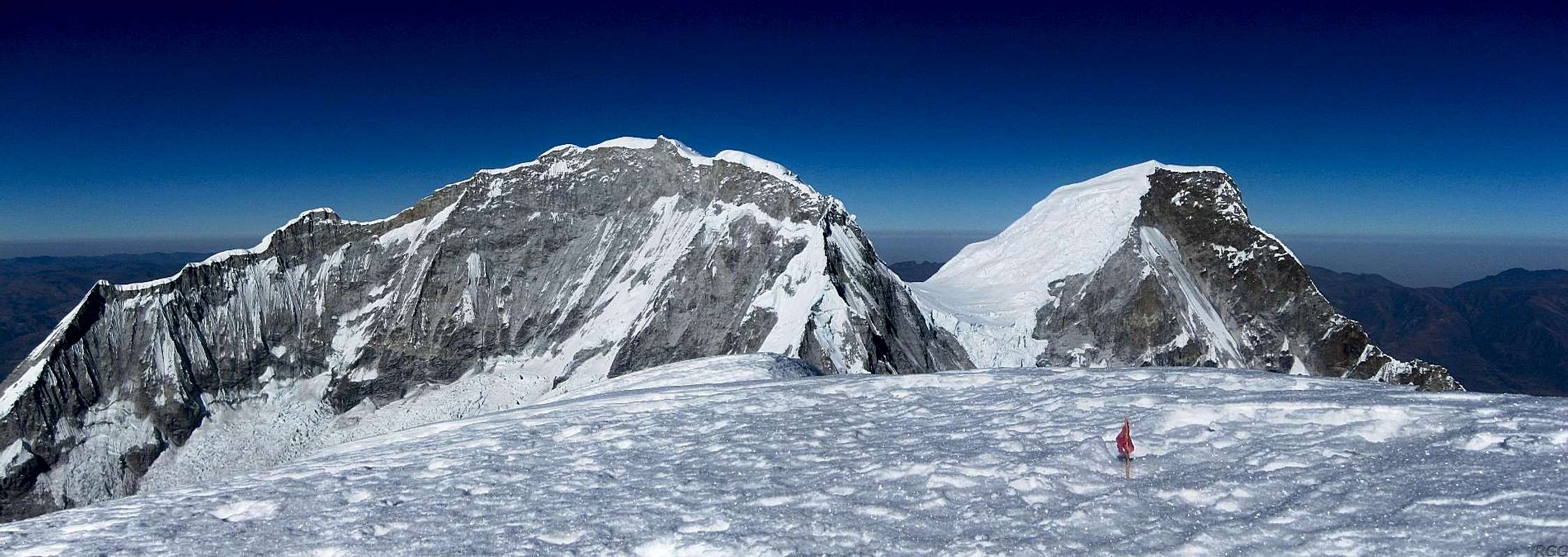
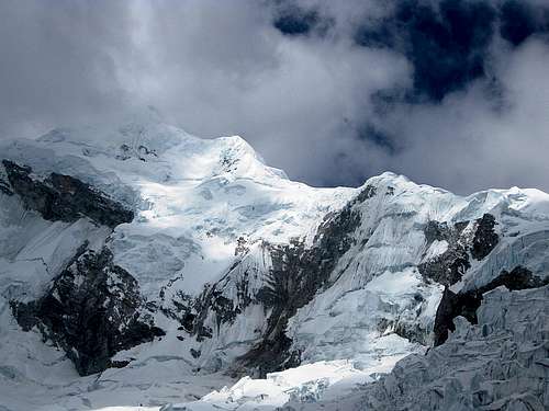
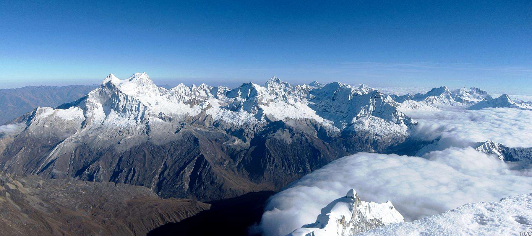
Photo taken on the ascent, less than an hour from the summit. The clouds would continue to build up.![Huascarán Sur and Norte from the summit of Chopicalqui]() Huascarán Sur and Norte from the summit of Chopicalqui
Huascarán Sur and Norte from the summit of Chopicalqui![Mark enjoying the views on Chopicalqui]() Relaxing and enjoying the views
Relaxing and enjoying the views![Looking down the north ridge of Chopicalqui]() Looking down the north ridge of Chopicalqui
Looking down the north ridge of Chopicalqui
Chopicalqui isn't threatened by the clouds. Some of them hug the east side of the mountain, but the summit and the southwest ridge, our route, stay completely clear. We spend half an hour on the top, enjoying the views, resting, relaxing.
Finally we decide it's time to start descending. Since everything is going so well, it suddenly looks like a very real possibility that we can make it back to the trailhead today. But it's still more than 2000m down, with a substantial part of the route on the glacier. So, no matter how beautiful it is up here, we can't stay much longer or we may find ourselves running out of time at the end of the day.
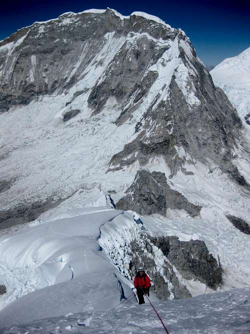
![Mark going over the edge on Chopicalqui]() Mark is about to go over the edge on the higher of the two steep sections Mark is about to go over the edge on the higher of the two steep sections | ![Mark rappelling Chopicalqui]() Rappelling the lower steep section, with Huascarán Sur in the background Rappelling the lower steep section, with Huascarán Sur in the background |
![Chopicalqui]() Looking back up after reaching the easy wide ridge
Looking back up after reaching the easy wide ridge
A bit lower, as we approach the wide ridge, we reckon we don't need the rope anymore, and walk down towards our high camp. So far, the descent has taken just over two hours.
Taylor is already on the lookout, and sees us coming from far away. By the time we get there, he and Hector have both our stoves running. They are quite cheerful and a happy spirit rules our camp. We drink, eat, rest and pack – that is, Taylor and Hector make soup and tea for us and do all the packing, while Mark and I do the drinking, resting and eating. Of course, our porters are well rested and we're a bit tired, but, probably more to the point, they too want to get back to Yungay the same day.
![Mark downclimbing on Chopicalqui]() Descending the 10 m wall
Descending the 10 m wall
![Chopicalqui disappearing]() By the time we've descended to moraine camp, the clouds have come over the top of Chopicalqui
By the time we've descended to moraine camp, the clouds have come over the top of Chopicalqui
Half an hour later, we get lucky: only the second car that passes by stops and, for a small fee, gives us a lift. It happens to be a 4x4 pickup, with shock absorbers that are an easy match for the rough road, and so we make it back to Yungay by nightfall.
Ursula gives us a warm welcome, including hugs and all that. She is happy for us that we have made it, and proud that we did it in only three days. We pay our porters, including a bonus on top of the five days I had promised them. They really went the extra mile, and I believe in rewarding that.
Hostal Gledel doesn't have a restaurant, but if you stay there and ask, they'll be happy to prepare something. We celebrate our climb with a big meal, centered around a lot of lomo saltado, the local version of steak and fries. It has been a long, fine day, one to remember.
Winding down with a lazy day
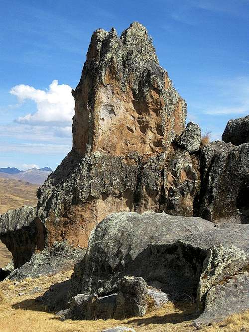
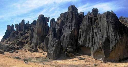
![Hatun Machay]() One of many rocks at Hatun Machay
One of many rocks at Hatun Machay
Well south of Huaraz, in the Cordillera Negra, lies Hatun Machay. It's an amazing collection of rocks, with at least 160 bolted rock climbing routes, and hundreds if not thousands more if you want to place your own protection. We rented rock climbing shoes and booked transportation.
![Climbers walking towards Hatun Machay]() The people provide a sense of the scale. All of these rocks are one pitch
The people provide a sense of the scale. All of these rocks are one pitch
After lunch, I felt a bit lazy. Having climbed so much in the last couple of months, was I finally getting satisfied? Whatever the cause, Mark climbed more than I did, and I was having a nice, relaxed day, with a bit of climbing a bit and a lot of enjoying the scenery. It felt like a fitting way to say goodbye to the mountains – for now.
I'll be back!
THE END
Links
Andean Kingdom organizes day trips to Hatun Machay, and the same company operates the nearby refuge.
Galaxia is one of the agencies in Huaraz that I used a couple of times - not this time though.
Panorama of the northern Cordillera Blanca from the summit of Chopicalqui


Comments
Post a Comment