“No, I forgot to bring it. It’s back at the cottage.” Marie said. She had just realised she had left her midge head-net back at our rented cottage.
I had mine but decided not to put it on at the moment. We both swiped at the small cloud of midges that had quickly found us. I decided, when it got really bad, I would put mine on!
We had arrived at the Allt Mor car park, near Loch Morlich at 8.15 for an early start on our first proper day in Scotland, it was warm in the trees and the sun was shining, a good day was promised.
We found the path and headed east through the woods. As we walked, the cloud of midges dispersed – I had no doubt they would return – in fact, that was our only real encounter with them for the next three weeks.
Walking through the trees was very pleasant and we made good time heading northeast, following the occasional signpost towards An Lochain Uaine (the Green Lochain).
Just before we reached the lochain, a cyclist overtook us. By the time we reached the lochain, he had stopped and was talking on his phone. We briefly admired the view and continued, only for him to overtake us again.
“I guess this is going to be a feature of walking on these paths.” I said to Marie.
When we visited in 2021, we were surprised by how many people cycled the footpaths instead of walking.
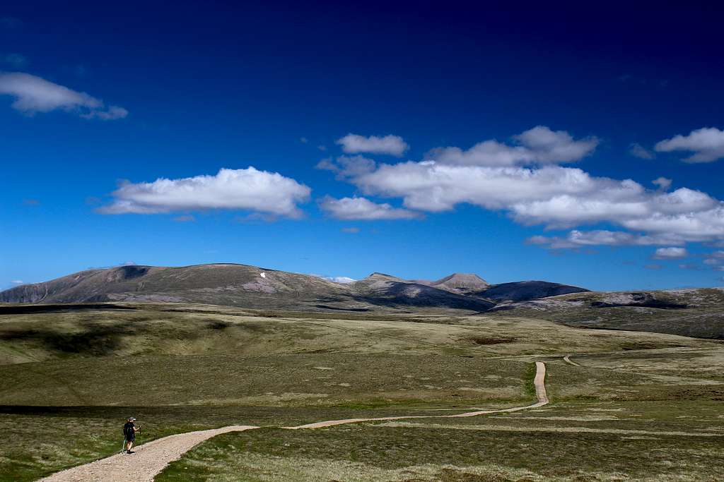
The trees thinned out above the lochain and the path forked. Left would take us past the Ryvoan bothy and on to Nethy Bridge, we chose the right fork. Ultimately, this could have taken us all the way through to Braemar but we were aiming for Bynack More, a Munro on the northeastern edge of the Central Cairngorms.
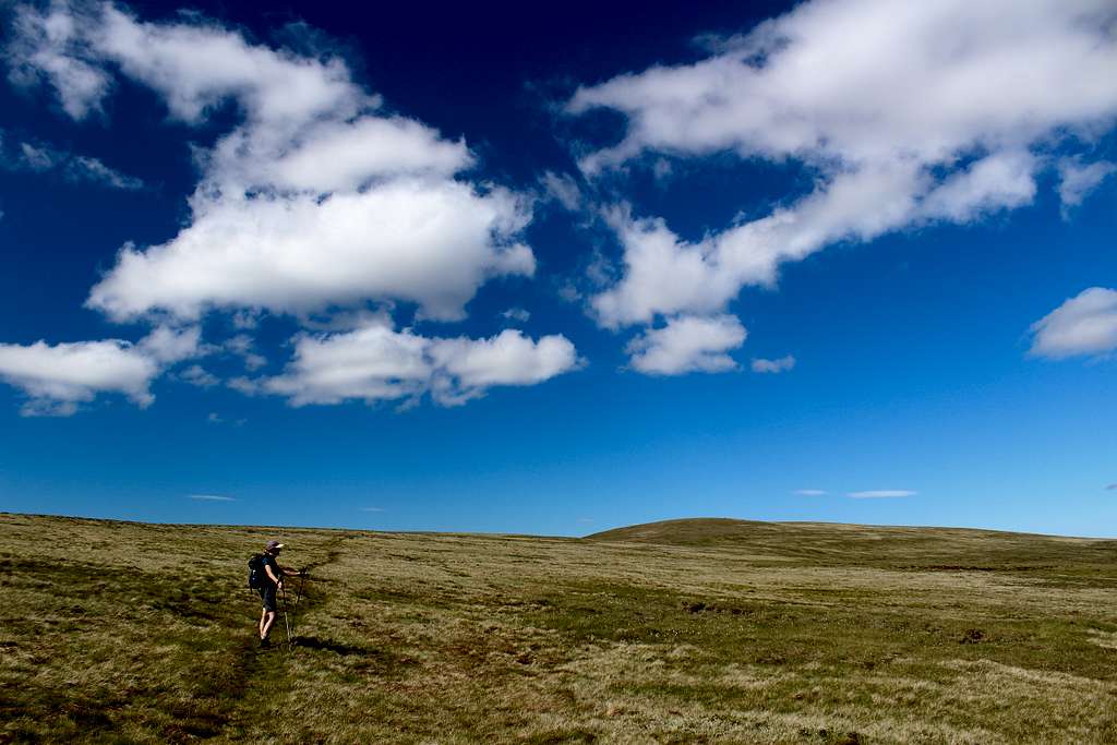
The path started heading eastwards, then drifted around to the southeast as we crossed the moor in pleasant sunshine.
We reached the footbridge crossing the River Nethy and found a group of young women packing up their camp. They were all being lectured to by our cyclist although, they seemed quite happy.
On the far side of the river, the path narrowed as it climbed towards a moorland plateau. The views opened up and to our right (westwards) our gaze followed the river down Strath Nethy. Cairngorm mountain had appeared and in the distance, we could make out the tors on top of Beinn Mheadhoin. A little closer but still seemingly, a long way off we could see another mountain with a rocky summit.
“Is that it, it’s a long way off?” Marie asked.
“Yes, I think so.” I replied.
We quickly made our way onto the plateau and to where the path forked again. We left the Braemar trail and headed towards the rocky ridge in front of us.
We were making good time so stopped for a cup of tea on some rocks.
“Look who’s here.” Marie said.
Our cyclist from earlier appeared and quickly past us, avoiding the many rocks on the path. He waved as he passed and we waved back.
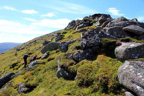
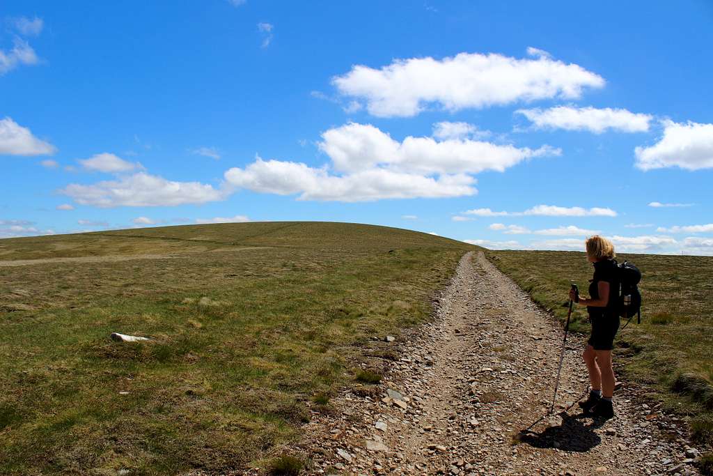
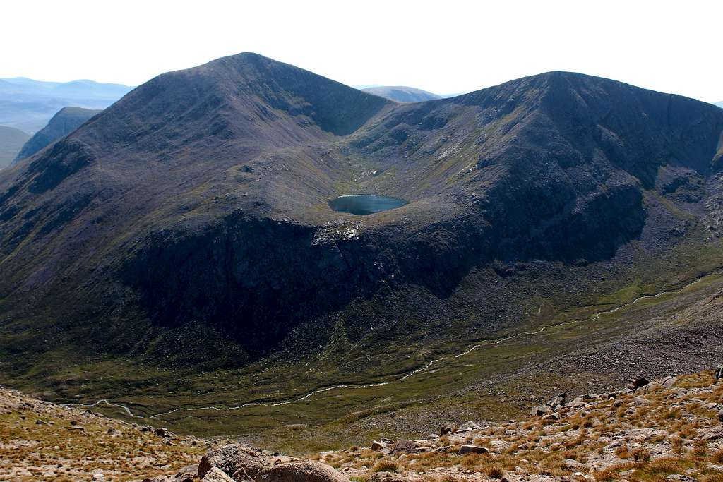
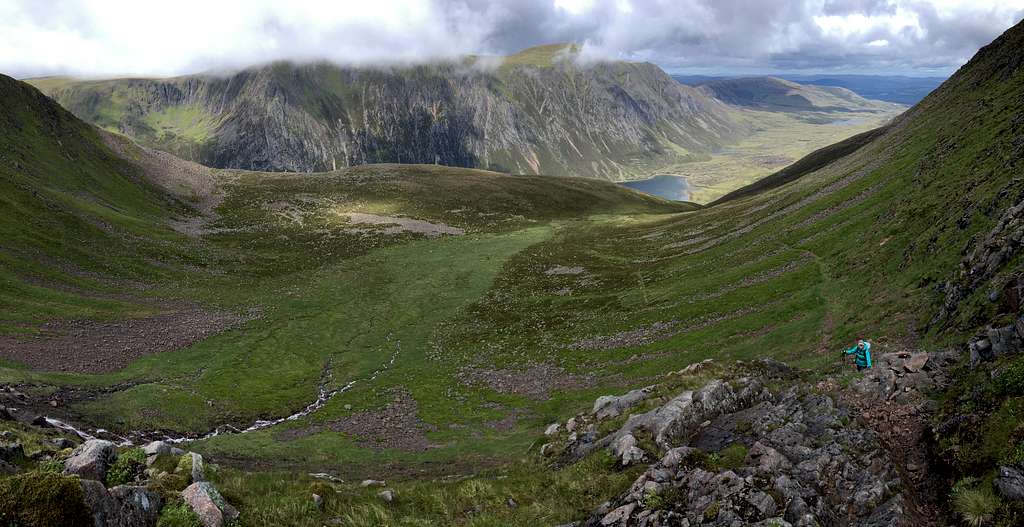
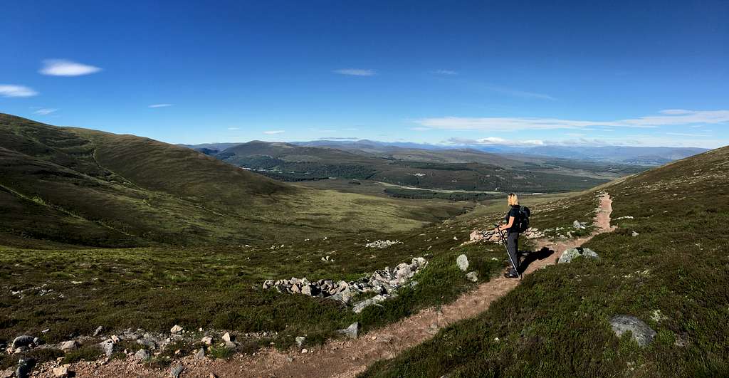
We set off again and the path headed up the boulder strewn north ridge of Bynack More.
North ridge of Bynack More, Cairngorms, Scotland.
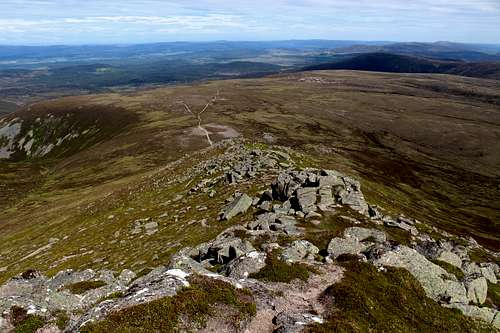
North from Bynack More, Cairngorms. Scotland
Now it was our turn to catch up to the cyclist. He had started to push his bike, which slowed him down but then he hefted it onto his back and resorted to struggling with it uphill.
“That looks like hard work!” Marie said to him as we passed by. “Couldn’t you leave it at the bottom?”
“I’m on my third ascent of all the Munros.” He replied. “I want to do them all by bike.”
So that was the reason.
“Good luck with the In Pin.” (Inaccessible Pinnacle on the isle of Skye) I said.
“If ….(he said someone’s name here but I didn’t catch it!) can do it, then so can I.”
I smiled and nodded as it was obvious I was supposed to know who this was!
We chatted. He was a Duke of Edinburgh award scheme assessor – hence his chat with the young women – he lived in Stirling and clearly knew Scotland very well.
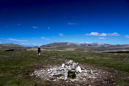
We all made our way over the false top to the main summit and admired the views, it was 11.30 am.
Cairngorm, Ben Macgdhui, Carn Etchachan and the Shelter stone crag, Beinn Mheadhoin and part of Derry Cairngorm. To the south we could see the tors of Ben Avon and the vast wilderness around and in between.
Bynack More (1090m) Cairngorms, Scotland.
Our cyclist friend descended carefully on his bike and we headed northwest and down to the nearby top of Bynack Beg. Then we contoured around to a path below the north ridge of Bynack More and descended back to the moorland plateau for some lunch out of the wind behind one of the many rocky tors (barns).
We headed down the same route as clouds started to grow, arriving back at the River Nethy footbridge at 2.30 pm. Back to the car by 4.00pm.
A very enjoyable day in good weather. I had done this route in the winter of 1995 but still couldn’t remember any of it!
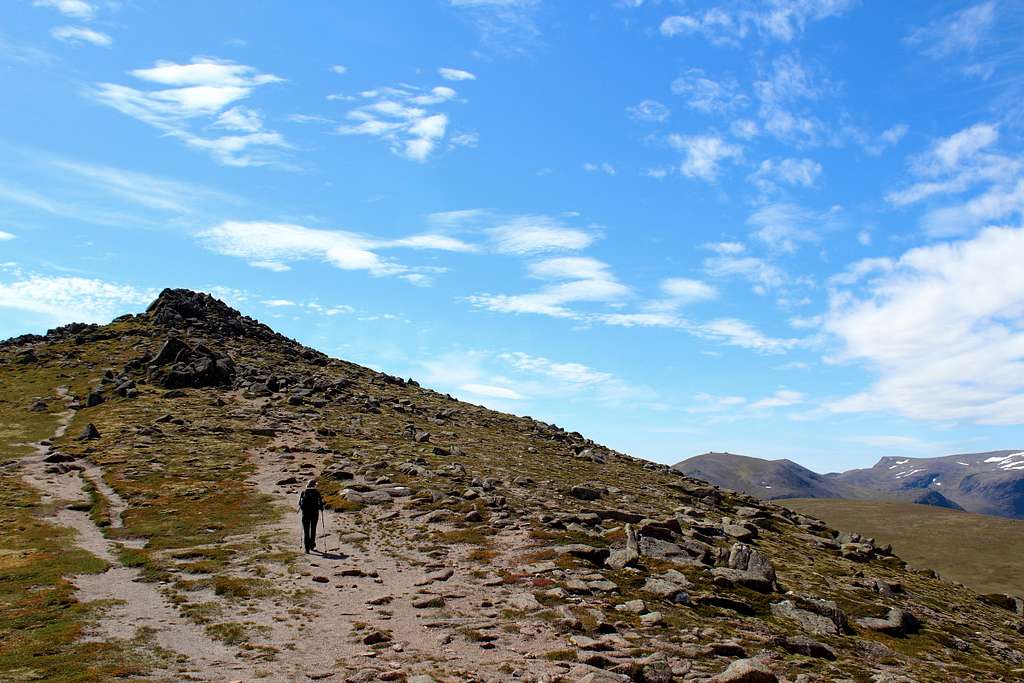
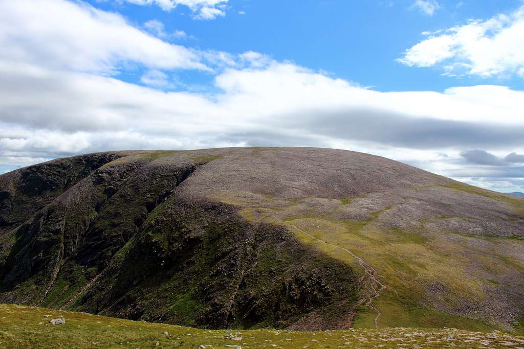
Mullach Clach a' Blair
Mullach Clach a' Blair (1019m), Cairngorms, Scotland.
The weather forecast predicted a cloudy day, possibly clearing later. We awoke to sunshine and light cloud so headed south on the A9 towards the Drumochter pass.
The good weather continued nearly all the way until a wall of cloud met us just before our destination. We turned around and headed back north, wondering if we could fit in something before the clouds reached us.
We set off from the car park at Achlean in Glen Feshie at about 10.50 am, a late start after all our driving around. We followed the path alongside the east bank of the river Feshie which was fine at first but more difficult where the river had flooded and washed away the riverbank.
When we reached the Forestry commission plantation it got more difficult. The path was blocked and wide tracks appeared that didn’t exist on my map or the written route description that I had. We decided to continue alongside the river – the only definite landmark – until we spotted the Carnachuin memorial buildings on the opposite bank.
(This is a War Memorial and buildings of the Highland fieldcraft training centre.)
My map showed a bridge crossing here but I had read that it was swept away in 2009. If it has been re-built, we certainly didn’t see it. Time ticked on and I still hadn’t found the track to take us up and onto the high Cairngorms plateau.
“I don’t think we have gone far enough yet.” Marie had said more than once.
I wasn’t convinced but we went about 200m further down the track we were on. Suddenly, the track appeared - obvious when you saw it – and we started upwards!
“Do you think it’s a bit late to be starting this?” I said glancing at my watch which showed 1.30pm and looking up at everything we still had to do.
“It’s too nice a day to give up yet.” Marie replied, so we carried on.
The clouds started to clear and the sunshine increased as we followed the ATV track upwards to one of the loneliest parts of the Cairngorms. The track itself takes a high line above the river in Coire Caol and is an ugly intrusion into what is an otherwise beautiful valley.
The views west and south were extensive on such a clear day and I spent some time trying to work out exactly what we were looking at. I identified Ben Alder and Creagh Meagaidh in the distance but could only speculate at some of the others.
We reached the grassy, rolling plateau around 2.30 pm.
Mullach Clach a' Blair (1019m), Cairngorms, Scotland.
The flat top of Cairn Toul and Sgor an Lochain Uaine next to it stood out in the sunshine under blue skies with white puffy clouds. It was hard to believe that in the worst conditions, this could be one of the most inhospitable places in the British Isles.
It only took us around 15 – 20 minutes to follow the track southwards then, cross the grassy hillside to reach the summit cairn of Mullach Clach a’ Blair (1019m). An insignificant cairn on a hill, notable only for its height!
Mullach Clach a' Blair (1019m), Cairngorms, Scotland.
Mullach Clach a' Blair (1019m), Cairngorms, Scotland.
We left the summit and returned to the track to sit in the sun and contemplate our next move.
“Wouldn’t it be easiest to return the way we came?” Marie said.
“Yes, but my way would be more exciting!” I replied.
Marie looked like she had heard it before but was happy with my idea! “It’s really beautiful up here so it won’t hurt to stay a bit longer.”
We headed back north on the ATV track, passed the turn of our ascent route and onwards. I was looking for a feint path, not marked on the map but one I had read existed. Somehow, I missed it and we continued along the track heading northeast. We forded a river and climbed up towards Pt 953m on the map.
Here, we headed cross country towards Pt 951m as shown on the map. As we crossed over the hill and descended we met the path I had missed and followed this over the outflow into Coire Garbhlach and across the wild, open moor.
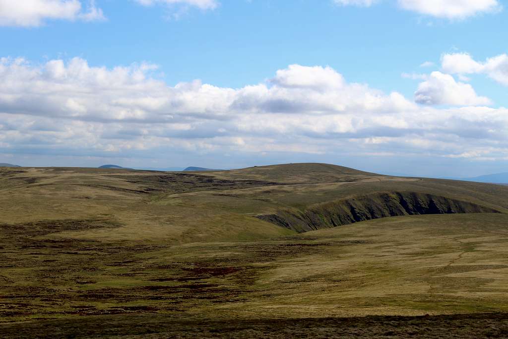
Moine Mhor (The Great Moss), Cairngorms, Scotland.
We headed towards the cairn we could see at Pt 1029m but lost the path in some boggy ground which caused us to detour westwards towards Meall Dubhag (998m), We skirted around this to regain the path back to our original destination.
(It was only after we had returned home that I realised that Meall Dubhag is a Munro “top” associated with Sgor Gaoith. Most likely the path continued over it and we just cut the corner!)
We sat in the sunshine, protected from the breeze by a drystone walled enclosure and surveyed the scene back towards Mullach Clach a’ Blair and the surrounding scenery, we noted seven nearby Munros.
Then, it was a case of heading down the footpath into Coire Fhearnagan accompanied by a stiff southwest wind. We enjoyed the views in the late afternoon sunshine and I even managed to get a little sunburnt!
We reached the car just after 6.00 pm. 7 hours in lovely weather in a very beautiful and lonely part of the Cairngorms.
Sgor an Lochain Uaine and Cairn Toul
Cairn Toul (1291m) and Sgor an Lochain Uaine (1258m), Cairngorms. Scotland
One of my objectives for this trip was to get out into the Cairngorms wilderness to visit these two mountains. To do this we would need two things in our favour. Firstly, whichever route we took, it would be a long way so we needed to be fit enough to do it. Secondly, we would need favourable weather to make it happen. Eventually, these two things coincided.
The weather forecast was quite good. Early cloud would clear by midday and no rain. A large Red Kite soared over the trees in the garden of our rented cottage and I took this as a good omen.
On the drive to the road ending at Whitewell, we saw a Buzzard on a post at the side of the road, another good omen?
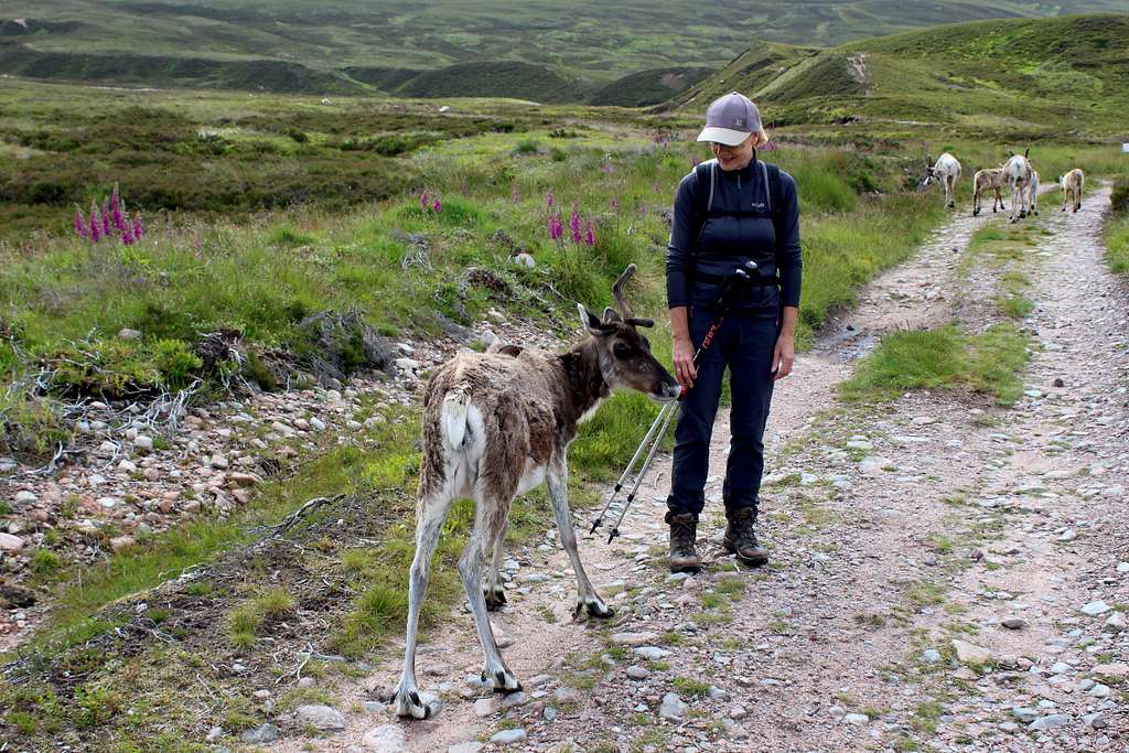
We left the car at 8.15 am under grey skies and headed through the rough moorland to a marked track through the Rothiemurcus forest. It was easy walking along the wide track and we soon left the woods and followed the path above the Am Beanaidh river onto the moor.
We re-joined the track into the lower reaches of Gleann Eanaich and looked ahead, there was a long way to go.
A small herd of about 30 animals were grazing, some were on the track. I thought they would run when they saw us. Instead, they watched us as we approached, seemingly unafraid. They were introduced into the Cairngorms in the 1950s and 60s and are semi domesticated. They approached Marie, probably hoping for some food, they looked cute but quite scruffy as they were moulting.
Another good omen?
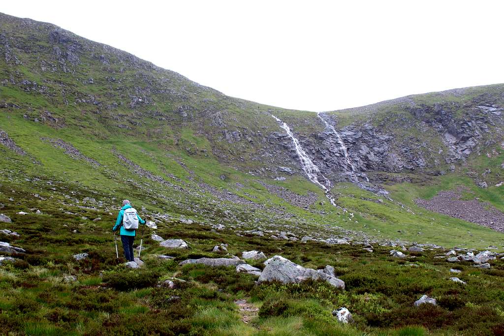
The sun briefly broke through the clouds then, vanished again and it started to drizzle. Perhaps the omens were wrong. The rain increased as we made our way up the glen and found our path into Coire Dhondail. I complained about the standard of weather forecasters every time we stopped to look up and into the grey mass that spilled rain down onto us, it didn’t look like it would stop.
The path ahead of us zig zagged upwards beside a waterfall that looked whiter as more water collected in the stream and fell over the cliffs.
Coire Dhondail, Cairngorms, Scotland.
A man and dog were descending towards us slowly until we met.
“Do you know this path?” he asked.
“This is our first time on it.”
“It’s ok going up.” He said. “Coming down is really dodgy. It’s all gravel and loose rocks and water. Take care.”
He carried on down past us.
“This might be a point of no return.” I said. It looked like it would only get worse.
We decided to carry on.
We took it slowly and scrambled up the first of the loose rocks. As we did the rain stopped and within a few minutes the sky started to brighten. We crossed the river at the top of the falls as the sun came out just after midday.
Shortly after this, the path ended at a large cairn. I took a compass bearing for Sgor an Lochain Uaine and headed up and across the hillside.
The clouds cleared across the moors to our right and Mullach Clach a’ Blair, Monadh Mor and Beinn Brotain appeared as high points in a world of grass, rocks and water.
As we crested the hill, Sgor an Lochain Uaine and Cairn Toul appeared in front of us and soon we were looking into An Garbh Choire and cliffs of Braeriach.
We reached the summit of Sgor an Lochain Uaine and after a short stop, descended to the bealach between the mountains to climb Cairn Toul.
Cairn Toul (1291m), Cairngorms, Scotland
This was more arduous as the path vanished in a slope of boulders.
We reached the top of Cairn Toul around 2.15pm, 6 hours after starting. Fittingly, as we ate our lunch on one of the remotest mountains in Scotland, a load of people arrived! A family of five and their dog (don’t kids go to school anymore?) a man and his dog who had already traversed Braeriach and an Irishman who had started from the Sugarbowl car park near Cairngorm, passed through the Larig Ghru and climbed the Devils point already.
The traverse of the Larig Ghru holds an almost legendary place in my mind. When I first came to the Cairngorms in the early 1980s, this was considered a stiff challenge for the best mountaineers. Time has softened that claim but it still would be something to do.
A thought popped into my head…perhaps we could return through the Larig Ghru back to Whitewell, it would be a similar distance? How long had it taken him”
“I left at 5.30 am this morning!” He replied. Nearly 9 hours.
We decided against that and set about returning the way we had come, re-tracing our steps. As we descended, I regretted that decision, perhaps we should have given it a go.
(I later worked out it would have been 2-3 miles longer, walking back via the Larig Ghru than the route we actually did. I’m sure we would have walked it quickly.)
We returned across the hillside, mostly on rough ground with no path. We were too low at one point, then too high but found the large cairn which marked the path to descend into Coire Dhondail.
Gleann Eanaich, Cairngorms, Scotland.
The weather didn’t really clear up all day but it didn’t rain anymore. The path down the Coire seemed a lot longer than it had in the morning, it seemed to go on for ages and somewhere along the way, my knee started to ache.
We reached the ATV track, rested and had some food and drink, then set off down the glen, my knee getting worse all the time.
Eventually we got back to the forest and after a bit of a struggle found the path back to the car for 8.00pm. 11 hours and 45 minutes to cover just under 35 km, about 22 miles.
It had been a memorable day in such a fantastic setting and we had climbed two mountains I had wanted to climb for a long time… but maybe we should have come back through the Larig Ghru!
Monadh Mor and Beinn Bhrotain
“…it is possible to reach these peaks from Glen Feshie, by following the Moine Mhor track to the centre of the plateau near Stob Loch nan Cnapan or Tom Dubh, on a crossing which is perhaps the most psychologically intimidating walk in Britain.” – I. Butterfield “The High Mountains of Britain and Ireland” 1986
The high peaks of the western Cairngorms, Scotland
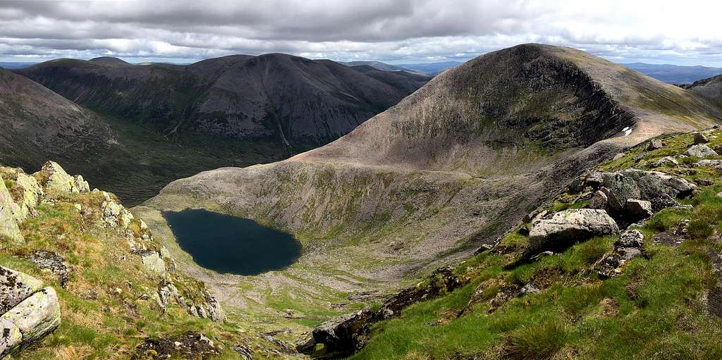
We had seen Monadh Mhor at (relatively) close quarters when we had climbed Mullach Clach a’ Blair, it was still a long way off and too far on that day but looked like it would be within reach. Beinn Bhrotain was even further away and looked like it might have to be left for another trip, maybe if we visited the Braemar side of the Cairngorms in the future?
Weather forecast was for a grey, cloudy start, improving as the day went on. So, when we awoke to clear skies we decided to get a move on. We left Achlean in Glen Feshie at 8.20 am and headed up the familiar path into Coire Fhearnagan. My knee had recovered but I was careful not to strain it as we ascended.
We enjoyed the usual fabulous views in the sunny weather as a few clouds began to form.
“What do flying saucer clouds signify?” Marie asked me, looking at the weird Lenticular cloud above.
“I think they are a harbinger of bad weather.” I replied. “…and alien invasion, of course!”
Marie rolled her eyes and set off again.
We reached the large cairn at the bealach at 10.00 am and continued straight ahead in a southeast direction on a feint path across the Moine Mhor (The great moss).
The path descended and ahead we could see our destination. Between us and it, we could see a lone walker. He had left just ahead of us but he had quickly increased the distance and now was a small figure in the vast landscape.
The Western Cairngorm summits looked great in the sunshine and we quickly met the ATV track taking us further east. Up to this point, the route had not been at all intimidating although that changed a little when the ATV track abruptly ended as the map had promised.
Monadh Mor (1113m), Cairngorms, Scotland
We descended the bank to the river and crossed easily. I took a compass bearing on a hill called Tom Dubh, an outlying Munro “top” of Monadh Mor, and we set off across the moor. A feint path appeared every now and then and we were lucky it had been reasonably dry lately so it was not too boggy.
I imagined what it might be like in thick cloud, with snow underfoot and shuddered, there were no distinguishing features, it would all look the same.
We continued in the sunshine up to Tom Dubh (918m) and stopped by a drystone wall near the top for tea break.
Another couple arrived and continued on downhill to cross the river, the Allt Luinneag. I had read it could be difficult to cross this, so we descended to a different spot on the bank and after some searching, found a way across.
We headed eastwards up the flank of Monadh Mhor whilst the other couple headed directly for the summit. There was no path and as we reached the wide crest of the north ridge, we turned south.
The other couple had reached the summit cairn already as we approached at 11.50 am. I could see Beinn Bhrotain beyond and knew it was only about 2km away. In the sunshine it looked closer, there was plenty of time to do it today.
We had a quick stop for photos on the windy, sunny summit. Then, carried on along a feint path along the ridge southwards. At a cairn at Leac Ghorm, the path droped steeply down to the bealach which looks into remote Glen Geusachan.
“The ascent on the other side looks really rough.” Marie said commenting on the eastern slopes of Beinn Bhrotain.
“We’ll have to take it slowly.” I replied but I was more worried about the cloud that I could see heading in from the west.
Beinn Bhrotain (1157m), Cairngorms, Scotland
We descended and started to reascend the height on the eastern slopes of our second mountain. It was hard going as the path quickly vanished in the extensive boulder field and on each step the rocks moved causing us to slow down and go carefully.
The cloud was surrounding us and finally rolled in at 12.50 pm, just as we reached the summit. We put waterproofs on against the wind and quickly retraced our steps down the boulder field.
We re-climbed the south ridge of Monadh Mhor and had some lunch, then set off back to the summit. By now it was 2.00 pm and we were in thick cloud, with no views, so I took a compass bearing to take us back towards the river crossing of the Allt Luinneag.
As we got there, it began to rain, blowing into our faces. Luckily, visibility wasn’t that bad and we had no trouble following our earlier route across the moors and up to the descent route at Coire Fhearnagan.
For once, we descended under grey skies and as we did, my knee started to ache again.
We got to the car at 5.35 pm. Just over 9 hours of walking and 18 miles covered over the remote western Cairngorms – another memorable day.
As we drove away from Achlean, our trip nearly over, I wondered…. How long might it be before I visit this great place again?
Hi Mike,
Great report.
I'm going to assume that the name of the cyclist in relation to the Inn Pinn is Danny Macaskill. His video entitled 'The Ridge' is quite well known in Scotland. It's at the very bottom of the Isle of Skye area and range page on here. Enjoy!
https://www.summitpost.org/isle-of-skye/916706
Hi Boydie,
Many thanks for your comment. I had been meaning to google who the cyclist might be and hadn't got around to it. I think you're right. I watched the video.... don't think I'll be doing that!
Cheers,
Mike
Parents refers to a larger category under which an object falls. For example, theAconcagua mountain page has the 'Aconcagua Group' and the 'Seven Summits' asparents and is a parent itself to many routes, photos, and Trip Reports.


Comments
Post a Comment