
-
 34938 Hits
-
 84.27% Score
-
 18 Votes
|
|
Canyon |
|---|---|
|
|
54.36820°N / 2.32611°W |
|
|
Canyoneering |
|
|
Summer |
|
|
Overview
At the time of writing there were 369 canyons featuring in SP. Predictably 80% were in USA (not a criticism – you just have to think Grand Canyon – and there is little more to be said…) Runners up, but a long way behind, were countries of Greece, Italy, Mexico, Spain and Montenegro, Iran and France. (Also) predictably there were no canyons listed for all of the UK. Not even one.
I’m a beginner at canyons and not very good at them, but it is my privilege nevertheless to submit my first canyon page – and first on SummitPost for all of the UK. Hopefully even proper canyoneers will not be too harsh on me for choosing Hell Gill.
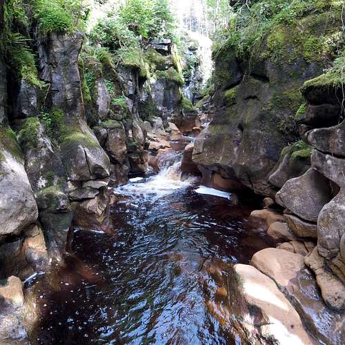
Hell Gill is a slot-canyon. It is mere 500m long and with walls no more than about 20m high. It isn’t a Grand Canyon, or a Verdon Gorge, not by along chalk. However, it is arguably the best Gill (or Ghyll) scramble in the Yorkshire Dales of England. And being Limestone country there are loads. In fact half of north Yorkshire is riddled with holes and slots a bit like the proverbial Swiss cheese. Cavers have an absolute ball – even some of the more distant readers may have heard of Gaping Gill.
Tolkein-esk section of Hell Gill about 100m in
Slot-canyons are what happens when a river or stream scours its way across soft rock over a few millennia. If it does so in the same place without moving about it eventually wears a deep groove or slot –and you get your canyon. Hell Gill is no exception – and the river is known as Hell Gill Beck. The source arises just a few kilometres away to the east in the peat bogs just below the top of Hugh Seat 689m 2,260ft. The initial stretch of the stream which is formed is called Red Gill Beck – but this soon turns into Hell Gill Beck as it slices into the underlying limestone and forms Hell Gill.
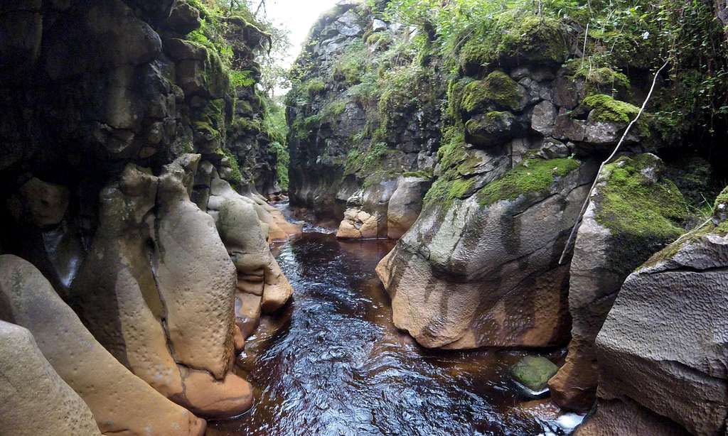
Being quite deep and very narrow, much of Hell Gill feels more like a cave than a slot. With the abrupt transition from (if you are lucky) sunny fell (hill) side to dark dingy interior shut off from the sun, it is possible to understand why it has been compared to the interior of the Whale which swallowed Jonah, in the Biblical fable. This effect is further added to by trees over-hanging the top for most of the length – which further softens what little light reaches the moss encrusted and in places overhanging walls of the gill. The overall effect is highly atmospheric.
Much of Hell Gill feels more like a cave than a slot
The traverse of Hell Gill is done from top to bottom. Being alone on my first visit I considered the more cautious approach of exploring it from the bottom end first. But Hell Gill is practically invisible until you virtually fall into it – and the position of the exit difficult to find, unless you have been before and know what you are looking for. So I did the normal thing and went through from top to bottom – with the flow of the stream. In contrast to the exit, the entrance is very easy to find, as will be seen from detailed description below.
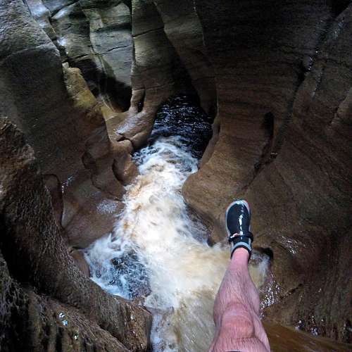
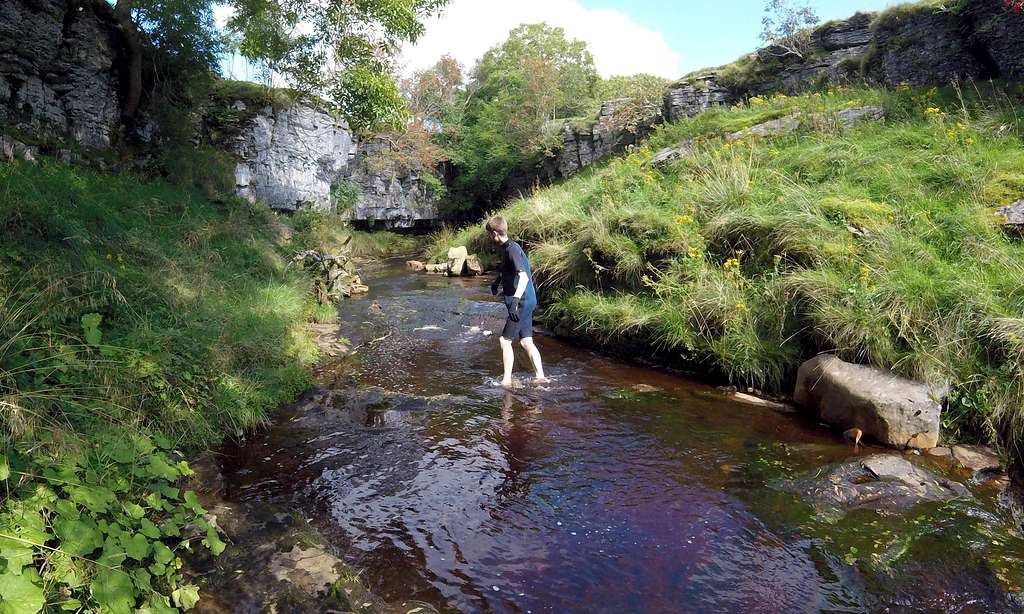
The canyon bottom is very narrow and often entirely taken up with the stream. The good news is there are no route finding difficulties. The canyon walls are impossible to climb so choices of route are forwards – or backwards, until even that option becomes near impossible (unless the fixed rope is used – see below). There are occasional sections where it is possible to scramble on the rocks at the edge of the stream, but for the most it is a matter of wading – and there are 3 places where it is possible to swim, albeit briefly. The stream bed is rocky and care is required to avoid turning an ankle. Being effluent from a peat bog the water is brownish – like walking through fast flowing beer. The net effect, what with the dim light, is that you often can’t where you are placing your feet.
In average conditions the water is mostly little more than knee deep, but there are a few stretches of waste deep – and thereare frequent little ‘steps’ with little waterfalls leading further into the depths. The crux – and (theoretical) point of no return – is a drop of about 5 feet into a sort of chamber, where there is no choice but to swim (unless fixed rope is used). If we are talking Whale entrails then this chamber would be the stomach...
Getting there
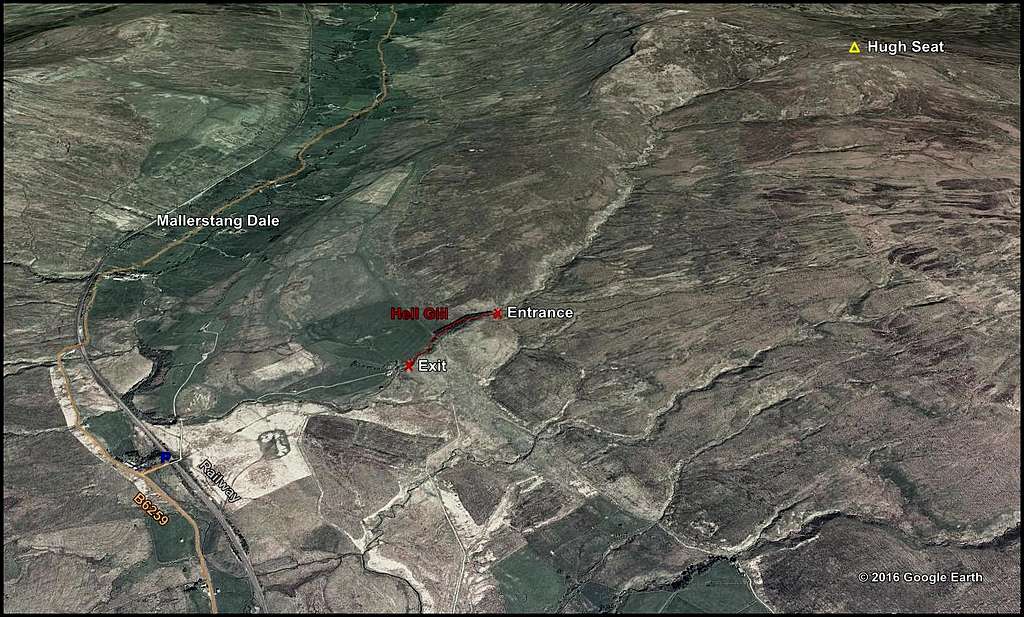
Hell Gill is in the north west of the Yorkshire Dales National Park, in northern England. More accurately it straddles the border of the Dales with the Lake District National Park, of Cumbria. The border actually follows Hell Gill Beck precisely for a substantial distance and so a person traversing the canyon will have each foot in a different county. However, the surrounding countryside is more typical of the Yorkshire Dales than the Lake District - and the spelling is Hell Gill, not (Lakeland) Ghyll – so in terms of ownership, it looks like Yorkshire got the upper hand.
The nearest centres are Hawes (south-east) and Kirkby Stephen (north).
Road connections:
Major north-south roads accessing the region are the motorways of M6 to the west and A1(M) to the east. Connecting these two motorway routes to the south of the region is the A684, which passes through Hawes as it traverses the northern Dales. In the north the M6 and A1(M) are connected by A66, which passes through Brough, just to the north of Kirby Stephen.
From the south: A few kilometres west of Hawes along the A684 there is a crucial turning north onto the B6259 (connecting the A684,at Garsdale Head, to Kirby Stephen 12km to the north). The turning is easily identified by the proximity to the Moorcock Inn. Heading north from here along the B6259 the railway (Settle to Carlisle Line) can soon be identified to the left of the road. About 3km from the Moorcock Inn the B6259 passes underneath the railway – such that the latter now appears to the right and is soon about 100m away. A further kilometre later is a right turn onto an un-metalled (‘white’) farm road which heads east towards the railway track. This right turn is identified by road signs (on B6259) marking the border between the two counties and the presence of some farm buildings just beyond and on the same RH side as the turning. The ‘white road’ is followed for 100m to a gate and bridge over the railway line. At this point there is a small widening with room for 2-3 cars to park. From here Hell Gill can be approached on foot and is some 1.5km distant.(If the spaces are taken up there are more parking bays a short distance further on up the B6259)
From the north: The A66 is followed to Brough, where a turning is taken south to Kirby Stephen. Soon after the town center and church in Kirby Stephen, a crucial left turn is made onto the B6259 (signed Hawes). This road is followed for about 10km further south passing through the tiny hamlets of Nateby, Outhgill and finally Aisgill. A few hundred metres beyond Aisgill just after farm buildings on the left and at the point where road signs(on B6259) mark the border between the two counties there is a final left turn onto the un-metalled (‘white’) farm road described above. Follow this for 100m to the small parking area just before the gate and bridge over railway. (If the spaces are taken up more parking bays will have been passed on B6259 a short distance before the turn off)
 GoogleMap image showing position of Hell Gill in northern England |  GoogleMap image showing position of Hell Gill in relation to nearby roads |
Approach to Hell Gill
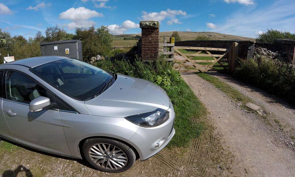 Parking area by the gate and railway bridge at start of walk to Hell Gill | 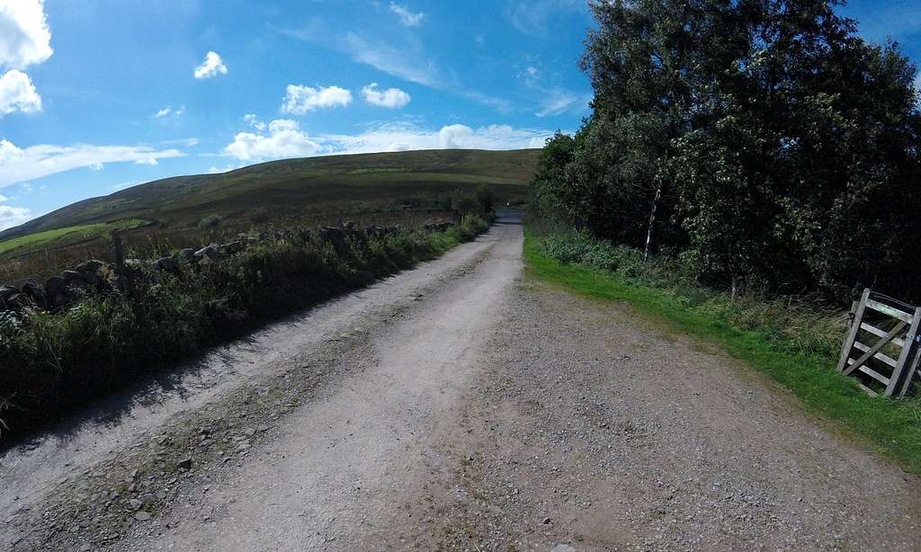 At the parking area looking back towards B6259 main road. |
 Google Earth image showing parking area in relation to Hell Gill | 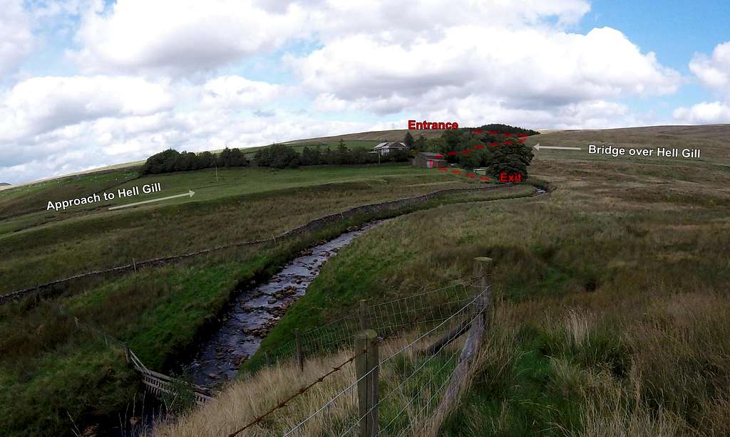 On the ground view of part of the same - closer up. You'd have no idea it was there |
Pass through the gate and follow the un-metalled (‘white’) farm road as it bends to left (north) and then back to the east, over a little bridge over Hell Gill Beck – and on through meadows to the farm. Pass through another gate and go through the farm into a gently rising meadow beyond. At the top of the meadow is a wall followed by the patch of forestry cultivation on the northern bank of Hell Gill, which is visible beyond. Note that the exit of Hell Gill is near the bottom end of the meadow and can be accessed by crossing an obvious breech in the wall…
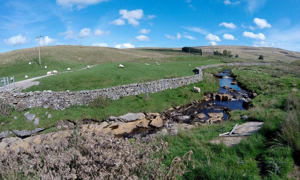 White road to the farm close to first little bridge over Hell Gill Beck | 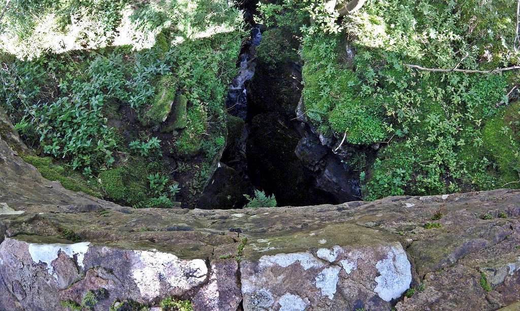 View into the middle section of Hell Gill from the stone bridge |
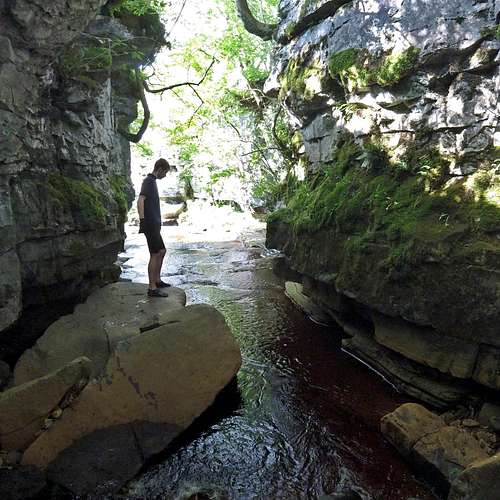
Walk to the top end of the meadow and climb over the wall on little steps – to join a rambler’s track which crosses Hell Gill via a stone bridge just to the right. The walls of the bridge are surprisingly high and views are further obscured by a thicket of tree branches. Nevertheless it is worth taking some time out to peer over the wall – and gain a first impression of the objective. Immediately below is approximately the mid point of the chasm, where the rocky walls are at their highest and whilst somewhat restricted, the view into the grim dark abyss is worth seeing.
It is not far now to the entrance of Hell Gill, which is at the far end of the pine plantation sprouting on the northern edge of the Gill. Facing uphill it is possible to reach the entrance passing to either side of the patch of forestry – but it is more direct (and better views) to go to the right and pass to the south – where a path follows fencing preventing access to the forestry but also too close access to the edge of the canyon, which can be presumed to be treacherous.
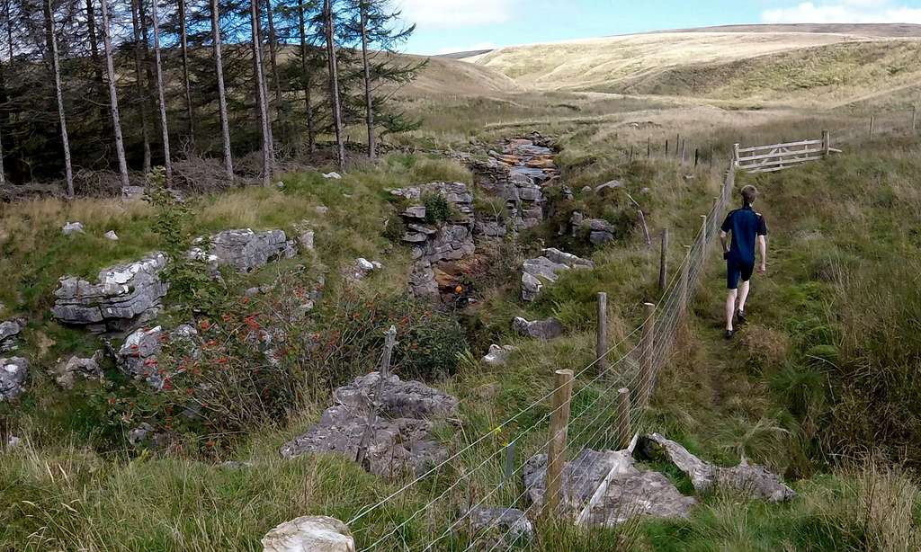 Approaching entrance to Hell Gill at top of plantation - an orange helmet visible | 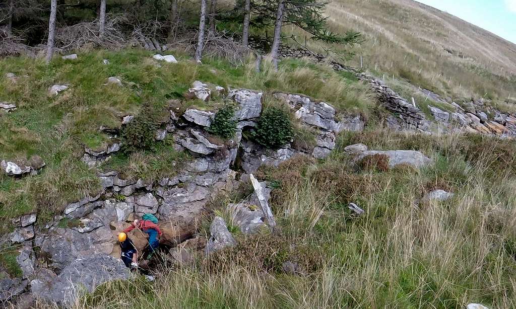 Closer view of Hell Gill entrance - and guide plus orange helmeted client |
Route through Hell Gill
As above there are no route finding difficulties. Options are forwards and backwards only – and the latter with increasing difficulty. Even a Yosemite or Verdon Gorge rock athlete would probably struggle to find a viable rock-climbing route up the dark slippery and moss encrusted and often overhanging walls of Hell Gill.
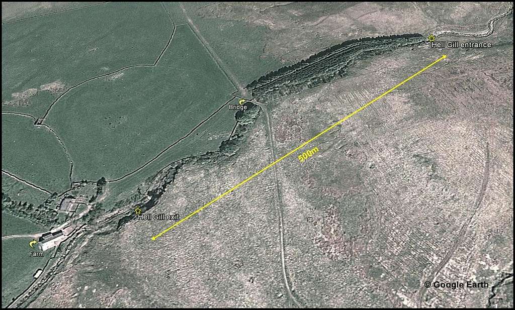
Google Earth view showing full extent of Hell Gill in relation to farm, bridge and pine tree plantation
Hell Gill can be divided into 3 sections, the middle of which being the deepest and narrowest – and where the crux and at least theoretical point of no return exists.
Start
The entrance to Hell Gill is easily identified as above, at the far end of the pine cultivation. A benign looking stream can be seen wending its way down a shallow depression in open grassy fell side – and then there is an abrupt transition and a total character change. Craggy rock appears around and within the beck, which immediately begins a stepped descent via a series of mini-waterfalls, each about a foot high. This soon has the effect of turning the rock into distinct walls – which soon tower over head – and the now lively and noisy beck disappears into a dark somber looking cleft and round a bend – and out of sight…
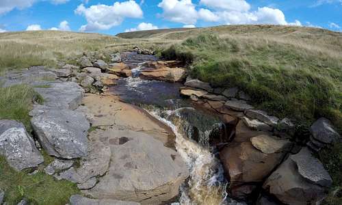 The benign stream coming down from Hugh Seat peat bogs... | 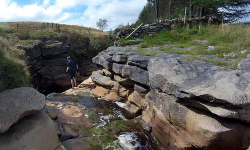 ...and the transformation at the entrance to Hell Gill | 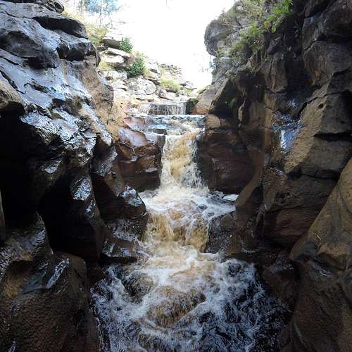 Looking back up 'the steps' |
Stepping carefully over the little waterfalls and mindful of a slippery scum of vegetation adorning some of the rocks in these parts it is nevertheless fairly straight forward to make this initial descent to and round the initial bend, which is fairly narrow and has a cavern like feel, with close set walls apparently bending overhead and shutting off the light.
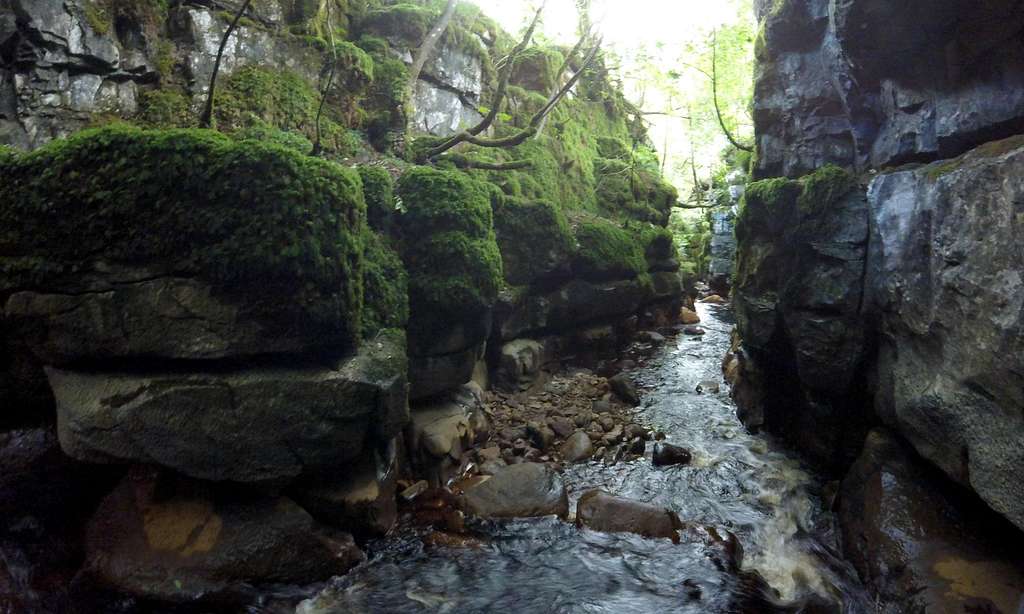
Once around the bend the beck levels off again, but at the same time the outside appears to have been shut off behind – further adding to the impression of having entered a totally different and alien world. The walls are probably no more than about 8m high at this point and further apart – but the atmosphere is surreal and still a bit cave-like with dark wet rock liberally plastered with great splashes of iridescent green moss. It could be a scene from Lord of the Rings. Spectators from an even more imaginative time could be forgiven for likening it to the insides of Jonah’s whale. This colourful section feels horizontal, although it will be sloping gently downhill – and heads in a straight line for some distance before the next bend and another character change. The water throughout this section is never more than knee deep – under normal conditions in fairly dry weather.
 Guide with either client or inexperienced partner near the start... | 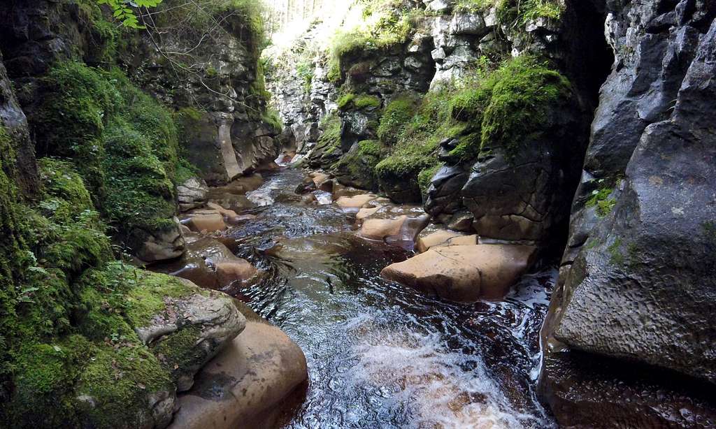 ...and just before the first 'Lord of the Rings' section |
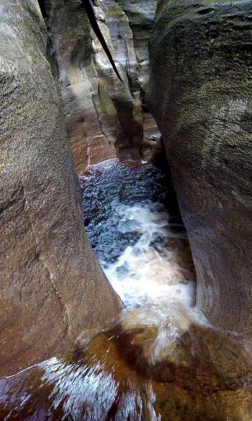
Middle section
At the end of the long straight mossy section the walls close in and it becomes gloomy and cavern like again. There are a couple of steps downwards – with lively little waterfalls, a little larger than those at the start – and use of the hands is needed to negotiate a bit of scrambling. Between the waterfalls are narrow chamber like sections where unbroken fast but smooth flowing water completely spans the 1m/3 foot diameter of the cleft at this point. In the last of these it is just deep enough to swim a few strokes.
 Looking back at Lord of the Rings section... | ...and onwards into the narrower and more cave-like.. |  ...Hell Gill middle section, approaching the crux |
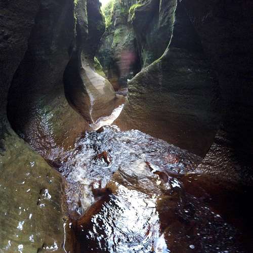
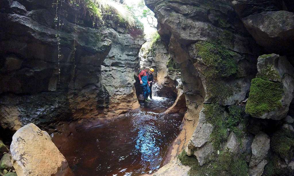
After some distance the rocky cleft abruptly narrows to its narrowest yet – and the crux is reached. Noise levels are rising as this feature is approached – and it is soon apparent that the majority of the cacophony is coming from a waterfall squeezing through this narrowing – and plunging 1.5m or 5 feet into a bowl shaped chamber below.
There is a fixed rope here, of black 11mm caving line – which hangs horizontally across the next chamber and for some distance beyond, to an anchor point high up on the left hand wall of the canyon and some 20m distant. The far attachment is about 5m above the floor of the canyon,which descends that amount over the distance – in two steps, starting with the ‘drop’ into the bowl.
There is more than one way of negotiating the next obstacle. The dark swirling water in the bowl below is a good 2-2.5m deep so safe to jump into. The bold approach is to launch over the edge and plunge into the maelstrom close to the foot of the waterfall. Trying to slide or brace across and lower oneself to a lower dropping point is not very easy and risks injury to clothes if not self. The rocky walls taper outwards and the waterfall packs more than enough punch to swat the most determined limpet into the depths below. The other thing is that the rock here is completely devoid of vegetation and not at all slippery - and actually quite rough, despite the wetness – so attempts to slither down the fall liable to result in leaving little bits of skin or (preferably) wet-suit behind. It is better to be bold – and just jump! (I now have a hole in a pair of wetsuit shorts!)
 The crux... | 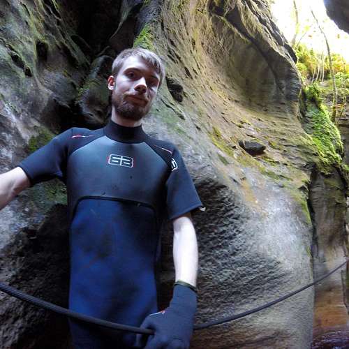 ...and Keith showing the fixed rope... | 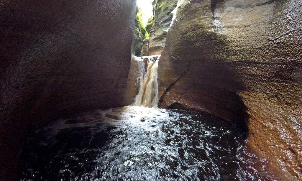 ...and looking back at the crux - the drop into the deep plunge pool |
The drop into the bowl is big enough to result in jumper becoming completely submerged for an instant – so not the best move for someone with an aversion to immersion in cold water or swimming – or both. For those who do like such things I can personally vouch for the pleasure to be experienced from swimming a few laps around the little bowl, before clambering over the rim – and negotiating the next section.
For the benefit of those with an aversion to being immersed in cold water I feel duty bound (but reluctant) to point out that it is possible to cheat – and to completely avoid the plunge: my 6’4’’ son demonstrated that it was easy for him to swing hand over hand along the fixed rope – with just his rubber encased toes dangling in the water – to then make land-fall on the rim of the scramble down to the next chamber. The fixed rope goes much further, but with the increasing drop below I would not recommend continuing along the rope without use of a harness and carabiner. This is in fact exactly what some do - completely bypassing the entire section by using the rope as a Tyrolean traverse (seems a bit of a shame to me)
The next and somewhat elongated chamber is about another 2m below, but the drop is not vertical this time – and can be negotiated via a somewhat wet scramble – mostly half inside the next bit of waterfall. The next water ‘pool’ is marked by a rather spectacular little rock arch – which can be passed underneath. It is possible to have another little swim here. Initially the water is too shallow but it soon deepens to just above waist deep, for enough of a distance to enjoy a few careful strokes.
 Next section with the rock arch and next 'swimming pool' | 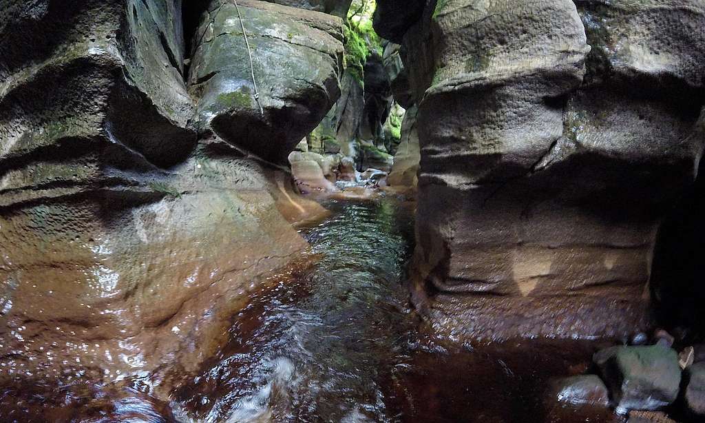 In the deepest part of the canyon |
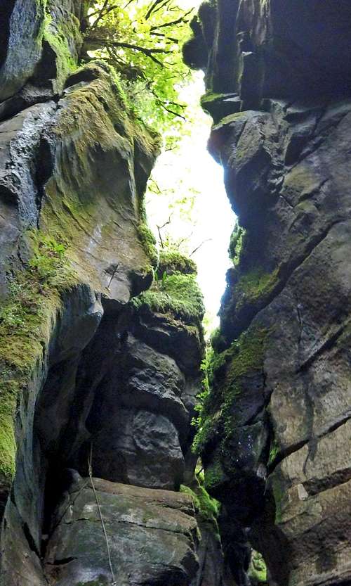
In all of this middle section the beck descends fairly steeply whilst the top of the cleft stays at nearly the same height. The net effect is that the deepest parts of Hell Gill are to be found just beyond the plunge pool, in the vicinity of the ‘second chamber’. It is very gloomy even on a bright summer’s day and there is the distinct impression of being in a deep cave, completely enclosed on all sides. But then the floor of the cavern widens again – and it gets lighter – and there is more of an impression of a narrow strip of sky, albeit largely obscured by overhanging trees, but clearly visible far above. With the widening (if blessed with a sunny day) a few golden beams of sunlight pierce the gloom and illuminate bits of the canyon floor and walls.
 Hell Gill deepest part, looking up... | 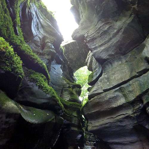 ...and another 50m or so later, the bridge... | 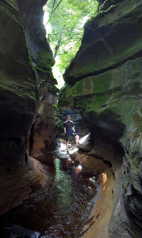 ...and the walls are getting lower now |
Final section
If the first section is the most surreal and the middle the hardest and most cave-like the third and final section is the prettiest part of the canyon – particularly on a sunny day. There is more vegetation again – but with sunbeams penetrating in places and the remaining light passing through leaves parts of the canyon walls appear to glow and it is quite beautiful. Having said that I have passed through twice on bright sunny summer’s days – and imagine it could be quite different on a dull day – or in winter.
The start of this next and final section is marked by the widening of the canyon – but also by the bridge, which appears high overhead. It is worth pausing to compare the impressions looking up – with those of looking down from the bridge perhaps an hour in the past. I would estimate the walls of the canyon as being about 20m high at this point. From this point on a long section of the stream is almost horizontal but the hillside far above is a little steeper – so the walls of the canyon gradually become lower.
Back to the Lord of the Rings scenery in the final and easy section
With the widening the beck no longer takes up all of the canyon floor and with the increased vegetation rocks are getting slippery again – and it is makes for easier going walking on the drier stones beside the stream at times.
The canyon walls continue lowering until back down to about 8m height – at which point they level off for some distance ahead in another fairly straight section of the canyon. With all the vegetation appearing again it looks similar to the ‘Lord of the Rings’ section close to the start of Hell Gill, the main differences being that the walls are not so overhanging and there appears to be daylight appearing between them looking straight ahead, as opposed to dark cleft. At a slight bend in the beck at the end of the straight section the canyon walls abruptly move apart and there is a complete change of scene – again.
It is back out into the light which feels dazzling after the gloom. The beck has turned into a small shallow river with green grassy banks with a few low trees sprouting in places. The canyon walls are still there but much lower and further away – and dry now, as well as exposed to the light, have returned to white limestone appearance (quite dazzling if in the sun).
 Just before the exit of Hell Gill - beware slippery! | 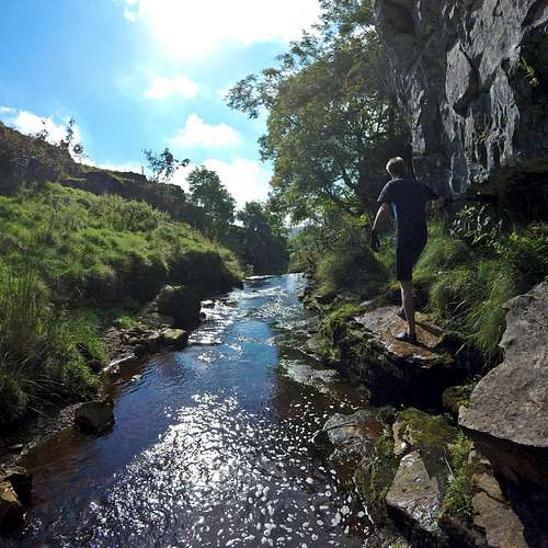 Just after the exit and trying to find the exit from the stream |
Over the next hundred or so meters the Gill metamorphoses from a rocky canyon to a steep sided but shallow grassy valley with tangled vegetation and bushes either side of the river. It soon becomes possible to climb out to the left in a few places – but the exit from the Gill is actually a little further on and to the right. The end comes almost unexpectedly – and care needs to be taken not to miss it.
There is an abrupt narrowing of the valley as the river turns into fairly impressive waterfall dropping a meter or so down into a large pool. It looks tempting for a plunge – but two things: firstly it is too shallow to swim and not to be recommended to jump into, but secondly if you scramble down the waterfall it would be difficult to get back up again – and the exit is just before the waterfall. Up on the right a few meters back from the waterfall there is an abrupt end to a 2 meter high section of limestone canyon wall – marked by a tree sprouting out of the top. A much lower dry-stone wall also appears to sprout from the end of the canyon wall just underneath the tree. A short muddy track ascends from the river edge to the join between limestone canyon wall and dry stone wall, which is easily scrambled over – to find same grassy meadow just above the farm, which was passed through on the approach to Hell Gill.
 Looking back at the exit from Hell Gill from beside exit from the stream | 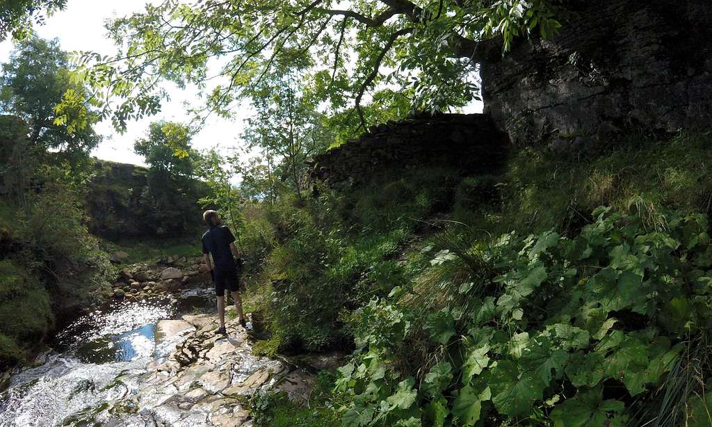 Keith looking at the exit: the muddy track up the bank and over the wall |
Equipment
Wetsuit: for me the little bits of swimming are some of the chief attractions for doing this canyon so a wet-suit was a bonus. For summer conditions a ‘shortie’ windsurfer wet-suit I picked up at a supermarket was more than adequate. I also managed fine wearing a combination of Gul neoprene 2mm shorts and 1.5mm vest. My son who has an aversion to cold water completely avoided all swimming and went hand over hand along the fixed rope as well as spidering his way along the canyon walls - which made me realise that the canyon could have been done without a wet-suit in relatively dry conditions and in summer – and wearing normal clothes above the waist. In winter I would suggest a full length wet-suit with boots and gloves.
Thick soled wetsuit shoes: feet are going to be immersed in cold water throughout most of the route and take something of a bashing from rocks. Ordinary swim shoes are fine for the beach but provide scant protection for a rocky canyon. I used Gul 3mm neoprene wet-suit shoes with Velcro strap which provided just enough protection to prevent bruising – and were ideal for swimming. My son used a pair of Vibram Fivefinger sports shoes which were slightly grippier for the scrambling he did in order to avoid swimming. We encountered one clearly experienced man guiding an inexperienced woman and he was wearing wellington boots (seen in photos above). He was also wearing hill clothes and intended to use climbing or caving gear to traverse the full length of the fixed rope – thus avoiding the two ‘swimming pools’. He clearly knew the canyon and what he was doing and so could get away with using ‘wellies’.
Gloves: wet-suit gloves were ideal to both protect hands from abrasion and also from cold. Not essential in summer – but a must in winter.
Helmet: part of normal canyoning equipment. Local Outward Bound organisations who take students through Hell Gill equip them with helmets (as well as full length wet-suits). This seems sensible – but I have to confess I didn’t take one.
Climbing/caving hardware: a harness, short sling and carabiner needed if intending to use the full length of the fixed rope. I didn’t take any hardware on either of my two visits to the canyon – although my son went hand over hand along start of the fixed rope to avoid getting wet! (see movie!)Red tape
There is no permit required nor bureaucracy to contend with. Parking and access to the canyon is ‘free’.
However, farmland with livestock has to be passed through on the way to and from Hell Gill. All normal and common sense rules of the Country Code apply: take nothing but photos, GoPro footage (and memories) and leave nothing other than footprints (and friendship). Be careful of damaging fencing and ensure gates are closed after passage.Dangers
Weather: in normal dry summer conditions the water levels in the Gill are low and easily manageable. However, with the source of the stream a mere 2-3 kilometers away up in the bogs below Hugh Seat it is easy to guess that water levels could rise swiftly if it rains. It takes a minimum of about 30 minutes to traverse the canyon – but some may take an hour or more if unused to scrambling on slippery rock. If there was a sudden cloud burst my impression is that you could be caught out. The message is don’t try to traverse the canyon in anything other than stable dry conditions.
Cold: I didn’t take the temperature in the beck when I traversed Hell Gill late summer in 2016, but from Wild Swimming experience in similar streams and rivers in the UK I guess the temperature to have been between 12-14°C (53-57°F). In early summer or late autumn the temperature could be in the vicinity of 10°C (50°F) In winter the temperature could well be 5°C (41°F) or less. If not acclimatised to cold water these kind of temperatures can induce cold shock - hence use of a wet-suit advisable if you are going to ‘take the plunge’…
Injury: the water in Hell Gill Beck is from peat bog and so it is brownish coloured, a bit like wading through beer (or for the teetotal: weak black tea) In addition any light reaching the bottom of the Gill is somewhat reduced. The net effect is that in some of the deeper water you cannot see what you are treading on - and the bed of the stream is very rocky. Another issue is that whereas in the middle and deepest section of the Gill the rocks are devoid of vegetation and pleasantly rough, at the entrance and exit there is a lot of moss and other greenery – and many of the rocks are extremely slippery. The overall message is that the risk of an ankle or foot injury is quite high – and pose proportionately the greatest risk of harm in Hell Gill. Reasonable balance and confidence walking on slippery surfaces is highly desirable – and even for an experienced person not a good idea to hurry too much (worst case scenario: broken leg plus stuck down the canyon - and then a thunderstorm with torrential rain... in the words of Clint Eastwood: this could ruin your day)
Mountain Rescue: Swaledale & Wensleydale Cave & Mountain Rescue Team are the local rescue organisation. In emergency dial 999 and ask for Police & mountain rescue. Note that mobile reception is very poor and in event of problems it may be a matter of accessing a landline at one of the farms in the area.Weather Forecast: Mountain Weather Information Service MWIS is a good service to use - click on the link and go to Peak District and Dales page for a 3 day forecast.
Map & Guidebook
Best map is OS Explorer OL 19 scale 1:25 000 - see below
Cicerone do a scrambling guide for the Yorkshire Dales - but only the southern area and not the northern bit, where Hell Gill is situated. It was only through looking at the Wild Swimming guide by Daniel Stuart, also shown below, that I learned about Hell Gill.
 OS Explorer Map of the area | 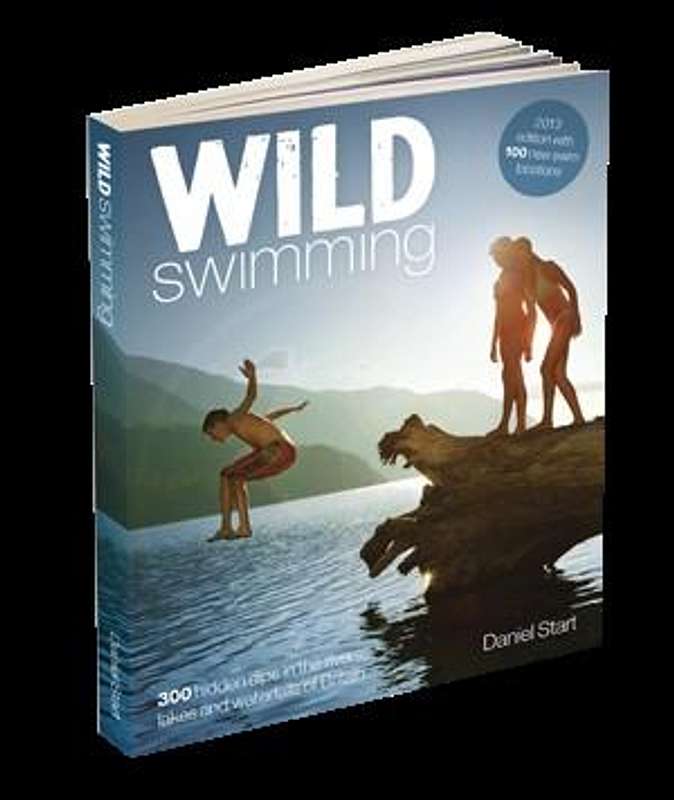 Hell Gill is one of the star prizes in this wild swimming guide by D.Stuart |
Links
Yorkshire Dales wiki page
Hell Gill Force on English Lakes website
Mallerstang Dale on English Lakes website
Hawes website
Kirby Stephen website
Wild swimming new guide
Low Mill Centre - for Gorge walking guide
Hell Gill Force
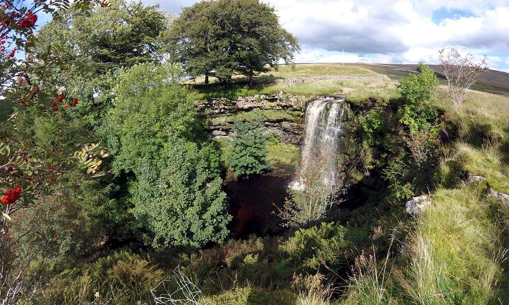
The beautiful waterfall of Hell Gill Force, with Hell Gill in far background on the other side of the distant pine plantation.
Hell Gill Movie
All the still images that feature on this page were taken with a GoPro Hero LCD. I also shot a considerable amount of video on two visits to Hell Gill one week apart - and edited into an 11 minute Vimeo movie, which captures the atmosphere of Hell Gill along with some dramatic footage of the plunge pool. If interested please click on the Vimeo link below:
Suggest view on large a screen as possible, with sound and HD at 1080 - or as high as possible according to the power of your computer.