
|
|
Route |
|---|---|
|
|
35.98661°N / 14.33103°E |
|
|
Hiking |
|
|
Spring, Fall |
|
|
Most of a day |
|
|
Overview
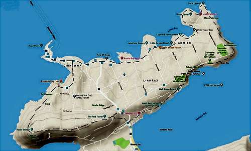
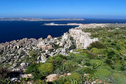
There are many options for coastal walks on Malta, this one lies in the quieter north part of the island. The area is dominated by the tourist routes heading across the water to the nearby islands of Camino and Gozo and you will never be far from a road or a house. Malta is quite a barren island and although this is no mountain route, sturdy footwear and appropriate clothing is recommended. Whilst this route follows the coast for a large part, some of this is on very rough ground with no established footpath and care is needed on these sections. On the map, the Marfa peninsula looks like the outline of the head of a Hammerhead Shark, with a ridge running east to west in the middle. The ridge itself starts as a tarmac road and degenerates into a dirt track which ends at the old Radar station towards the end of this walk.
Spring and Autumn (Fall) are the best times to walk on Malta. In Summer it will be too hot to walk (expect temperatures in the high 30 ‘s C or more) especially as there is virtually no shade on the rocky coast. Winter can be ok but the weather could be unpredictable, beware of strong winds.
There are very few signposts on the walks other than some home-made ones and a few other painted markers. There are no legal rights of way across private land in Malta and access is maintained through the good will of the landowners.
There are very few places to get refreshments so it’s best to take something for your lunch.
Getting There
Malta is justly famous for its bus services. Frequent and regular services can bring you from wherever you are based to just about anywhere on the island. The busiest routes run from the capital Valetta up the east coast to the north of the island but this does mean that the wait for the next bus is never that long.
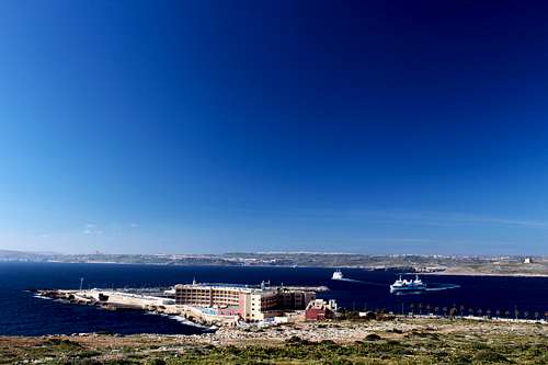
For this walk, head north as far as you can go leaving the bus (or your car) at the ferry terminal for Camino and Gozo, there is plenty of parking space.
The bus timetable has seasonal differences so see the online version for up to date information.
Accomodation
There are plenty of hotels, villas, apartments or campsites throughout the island. Whilst Valletta (the capital) and the east coast just north of Valletta is very built up, virtually all the bus routes go there so travel options increase by way of compensation.
Valletta is very interesting from an historical perspective if you are so inclined.
There is plenty of hotel accomodation in the north of the island which is cheaper than hotels that are nearer to Valletta but it does seem particularly quiet compared to the east coast.
Route Description
As this is a circular route, a good place to start is at the ferry terminal at Cirkewwa, the far northern road point of the main island. This is the end of the line for the bus route and has a car park for those with their own transport. It has a certain type of bleak quality to its landscape but catches the wind off the sea and we were glad to be there on a sunny day. Admire the views across the water towards Camino and Gozo beyond, then set off along the main road eastwards.
Soon the main road heads south but this route continues eastwards along a track besides the seashore towards the hotel complexes of the Ramla bay.
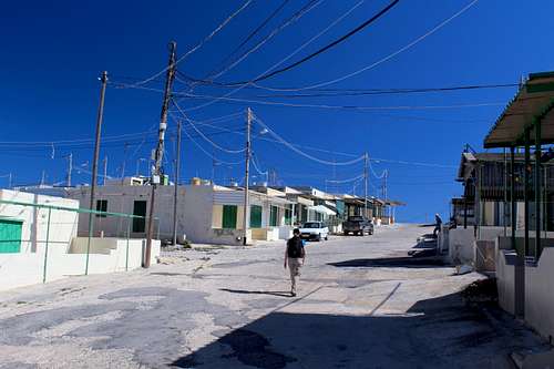
Not surprisingly, this is a little built up but once these hotels have been passed, follow the seashore through a succession of old holiday apartments along this far northern coast. When we were there, most of these seemed to be deserted and had the feel of a “ghost town” but it was low season. Bizarrely, it reminded me of one of the towns in an old Clint Eastwood, spaghetti western!
Follow the road straight across the headland to the “Palm beach resort” and follow the bay towards “Ray’s Lido” on the far side. On the day we visited, this was a pleasant, sunny beach with a few local men fishing in the quiet waters. From here, follow the road a little way before turning left towards the sea, passing more deserted apartments and see the White Tower ahead on the next headland.
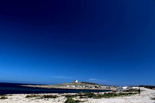
The White Tower was built in the 17th century as a lookout point across the water to the island of Camino and beyond to Gozo. Any approaching ships would be spotted and a warning beacon could be lit from it’s roof. This would be easily seen by the occupants of the larger Red Tower seen on top of the Marfa ridge itself.
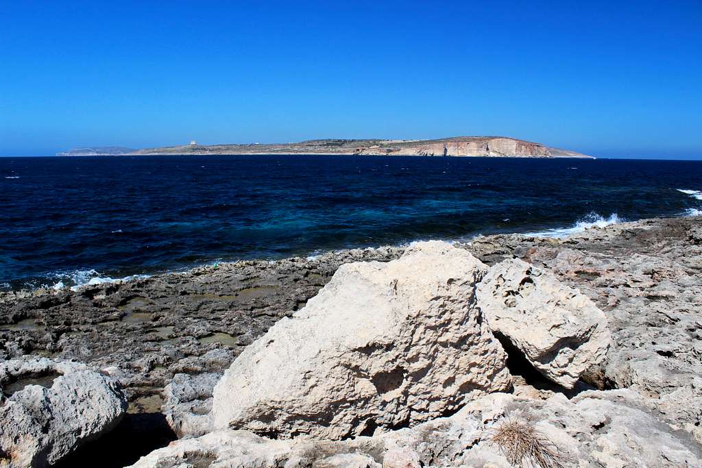
Keep following the shoreline around the Armier bay, as it swings northwards you get great views of the island of Camino. You are on a deserted rocky shore here. Pass around the headland with the White Tower on your right and continue to follow the shore towards Ahrax point.
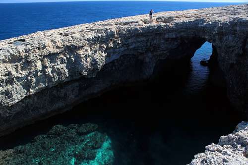
The path disappears and you will need to cross the rough, limestone rock until you find the “Coral Lagoon”, a huge sink hole, filled with deep sea water. There is an opening to the sea on the northern side.
This part of the route is particularly rough, take care not to fall as it would be easy to cut yourself on the sharp-edged blades of rock.
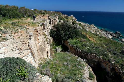
From here you head south but you have a choice of route. The most aesthetically satisfying choice is to follow the cliff tops, looking east over the sea but there is no real footpath and you will need to go slowly and concentrate on your footsteps to be safe.
The second choice is to head back inland a little to a dirt track that heads southwards, parallel to the sea. Either way, follow the route to the south east corner of the peninsula. Here on the cliff tops is a small chapel, the “Chapel of the Immaculate conception”. A good place to stop for lunch.
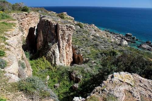
Head south-westwards along the southern edge of the peninsular, following a good path through scrub land and trees. The cliffs here are slowly tumbling into the sea and they form “islands” covered in green vegetation with deep “crevasses” in the rock as they slide away. At this point, you are on the north side of the Mellieha bay with a view of this town dominating your view across the water to the south.
|
|
Follow the path through fields of wildflowers until reaching the Mellieha bay hotel and you reach the point where you cross the main road just north of the entrance to the Ghadira nature reserve. There are public toilets here if needed and the opportunity to end your walk by catching the bus southwards – or back north if you have left a car at Cirkewwa.
Assuming you have decided to continue, cross over the road and head up the hill into the Foresta 2000 reserve. Follow the old road uphill and leftwards to climb 70 wooden steps (count em’) and onto the narrow road on the crest of the Marfa ridge.
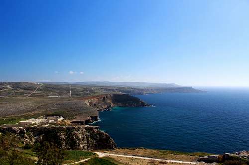
Turn left and follow the road as it continues westwards along the (albeit rather wide) crest until you reach the distinctive “Red Tower” also known as St Agatha’s tower. It was closed when we visited but I understand it originally dates from the 17th century. Armed with cannons, it was built to defend the north coast of Malta and with commanding views of the whole peninsula, act as a post to send an early warning of invasion, it has recently been restored by the National Trust of Malta. From this point we also have extensive views of most of this walk.
Leaving the tower, continue westwards along the crest of the ridge. The track deteriorates and becomes more lonely as you head towards the abandoned and ruined radar station at Ras il – Qammieh, at 424m the highest point on this walk. Beyond this is the western end of the peninsula where the cliffs tumble down into the sea.
|
|
Enjoy the view southwards down the west coast of Malta, then turn your back on this. To the north, in front of you are the islands of Gozo and Camino and the ferry port of Cirkewwa. Once again, the path has vanished. Pick your way down the hillside around the exotic plants until you can join a farm track and use this. Keep heading northwards towards the Paradise bay lido and find a way through the farmers’ fields to join the road at a large car park.
From here, follow the road which heads back towards the ferry port and soon you will recognise the route from earlier in the day. Soon you return to where you started the route from and gain your transport back to your accomodation.
Essential Gear
Sturdy footwear for the rocky ground, appropriate clothing for the weather including a fleece in case of a cool wind and waterproof in case of rain. A hat, sunglasses and suncream. Water and food.
Maps and Guides
Kompass No 235 1:25,000 Malta, Gozo
Cicerone – Walking on Malta.
External Links
https://www.publictransport.com.mt/en/timetables