

Comments
No comments posted yet.
|
|
Trip Report |
|---|---|
|
|
45.80940°N / 6.96260°E |
|
|
Aug 28, 2016 |
|
|
Hiking |
|
|
Spring, Summer, Fall, Winter |
Pictures of fluvial page are by andrea.it, Antonio, livioz, marco87, Maria Grazia Schiapparelli, om & Osw.
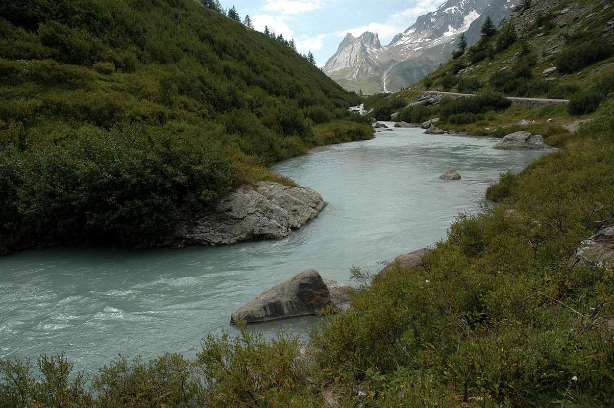
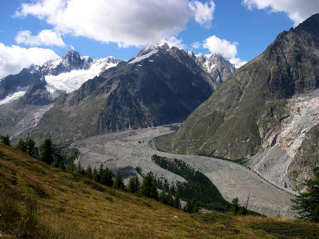
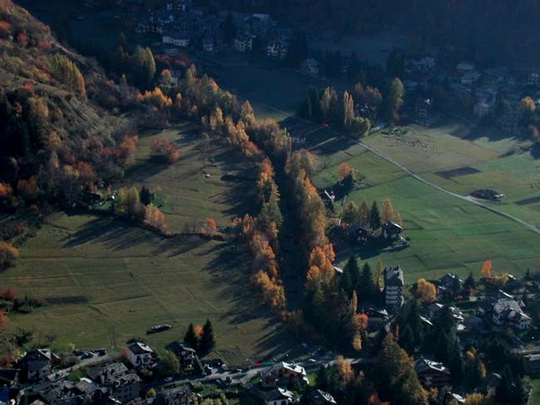
A more pronounced branch that comes from the Valley of Vény or Veny that originates itself at the Col de la Seigne, collecting all the waters into the Veny's Doire, that come from the Southern Slopes of this gigantic mountain with its big and wild glaciers. The other comes from the oblique opposite direction, ie North, coming from the slopes of Mont Dolent to the borders with France and Switzerland with the Dora of Ferret. The two come together just below Entrèves, where climbs to the Rifugio Torino and the Aiguille du Midi the eighth wonder of the world, or the Cable car of Mont Blanc Glaciers towards Chamonix-Mont Blanc. In diametrically opposite course instead begins to move around the Dora Baltea that crossed the whole Region of Aosta Valley, is directed towards that of Piedmont where, along with Dora Riparia, go to form the great River Po. This turning to Southeast and crossing the homonym plain or whole Po Plain, reaches the Adriatic Sea. A contradiction of Nature because it could more quickly reach the Ligurian Sea, but you have to deal with the Chain of the Apennines, and for this reason all the rivers bend flexing towards Lombardy, Veneto and Emilia Romagna abandoning to the right or East nearby Liguria. After being born at the foot of the highest mountain in all of Europe, here "he dies" the Dora Baltea that, to be born again, wait again its water from the Sea. The Dora Vény principally comes from the Miage Glacier perpendicular towards the South homonymous valley, while the Ferret arrives, with North to South axis, from the Pré de Bar Glacier at the foot of the Aiguille de Triolet, Mont Dolent, Mont Grapillon, Head Ferret and Grand Golliat or Golliaz (further East but always in Val Ferret) After coming together down decisively toward the underlying Commune of Pré-Saint-Didier, where it receives the water of the Dora of Verney and these of Dora La Thuile and at the foot of the great Glaciers of Rutor or Ruitor. Following reaches near Morgex to switch between La Salle and Derby; in addition, and further downstream, it receives the rich contribution of Dore of Valgrisenche and Rhêmes, the Savara Creek and Grand Eyvia Torrent who respectively come from Rhêmes and Cogne, both at the Gran Paradiso slopes and that all together make up the tributaries on the right orographic. From Aymavilles crosses the Southern part of the City of Aosta getting left the Grand Buthier (which brings together all Buthiers, including Rio Artanavaz, of the great St. Bernard Valley and the Valpelline) and dipping later several Municipalities such as Saint-Christophe, Nus, St. Marcel, Fénis (with the very magnificent, splendid Castle of the XIV° Century, built by Count Aimone of Challant in 1330), Chambave and Châtillon, which is reached from the North by the Marmore River, which runs through the Valtournanche from Western Breithorn, Cervino or Matterhorn and Grandes Murailles, and the famous Saint-Vincent small Town at the foot of Mount Zerbion. Then, abruptly changing direction, it is always addressed more to the South-southeast. Reached the Municipality of Verrès (beautiful and renowned medieval Castle, built between 1361 and 1390 by Ibleto Count of Challant, with famous Carnival, just above the confluence of Evançon Torrent with the Dora Baltea) and, after receiving more in left the Torrent Evançon from Valley of the Lys Torrent is adress itself to the Municipality of Arnad and Bard and flows collected at the foot of the Fort Bard (the one in May 1800 stopped the Army of Napoleon), leaving on your right to Hône, where he received the Ayasse, from the right orographic valley or of Champorcher. After continues in the direction of Pont-Saint-Martin, the last little town in the Valle d'Aosta wet from the river, receiving the waters of the Lys Valley coming from Monte Rosa, then reaches Piedmont, leaving in high the Municipality of Carema. Then drains most of the Canavese Area coming shortly the City of Ivrea, famous for "red crenellated towers", as by Giosué Carducci great italian Poet, and where, after crossing a small narrow passage at the center of the town, is barred by a long dam, which in turn feeds the Naviglio of Ivrea. From here the river, depleted in part of its range, it begins to flow in the direction of the Po Valley or, better, Plain which yielded on the right, near the small Town of Strambino, the Hamlet of Cerone's Creek where come the Chiusella Torrent arriving from the Orco Valley into the South side Gran Paradiso to Piedmont. Finally, sinuous course, to the Po flowing near the small Common of Crescentino, always in Piedmont into the more Eastern sector of this Region, after being born to 1400 meters high.
Baltea's story which derives its name by great Balteus Glacier and then scroll through the millennia for more than 168 miles to the sea. Crossing Aosta Valley ...
Un ramo più accentuato che proviene dalla Val Vèny o di Veny che, originandosi presso il Col de la Seigne, raccoglie tutte le acque nella Dora di Veny, che provengono dai Versanti Meridionali di questa gigantesca montagna con i suoi grandi e selvaggi ghiacciai. L'altro proviene dalla obliqua direzione opposta, cioé Settentrionale, arrivando dalle pendici del Mont Dolent ai confini con la Francia e la Svizzera con la Dora di Ferret. I due si riuniscono appena sotto Entrèves, dove sale verso il Rifugio Torino e l'Aiguille du Midi l'ottava meraviglia del mondo, ovvero la Funivia dei Ghiacciai del Monte Bianco verso Chamonix-Mont Blanc. In senso diametralmente opposto inizia invece a scorrere la Dora Baltea che, attraversata tutta la Regione Valle di Aosta, si indirizza verso quella del Piemonte dove, insieme alla Dora Riparia, và a formare il grande Fiume del Po. Questo volgendo a Sudest ed attraversando l'intera omonima pianura o Pianura Padana, raggiunge il Mare Adriatico. Un controsenso della Natura perché potrebbe raggiungere molto più rapidamente il Mare Ligure, ma bisogna fare i conti con la Catena degli Appennini e per questo motivo tutti i fiumi flettono verso la Lombardia, il Veneto e l'Emilia Romagna abbandonando sulla destra od Oriente la più vicina Liguria. Dopo essere nato ai piedi della più alta montagna di tutta l'Europa, qui "muore" la Dora Baltea che, per rinascere, aspetta nuovamente le sue acque dal Mare. La Dora di Vény prifcipalmente proviene dal Ghiacciaio del Miage perpendicolare verso Meridione all'omonima valle, mentre quella di Ferret arriva con asse da Nord verso Sud dal Ghiacciaio di Pré de Bar ai piedi dell'Aiguille de Triolet, Mont Dolent, Mont Grapillon, Testa di Ferret e Grand Golliaz o Golliat (più ad Oriente ma sempre in Val Ferret) Dopo che si riuniscono scendono decisamente verso il sottostante Comune di Pré-Saint-Didier, dove riceve l'acqua della Dora di Verney e di La Thuile ai piedi dei grandi Ghiacciai del Rutor o Ruitor. In seguito raggiunge il vicino di Morgex per passare tra La Salle e Derby; oltre, ed ancora più a valle, riceve il ricco apporto delle Dore di Valgrisenche e di Rhêmes, del Torrente Savara e della Grand Eyvia che rispettivamente provengono da Rhêmes e Cogne, entrambe alle pendici della Catena del Gran Paradiso e che tutti insieme costituiscono gli affluenti sulla destra orografica. Dal sottostante Comune di Aymavilles attraversa la parte Meridionale della Città di Aosta ricevendo da sinistra il Grand Buthier (che riunisce tutti i Buthiers, compreso il Rio Artanavaz, della Valle del Gran San Bernardo e della Valpelline) e bagnando in seguito numerosi Comuni come Saint-Christophe, Nus, St. Marcel, Fénis (magnifico Castello del XIV° Secolo, costruito dal Conte Aimone di Challant), Chambave e Châtillon, dove viene raggiunto da Nord dal Torrente Marmore, che percorre la Valtournanche partendo dal Breithorn Occidentale, dal Cervino e dalle Grandes Murailles, e la famosa Cittadina di Saint-Vincent (Casinò) ai piedi del Monte Zerbion, con la sua alta Madonna ben visibile da ogniddove. Indi, cambiando bruscamente direzione, si dirige sempre più verso Sud-sudest. Raggiunto il Comune di Verrès (splendido Castello Medioevale, costruito tra il 1361 e il 1390 da Ibleto Conte di Challant, con famoso Carnevale appena al di sopra della confluenza dell'Evançon con la Dora) e, dopo aver ricevuto sempre da sinistra il Torrent Evançon dalla Valle del Torrente Lys, ai piedi dei Lyskamm, si indirizza verso le Municipalità di Arnad e Bard e scorre incassata ai piedi del Forte di Bard (quello che nel Maggio 1800 ha fermato per un mese l'Armata di Napoleone impegnata nella Campagna d'Italia), lasciando subito sulla destra quello di Hône, dove riceve il Torrente Ayasse, dalla destra orografica o Valle di Champorcher. Poi prosegue in direzione di Pont-Saint-Martin, l'ultimo comune della Valle d'Aosta bagnato dal fiume, ricevendo le acque della Valle del Lys che provengono da Gressoney-La Trinité ai piedi del Monte Rosa; dopodiché raggiunge il Piemonte, lasciando in alto il Comune di Carema. Poi attraversa gran parte del Canavese giungendo in breve la Città di Ivrea, famosa per le "Carducciane" rosse torri merlate e dove, dopo aver attraversato una piccola strettoia presso il centro della città, viene sbarrata da una lunga diga, che a sua volta alimenta il Naviglio d'Ivrea. Da qui il fiume, impoverito in gran parte della sua portata, inizia a scorrere in direzione della Pianura Padana ricevendo in seguito sulla destra, nei pressi del Comune di Strambino, alla Frazione di Cerone, il Torrente Chiusella che arriva dalla Valle dell'Orco e dalla parte Meridionale del "Granpa". Infine con percorso sinuoso si dirige al Po confluendo nelle vicinanze del Comune di Crescentino.
Questa é la storia della Dora Baltea che deriva il suo nome dal grande Ghiacciaio Balteo per poi scorrere nei millenni per più di 168 Kilometri verso il mare. Attraversando la Valle d'Aosta ...
The same quench the Mountaineer and Hikers returning from the goal achieved by giving him a first signal of peace, safety and contentment. After so much hard work ...
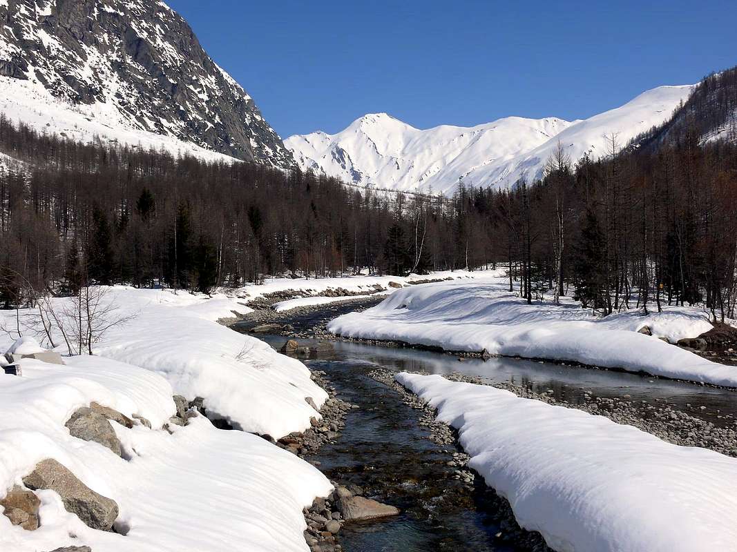
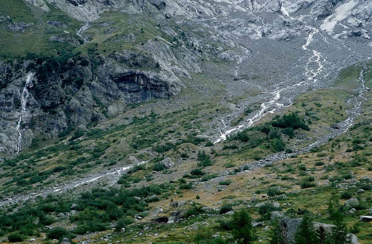
I torrenti iniziano là dove "muoiono" i ghiacciai, dando forma a qualsiasi spunto di vita con l'acque fresche ed ancora incontaminate, come sol in Madre Natura.
Le stesse dissetano l'Alpinista e l'Escursionista al rientro dalla meta raggiunta donandogli un primo segnale di riposo, sicurezza ed appagamento. Dopo tante dure fatiche ...
 |
 |
 |
 |
 |