
|
|
Route |
|---|---|
|
|
36.25294°N / 137.66039°E |
|
|
Hiking |
|
|
Spring, Summer, Fall |
|
|
Overview
Azusa River Trail
The trail from Myojin to the Kappa Bashi bridge along the western shore of the Azusa river is, in my opinion, the most beautiful and scenic trail inside Kamikochi. The things to be seen from this trail are more diverse compared to the other trails in the area. The trail leads through marshes, a thick forest, it passes along many small streams and has great views on the Azusa river and the surrounding mountains like Hotaka-Dake.
The most rewarding part of this trail is the part where a wooden trail was created to be able to walk right through the marshes and streams present in the valley. The trail has a length of 3.5 km (one way) and it takes about 70 minutes to complete the trail (also one-way). The trail starts at the Myojin Bashi bridge and passes the famous Myojin shrine. Here you can take a small side tour to see the Myojin-ike pond which is very beautiful. The trail can be combined with the Kappa Bashi - Moyjin Eastern shore trail creating a nice round tour. Also it is possible to go further into the Kamikochi valley by combing the tour with the Myojin - Tokusawa Trail.
If you plan on visiting Kamikochi, make sure to visit this trail since it is the most beautiful and scenic one in the valley. The route is graded T1 and is easy hiking.
Route Overview
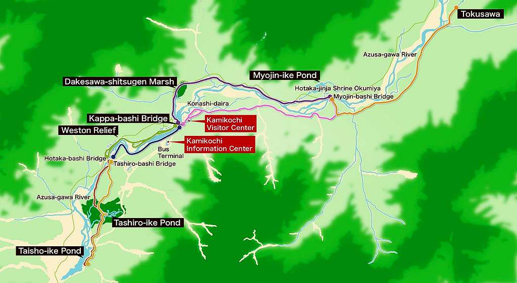
Kamikochi Trail Overview Map
Route Description

Myojin - Kappa Bashi Trail (West-shore)Â MAP
Route Description
 | The trail starts at the Myojin Bashi bridge. Cross the bridge to the western side of the Azusa river and follow the marked trail along the flowpath of the river. |
 | The trail goes along the western shore of the Azusa river along a broad path. In minutes, you will arrive at the Myojin shrine and Myojin-ike Pond. This is not part of the trail, but a quick stop is very worthwile. |
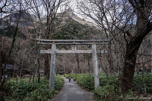 | The Hotaka Jinja Shire or Myojin shire. This is the entrance to the Myojin Ike pond. It is very nice to check the pond out. IT takes only minutes from the shrine to get there. |
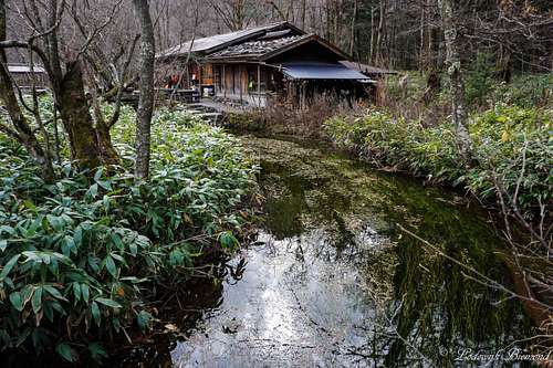 | Near the Myojin Ike pond. At the cabin it is possible to have a drink or buy water/food. |
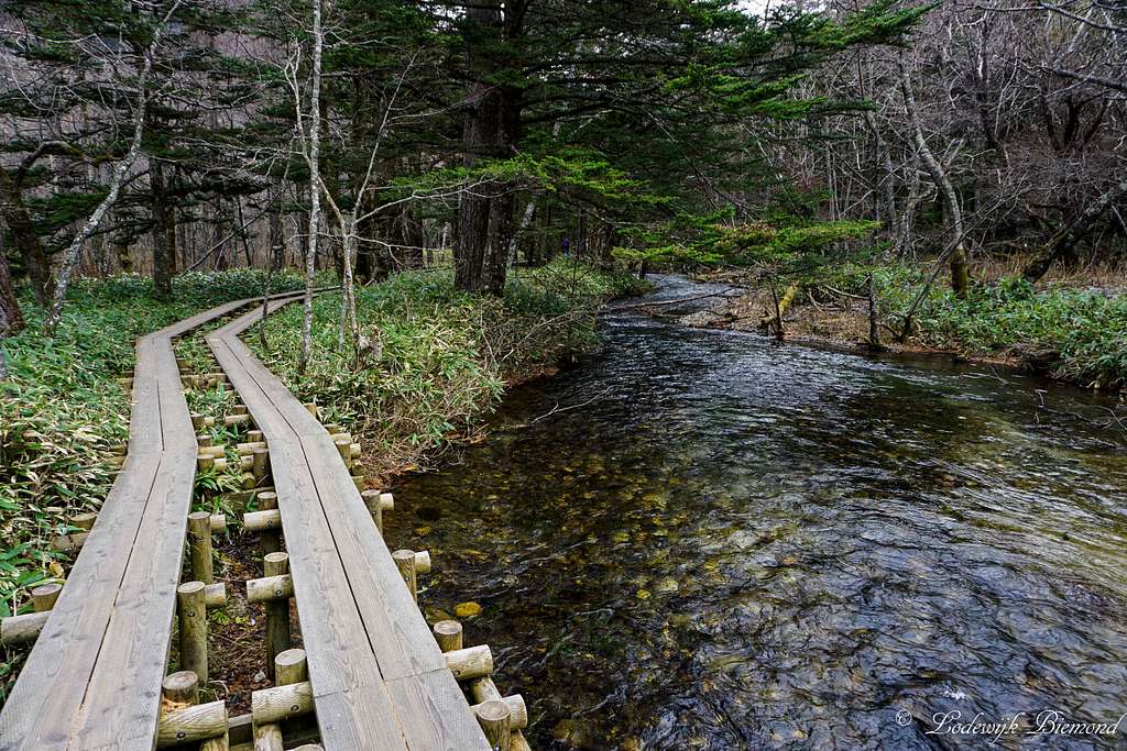
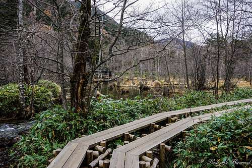
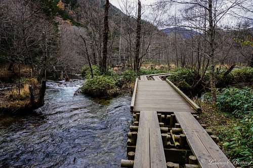 | After passing the shrine keep following the trail. The trail enters the forest and soon becomes the wooden trail as showed on this photo. |
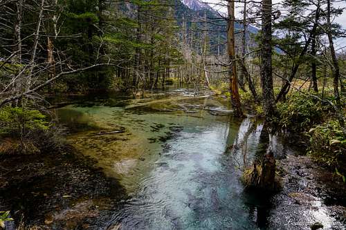
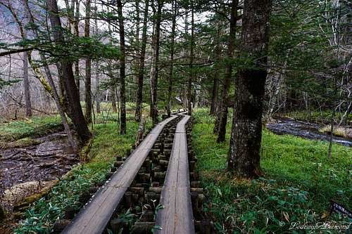 | The wooden trail is very scenic and offers fine views of the surroundings. At this point the Azusa river is flowing to the left and another, smaller stream, to the right. |
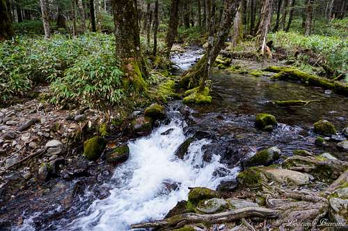 | About half-way along the trail the wooden part ends and makes place for a broad hiking path. Along the way many streams like this one are passed. |
 | This is the Dakesawa Shitsugen marsh, which is crossed by the trail |
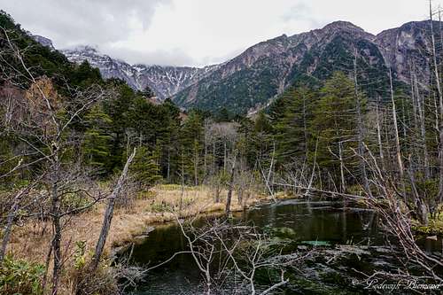 | The Dakesawa Shitsugen Marsh from the trail. Behind , in the clouds, is Hotaka-Dake, the third highest mountain of Japan (3190m) |
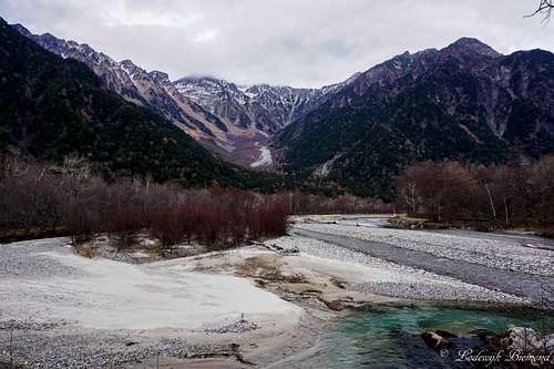 | After passing the Dakesawa Shitsugen Marsh the trail goes back following the western shore of the Azua river. The views on Hotaka-Dake are great. |
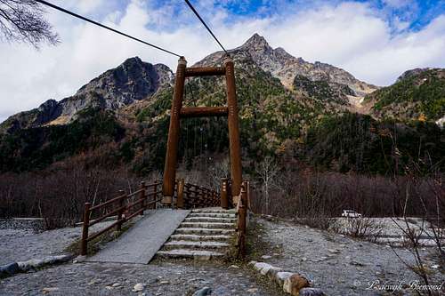
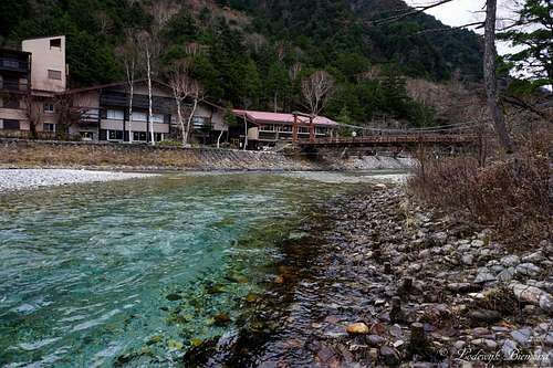 | The final meters of the trail The Kappa Bashi bridge is in sight and is the ending point of this route. The Visitor Center is nearby as well as the bus stop. |
Essential Gear
The wooden trail passes marshes and streams
Weather & Climate

Kamikochi Climate Map