
|
|
Mountain/Rock |
|---|---|
|
|
40.33634°N / 7.53628°W |
|
|
Hiking, Scrambling |
|
|
Spring, Summer, Fall, Winter |
|
|
5597 ft / 1706 m |
|
|
Overview
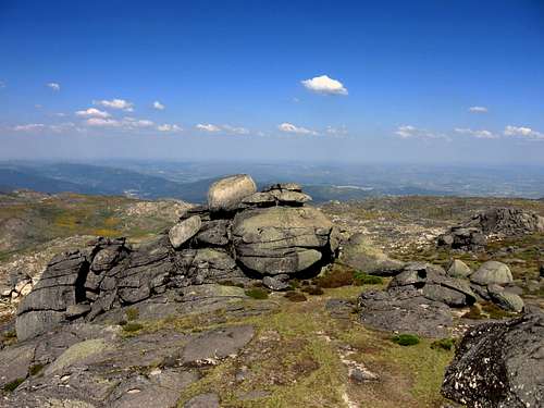
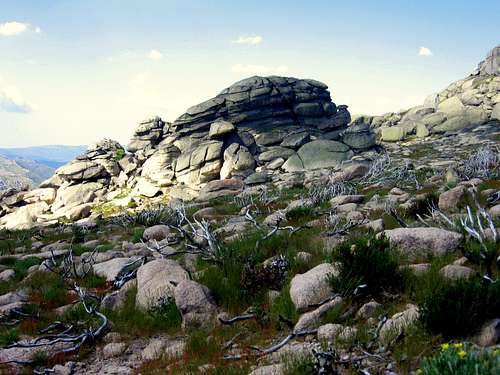 Heavily eroded Granite | 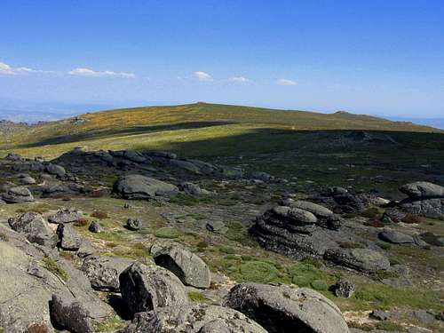 1800m view |
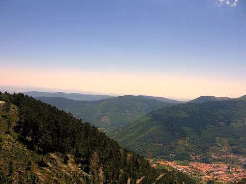
Poios Brancos is one of the major peaks of the Serra da Estrela , a National Park in Portugal home to the highest mountains on the mainland of Portugal. With it's 1706 meters in elevation, the views from the summit of this mountain are truly amazing. On a clear day you are able too see large parts of the Portugese, green lowlands surrounding the Estrela mountains. You truly feel like you are on 'top of Portugal'. Furthermore, this peak offers some impressive views towards the other main Estrela mountains: The sharp peak of Cantaro Magro (1926m) is a great sight, as well as it's slightly smaller brother Cantaro Raso (1917m). Behind Raso the summit of Torre (1997m) ,the highest point on the mainland of Portugal is visible as well. Last but not least, the view over the Zezere valley is majestic. This valley, carved out by glaciers millions of years ago, is perfectly straight, like a higher force had a hand in creating this wonder.
 Summit view! | 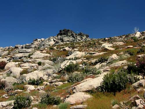 Getting close to the summit |
Poios Brancos can be described as a large hill, with a large Granite outcrop forming the summit block. Climbing this mountain therefore, is quite straightforward. Hiking skills are enough to reach the edge of the summit block (T2). For the final part to the actual summit some scrambling up the Granite summit block is needed, but no serious climbing skills are required here. Poios Brancos is a great hikers destination, and the impressive summit views make a trip to this peak a very rewarding one.
Another advantage is the quietness; the Estrela National Park is well known in Portugal, but not in the outside world. Hiking in the region means being accompanied by silence. The chance of encountering other people during an ascent on Poios Brancos is very small, which in my opinion, is a great plus.
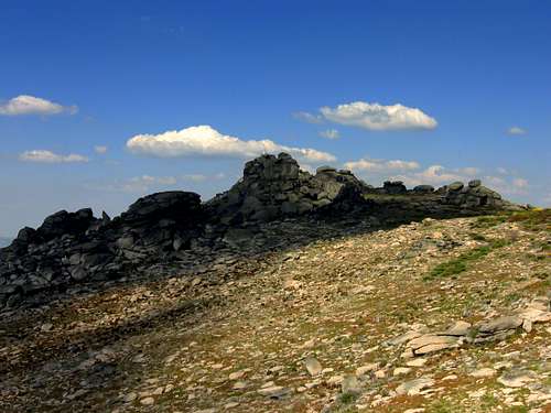 Poios Brancos with the Granite Outcrop marking the summit |
Getting to the Summit
From this point, start by following the road that starts in the corner of the main road. At your right hand you are able to see the summit of Poios Brancos at all time. It is as easy as heading towards it. There is no main route leading towards the summit, since the ascent is not very steep you can find your own way up. Getting up the hill requires about one to two hours. From here it is impossible to miss the granite outcrop that froms the summit block of Poios Brancos. On top is a white tower-like structure of about 2 meters high that marks the actual summit. Scramble your way up the granite summit block (many routes possible), this will take about 5 minutes. Now you have reached the summit: Enjoy the great views!
Descent is the same way back. Since there is no marked route you can find your own route down as well.
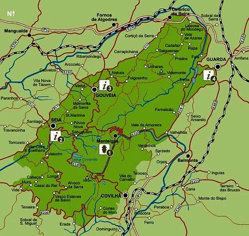 Serra da Estrela Map Serra da Estrela Map |
Maps and Practical Information
Zezere
1:50.000 Carta Turistica Serra da Estrela
Other options are:
-->1:50,000 Gouveia 17D,
-->Guarda 18C and/or Covilha 20C maps,
-->1:10,000 Viseu Fl17, Guarda Fl18, Covilha fl20,
-->1:200,000 Beiras Fl14 maps.
These are available from the Instituto Geografico e Cadastral in Lisbon or regional offices in Porto, Castelo Branco and Coimbra.
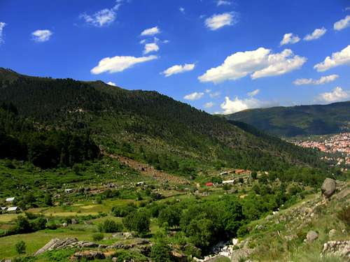
Manteigas: Starting Point
Manteigas
Some info on Manteigas:
It is located inside the Estrela Park and therefore closer to the mountains. It is located at an altitude of 700 meters at the end of the famous Zezere valley, which is an ancient glacial valley. From this mountain town you have great views over the Estrela mountains. Especially the view towards Poios Brancos and the mighty Cantaro Magro are beautiful.The history of Manteigas dates from the pre-Christian era, but its first charter was granted in 1188 by King Sancho I. Obvious Typical shepherds jackets, wood carvings, tin work, sheep-skin items and granite carving are also among handicrafts that are a reflection of the past. Other flavours from the past and the mountains can be savoured in the roast kid, mountain style stew, bean stew trout, smoked sausages, whey cheese, Serra cheese, milk cakes and Crista cakes, "cavacas" (a kind of hard, sweet cake or biscuit) and "queijadas" (a type of cheese-cake).
Although somewhat further away: Seia and Covilha are also good destinations when planning a trip to Torre.
How to get there
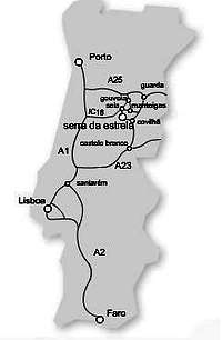
Access Map Portugal

Overview MAP
The main access routes by car are: (See Map at left)
The A25 highway when you are coming from Porto
THe A1 and IC 16 when you are coming from Lisbon
The A2 and A23 when you are coming from Faro
The A23 when you are coming from Spain
Distances:
Lisboa – Manteigas: 315 km (3h45)
Porto – Manteigas: 200 km (2h50)
Coimbra - Manteigas: 131 Km (2h10)
Faro – Manteigas: 548 km (5h45)
Vilar Formoso - Manteigas: 105 Km (1h30)
Visitors Centers/ Information
1)Rua 1º de Maio, 26260-101 MANTEIGAS
Tel.: (351) 275 980060/1
Fax: (351) 275 980069
e-mail: pnse@icn.pt
2)Pr. da República, 28
6270-496 SEIA
Tel.: (351) 238 310 440
Fax. (351) 238 310 441
3)Casa da Torre, Av. Bombeiros Voluntários, 8
6290-520 GOUVEIA
Tel.: (351) 238 492 411
Fax. (351) 238 494 183
4)R. D. Sancho I, 3
6300-548 GUARDA
Tel.: (351) 271 225 454
Camping/Hotels
The following links are of two nearby campgrounds:Camping Cegonhas
Camping Quintadacera
There are some hotels in the area, especially in Covilha.