The Lake District
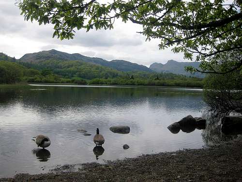
![Elter Water]() Elter Water, one of the many lakes
Elter Water, one of the many lakesOne of the more rugged areas in England is The Lake District. I wouldn't call it mountainous, but there are plenty of hills - and lakes of course. It's also the wettest part of England. Whether it's the rough nature of the countryside or the climate, I couldn't say, but it's not heavily populated. There are a couple of towns on the outskirts, and plenty of small villages in the valleys, but, higher up, the hills, or fells as they are called locally, are pretty much bare. Most are walk ups, but there are plenty of nice scrambling routes as well as some serious rock climbing possibilities.
Officially, camping wild is not allowed in England, but in some areas, such as The Lake District, unofficially it is accepted provided you stay well away from civilization, which means high up and away from cultivated land.
In the spring of 2012, I packed my camping gear to go wandering and have a look for myself. I expected to get wet, but I got really lucky: apart from a very light drizzle on first day, I didn't get rained on. Instead, it got better and better, and one day it even got so hot that a short but violent thunderstorm developed by the end of the day. But by then I was safely back in the valley.
A day later it was hot again, but no thunderstorm this time, which was a good thing because I was camping high up at the banks of Red Tarn, east of Helvellyn. During the night, the wind got stronger and stronger and eventually one of my tent poles snapped. I fixed it provisionally, but that didn't last long. Being out of spare parts, my tent was now reduced to a bivvy bag. It was a good thing that it was the last night I would be camping; tomorrow night I would stay in a hostel in Ambleside, so I could enjoy a shower before traveling home. I'm sure my fellow passengers on the plane would have appreciated that, if they had known...
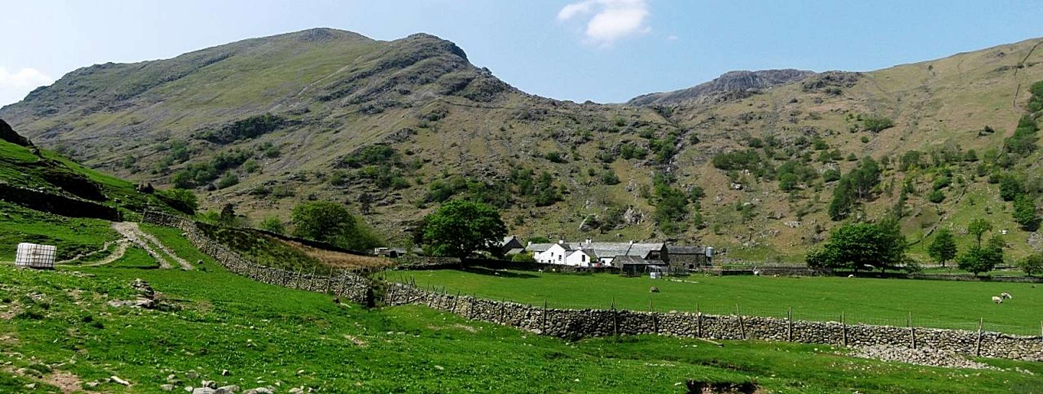
![Approaching Seathwaite Farm and Base Brown]() Seathwaite Farm with Base Brown (646m) behind it
Seathwaite Farm with Base Brown (646m) behind itMy itinerary
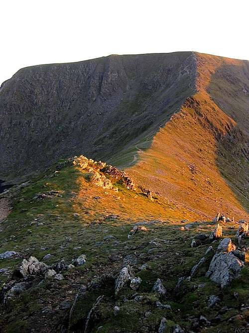
![Looking across Swirral Edge from Catstycam to Helvellyn]() Swirral Edge, from Catstycam to Helvellyn
Swirral Edge, from Catstycam to Helvellyn |
- After traveling to the village of Windermere, there was still time for a late afternoon hike over Wansfell Pike to Ambleside. Stayed in a hostel.
- Via Lily Tarn, Skelwith Bridge, Elter Water and Little Langdale Tarn over Wetherlam to Levers Water. It was a slightly damp place.
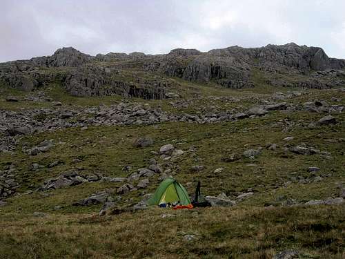
![Camping in the Lake District]()
Unobtrusive wild camping just north of Levers Water (54.424°N, 3.129°W)
- Via Low Water over Coniston Old Man, Brim Fell, Swirl How and Great Carrs to Wynose Pass, and then to Red Tarn just a little further north.
- Over Crinkle Crags, Bowfell, Esk Pike, Great End, Ill Crag, Broad Crag and Scafell Pike to a beautiful spot somewhere along the Lingmell Gill.
- Via Mickledore and Foxes tarn to Scafell, then via Bell Rib up and over Yewbarrow to the saddle of Dore Head.
- Over Red Pike, Scoat Fell, Pillar, Kirk Fell, Great Gable, Green Gable, Brandredth and Grey Knotts to Honister Pass. From there by taxi to a hotel in Rosthwaite.
- With only a day pack via the Grains Gill direct route up Allen Crags, over Glaramara and back. After eating in Rostwaite during the thunderstorm, I hitched a ride to Keswick (it was well past the last bus) and stayed in a hostel.
- By bus to Glenridding, from there a short hike to the shores of Red Tarn, east of Helvellyn (that's a different Red Tarn from the one on day 3). Watched the setting sun from Catstycam.
- Via Striding Edge to Helvellyn, then over Nethermost Pike, Dollywaggon Pike, Fairfield, Hart Crag, Dove Crag, High Pike and Low Pike to Ambleside, where I stayed in the same hostel as on the first night.
|
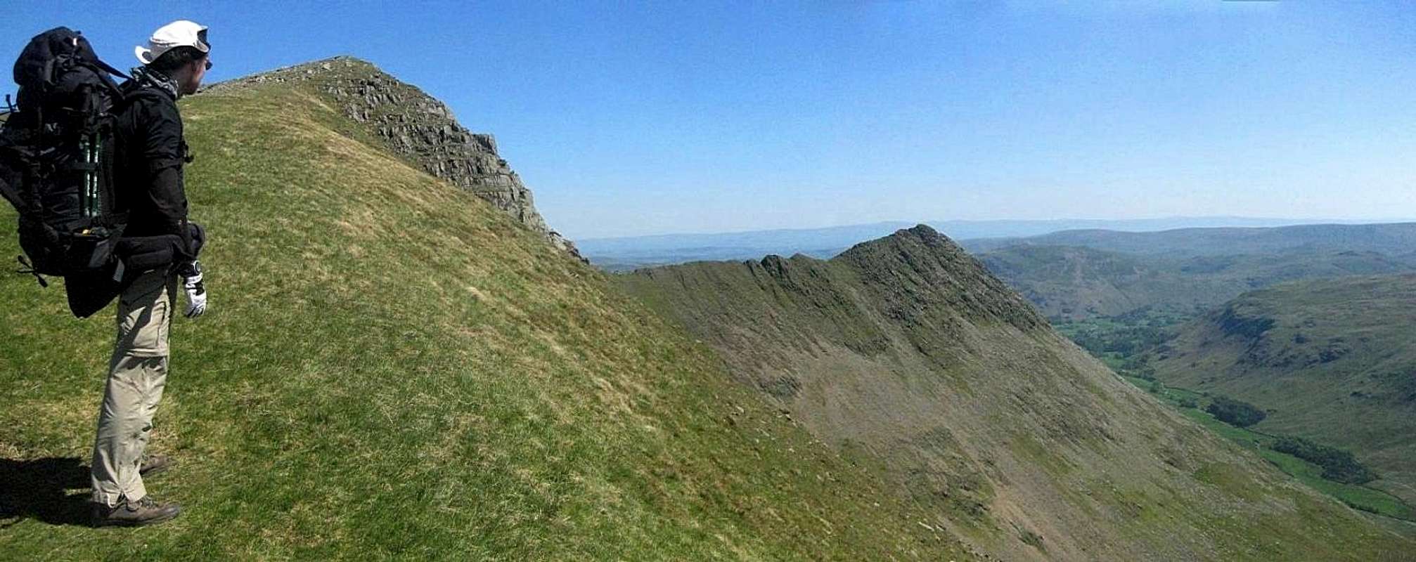
![Looking down Striding Edge]() I'm having a last good look back at Striding Edge before continuing on my way to Nethermost Pike
I'm having a last good look back at Striding Edge before continuing on my way to Nethermost Pike


Comments
Post a Comment