
-
 293 Hits
-
 79.78% Score
-
 11 Votes
|
|
Route |
|---|---|
|
|
46.22264°N / 10.57041°E |
|
|
Summer |
|
|
Most of a day |
|
|
IV UIAA |
|
|
5.5 (YDS) |
|
|
6 |
|
|
IV |
|
|
Overview
Spigolo Faustinelli (NE ridge), Corni di Lagoscuro
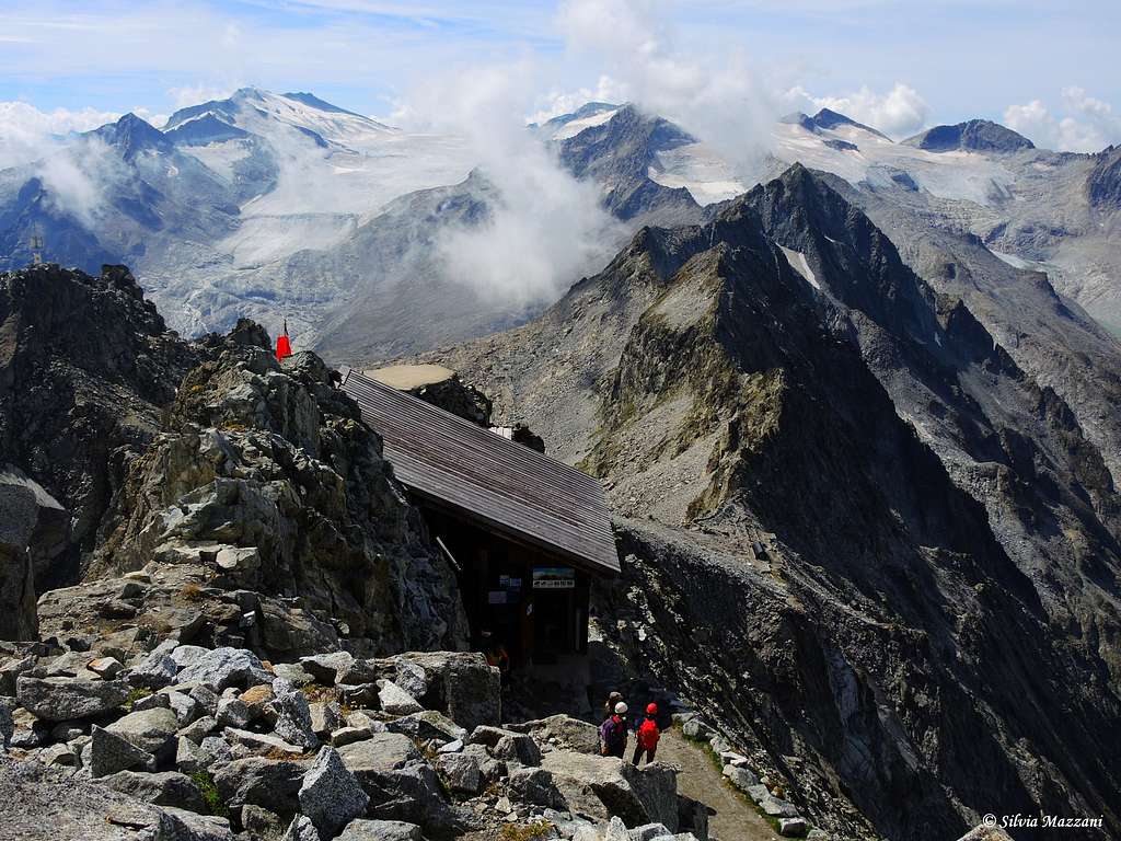
The North-East ridge or Spigolo Faustinelli is a classic climb reaching the top of Corni di Lago Scuro 3166 m, a mountain located in the Adamello Group, Nodo del Venerocolo, formed by three summits amongst which the highest is the central one, the most individualized. Three main ridges converge near the summit: the SW ridge arising from Passo di Lago Scuro, the East ridge running from Passo del Maroccaro and the longest North ridge starting from Passo di Casamadre. This latter originates the Northern Corno di Lago Scuro. The mountain is famous and frequently climbed also in reason of the presence, a few meters below the summit, of the Bivacco Amici della Montagna, a little shelter realized by the alpine guide Giovanni Faustinelli, using the remains of the Great War (WWI) still existing on the summit. The route described on this page was climbed for the first time by Faustinelli and his companions in the summer of 1937.
Getting There
The starting point is Passo del Tonale, located at 1883 m, an alpine col dividing the Ortles-Cevedale Group to the North from the Adamello and Presanella groups to the South. It connects the Val di Sole (Trento province) to the East with the Alta Valle Camonica (Ponte di Legno, Brescia province) to the West.
Getting to Passo del Tonale
- From Autobrennero (Trento or Bolzano) exit San Michele and take the road 43 running through Val di Non and then Val di Sole, getting to Passo del Tonale.
- From Pinzolo and Madonna di Campiglio (Val Rendena)
Take the road getting to Passo Campo Carlo Magno and Malè, here turn to left taking the road to Passo del Tonale
- From Brescia and Bergamo
The roads coming from Brescia and Bergamo combine near Darfo into the state road SS42 of Tonale and Mendola, which is running near the western limits of the Adamello Natural Park, crossing the villages of Boario Terme, Breno, Cimbergo, Paspardo, Cedègolo, Edolo, Temù and getting to the important resort of Ponte di Legno m. 1258 (66 km from Darfo), then to Passo del Tonale.
Approach to the route
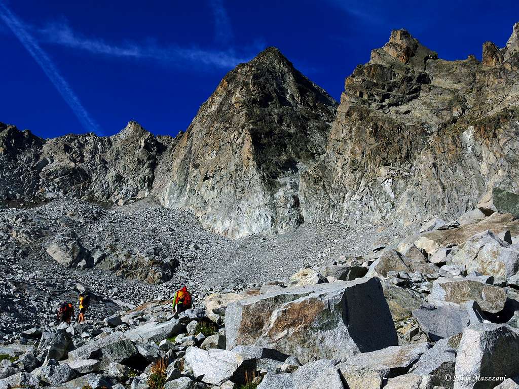
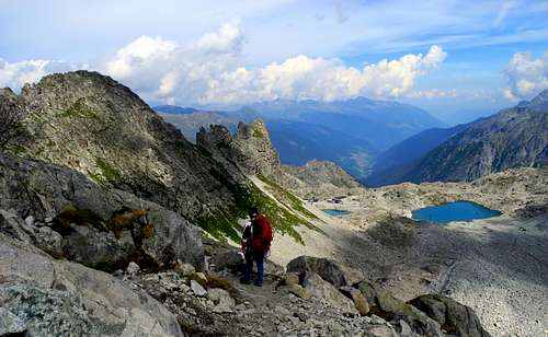
From Passo del Tonale take the cable car to Passo Paradiso and then the chairlift to Capanna Presena. From the Capanna the base of the ridge is clearly visible on the right, surrounded by residual snowfields. Without an obligatory route you can reach it about half a hour, heading to the right to go up the steep moraine slope towards the NE face of Cima Lagoscuro, aiming for the base of the obvious edge.
Route Description
Spigolo Faustinelli report
Summit altitude: 3166 m
Difficulty: UIAA II, III with some passages of UIAA IV (obligatory) - YDS 5.5
Equipment: some pegs and bolts
Climbing length: 220 m
Exposure: NE
First ascent: Faustinelli G., Castelli, Reina, 8/8/1937
Starting point: Capanna Presena 2738 m
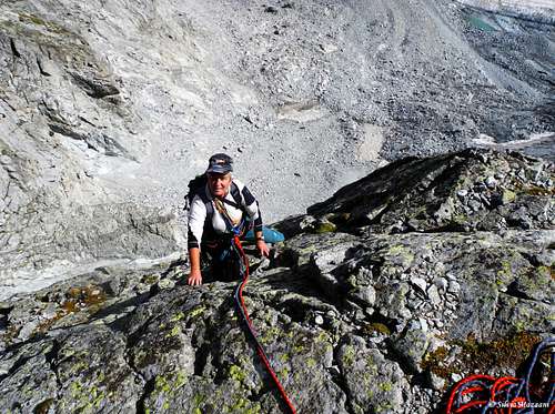
A classic and pleasant climb in altitude with a panoramic setting and reaching the summit of a fine peak. The rock is the tonalite, the typical granite of Adamello and Presanella. A minimum of attention to the quality of the rock is required on the initial and final pitches (debris and some loose stones). The route is reasonably equipped, but easily integrable with nuts or friends. The start of the route is just to the right of the ridge, corresponding to a small pillar to the left of a gully.
The first pitch goes up the rocks located between the ridge and the "Canalino del Diavolo" (the gully located to the right of the edge).
L1 - Climb the pillar first on broken rocks or, more beautifully, the left wall until reaching the stop at the base of an obvious slab, III+, 35 m
L2 - Climb the slab slanting to the right, then vertically to the belay on the right of edge III+, 35 m
L3 - Diagonally to the left reach the edge of the ridge and follow it to the belay, IV, 30 m
L4 - Continue climbing along the ridge with fun climbing, then traverse to the right to reach the terrace at the base of an open dihedral, III, 50 m
L5 - Climb the slab on the left side of the dihedral, at its end exit onto the ridge on the right along slabs and blocks, IV, 50 m
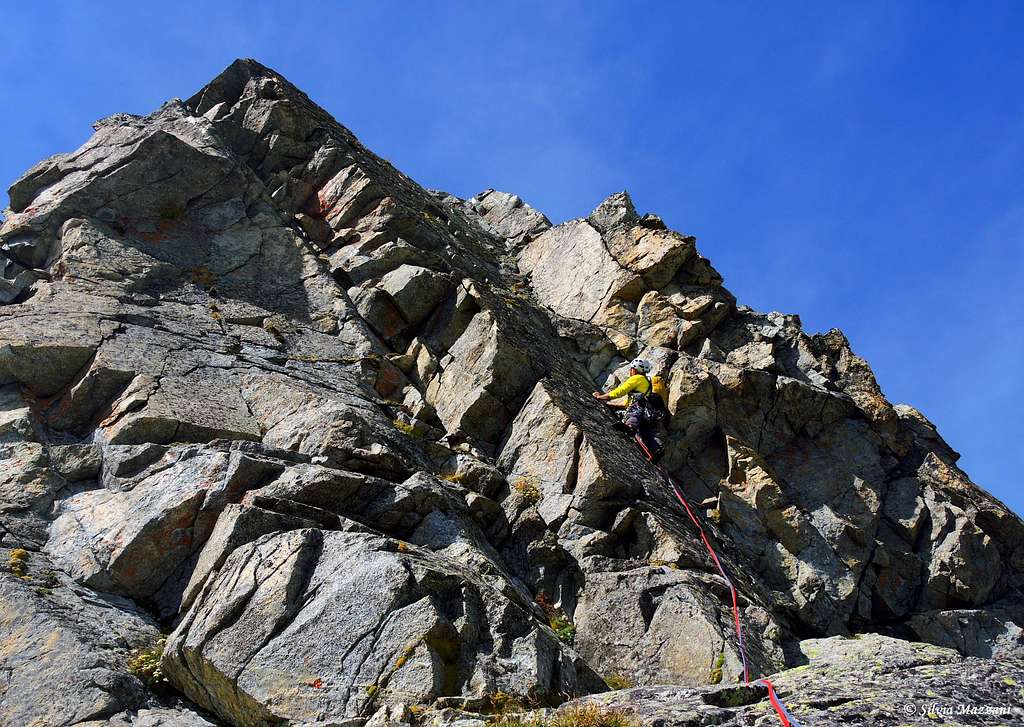
L6 - Continue along the edge up to a shelf where the edge drops and becomes unclear, III, 20 m
L7 - L8 With easy climbing through gullies and short walls for about 100 m you reach the top, just below which, on the opposite side to the climbing side, is located the famous Bivacco Amici della Montagna.
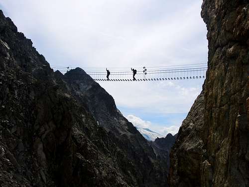
Descent: the recommended descent, although longer, either because it is safer or because it is very interesting, is the one heading North along the Sentiero dei Fiori, a beautiful war itinerary partly equipped and with scenic suspension bridges leading to the Pass of Castellaccio, from where to the right along a marked path you descend to Passo Paradiso.
Essential Gear
60m single rope (or two half ropes), descender, Kevlar webbing and cords, helmet, small set of friends and nuts, descender, cords, some quickdraws. In case of climbing at the beginning of the season the descent may require ice axe and crampons.
Red Tape


No fees no permits required. The Adamello group is governed by two parks: Parco Naturale Adamello-Brenta, the largest protected area in Trentino, established in the year 1967. It's located in Western Trentino and with its 620.51 square kilometers includes the mountain groups of Adamello, Presanella and Brenta Dolomites, separated by Val Rendena. On the Lombardy side there is the Parco dell'Adamello, which extends for 510 square kilometers on the left orographic side of Valle Camonica, in the north-eastern portion of the Province of Brescia. Camping is not allowed and fires are strictly forbidden.
When to climb
Best period is from middle June to the end of September. In case of climbing at the beginning of the season the descent may require ice axe and crampons.
Where to stay
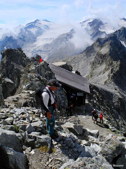
Different possibilities of accomodation in Val di Sole and Val Camonica. Near the summit there is the Bivacco "Amici della Montagna", a small emergency shelter.
Meteo
Meteo Trentino
Meteoblue Lombardia
Guidebooks and maps

"Adamello vol. II" - Pericle Sacchi (Guide dei Monti d'Italia CAI-TCI)
Map "Adamello - Presanella" - 4LAND Alpine Cartography n. 138 1:25.000