
-
 18172 Hits
-
 75.62% Score
-
 6 Votes
|
|
Area/Range |
|---|---|
|
|
36.95324°N / 22.34991°E |
|
|
Hiking, Mountaineering, Scrambling, Canyoneering, Skiing |
|
|
Spring, Summer, Fall, Winter |
|
|
7897 ft / 2407 m |
|
|
Introduction
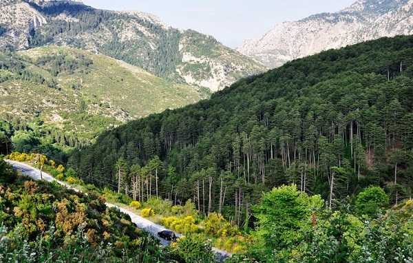
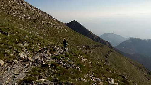
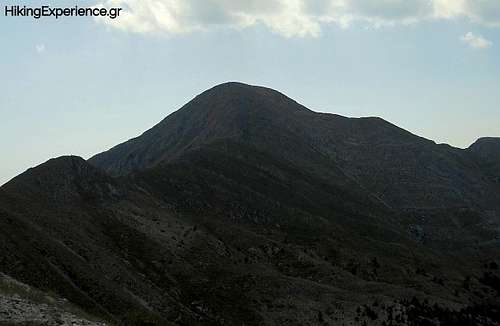
Taygetos or Taygetus (“Ταΰγετος”) is the highest mountain range in the Peloponnese, it is also one of the longest, and makes up the Southern end of the Pindos Mountain range, which begins around the Albanian border. Its highest summit, Profitis Ilias (2,405m) was most likely mentioned by Pausanias as “Mount Taleton” and it is an Ultra prominent peak at 2,405m elevation and 2,344m of prominence. From this main area the rivers of Eurotas and Vyros carry snowfall into the sea, on the East and West sides respectively. North of Profitis Illias lies a collection of peaks of similar elevation (all above 2,000m) which make up the Pentadaktylos ("Πενταδάκτυλος") ridge.
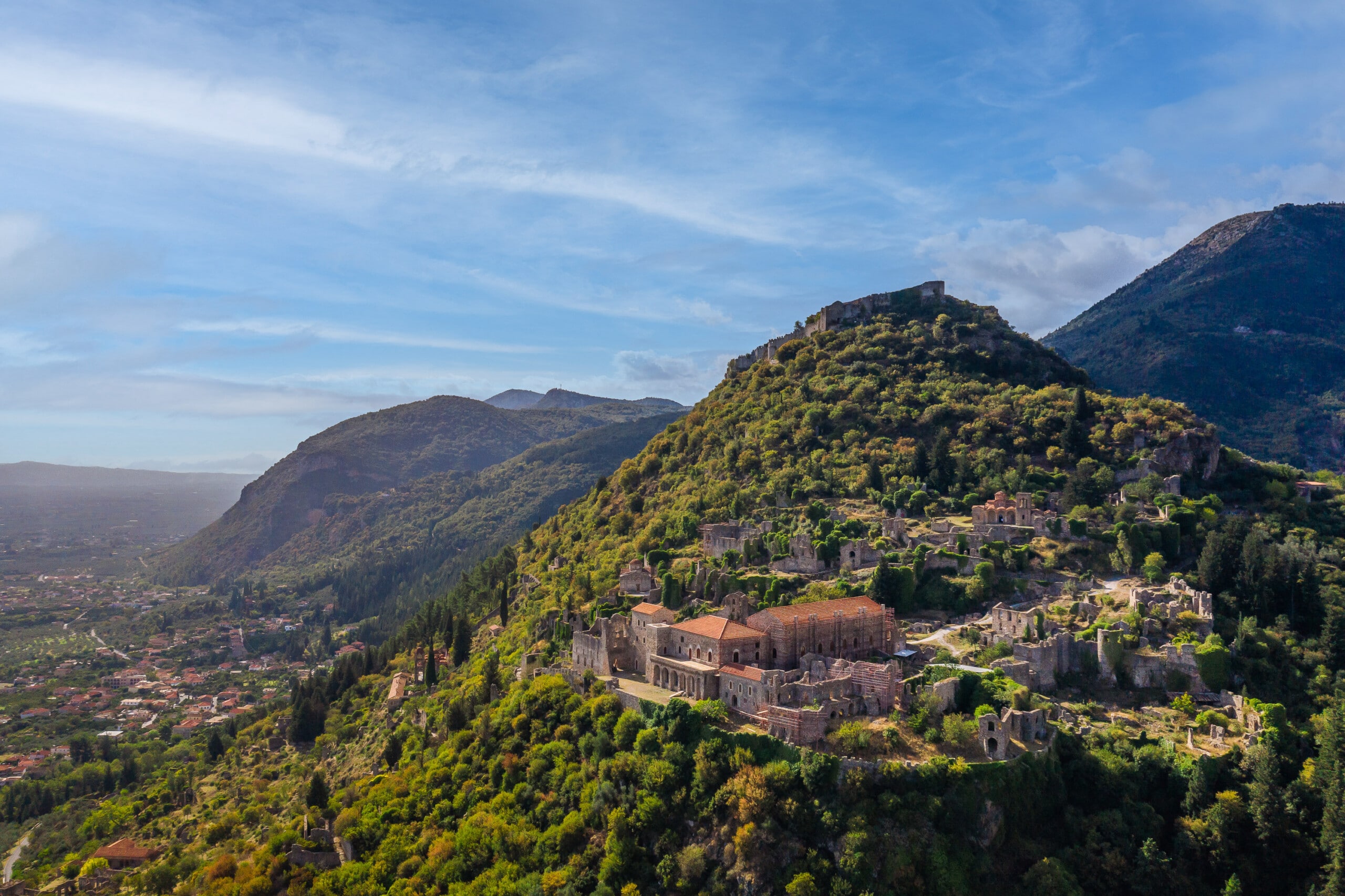
The mountain has a long history and remains relatively unexplored even today. It fell under Mycenean and later Spartan control with the chasm of Ceadas ("Καιάδας") on the mountains East side serving as a location where criminals and captives would be executed during the time of the latter. In later times the Byzantine seat of power of Mystras was located on its Eastern foothills. Today the mountain has a well maintained network of trails with the European Route E4 crossing the summit, while a popular long-distance trail running race takes place every year. It is also one of the most popular hiking destinations in Greece, including camping on the summit.
In classical mythology the name "Taygetos" is derived from the Nymphe "Taygete" ("Ταϋγέτη") and being first recorded in the Odyssey.
|
|
|
|
Subdivisions of the Mountain Range
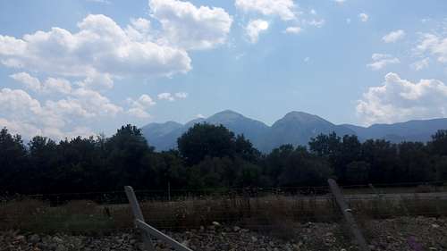
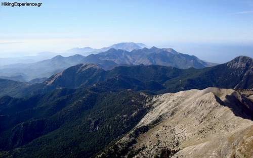
Taygetos is one of the largest mountain ranges in Greece. Located in the South of the Peloponnese and streching 110km in length and 30km in width. It has multiple +2,000m peaks and is divided into three geographic groups, the North, the Central, and the South. The highest summit of Profitis Ilias (2,405m) is in the Central while the lowest summits are in the South (<1,500m).
North Taygetos
The Northern part of the range begins at Megaloupoli until the Lagada Pass near the village of Trypi ("Τρυπη"). The highest summit is "Xerovouna" ("Ξεροβουνα") meaning dry mountain, at an elevation of 1,852m. Most of the Northern range is hill-like and not alpine whilst the only high-elevation locations are on the Southern ridge and the general Xerovouna area. The key areas of interest and peaks for this area follow:
- Xerovouna (1,852m) ["Ξεροβουνα"] is the highest peak and the second-Southern-most of this group.
- Neraidovraxos (1,784m) ["Νεραιδοβραχος"] is the second-highest peak and Southern most just above Lagada Pass.
- Pyrgaki (1,732m) ["Πυργακι"] is the Northern most alpine peak of this group and considered the most technically demanding.
|
|
Central Taygetos
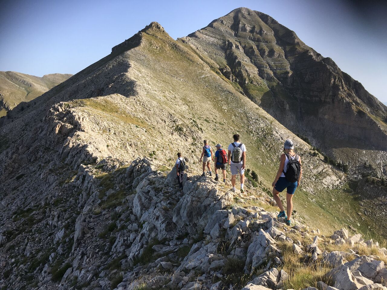
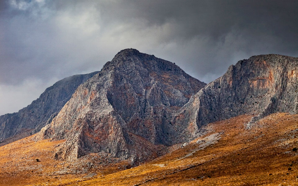
The central section of the Taygetos range begins at the Lagada Pass, across from Neraidovraxos (1,784m) peak and ends at the Gorge of Saggias between Aeropoli and Kotronas. This section is home to Greece's 11th highest summit and highest in the range, Profitis Ilias (2,405m). It is the last alpine summit of this section until Saggias, more than 50km South. This section is also where the Pentadaktylo ridge is situated, North of Profitis Ilias.
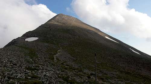
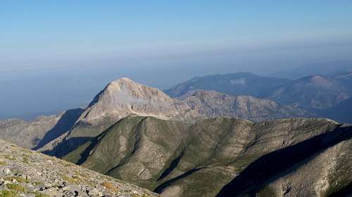
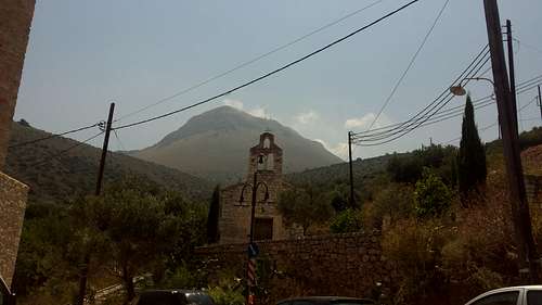
The pyramid of Profitis Ilias is named as such both due to its unique shape and beacause of a small chappel of Prophet Elias on the summit, which is open to visitors sans snow. The following are all the different peaks of interest in this section:
- Goupata (2,031m) ["Γουπατα"] is the northernmost summit of this section and can be accessed directly on its own from the East.
- Neraidovouni (2,028m) ["Νεραιδοβουνι "] is directly on the ridge of Goupata (2,031m) and is the northmost summit acssesed by the ridge trail that heads southwards,
- Spanakaki (2,098m) ["Σπανακακι"] is the first on the main ridge that is also the first summit that is reached by the trail begining at the village of Anavryti.
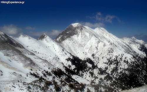
- Athanati Raxi (2,360m) ["Αθανατη Ραχη"] is the neighboor of Profiths Ilias (2,405m) and the second heighest summit. It is accessible from both the ridge and East trails.
- Sidirokastro (2,340m) ["Σιδιροκαστρο"] is the third highest peak and the most extreme, being a shere rock-face on the East and South. It can be seen when looking North on the "Plakes" area of the trail to Profitis Ilias (2,405m).
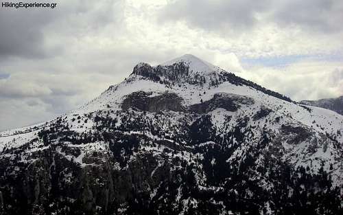
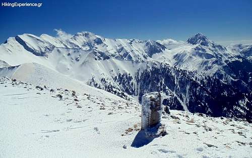
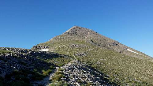
- Profiths Ilias (2,405m) ["Προφητης Ηλιας"] is the highest peak in the range with the impressive summit pyramid and the small church on the summit. It can be acssesed by multiple trails.
- Xalasmeno (2,204m) ["Χαλασμενο"] is the 4th highest peak of the range and is one of the most visulay distinctive. It is quite remote and can only be acssesed by the main trail head on the East, going past Profitis Ilias (2,405m) but not climbing it, and then going back again.
|
|
|
|
|
|
The remote Southern section of Taygetos starts at the Gorge of Saggias and finishes as the mounatain fades into the Aegean Sea at Cape Tenaron. The highest summit is "Saggias" (1,227m) and is at the Northern-most part of this section. There are only three notable peaks and the area further South has progressively lower elevations.
- Saggias (1,227m) ["Σαγγιας"] is the highest summit on the southern section and it is a rocky outcrop at the meeting point of two sharp ridges.
- Profoiths Hlias Fragkoulias (1,137m) ["Προφιτης Ηιλιας Φραγκουλιας"] is the second highest and located on another rocky outcrop further South, on the plateau.
- Pyrgos Dyrou (1,079m) ["Πυργος Διρου"] is the lowest of the three and is located on the top of the Western ridge, it can be hiked on the way to Saggias.
|
|
|
List of Highest Peaks
|
|
|
|
 |
| Profitis Ilias | Athanati Raxi | Sidirokastro | Xalasmeno | Spanakaki |
| 2,405m | 2,360m | 2,340m | 2,204m | 2,098m |
| Central | Central | Central | Central | Central |
|
 |
 |
No Image | |
| Goupata | Neraidovouna | Xerovouna | Neraidovraxos | Pyrgaki |
| 2,031m | 2,028m | 1,852m | 1,784m | 1,732m |
| Central | Central | North | North | North |
 |
No Image | 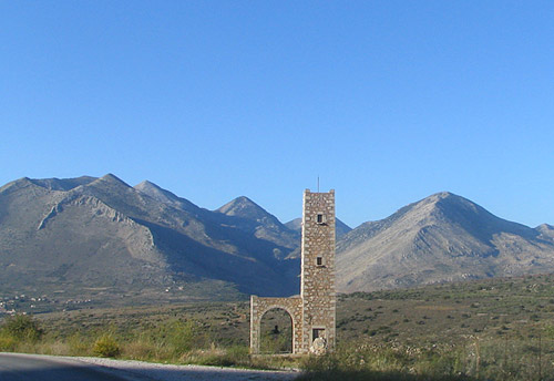 |
||
| Saggias | Profoiths Hlias Fragkoulias | Pyrgos Dyrou | ||
| 1,227m | 1,137m | 1,079m | ||
| South | South | South |
Generally if you are looking to climb Profitis Ilias (2,405m) you'd want to start from Taygetos Refuge just South East of the city of Sparta ("Σπαρτη").
But since we are covering the entire range here is a breakdown of the main trailheads.
North Taygetos Trailheads
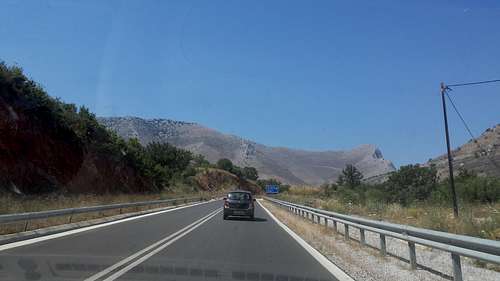
- To access the North section you need to get to the village of Alagonia ("Αλαγονια") which is famed for its oranges. The dirt roads on the West flank of the North range lead as high as possible an near all three peaks. Google Maps Directions Link.
Central Taygetos Trailheads
- The village of Avaryti ("Αναβρυτη") serves as the Northern trailhead, enabling hikers to traverse the Pentadaktylos on their way to Profitis Ilias. Google Maps Directions Link.
- The Refuge of Taygetos operated by EOS Spartis is the main and easy trailhead to access Profitis Ilias (2,405m) directly from the East. Google Maps Directions Link.
- The Refuge of Taygetos operated by EOS Kalamatas is the hard trailhead for access to Profitis Ilias (2,405m) from the South. Google Maps Directions Link.
South Taygetos Trailheads
- Saggias and the associated summits are generally accessible via the village of Pyrgos Dirou ("Πυργος Διρου"). Google Maps Directions Link.
Backcountry Skiing & Snowboarding
The mountain of Taygetos has no organized ski area, althrough it does see high levels of snow-fall throughout the winter. It is however, a favourite among ski and splitboard mountaineers who commonly make descents from the summit of Profitis Ilias (2,405m).
There is no avalanche reporting for any backcountry areas in Greece, the snowpack conditions are not recorded either. Taygetos is very steep and can see variable weather, avalanche danger can get very hight.
Here are some people skiing or snowboarding on the mountain.
- Konstantinos Xatzelis, Snowboarding from Profitis Ilias on 21/3/2012. Youtube.
- Frozen Ambrosia, Ski Touring on Taygetos, February 2018. Blog Post.
- Alexandros Sampanis, Skiing the "May Coluoir" in well... May 2022. Facebook.
- deprovenceetdailleurs, The Taygetos on Skis, February 11, 2022. Blog Post.
Huts & Camping
Tygetos Refuge
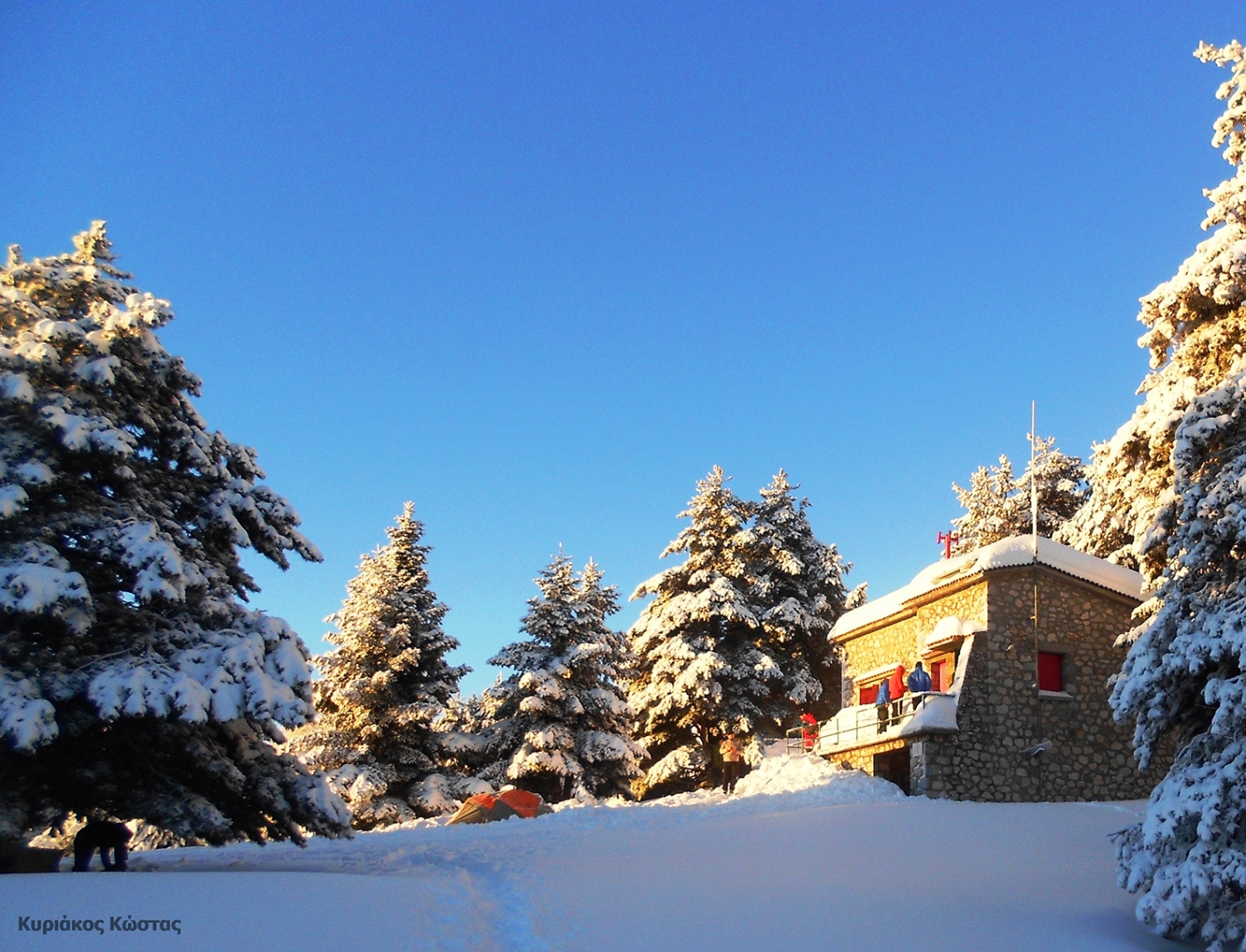
The Tygetos Refuge or Hut is operated by the Sparti Mountaineering Club (EOS Spartis) and is opened upon request, it is located below Profitis Ilias on the East slopes at an elevation of 1,500m. It has a capacity of 26 people and both electricity and heating, provided by PV and petrol respectively, as well as running water including drinkable from a spring 200m away. There are toilets outside the hut. The original hut was first built in 1940 but was never operated due to WW2, the current one has been built from the same materials and opened in 1962.
Your can find more on the Taygetos Refuge, EOS Spartis website.
EOS Kalamatas Emergency Refuge
On the South side of Profitis Ilias (2,405m) at the top of the forest of Vassiliki, is the emergency refuge operated by EOS Kalamatas. It is completely disused and unclear if it is even unlocked.
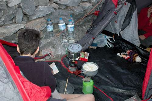
Camping
Wild camping is generally allowed in Greece. Do not camp below the tree line due to animals, and especially do not light any fires below the tree line. Taygetos is frequented by through hikers across the ridge, so there may be unofficial campsites at convinent locations. One of these is the summit of Profitis Ilias (2,405m) which is a very popular campsite.
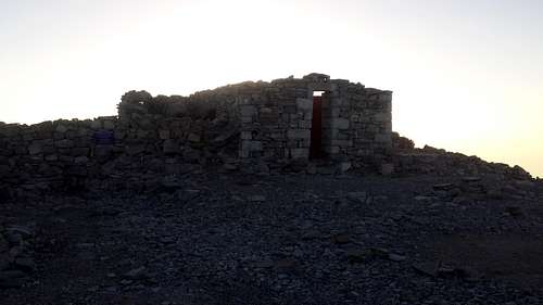
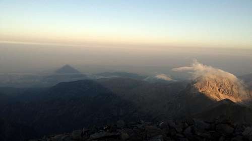
Camping on the Summit of Profitis Ilias
It is very popular for hikers in the summer to camp on the summit of Profitis Ilias (2,405m), in part to experience the unique sunrise shadow of the peak, creating a perfect pyramid on the land below. The area on the summit is relatively flattened around the chapel of Profitis Ilias and on the Eastern false summit, and wind-breaker walls also have been put in place using local stones.
Because of its popularity, it may be hard to find a camping spot during the peak summer hiking season in early June and September.
|
|
|
Weather
Taygetos is a very isolated peak, it has an isolation of 174km which makes the peak of Parnassos (in Central Greece) the next highest peak nearby. That means that the peak gets a lot of snow and rain, even though it is far South.
To find the weather for the mountain use the following :