
-
 8174 Hits
-
 74.01% Score
-
 4 Votes
|
|
Area/Range |
|---|---|
|
|
39.50875°N / 21.36069°E |
|
|
Hiking, Mountaineering, Trad Climbing, Sport Climbing, Toprope, Bouldering, Ice Climbing, Aid Climbing, Big Wall, Mixed, Scrambling, Via Ferrata, Canyoneering, Skiing |
|
|
Spring, Summer, Fall, Winter |
|
|
8652 ft / 2637 m |
|
|
Page Duality
You can see that there exist two pages for the Pindos Mountains; here is the other. I have created this page since the other page has not been edited since April 25 2008. I have requested the page and so far have not gotten a response. That page and user have been inactive for a long time. Thus I took it upon myself to create a complete Pindos page.
Thank you.
Definition
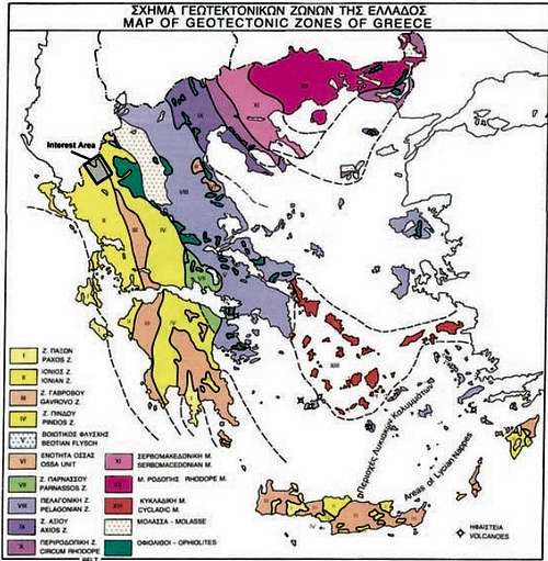
The definition and therefore, summits included in the range, are highly contested in the scholarship. Classifying Pindos as a geological feature, like say the Alps which consists of smaller sub-ranges, is what makes the most sense. Several sources consider Pindos to extend from Smolikas to Timfristos, around 250km, yet this definition does not account for the geological similarity which continues all the way South to the Githeio Cape. Citing the map on the left, retrieved from this paper on the geology of Timfi, we can see that zones 1-4 are concentrated parallel to the Pindos range. Zones 1,3,4 and 7 (thus and Parnassos) are similarly aged and grouped and therefore, should represent the Pindos range, which is a geological feature of 442km (274mi) long stretching from Grammos to the North to Geitheio Cape in the South.
Such, Pindos is very diverse in altitude and in types of mountains encountered. There are some peaks that are a bit more widespread in width than the main spine of the range. Pindos is a mountain range that is a parent range (see the Alps) and has several subdivisions. The Aoos National Park, The Tzoumerka Mountains, Agrafa Mountains, Akarnanian Mountains, Chelmos, Mainalo, and Taygetos.
The Range
The Pindus mountain range spans the entire length of Greece, from the Albanian border to the South Aegean. In the interactive map (below) key features discussed on this page, such as summits, alpine lakes and snow centres are placed. From North to South, the range is divided into several sections. The map includes several secondary smaller summits of interest throughout the range. Some specific complexes and peaks are worth exploring in detail, which you can do by clicking on their page on SummitPost, the links will be provided where available.
Interactive Map
| Area Name | Highest Summit | Description |
| Aoos Valley | Smolikas (2637m) | This area begins at the Greek-Albanian border and includes the summits of Grammos, Timfi, Smolikas and, Avgo, among others, it ends in Metsovo & Ioannina. This region is dominated by dense old-growth forests populating the meandering low-slung hills around the larger massifs. With both high elevation and latitude, this area has one of the highest snowfall averages in the country; by springtime, the snowpack feeds into many small rivers and gorges, forming the Aoos river to the North as well as feeding the artificial lakes to the South. |
| Tzoumerka | Kakarditsa (2429m) | Located South of Metsovo, this region plays host to some of the largest and steepest mountains in the range. Unlike North Pindus (above), this area is dominated by valleys and long, tall, alpine ridges, featuring lesser forest cover and big headwalls. The region is renowned for its beautiful hikes, demanding rock, mixed and ice, climbing routes as well as some of the most extreme skiing terrain in the country. Therefore, it hosts several mountaineering refuges as well as well-marked trails. Year-round travel to the region may reward visitors with views of majestic waterfalls during spring and summer. Only the skiing area of 'Pertouli' is located here and its serviced terrain is smaller and peripheral to the highest peaks, Kakarditsa and Katafidi. |
| Agrafa | Karava (2184m) | Located West of Lake Plastira, the Agrafa mountain complex is renowned for its beautiful vistas, accessible terrain and friendly locals. Agrafa hosts a diverse range of forested and high elevation alpine terrain rising from deep valleys. The higher elevations of this complex, which is anything but the Eastern foothills around Lake Plastira, are less frequented and have extremely step approaches making them a tough hiking objective. |
| South Pindus | Giona (2510m) | This section includes the mountains of Timfristos, Kaliakouda as well as Vardousia, Giona, Oiti and Parnassos. These mountains are different but generally can be described as being more spread out and having significant prominence from the surrounding area. Excluding Oiti, all other major summits have significant alpine sections. The terrain is usually defined by large open alpine areas and heavily forested valleys. |
| Peloponnese | Taygetos (2407m) | Encompassing most of the Peloponnese's large summits, excluding Erymanthos to the East and Artemisio to the West, this region is quite diverse but is dominated by high prominence summits and large alpine expanses of the three key mountains, Chelmos, Zhreia and, Taygetos. |
Significant Summits List
| Rank [1] | Mountain | Summit | Elevation (m) | Image | Coordinates | Difficulty [2] |
| 2 | Smolikas | Smolikas | 2637m |  |
40.0888N, 20.9252E | Easy |
| 3 | Kaimaktsalan | Profitis Ilias | 2524m |  |
40.9302N, 21.7862E | Easy |
| 4 | Grammos | Tsouka Petsik | 2520m |  |
40.3480N, 20.7794E | Hard |
| 5 | Giona | Pyramid | 2510m |  |
38.6472N, 22.2528E | Medium |
| 6 | Timfi | Gkamila | 2497m | 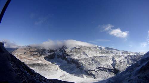 |
39.9880N, 20.8085E | Hard |
| 7 | Vardousia | Korakas | 2495m |  |
38.6799N, 22.1443E | Medium |
| 8 | Parnassus | Liakoura | 2457m | 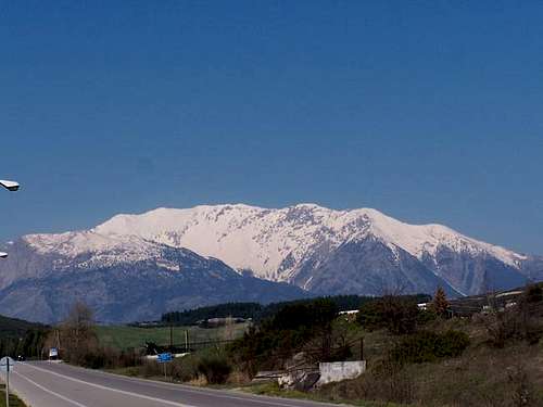 |
38.5343N, 22.6222E | Medium |
| 11 | South Tzoumerka | Kakarditsa | 2429m | 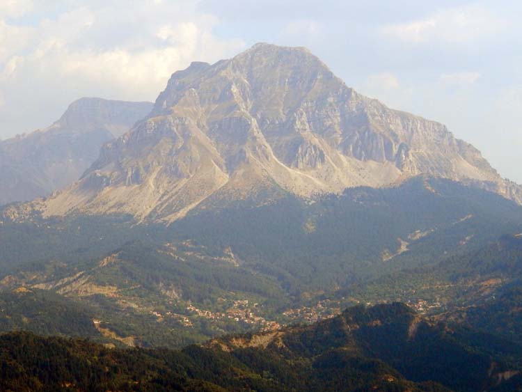 |
39.5271N, 21.2005E | Hard |
| 12 | Taygetos | Profitis Ilias | 2407m |  |
36.9530N, 22.3504E | Medium |
| 13 | East Tzoumerka | Katafidi | 2393m | 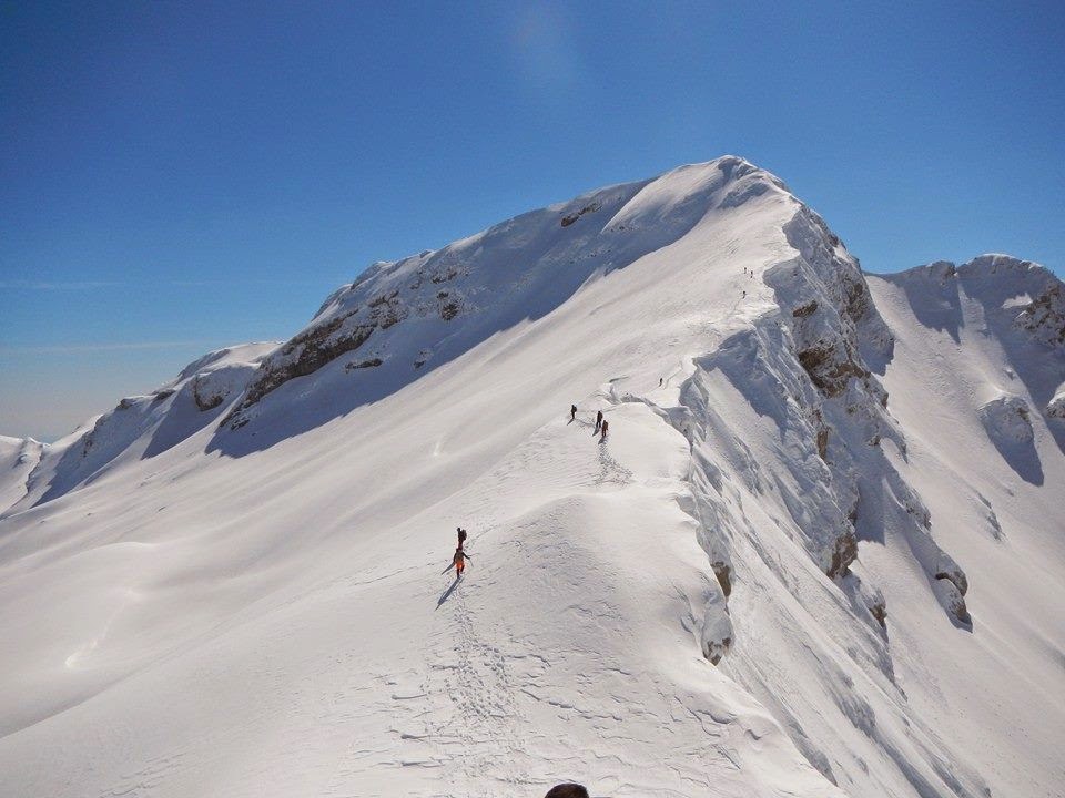 |
39.4298N, 21.1478E | Hard |
| 14 | Zireia | Killini | 2376m |  |
37.9387N, 22.3956E | Medium |
| 15 | Chelmos | Aroania | 2340m |  |
37.9717N, 22.2007E | Easy |
| 16 | Varnous | Gkarvani | 2334m | 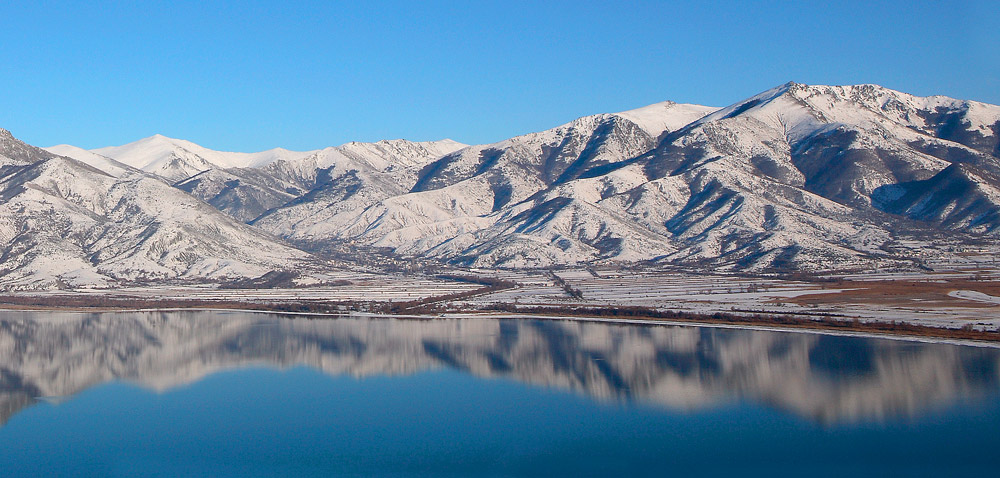 |
40.8734N, 21.2429E | Hard |
| 17 | Timfristos | Velouchi | 2315m | 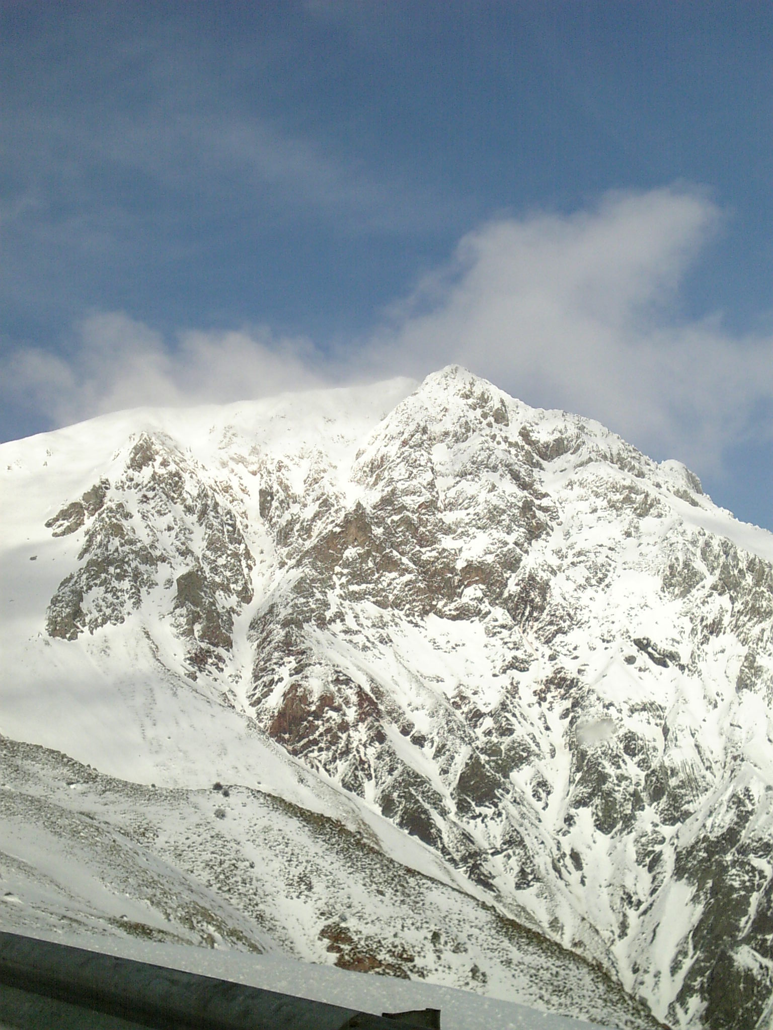 |
38.9437N, 21.8243E | Easy |
| 18 | Lakmos | Tsoukarela | 2295m |  |
39.6838N, 21.1228E | Medium |
| 19 | Vasilitsa | Vasilitsa | 2249m | 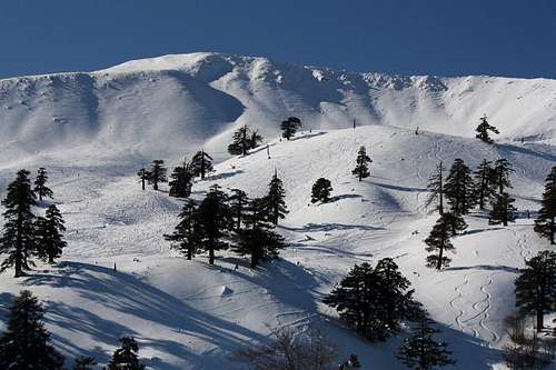 |
40.0344N, 21.0787E | Easy |
| 23 | Nemertsika | Dousko | 2207m |  |
40.0674N, 20.4729E | N/A |
| 25 | Agrafa | Karava | 2184m |  |
39.3116N, 21.5574E | N/A |
| 26 | Lygkos | Avgo | 2177m |  |
39.9252N, 21.0957E | N/A |
| 27 | Agrafa | Delmidi | 2163m | 39.2187N, 21.5606E | N/A | |
| 28 | Agrafa | Voutsikaki | 2154m |  |
39.2802N, 21.6304E | N/A |
| 30 | Oiti | Pyrgos (Tower) | 2152m |  |
38.7919N, 22.2552E | Hard |
| 31 | Agrafa | Avgo | 2148m |  |
39.4895N, 21.3835E | N/A |
| 35 | Kaliakouda | Kaliakouda | 2101m |  |
38.7959N, 21.7588E | Medium |
[1] Rank is derived from a list of Greece's highest mountains.
[2] The expected difficulty of the easiest route during the best possible hiking conditions. Please read more about each summit before attempting.
Gorges & Canyons
Due to its extensive network of snow-capped mountains and, high levels of precipitation, the Pindos range is home to several imposing Gorges including the world-famous Vikos Gorge in the North, providing excellent conditions for activities such as canyoneering, rafting, climbing and hiking.
Vikos Gorge
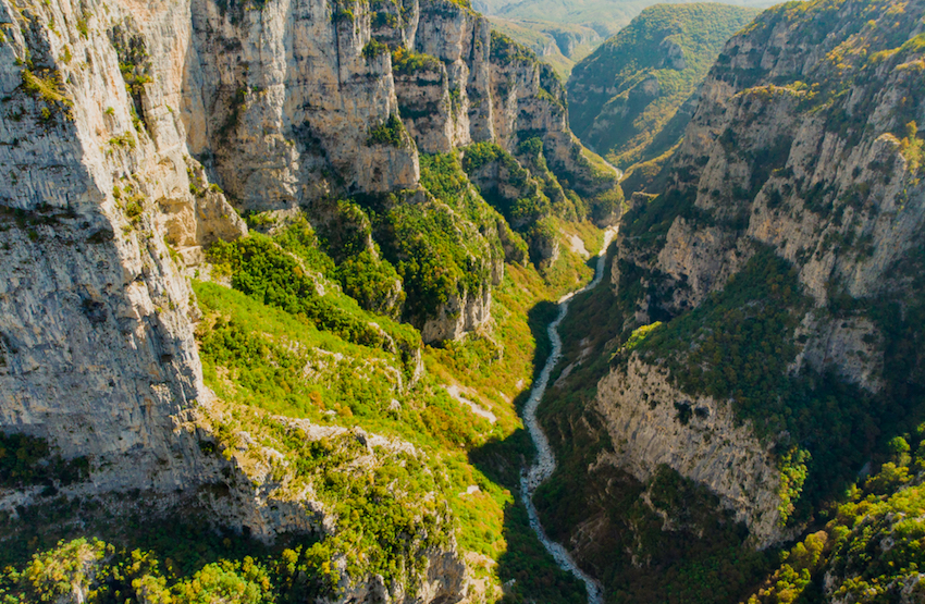
Widely regarded as one of Europe's most imposing gorges, Vikos is a key lifeline stemming from the heart of the Pindus range. Its source is located to the East of Timfi and North of Tzoumerka, in one of the snowiest areas in the country. In Spring, all this snow flows through the gorge on the 'Voidomatis' (Blue-eyed) river, named after its beautiful blue hue. The gorge is best known for its depth to width ratio, making it one of the deepest and narrowest in the world at certain points. The gorge walls reach a height of 1300m from the gorge bottom, with a width of fewer than 5 meters. Visitors can engage in all sorts of activities in and around the gorge, such as hiking, rafting, climbing and swimming.
Voraikos Gorge
Located at the city of Diakofto and rising up 20Km to the city of Kalavrita (Base of Chelmos), this gorge is of great natural beauty and includes caves, waterfalls and dense vegitation. You can also go up or down the gorge with the small train that is 65 minutes round trip.
Great Klisoura Gorge
This gorge is 20km long and on the its south entrance lies the Agia Eleousa monastery. The gorge is located between Magoulia (S) and Fragkoulika (N).
Lousios Gorge
This is one of the more well known gorges in Greece being a popular white water rafting destination. The gorge is rather long. The north entrance is just below the village of Dimitrasna.
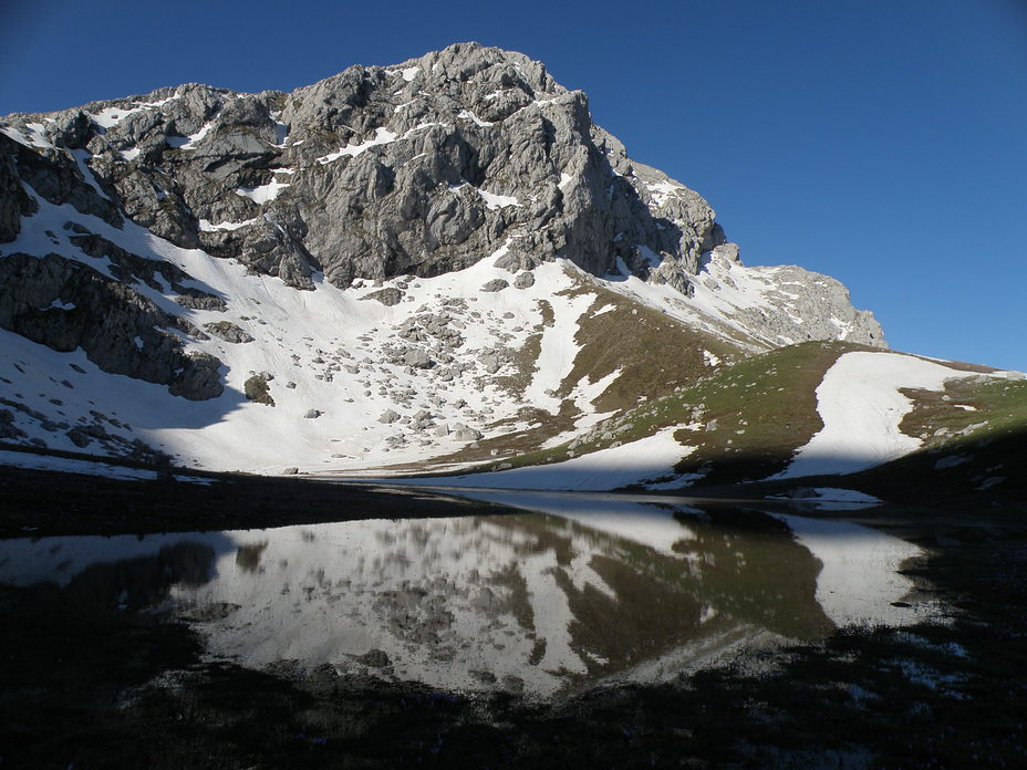
Alpine Lakes
| Name | Elevation | Coordinates | Type | Mountain | Area |
| Gistova Lake | 2350m | 40.3643N, 20.7905E | Permanent | Grammos | 8.000sqm |
| Dragon Lake Smolikas | 2200m | 40.0900N, 20.9091E | Permanent | Smolikas | 3.500sqm |
| Mosia Lake | 2150m | 40.0894N, 20.9586E | Permanent | Smolikas | 5.000sqm |
| Verliga Lake | 2050m | 39.6729N, 21.1283E | Seasonal | Lakmos | up to 10.000sqm |
| Timfi 'Drakolimni' | 2050m | 39.9940N, 20.7866E | Permanent | Timfi |
8.500sqm
|
| Vatheia Laka | 1950m | 38.6519N, 22.2586E | Seasonal | Giona | N/A |
| Flenga Lakes | 1950m | 39.8756N, 21.1218E | Permanent | Mavrovouni | 5.000sqm |
| Padi Lake | 1900m | 39.3172N, 21.5631E | Seasonal | Karava | 10.000sqm |
| Velouchi Lake | 1870m | 38.9428N, 21.7989E | Seasonal | Timfristos | 3.000Sqm |
| Distrato Lake | 1750m | 40.0553N, 21.0704E | Permanent | Vasilitsa | 8.000sqm |
| Arenon Lake | 1740m | 40.3074N, 20.9133E | Permanent | Grammos | 15.000sqm |
| Arvanitsa Lakes | 1450m | 39.9533N, 20.8851E | Permanent | Timfi | 9.000sqm |
| Stefaniada | 700m | 39.2647N, 21.4954E | Permanent | Delmidi | 130.000sqm |
Notable Lakes

The most popular greek alpine lake is the permanent "Dragonlake" on Timfi mountain, located at 2000m, right on the cusp of large north-facing cliffs. A 2-hour hike from the Timfi refuge, providing incredible views of the Aoos Valley, the lake has become an international hiking destination. Its name is derived from the species of Alpine Newts which resides in the lake. Due to its elevation and placement, the lake successfully freezes during the winter with it being possible to ice-skate on its surface during cold spells.
"Vathia Laka" of Giona is one of the most impressive. Forming right under the 500m tall pyramid North aspect, the dramatic views complement the seasonal lake which forms from April till July/August. Unlike permanent lakes certain alpine lakes, including this one, create run-offs of drinkable water (always check for contamination by yourself) which make excursions into the range during warmer days easier.
National Parks
Greece currently has 12 national parks, 5 of which are part of the Pindos mountain range.
| Name (website linked) | Established in | Area (ha) | Go for | Image |
| Prespes Lakes | 1974 | 19,740 | Birdwatching, history & culture. |  |
| Vikos-Aoos | 1973 | 12,600 | Hiking, Climbing, rafting and general outdoor activities. |  |
| Oiti Mountain | 1966 | 7,210 | Hiking, mountaineering and cat skiing. |  |
| Pindus Mountains | 1966 | 6,927 | Hiking, mountaineering, and general outdoor activities. | 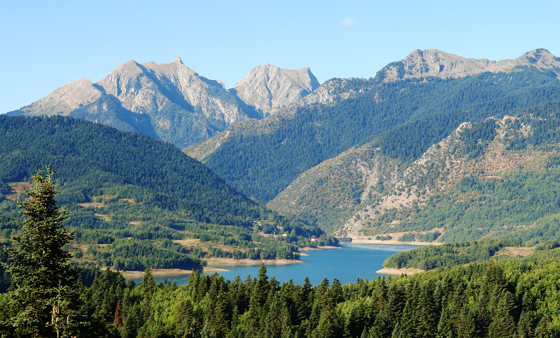 |
| Parnassus Mountain | 1938 | 3,513 | Hiking & mountaineering. | 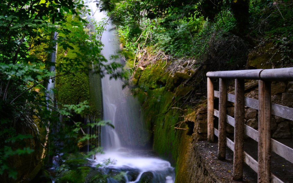 |
Flora & Fauna
Red Tape
Even when you will be in National parks there are no fees or checks. No need for climbing permits either.
Camping
You can camp freely anywhere in the range, although try to avoid camping under the treeline during summer since there is a high fire risk. It is recommended that you camp above the treeline and don't leave any trash.
External Links
https://en.wikipedia.org/wiki/National_parks_of_Greece