
|
|
Mountain/Rock |
|---|---|
|
|
46.69900°N / 10.99600°E |
|
|
Hiking, Mountaineering, Scrambling, Skiing |
|
|
Spring, Summer, Fall, Winter |
|
|
10417 ft / 3175 m |
|
|
Overview
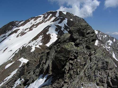
Gfallwand from high on the WNW ridge
To the northwest and north, about three kilometers away, are the Texelspitze (3318m) and Roteck (3337m), the two highest peaks in the area. Turn clockwise, to the northeast, and a bit further away are the striking Hohe Weiße (3278m) and Lodner (3228m). Behind these four stretches the higher main ridge of the Alps, defining the Italian-Austrian border, with popular peaks such as Weißkugel (3738m) and Hochwilde (3482m).

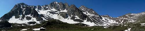
Texel Group panorama from the Gfallwand WNW ridge
The green paddle points at the Gfallwand.
Click here to view a larger map
Click here to view a larger map
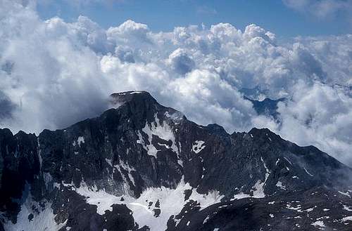
The distant glaciated peaks of the Ortler-Cevedale Group seen from the Gfallwand WNW ridge
Four Ridges
Four ridges lead to the summit platform, roughly corresponding to the four winds.The most scenic one is without a doubt the two kilometer long Hühnerjochkamm. Starting out to the north from the summit plateau, it quickly turns to the northeast. At first it descends sharply, but it soon eases up. Before long, the ridge becomes jagged again on its way to the Schwarze Wand (3065m). After that it continues up and down, until eventually it ends at the Blasiuszeiger.
The Hühnerjochkamm seen from the Lafaistal. The high peak on the right is the Schwarze Wand, hiding the Gfallwand behind it. The Ginggljoch is on the right.
To the WNW is a gentler ridge, but still well defined and exposed in places. After almost one kilometer it leads to the wide Ginggljoch (2938m). This mountain pass is the key saddle of the Gfallwand, giving it a prominence of 237 m.
The fourth and final ridge, to the ENE, is the shortest and least well defined. It leads down to the former Königshof Alm, south of the Blasiuszeiger.
Gfallwand NW face, seen from Roteck. This frontal view makes it appear steeper than it really is. The N ridge is on the left, the WNW ridge on the right.
Four Faces
Four ridges mean four faces. On the north, covering the NW and NE faces respectively, there used to be two small glaciers, the Gfalleitferner and Bircherferner. Both are gone now, leaving behind steep slopes of bare rocks, talus and scree.On the south side the ice disappeared much longer ago, and the slopes have some grass between the rocks. Still, the big bowl shape of the SW face serves as a silent witnesses to the glaciated past. Low down the slopes are easy, where the face meets the ridges it gets steep.
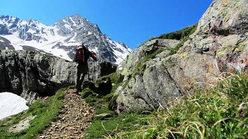
Hiking up the Lafaistal, with the Schwarze Wand towering over me.
Valleys
With many ridges and other peaks nearby, there is only one proper valley real close to the mountain: the Lafaistal. It runs parallel to the Hühnerjochkamm, descending from the Ginggljoch towards the NE. Just past the Blasiuszeiger it joins the larger Zieltal, which then descends to the south, to the wide, populated Vinschgau valley stretching east-west.Well west and southwest of the Gfallwand lies the lower Schnalstal, which in turn is a side valley of the Vinschgau valley.
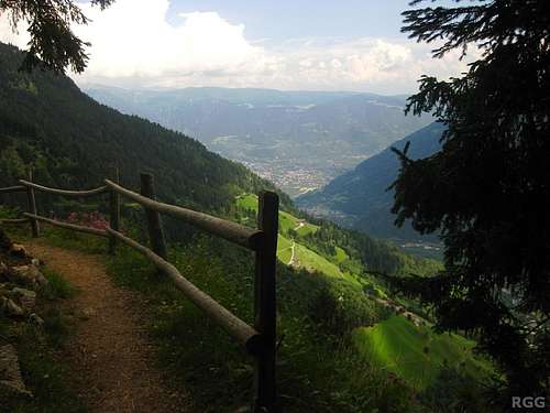
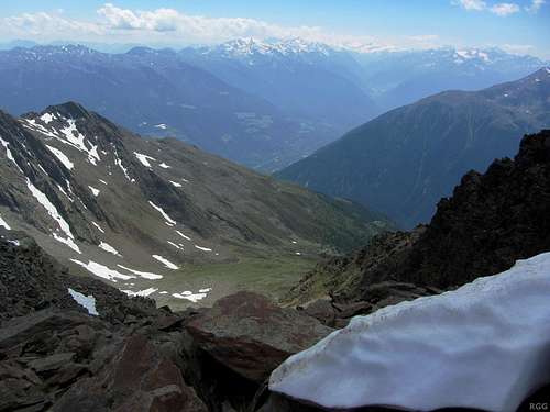
View down to the Vinschgau valley from the Meraner Höhenweg
A note on the name
The Gfallwand lies in Süd-Tirol, a relatively autonomous region in Italy these days. The main language is German. In the past that was different: German was suppressed, and all geographical features received Italian names. In Italian, the mountain is called Croda del Tovale.Getting There
Katharinaberg is a small village; zoom in a few times and it will appear to the SW.
Click here to view a larger map
Getting to the area
The nearest city is Meran, a pleasant place southeast of the Texel Group. Well shielded by the Alps from bad weather coming in from the north, it has a very nice climate. In summer, the area attracts a lot of visitors and for a small city it is well connected.The two villages closest to Gfallwand are Naturns (±570m) to the south, and Katharinaberg to the southwest (±1230m).
By car
- From the north there are three options:
- Along the provincial road over the Reschenpass via Nauders and then down the Vinschgau valley;
- Via the mountain road over the Timmelsjoch (closed in winter), down the Passeiertal and turn right at Meran, into the Vinschgau valley;
- Over the Brenner motorway via Sterzing, and then also down the Passeiertal.
- Along the provincial road over the Reschenpass via Nauders and then down the Vinschgau valley;
- From the south, the only way is by the motorway from Bozen / Bolzano.
- From Switzerland, in the west, the Ofenpass and then down the Vinschgau valley is the most logical route
By public transport
Meran has regular train connections with Bozen / Bolzano, which is well connected to the rest of the Italian rail network as well as to Austria and Germany to the north. In addition, a regional train heads up the Vinschgau valley, west of Meran, as far as the small village of Mals. Naturns has a train station, and both Naturns and Katharinaberg are served by buses from Meran.From the north, from Austria, regular buses come over the Reschenpass to Mals. And likewise, from the west, from Switzerland, regular buses come over the Ofenpass to Mals.
Getting to the mountain
The nearest road access is from the slopes above Katharinaberg. It's a long ascent from there, but if you have a car you can drive up the mountain road to Schrofl (46.6903°N / 10.9476°W, ±1700 m). There is some room to park by the side of the road.If you have more time, an overnight stay at the Lodnerhütte is recommended. The shortest way to get there is from the south, hiking up the Zieltal. From the Birkenwald car park (980m), still fairly low in the Zieltal above the village of Partschins, it's about 4 hours to the refuge.
Alternatively, to save an hour and some energy, take the Texelbahn cable car from Partschins up to the Giggelberg (1544m) and hike north on the Meraner Höhenweg to the Nassereithhütte (1523m) and from there up the Zieltal to the Lodnerhütte.
Routes
The WNW Ridge (Normal Route)

Big cairn on false summit
Beyond the false summit, the route becomes serious. The ridge drops a bit, gets exposed and jagged and some scrambling is required. Most hikers will hesitate to do this. Perhaps that's the reason for the large cairn on the false summit, as if to present a target where to call it a successful climb. But the exposed section isn't very long, soon it gets easier again. It's still a bit steep, but less exposed and manageable without using your hands. The guidebook (see below) doesn't even give it UIAA grade I. I think it could be grade I though. From the saddle to the summit takes about an hour.
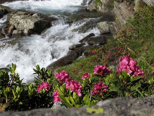
Alpenrosen at the banks of the Lafaisbach
The Moaralm, with Similaun in the background
An alternative way down from the Moaralm is trail nr 10, descending to the south past the Dicker Alm to the Meraner Höhenweg. This is a popular long distance hiking trail, and consequently there are plenty of accommodation options along the way.
If you plan to ascend this way, be advised that, on the way up, trails 9 and 10 join at the Moaralm and ascend together for almost one kilometer. At that point the trails split up, nr 9 going sharply to the left. In 2013 there where clear traces of a signpost, but it was gone. If you don't pay attention, you probably miss the junction, in which case you most likely end up on trail 10 to the Kirchbachkreuz. See the image below:
Missing signs at an important junction. Trail 9 to the Ginggljoch is to the left, trail 10 to the Kirchbachkreuz to the right.
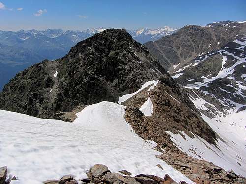
Looking back down along the Gfallwand WNW ridge to the false summit, from the point where the snow on the NW face reaches up to the ridge
The NW Face
Although technically easier than the WNW ridge, this route is only to be recommended for an ascent if the slopes are covered with hard packed snow. With soft snow it's hard work, without snow at all the loose rubble and scree will be no fun and could be dangerous. On my visit I was fortunate enough to have plenty of old snow, but it was soft on top. That would make self arrest easy, but hiking up tiresome.I didn't ascend this way, but used the snow to my advantage for an easy descent. That is, not quite from the summit, both because the snow didn't reach that high and because it was too steep (which, obviously, was why there was no snow cover); but after descending the WNW ridge for a few minutes, I reached the snow, and there I dropped off the ridge. The gradient was steepest just below the ridge, but not to steep to walk down. I estimate that it at most 40° there, and soon it got easier.
The NE Face
The NE face can be ascended from the Königshof Alm, reaching the N ridge shortly below the summit. UIAA grade I.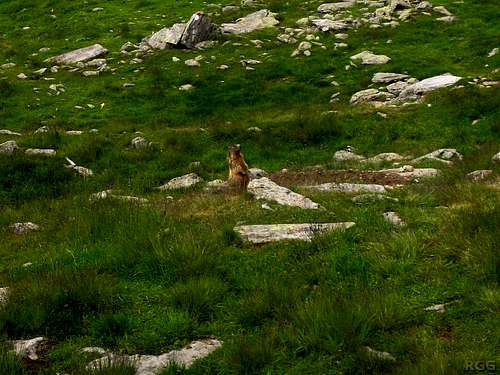
A watchful marmot at the quiet Königshof Alm. No people live there anymore, and not many hikers pass by either.
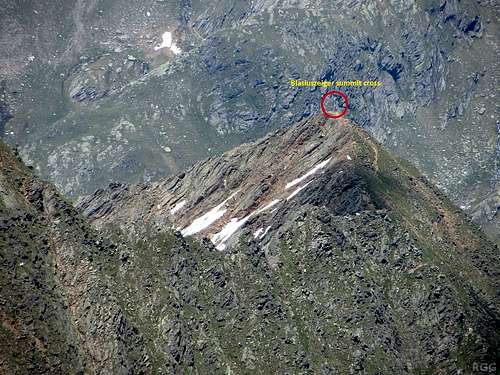
Zooming in on the Blasiuszeiger summit from Gfallwand. Only a short part of the Hühnerjochkamm is visible
The Hühnerjochkamm
Starting towards the N, the first part is UIAA grade I, but further along it gets harder, up to UIAA grade III. Near the end it gets easier again, and the Blasiuszeiger has a steep hiking trail to the summit, coming from the Lodnerhütte or Königshof Alm.The S Ridge
To the Kirchbachkreuz, the S ridge is an exposed scramble, UIAA grade I. There are two marked hiking trails to the Kirchbachkreuz: nr 10 from the west, and nr 6 from the south.When to Climb
Best from late spring to early fall.Accommodation
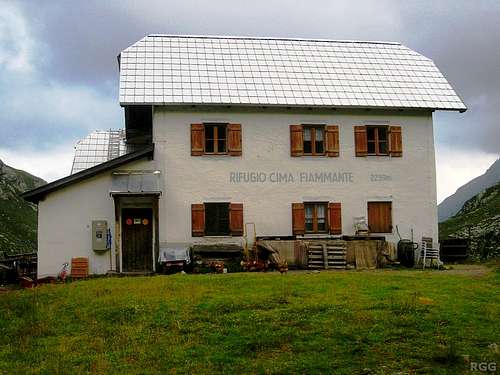
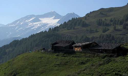
Lodnerhütte
Meran and the many nearby villages offer countless accommodation options. Furthermore, along the Meraner Höhenweg there are many places to stay. On my way down I ended up at one of those, Patleid, a nice place that I remembered from a previous visit to the area. Dinner was outstanding.
Wild camping is not allowed.
Red Tape
The Texel Group is a Natural Park, and is protected as such.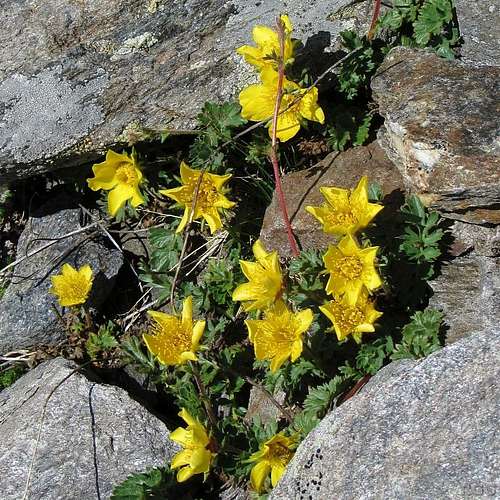
Geum reptans, a little SW of the Ginggljoch
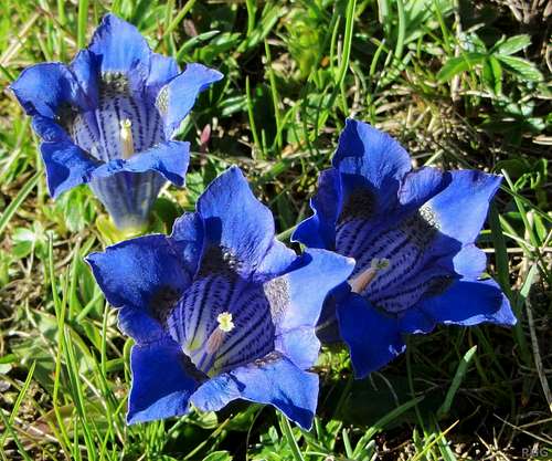
Gentiana clusii, a bit further SW of the Ginggljoch
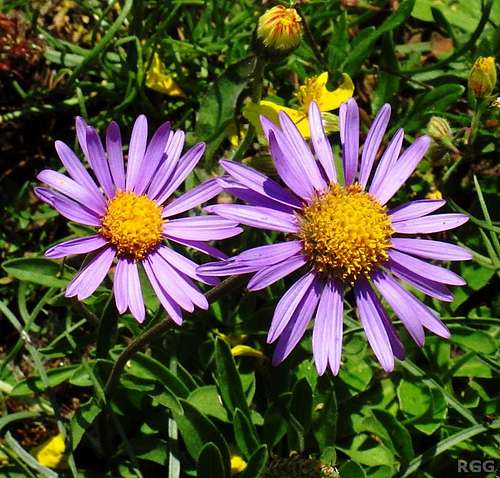
Alpine asters (Aster alpinus) near the Dicker Alm
Maps and Books
- The 1:25000 Tobacco map Parco Naturale Gruppo di Tessa covers the whole national park. It is the most detailed map, but considering its scale, it gives relatively poor information.
- Excellent free topographic maps are available at the base station of the Texelbahn cable car. The map covers a somewhat smaller area than the others, and highlights the the Meraner Höhenweg, but it has all the other trails and many details. Just one minor point: The map legend claims it is scale 1:50000, but it is close to 1:60000.
- Alpenvereinsführer Ötztaler Alpen, Walter Klier. 14th ed. Bergverlag Rother, 2006, ISBN 978-3-7633-1123-1. A good guidebook for the Texel Group. In German.
External Links
Vinschgau
View towards the Gfallwand and beyond to the distant Ortler group from the Lodner summit. I zoomed in, that's why Cevedale and Palon de la Mare look so close: they are in fact almost 50 km away!