|
|
Mountain/Rock |
|---|---|
|
|
46.72350°N / 11.04920°E |
|
|
Hiking, Scrambling |
|
|
9964 ft / 3037 m |
|
|
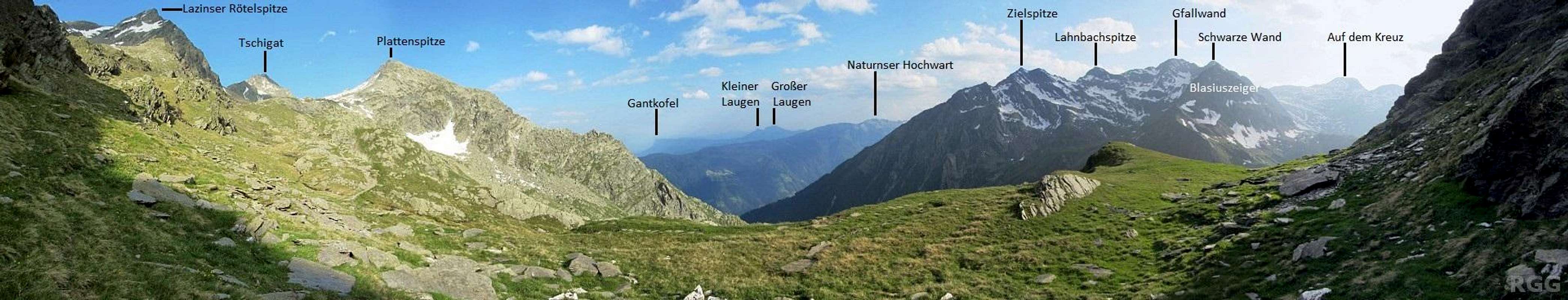
Overview
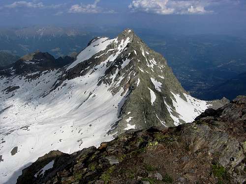
The Lazinser Rötelspitze from the north. Although the round summit just right of center looks higher, the true summit is the one just left of center.
The normal route follows the ridge from the saddle on the left.
In addition to the SE ridge, there is a second ridge, to the NNW. Eventually this leads to the base of the very steep south ridge of the Lodner (3228m). In contrast, on the side of Lazinser Rötelspitze the gradient is very easy. The maps I checked don't give an elevation for the key saddle (location 46.727°N / 11.046°E), but the contours put it between 2950 and 2975 m, which gives the Lazinser Rötelspitze a prominence of between 62 and 87 m.
Lazinser Rötelspitze from the southwest, clearly showing the two ridges
Right below the peak, on the south side, are a couple of small but pretty alpine lakes: the Tablander Lacken.
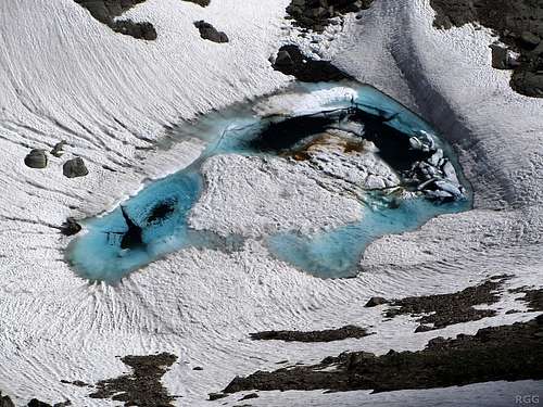
Looking down on the smaller one of the Tablander Lacken
About the name
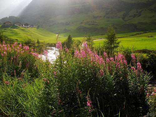
North of the mountain, at the head of the Pfelderer valley lies the Lazinser alm. The Lazinser valley stretches south from there.There are a lot of name variations for this peak. It's also called the Partschinser Rötelspitze, named after the village of Partschins in the south. Sometimes it's even simply called the Rötelspitze. And finally, the 'e' at the end is sometimes omitted.
The Lazinser Rötelspitze lies in Süd-Tirol, a relatively autonomous region in Italy these days. The main language is German. In earlier days, that was different: German was suppressed, and all geographical features received Italian names. In Italian, the mountain is called Cima Rosa.
Confusingly, the Spronser Rötelspitze (2625m), a little further east in the Texel Group, is also called Cima Rosa in Italian.
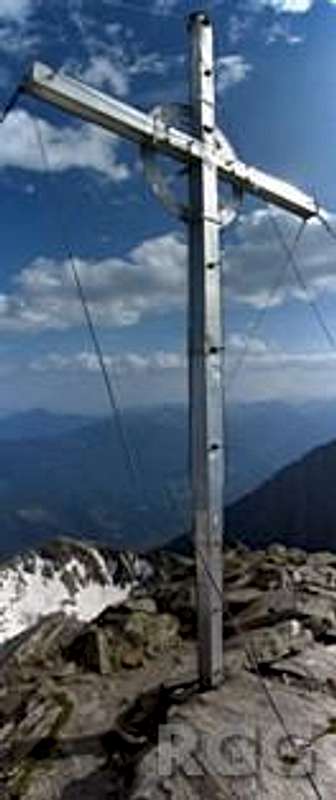
Summit cross
The summit
The summit itself is small, but not really exposed. A large steel cross marks the spot.Getting There
A fine view of close neighbor Tschigat from the Lazinser Rötelspitze.The moist air makes it hard to see clearly, but Meran is on the right.
Getting to the area
The nearest city is Meran / Merano, a pleasant place southeast of the Texel Group. In summer, the area attracts a lot of visitors and for a small city it is well connected.
By car
- From the north there are three options:
- Along the provincial road over the Reschenpass via Nauders and then down the Vinschgau valley;
- Via the mountain road over the Timmelsjoch (closed in winter) and then down the Passeiertal;
- Over the Brenner motorway via Sterzing, and then also down the Passeiertal.
- Along the provincial road over the Reschenpass via Nauders and then down the Vinschgau valley;
- From the south, the only way is by the motorway from Bozen / Bolzano.
- From Switzerland, in the west, the Ofenpass and then down the Vinschgau valley is the most logical route
By public transport
Meran has regular train connections with Bozen / Bolzano, which in turn is well connected to the rest of the Italian rail network as well as to Austria and Germany to the north. In addition, a regional train heads up the Vinschgau valley, west of Meran, as far as the small village of Mals.
From the north, from Austria, regular buses cross the Reschenpass to Mals. And likewise, from the west, from Switzerland, regular buses come over the Ofenpass to Mals.
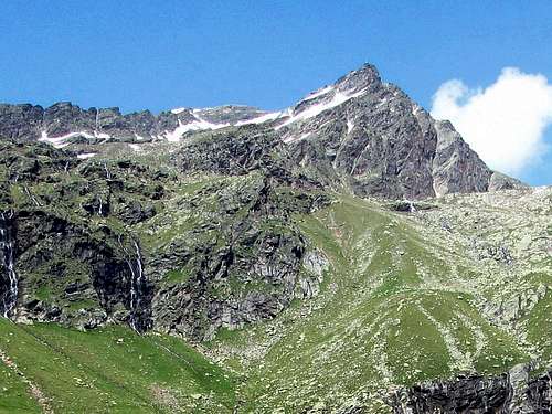
Zeppichl seen seen from just outside of PFelders
Trailheads
The trailhead nearest to the mountain is deep in the Pfelderer valley, to the northeast. This is a side valley of the Passeier valley north of Meran. Public access to the road into the valley ends at the hamlet of Zeppichl (1676m), but the bus service only goes as far as Pfelders (1628m). There is ample parking space at the beginning of Pfelders. Alternateively, if you spend the night at one of the few accommodations at Zeppichl, you can of leave your car there, saving you a 15 minute walk.A longer, alternative approach is possible from the south, hiking up the Zieltal valley from the village of Partchins. You can drive partway up the Zieltal valley to shorten the approach. There is a large parking lot at around 980m, at Birkenwald along the Wasserfallweg (46.692°N / 11.054°E). It's still more than 2000m up from there. Or you can save some energy and take the Texelbahn cable car up from Partschins to the Giggelberg (1544m) and start hiking from there.
Routes
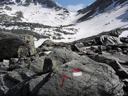
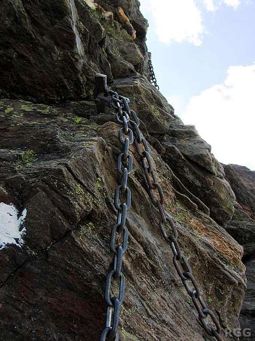 A chain on the SE ridge A chain on the SE ridge | 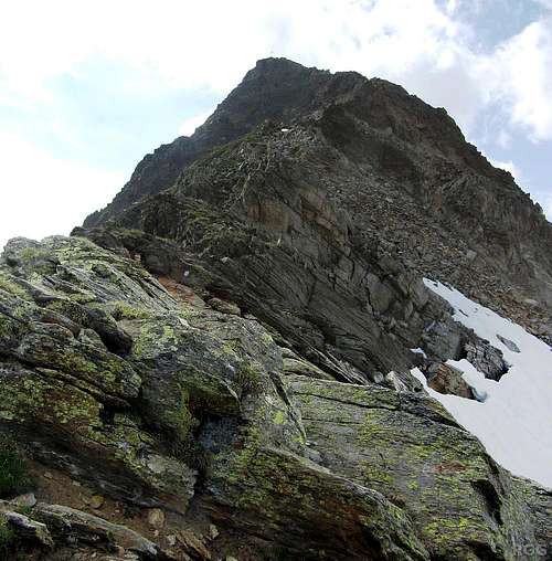 On the SE ridge On the SE ridge | 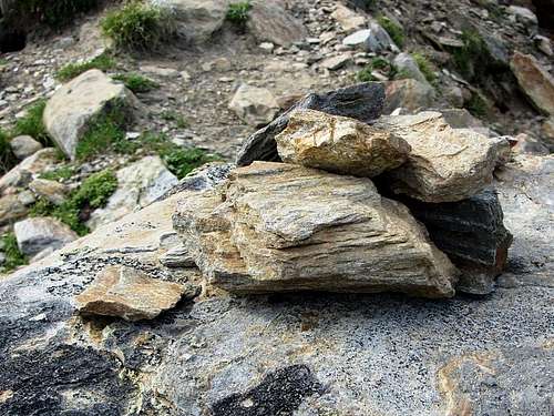 A cairn on the SE ridge A cairn on the SE ridge | 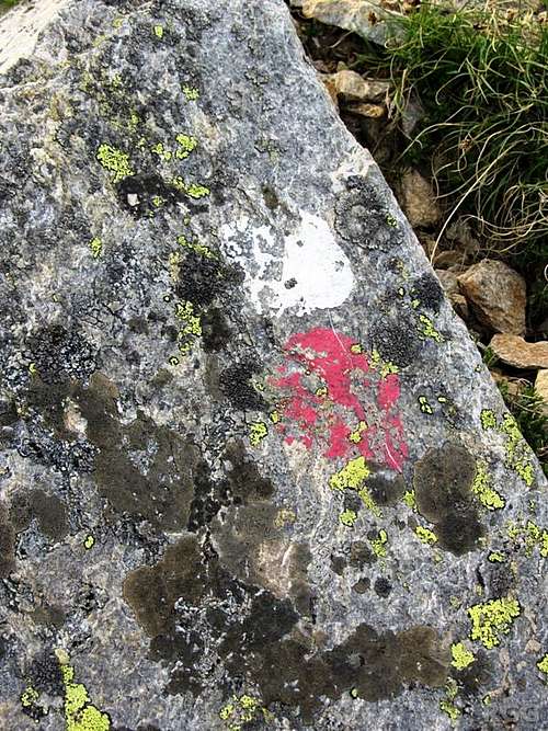 Old paint on the SE ridge Old paint on the SE ridge |
The SE ridge
The normal route follows the southeast ridge from the Halsljoch saddle (2808m). The ridge is a mix of steep hiking with some scrambling sections (UIAA grade I). There are steel chains and cables to secure the more exposed parts, and occasional paint marks to help point out the easiest route where the best way might be less obvious. But even without the marks, getting lost would be practically impossible. It takes less than an hour to hike and scramble up the ridge. But first you have to get to the Halsljoch, and that takes much longer.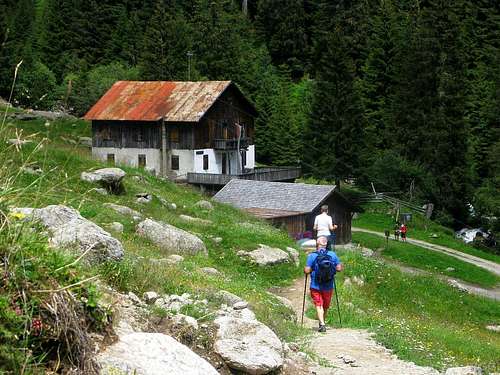
Nassereithhütte
Approaching the Halsljoch from the north
Getting to the Halsljoch
The two main trails to the Halsljoch start in the Pfelderer valley to the northeast, or the Vinschgau valley to the south.From Pfelders it's a 4 hour hike along a marked trail. First head up the Pfelderer valley along the Meraner Höhenweg. The Lazinser Alm (1858m) at the head of the valley is the last place where you can enjoy refreshments. After that, a wide steep trail heads up towards the Strettiner Hütte and Eisjochl. But well before that, after gaining some 300m, you reach a junction (46.7695°N / 11.0525°E) where you have to turn left, due south. The trail is smaller now, and much less steep. This trail up the Andelsboden takes you all the way to the Halsljoch.
From the Texelbahn cable car summit station it takes 5 to 6 hours, from Birkenwald add half an hour to an hour. In both cases the route passes by the Nassereithhütte (1523m) and the Lodnerhütte, where you can spend the night if you don't want to make it a very long day. From the Lodnerhütte to the Halsljoch takes the better part of 2 hours, back down an hour and a half.
Panorama from Andelsboden towards Tschigat and Lazinser Rötelspitze, both on the left, with the Halsljoch between the two
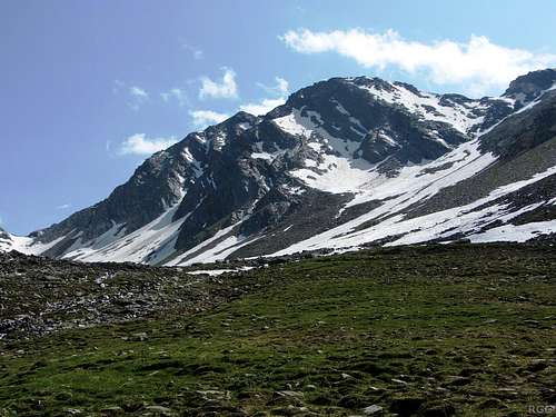
The NNE ridge
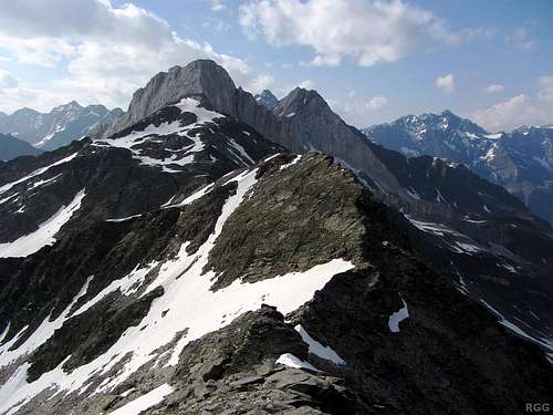
Summit view towards the Lodner, along the NNE ridge. On my descent, I left the ridge shortly before the snow field and followed it down. Under the snow lies scree.
The western slopes
I'll describe this as a descent route, for this is how I came down the mountain.
A goat on the western slopes
Once safely off the ridge, you won't need your hands anymore. There is no trail and there are no markers or cairns, but if visibility is good, finding a way down is easy. Don't expect a trail, just go where the terrain is easiest, and keep heading in a generally western direction. If you venture too far left, you'll find yourself above steep cliffs, and too far to the right you'll find your way blocked by rocky spurs.
Eventually you'll spot the clear hiking trail that connects the Lodnerhütte to the Halsljoch, and you can easily get back on it at around 2500m or so, a little more than one kilometer west of the summit (46.721°N / 11.033°E).
Frankly, I don't think this would be a pleasant ascent route. With snow on the slopes it's cumbersome, without it the higher parts of the slopes are scree which is no fun either. But on the descent it was fine, and sliding down the snow was fast.
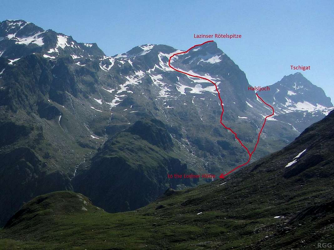
The trail to the Halsljoch as well as the descent route down the western slopes. The Lodnerhütte hidden from view behind the grassy knob on the left.
A trip suggestion
The area has many interesting scrambling peaks, and if you have more than just a day, it's easy to visit several of them.An interesting two day trip would be to start in Pfelders, hike up to the Spronser lakes, then traverse Tschigat from east to west (UIAA grade II). That brings you to the Halsljoch. From there you can choose between the Lodnerhütte or the nearby Guido Lammer bivouac to spend the night. The next day you can climb the Lazinser Rötelspitze and head back to Pfelders.
If you start early enough and have the energy for it, you can climb the Lazinser Rötelspitze on the first day as well, and then on the second day return to Pfelders via the Johannisscharte and Eisjochl, and climb either Hochwilde or Hohe Weiße along the way, to give just a few examples.
There are many more variations, depending on how much time you have, what condition the routes are in and on what kind of scrambling and exposure you are comfortable with. Some other interesting nearby peaks include Roteck, Lodner and Blasiuszeiger.
When to Climb
The best period is from late spring to early fall.Accommodation
At the western edge of Pfelders. That first building is Pension Rosemarie.
Meran and the many villages in the valleys all around offer lots of options. On the south side of the Texel Group, the Vinschgau valley has numerous villages with plenty of accommodation options, ranging from simple camp sites to luxury hotels.
In winter, Pfelders is a ski resort, and consequently it has plenty of hotels which don't fill up in summer. On my last visit, I walked into town and found a bed in the first place I tried. That was Pension Rosmarie and I had a very pleasant stay. My room was nice and the food was outstanding! Zeppichl has limited options as well.
Wild camping is not allowed.
Red Tape
The Texel Group is a Natural Park, and is protected as such.Maps and books
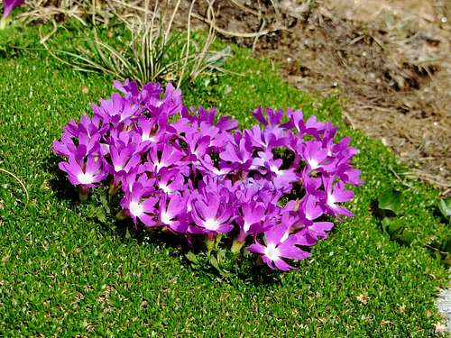
Primula minima on the SE ridge
- The 1:25000 Tobacco map Parco Naturale Gruppo di Tessa covers the whole national park. It is the most detailed map, but considering its scale, it gives relatively poor information.
- The 1:50000 Freytag&Berndt map WK S8, Passeiertal * Timmelsjoch * Jaufenpass is sufficient, although the 100m contours are rather coarse.
- Excellent free topographic maps are available at the base station of the Texelbahn cable car. It covers a somewhat smaller area than the other maps, and highlights the the Meraner Höhenweg, but it has all the other trails and many details. Just one minor point: The map legend claims it is scale 1:50000, but it is close to 1:60000.
External Links
VinschgauPfelders