
-
 21987 Hits
-
 83.1% Score
-
 16 Votes
|
|
Route |
|---|---|
|
|
54.46110°N / 3.10486°W |
|
|
Scrambling |
|
|
Spring, Summer, Fall, Winter |
|
|
Less than two hours |
|
|
UK Grade 1 scramble |
|
|
Class 4 |
|
|
II |
|
|
OVERVIEW
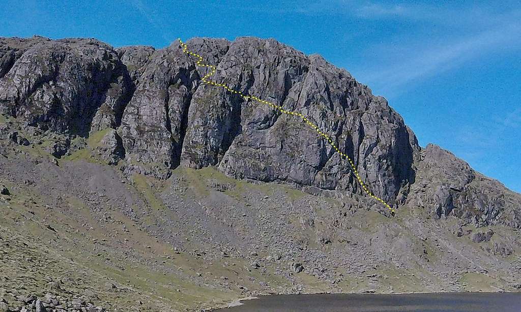
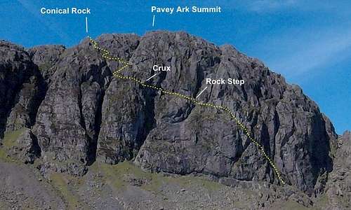
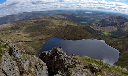
Pavey Ark & Jack's Rake from Stickle Tarn
On the lower rocks of Jacks Rake
Height: about 150m gained over 200m distance. The summit of Pavey Ark is at 700m (2297ft)
Grade: thanks to feedback from both chugach mtn boy and yatsek and having reviewed my sources of information on grades, in addition to new ones supplied below by yatsek I have concluded that: the route is definitely a UK Grade 1 Scramble; it is in the region of UIAA I/II (I have given an overall grade of II above) - and because there are short sections of the route which could/should definitely not be down climbed facing out, it should attract the US grade of Class 4. The terrain for 90% of the route would rate no more than UIAA 1 and US Class 3 but because of two short sections of difficulty I think it is justified to promote the overall grade to these slightly higher ratings. A further justification maybe taken from the sad accident history of this route (see below): several accidents have occurred as a result of trying to down climb it.
Time: a competent party in dry conditions should manage this route in under an hour. At peak summer holiday season, in fine weather, expect to queue (unless full use made of the longer daylight hours and either a very early or late start is made – which is better anyway from an aesthetic point of view)
Exposure: south-east – which begs for a start soon after dawn, if the rocks are dry.
Seriousness & dangers: perhaps surprisingly for a ‘mere grade one’ Jack’s Rake keeps the local Ambleside and Langdale Mountain Rescue Team disproportionately busy. No year seems to pass without the need for their attention – to attend to anything from a broken ankle to a fatality. In 2012 there were two fatal accidents on the Rake within a week of each other. Various factors may be identified:
- As above there is no escape route from Jack’s Rake, with severe rock-climbing territory above and below
- The route follows what instantly becomes a natural water course (read water-fall) in bad weather
- The route attracts a lot of people, including novices, who can get out of their depth
- A common theme seems to be inexperienced scramblers getting caught out by weather (or just fear of heights) and trying to reverse the climb – and falling. Over much of the route a fall may be confined to the rocky cleft of the Rake and consequences no worse than bruising and/or the odd broken bone. Nevertheless there a few places where a fall can and clearly does result in a fall over the edge of the lower buttress, with lethal results.
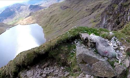
Fallen sheep on Jacks Rake
A final word on winter conditions: if the route involves an element of seriousness in summer, it is not unreasonable to assume this will step up a few degrees of magnitude in the winter with short days, increased wet weather and (if lucky) snow and/or ice. It is perhaps surprising that the route is given a Scottish winter grading of only I but this presumably will be only when the route is in perfect condition, with a good depth of well bonded frozen snow throughout. Given the routes propensity for becoming a waterfall there will be times when this becomes frozen into a great long diagonal icicle and in that kind of condition it could become an awful lot harder.
 Looking up Jack's Rake in summer by daw37... | 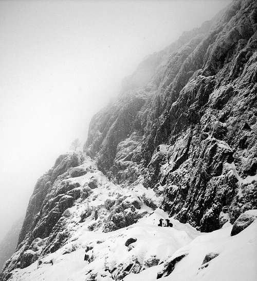 ...and in winter by Simnel | 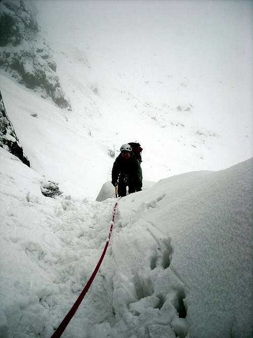 Climbing in winter by Simnel |
GETTING THERE
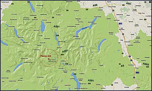
The main access to Pavey Ark is the Car Park at the New Dungeon Ghyll Hotel, in the Langdale Valley.
By car:
See maps for principle road connections. From Ambleside, follow the A593 road. At Skelwith Bridge, turn right onto the B5343. New Dungeon Ghyll Hotel and Sticklebarn pub are approximately 6 miles/10km down this road. Park here for access to Pavey Ark and the Langdale Pikes (expect to pay £4-5 for a days parking, so worth having some change). Note that the Old Dungeon Ghyll is further on down the road so if you encounter this you have gone too far.
 Google Maps image showing regional road connections for reaching Pavey Ark | 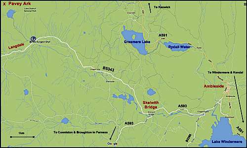 Google Maps image showing local road connections for reaching Pavey Ark |
By public transport:
Trains to the Lake District terminate at Windermere railway station. From Windermere take the 505 or 599 bus to Ambleside, and from Ambleside you can pick up the 516 Langdale Rambler.
For timetable information, call 0871 200 22 33 or visit Travel Line or Cumbria County Council websites.
Approach:
Lower Approach – see the following excerpt from Walk Lakes:
“Starting in Langdale from the New Dungeon Ghyll National Trust car park alongside Sticklebarn Tavern, head up to the back of the car park past the information boards and shelter. Turn right through the gate, then left through the next. Cross the grass to the bottom of the Stickle Ghyll path. Now the climbing begins. Continue on the path, it's a mixture of stone pitched path, and rough boulders. Climb the stile, there is a lift up dog gate here. Shortly after the stile is a footbridge, cross it to the other bank. Continue now on the east bank. The west bank is not such an easy path, and has a stile without a dog bypass. Follow the pitched path, occasionally there are some lumps of rock that require a bit of clambering over. Allow yourself to be guided by the path to cross the ghyll again back to the east bank by way of some very large stepping stones. It's a good idea to note this crossing as it's not so obvious on the return journey.Turn right and continue climbing, it's not far now to the tarn.” Overall this involves about 300m ascent and 1km distance: expect to take about an hour.
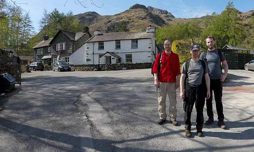 Three Lancashire lads near New Dungeon Ghyll Hotel | 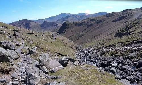 High on Pavey Ark lower approach looking back | 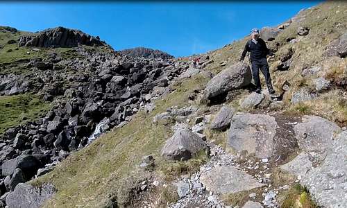 Descending from the Pikes alongside Stickle Ghyll |
Alternative (and more sporting) lower approach route - Stickle Ghyll Scramble:
Beside the above path is another Grade 1 scramble, following the stream. The route involves boulder hopping and pleasant scrambling alongside the stream with its numerous cascades, anything from 1-10m in height. The crux is a 10-12m high wall alongside a cascade which may warrant a rope for security, but can easily be bypassed by scrambling up grassy ledges to the left. Otherwise pretty much any line can be taken according to whim and expertise. Keep following the stream all the way up to the low dam at the edge of Stickle Tarn. This adds an hour to the above so expect to take 2 hours if the Ghyll Scramble is followed.
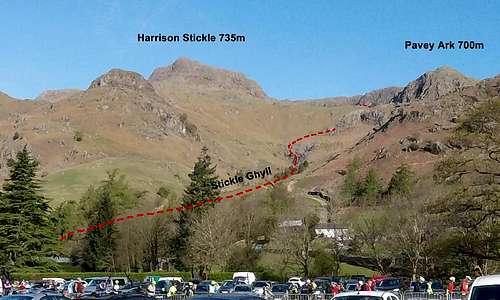 Stickle Ghyll route topo | 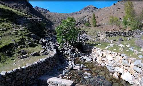 Looking up Stickle Ghyll towards the Harrison Stickle and Pavey Ark |
Upper approach - from Stickle Tarn:
If you are lucky you may be rewarded by still conditions and a perfect mirror reflection of Pavey Ark and Harrison Stickle in Stickle Tarn. The formidable buttresses of the south east face of Pavey Ark are now dead ahead. Jack’s Rake can easily be made out as a diagonal fault line rising from low right to high left and splitting the buttress into a lower left and upper right wedge. There is a prominent scree fan below the lowest extremity of the Rake, dropping perhaps 50-60m down to the north western edge of the little lake. An obvious trail rises up the scree which can be accessed by following paths around the lake in either direction. Follow the trail up to the start of Jack’s Rake. Less than half an hour from the Stickle Tarn Dam to the start of the climbing.
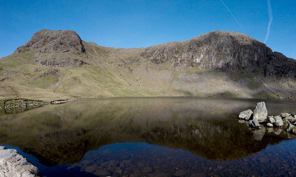
Perfect mirror reflection of Harrison Stickle and Pavey Ark
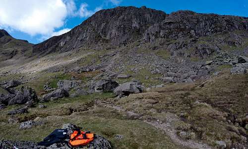 Looking up the path up the scree fan to the start of Jack's Rake | 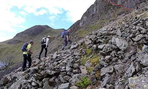 Final approach to Jack's Rake on the scree fan above the lake |
ROUTE DESCRIPTION
 Pavey Ark with Jack's Rake topo | 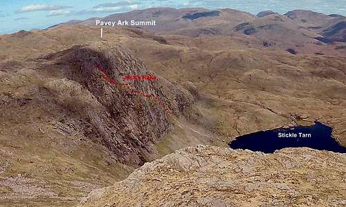 Pavey Ark & Jack's Rake from top of Harrison Stickle |
Lower section:
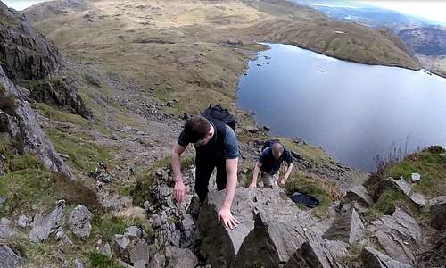
The start of the Rake is very obvious since, as above, it forms the only breach in the otherwise vertical world of the main Pavey Ark cliff. A polished (through decades of use) cleft rises at an average angle of around 30° up and across the buttress. It is fairly wide at the bottom but soon narrows to a width making passing difficult and single file is the rule. It is possible to scramble the cleft itself, which most of the time completely avoids any exposure. However it is also possible and a lot more pleasing to scramble the slabby rocks at the edge – thereby getting to appreciate the growing void (and the lake) down below. Maybe 30-40m of height is gained in this lower section, which ends at a small grassy ledge – with a tree.
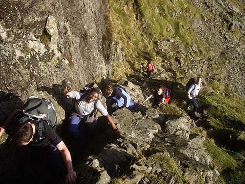 Party starting on Jack's Rake by daw37 | 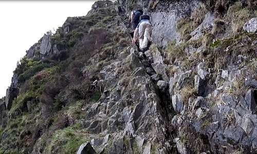 Climbing the initial steep cleft looking up | 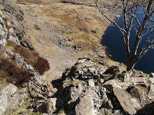 Tree at top of lower section by nks |
Middle section:
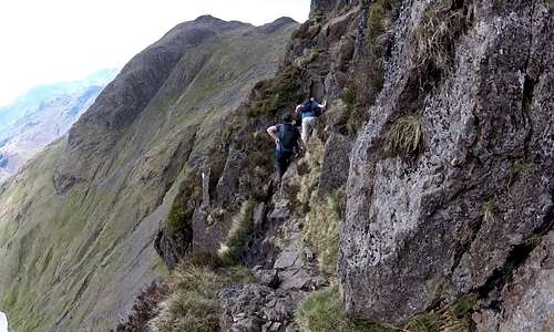
Beyond the ledge with the tree is the first of two apparently horizontal traverses. At least after the steepness of the initial cleft they feel horizontal, but in actuality are still gradually gaining height. There is no cleft anymore but the going now feels more of a stony path traversing a narrow grassy ledge. With the precipices above and below there is a slightly Dolomites feel – albeit that the rocks on Pavey Ark are dark Rhyolite as opposed to pale Limestone – and the void not that big.
The first traverse ends abruptly with a craggy spur dropping down from above and which forms a rock-step barrier to be crossed, before reaching the second traverse. For a few meters it is back to climbing with hands as well as feet, but right at the edge now. For those nervous of heights, it is worth noting that there is no avoiding the exposure here.
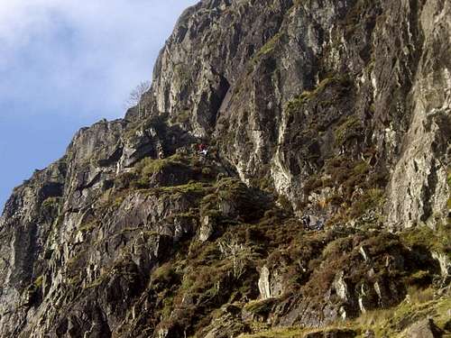
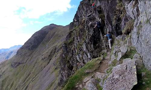 End of the first traverse with mildly exposed rock step to cross | 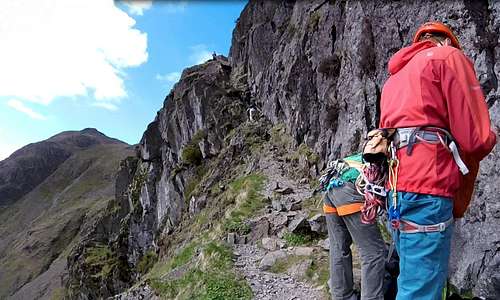 Rock-climbers on second traverse with crux pitch at the far end |
The second traverse starts a couple of meters higher and is also narrow. If any rock-climbers are belaying here, a careful step may need to be taken to step around. After around 20-30 meters of airy path the ledge steepens and starts to become a cleft again. Very quickly this rears up into a kind of chimney, with a prominent chock-stone at the top, which has to be got around. This is the ‘crux’ of the route. A couple of slightly awkward moves have to be made to get round and then on top of this rock, to where, after a little more scrambling, there is a wide grassy ledge.
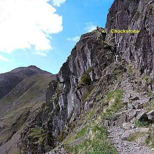 Crux pitch at the end of mid section | 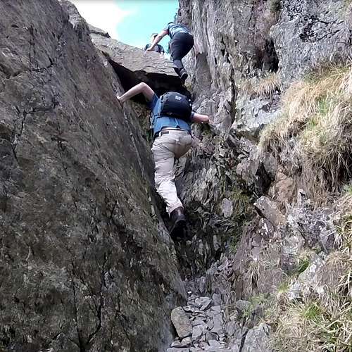 Climbing crux pitch... | 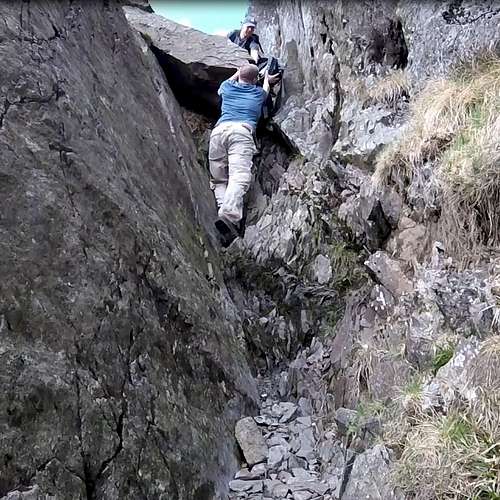 ...taking pack off to get round chockstone | 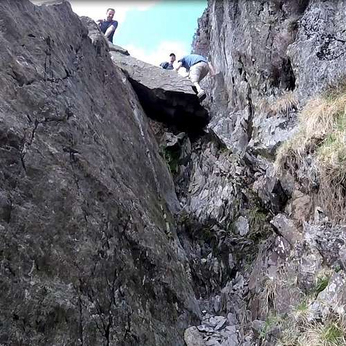 ...and on up to the ledge |
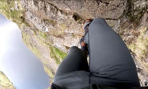
Although climbing the little chimney is ‘the crux’ there is next to no exposure, since all the action is buried in the cleft and well away from the edge. For more elegant climbing the chimney can be by-passed by stepping left onto steep slabby rocks on the very edge of the now appreciable drop below. This is slightly more delicate and somewhat bolder – and with a head for heights, more aesthetically pleasing. At the top of the little pitch and still on the edge of the drop, a narrow walk-way leads round a large block and onto the ledge above the chock-stone.
 By-passing the chimney by climbing out on the edge above the drop... | 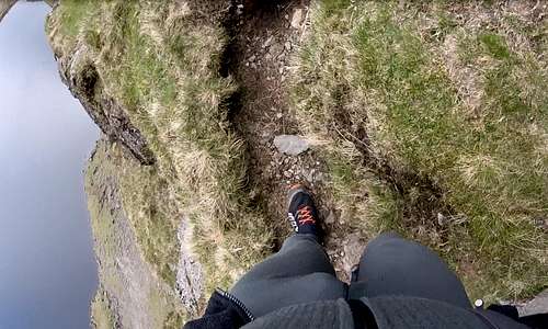 ...and on the narrow walk-way at the top leading to the grassy ledge |
Upper section:
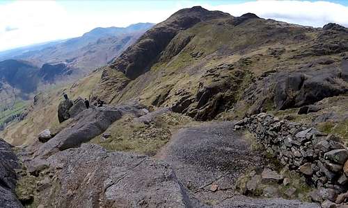
At the grassy ledge, the end of Jack’s Rake is now in sight. The line of the top left hand end of the buttress is now visible and breaking this skyline is a prominent conical rock. This is the next objective and marks the end of the climb, but not the summit of Pavey Ark. The route no longer follows a straight line but now winds its way in the general direction of the conical rock in short zig-zag sections of path, broken by small rock-steps. The terrain is quite steep and although not quite as airy as some of the scrambling of the main Rake below, there is nevertheless an impressive view down to the lake, far below now.
 View at the grassy ledge with the top of the chimney visible to the left... | 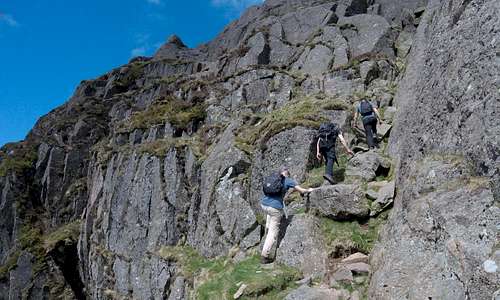 ...and looking the other way at the final scramble up towards the conical rock |
A final minor wall has to be surmounted to get on-top of the conical rock - and a nearby cairn marks the end to the climb. It is slightly exposed, but the climbing is very easy with huge hand and footholds.
 Climbing the upper section looking across... | 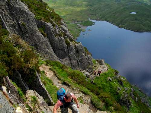 ...and looking down by daw37 | 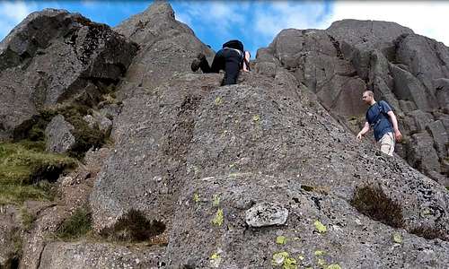 Mildly exposed final climb up to the conical rock |
To Pavey Ark summit:
The conical rock can be seen to be like a fin from sideways on and makes for a fine view point, albeit not very spacious. Adjacent and set back from the edge is another grassy ledge marked by the cairn and running back 20-30 meters towards a stone wall, on the other side of which is the main walkers path to the summit of Pavey Ark. This is one option. It is also possible to scramble over the rocks to take a more direct route to the summit - a few meters higher and little more than 100 meters distant to the north-east.
 Looking back at the conical rock at top of Jack's Rake from stone wall | 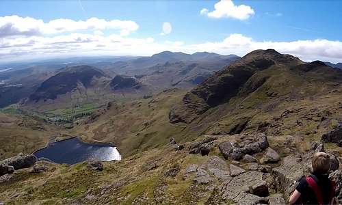 View from summit of Pavey Ark looking over Stickle Tarn to Harrison Stickle |
Beyond Pavey Ark:
Descent: Reference to map excerpt below or OS map OL6 (see Maps & Guides below) will show that there are various options for descending from Pavey Ark and back into Langdale.
Langdale Pikes: Pavey Ark is one of the four Langdale Pikes and the other three summits are all easily accessible and manageable within a day. See map below and refer to the following link to a WalkLakes walk.
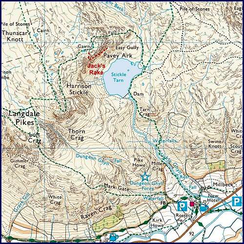
1:25000 OS Map excerpt of Pavey Ark
ESSENTIAL GEAR
Summer:
Normal hill-walking attire for the English Lake District, including suitable footwear, waterproofs and appropriate warm layers.
Map and compass (the top of Pavey Ark is wide and flat – and it would be possible to get disorientated in mist) - or GPS, for users of this kind of modern wizardry.
Walking rope and a few slings – if inexperienced/nervous members in party. (as above in 'Overview' at least one fatality has occurred on Jack’s Rake as a result of an inexperienced person being unable to manage the scramble and then trying to climb back down). For a climber/scrambler of average to good ability a rope would not be necessary – unless caught out by bad weather.
Helmet: as above there is risk of stone-fall (and falling sheep) on the route and use of a helmet not unreasonable.
Winter:
Although only given grade of Scottish Grade I for the making of a winter ascent, conditions on Jack’s Rake (as per Overview) could vary enormously. Whatever the conditions, the route will be a serious proposition in winter. It is to be assumed that anyone with the sort of experience required to tackle the Rake in winter will know what clothing and equipment to bring. SP writer Simnel has clearly done the climb in winter (see photos in 'Overview' above) and I intend to invite his comments on how he found things, either in the comments section or in climbers log.
Maps & Guides:
Map: OS 1:25000 sheet OL6 "The English Lakes - South-western area Coniston, Ulverstone & Barrow-in-Furness" gives by far the best cover. In the 1:50000 series the area falls between sheets 89 and 90.
Guide: Cicerone Guide "Scrambles in the Lake District, Volume 1: Southern Lakes" by Brian Evans.
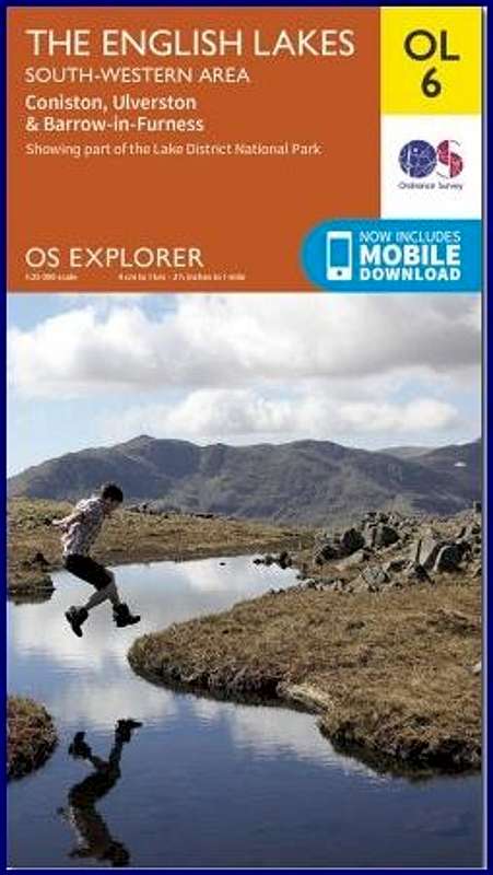 OS OL7 Cover image | 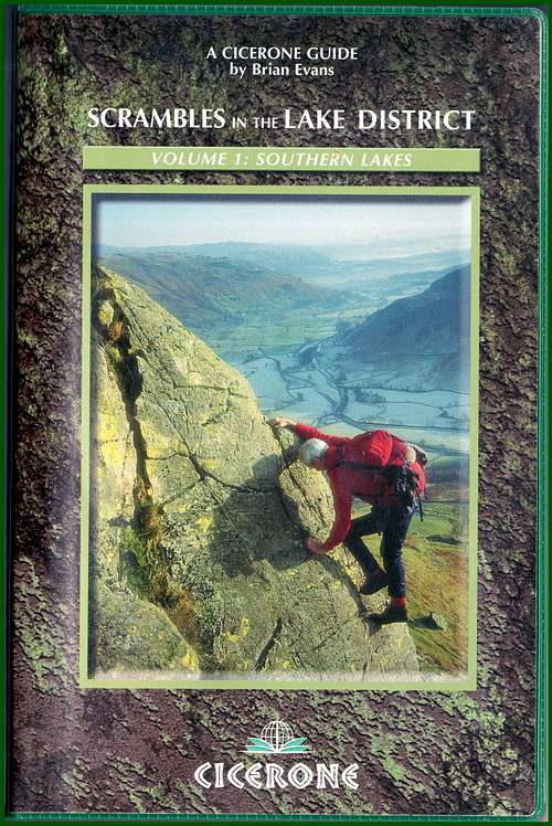 Cicerone Lakes Scramble Guide |

chugach mtn boy - Jun 4, 2017 7:32 pm - Voted 10/10
Not YDS Class 5This is a marvelous page! My one complaint is equating UK Scramble Grade 1/UIAA I with YDS 5.0. These grades equate to YDS class 3. The source of this misconception is an old, misinformed UIAA comparison chart that says YDS 3 and 4 are walking grades. I despair of talking any of my European friends out of this until they come over here, get on one or two of our class 3 or 4 routes, and say "oh." Having climbed and scrambled on both sides of the Atlantic, I can tell you that by the time you get to class 5 in the US, you are up to, say, some of the easier routes on your Idwal Slabs--which, although not difficult, are not in UK Scramble Grade 1 and are in a different category from the route you're describing here. Anyway, that's my two cents--if you're not sure you believe me, you could just take off the YDS rating and leave it with a UK scramble grade for others to interpret. Again, fabulous page--I may be up in the Lakes next year, and this adds a new route to my itinerary! Cheers, Chris
markhallam - Jun 5, 2017 1:53 pm - Hasn't voted
Re: Not YDS Class 5Thanks very much Chris! Unlike you I have not rock-climbed on both sides of the pond, so I can only defer to your superior knowledge - and appreciate the correction, which makes good sense. I have changed to YDS Class 3. Yes, the easiest Idwal Slab routes are around 'Difficult'... and in UK scrambling terms that would potentially slightly overlap with Grade 3, certainly Grade 3'S' or as I have now seen it referenced as Grade 4 (and that would equate to US 5.0?) I do hope you make it over to the Lakes next year. The mountains will be tiny compared to what you are used to, but they have a charm of their own. Best wishes, Mark
chugach mtn boy - Jun 5, 2017 4:20 pm - Voted 10/10
Re: Not YDS Class 5Ah, the UK mountains that I've been in are fantastic. My mother was English and always told me the Lakes were the best part of England ... but she never took me there! So I need to rectify that.
yatsek - Jul 3, 2017 6:07 pm - Voted 10/10
Re: Not YDS Class 5To paraphrase mvs and Fred Spicker (Handy Alpine Grade Facts), I think there are real differences in the application of the UIAA system within Europe. I believe these differences are actually largest with the lowest grades. I've written about it before on some SP's Tatra pages, e.g. here. I haven't been to America, but I often read, e.g here that "An indicator of class 3 is that most people can downclimb it facing outward." So, looking at the photos of the crux, I guess that'll be Class 4 rather than Class 3. Best wishes, Jacek
markhallam - Jul 8, 2017 12:52 am - Hasn't voted
Re: Not YDS Class 5Hello again Jacek and thanks again for your feedback. I have studied your information and saved the links for future reference. I have accordingly slightly altered the overall grades, but added also a new sub-section on grade in the 'Overview'. I have personal experience of UIAA (and UK naturally) but thanks to you and Chris, I now feel I have the beginnings of an understanding of the US/Yosemite system - so thanks again to both of you!
yatsek - Jul 9, 2017 3:43 pm - Voted 10/10
Re: Not YDS Class 5No problem, Mark. The sub-section on grade is so comprehensive, worth much more than a mere number. Thanks!
chugach mtn boy - Sep 19, 2018 7:54 am - Voted 10/10
YDS translation, updateJust been to the Lakes. Could not do Pavey Ark due to weather, but from other routes done it seems that UK scramble grade 1 is YDS class 2-3 (with some routes, like Hall's Fell, definitely in the class 2 realm). UK scramble grade 2 is solid YDS class 3, but perhaps lapping into class 4. From just eyeballing Pavey Ark, I think my North American brethren should go into it expecting some 4th class in the upper part of the route.