
-
 272 Hits
-
 75.81% Score
-
 6 Votes
|
|
Mountain/Rock |
|---|---|
|
|
39.68380°N / 21.12260°E |
|
|
Trikala |
|
|
Hiking, Mountaineering, Mixed, Scrambling, Skiing |
|
|
Spring, Summer, Fall, Winter |
|
|
7467 ft / 2276 m |
|
|
Overview
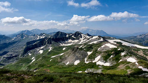
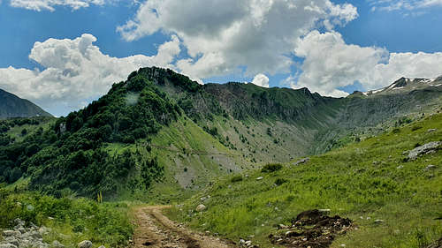
Lakmos (2,276m) [“Λακμος”] is a mountain complex located in Northern Pindos, South of Timfi (2,497m), Smolikas (2,637m), the village of Metsovo, and North of Tzoumerka. It is known for its meandering alpine lake called “Verliga” (“Βερλιγκα”), its long ridges, and the pristine nature which envelops it. Its highest summit is called “Tsoukarela” (“Τσουκαρελα”). Located in one of Greece’s most remote areas right at the core of the main Pindos range it is home to a plethora of animal and plant species including brown bears and wolves. This area is of exceptional environmental interest as it is part of Aspropotamos Valley (“Ασπροποταμος”) meaning “white river” and is home to the only sub-temperate forest in the country. It is also the location of the springs of the Achelous River (“Αχελώος”) and several 18th century churches.
History & Area Guide
The near vicinity of Lakmos (2,276m) is dominated by the history of the village of Chaliki (“Χαλίκι”) situated on its Eastern flanks, within the Aspropotamos Valley. The village is known to have been inhabited since at least 1331 when it was first mentioned in Byzantine texts, it was considered to have been one of the most important settlements of Pindos. In the census of 1454, the village had a population of 174 with most (74%) working in animal husbandry followed by (17%) nut harvesting and (9%) beekeeping. Its name may originate from the white pebbles of the spring of Achelous River, situated next to the village.
|
|
|
During the Ottoman period the village was considered of great importance and resident families would often be rulers of the region. Local legend suggests that Kosmas the Aetolian, when passing to conduct a sermon, would meet Ali Pasah of Ioannina and predicted that he would become important and return to Istanbul with a “red head” – he would return, beheaded years later. The importance of the village as a trade route and point of control through Pindos was also confirmed by European explorers who visited in the 19th century. According to their texts the area was the wild and cold home of the Vlachs, where “summer only lasted 3 short months”. During Ottoman rule a Greek school operated in the village, a sign of its importance and autonomy, potentially in part due to the treacherous terrain which surrounds it.
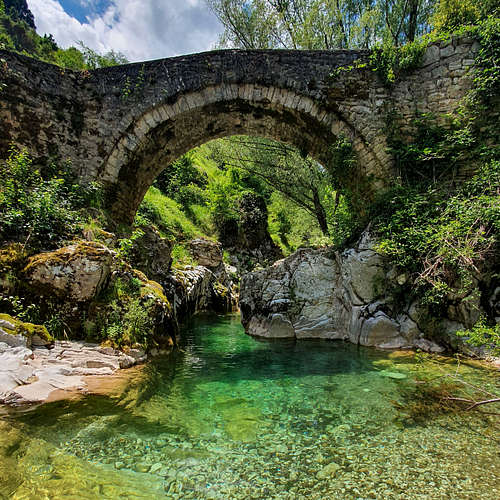
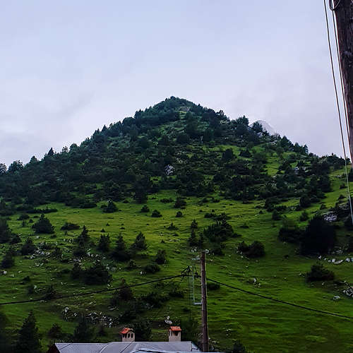
Chaliki village today is also known for its churches which date from the 18th century, constructed using traditional Pindos masonry, some using local slate, they showcase some of the best examples of Vlachic architecture available in Greece today. Additionally, the spring of river Achelous is located just South of the village, and essentially runs through it. Just below the village a small arched bridge – of c.17th century – gives way to a small “beach” with pebbles; the water temperature remains exceptionally cold. The river which begins its journey here will travel 220km down Pindos, generate electricity, and finally make its way into the Ionian Sea near Messologi.
Getting There
From Greece
The village of Chaliki is located in the broad area of Metsovo and is a 5-hour drive from Athens. Thus, for visitors looking to come to Pindos specifically, there are other starting locations we’ll provide directions for.
- Athens to Chaliki [429km / 5:45h]
- Thessaloniki to Chaliki [236km / 3h]
- Ioannina to Chaliki [68km / 1:3h]
- Trikala to Chaliki [101km / 2:15h]
From Albania
The area of Metsovo is relatively accessible from Albania, due to the Konitsa border crossing. It may be possible to link Lakmos with a trip or ascents around Southern Albania.
Trailhead Access
From the village of Chaliki (1,130m) it is possible to reach “Lakos” at 1,790m via 4x4 during the summer. This is done through an old logging road which may have seasonal obstacles such as rocks or snow. The road is not cleaned in the winter and is not paved.
It is possible to start the hike from Chaliki village but that would require an approach of 5km and 660m vertical gain.
Route(s)
Short Standard Route (Chaliki – Verliga – Lakmos)
This is the short route starting from “Lakos”, a swampy area at 1,790m accessible only using a 4x4 in the summer from Chaliki, skipping the 5km approach hike. The route passes through Verliga seasonal lake and traverses the ridge to summit Tsoukarela (2,276m).
Distance: 4.5km (one-way)
Duration: 1:30h
Elevation Gain: 497m
Difficulty: Medium
Water: Yes – untreated snowmelt
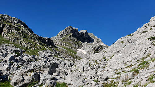
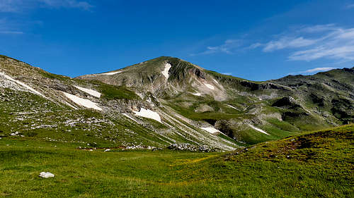
From Lakos the trail heads South and then Southwest through a couloir on the viewers left of the rockface above Lakos. This couloir is rocky but neither exposed nor steep. From the top of the couloir, it is a short hike to the Western edge of “Verliga” seasonal lake at 2,000m. Here the trail follows the logging road – which at this elevation is usually inaccessible year-round – around the South and West of Verliga, under the summit of “Megas Trapos” (2,228m) and the seasonal lake “Farmakolakka”. Follow the road and trail under Megas Trapos until the Lakmos Pass (2,116m) at the western edge of the bowl. From here the trail will head dead North and follows the ridgeline up towards “Tsoukarela” summit (2,275m).
List of Highest Peaks
 |
 |
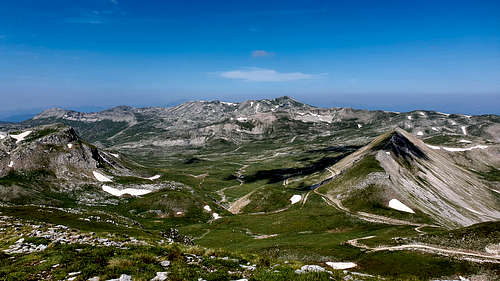 |
| Tsoukarela | Megas Trapos | Giannakaki |
| 2,276m | 2,228m | 2,164m |
 |
||
| Kourkoumbeta | Plaka | Katsarou |
| 2,162m | 2,151m | 2,101m |
 |
||
| Stakokola | Botai | Tsouma Arosa |
| 2,023m | 1,998m | 1,702m |
When to Climb
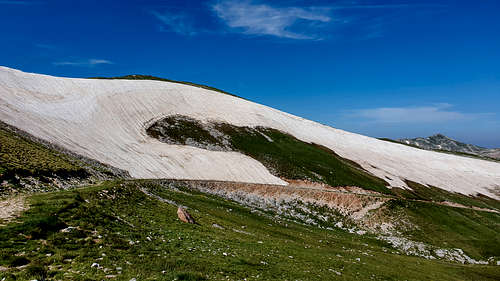
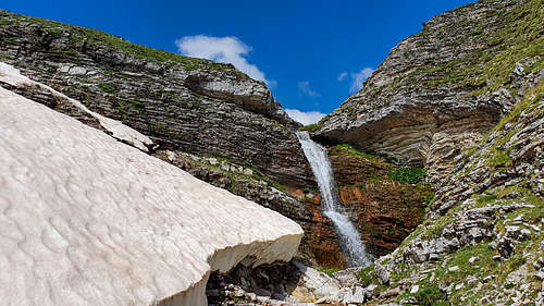
The mountain is both remote and benefits from a local microclimate of high precipitation. It is recommended that hikers attempt to summit in the summer. The best conditions can be found from late May to late June. By September the mountain is dryer while by mid-October, winter storms return. For mountaineers, skiers, and snowboarders, it is generally best to attempt in late February through April. Note that the logging road is usually not open until May.
Huts & Camping
Huts
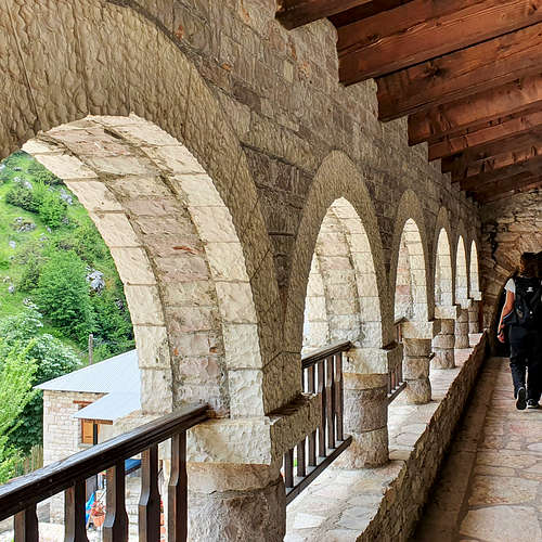
There are no huts on the mountain. The Kasaria Guesthouse at the village operates as a refuge of sorts since its operation is government mandated and subsidized. The quality is ok for the location.
Camping
In Greece there are no restrictions in relation to wild camping. Lakmos and especially the area of Verliga are popular camping destinations for hikers, especially those hiking from Chaliki. It is generally not recommended to camp in Verliga, for obvious reasons of pollution, although some people tend to do it. Camping season is between June and August and hiking clubs from nearby cities make the trip on weekends.
Verliga Seasonal Lake
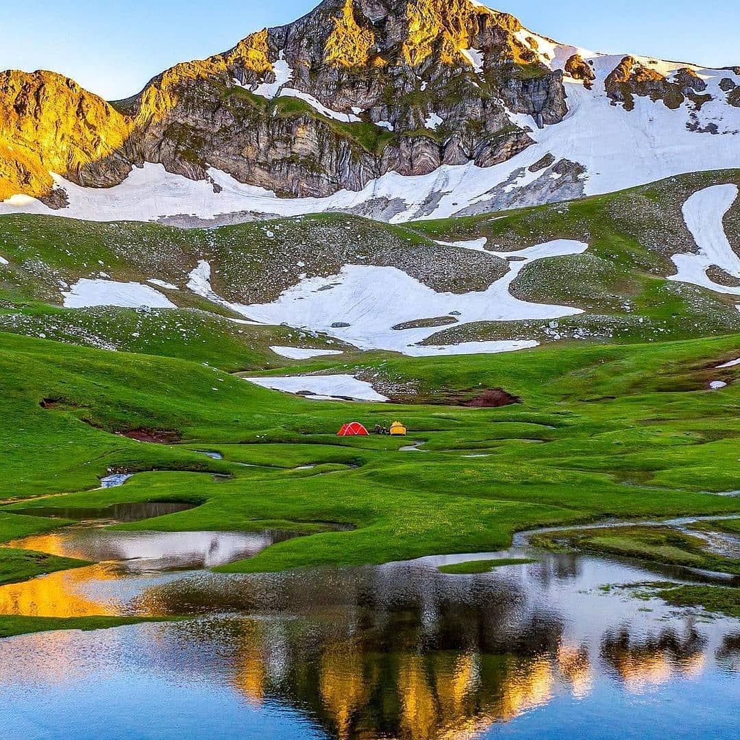
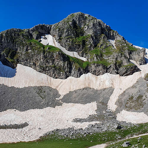
The seasonal lake of “Verliga” (“Βερλιγκα”) is located at 2,000m at the center of the bowl formed by Megas Trapos (2,228m) and Tsoukarela (2,276m), its name means “meander” in Vlachic, a reflection of its unique structure. The “lake” looks more like a miniature of a river, meandering across the plateau, in its waters Alpine Newts are said to live, making it one of the Pinos Dragonlakes. It is a somewhat well-known location, but not too popular with visitors. Its water can be drunk at lower levels during the early season – before animal grazing starts.
Natura 2000
The mountain of Lakmos is classified as a Natura 2000 protected site spanning 203km2 and protects 24 species and 9 habitat types. Among the species protected are 17 birds, 1 amphibian, 2 fishes, 1 invertebrate, 2 mammals, and 1 reptile. The protected mammals are the Brown Bear and Otter, while the protected fishes are the barbus peloponnesius and the Telestes pleurobipunctatus.
In recent years the Natura 2000 designation has become of interest in this area as there has been a lengthy legal battle regarding a concession for the installation of a Wind Farm on the mountain. Although in March 2023 a government body blocked the project following an environmental study.
External Links
Metsovo Municipality, website
Verliga Lake, VisitThessaly, website
Aspropotamos Municipality, website
Chaliki Village Information, Aspropotamos Org, website
Lakmos Protected Area, Natura 2000, website
"Metsovo Forestry Office blocks Wind Farm installation on Lakmos", epirusgate, 2023
"Verliga Alpine Lake - Wild Camping in Greece's Secret Paradise", OlympusMountaineering, 2018
Lakmos Trails, HellasPath, website (GPX viewer)
Kasaria Guesthouse, Tripadvisor, website