


-
 2421 Hits
-
 77.48% Score
-
 8 Votes
|
|
Area/Range |
|---|---|
|
|
45.83740°N / 7.07818°E |
|
|
Hiking, Mountaineering |
|
|
Summer, Fall |
|
|
9606 ft / 2928 m |
|
|
Note
La montagna chiama i suoi figli, ed essi rispondono fedelmente al suo appello… Osvaldo Cardellina, Diario alpinistico, 1964-65 Page texts: @ OsvaldoCardellina "Osva", passed away on May 2, 2022. Page owners: Christian Cardellina e Osvaldo Cardellina. Any updates from September 12, 2022: Antonio Giani, page administrator, friend and climbing companion. Testi della pagina: @ OsvaldoCardellina "Osva", scomparso il 2 maggio 2022. Proprietari pagina: Christian Cardellina e Osvaldo Cardellina. Eventuali aggiornamenti dal 12 settembre 2022: Antonio Giani, amministratore della pagina, amico e compagno di salite. |
Overview
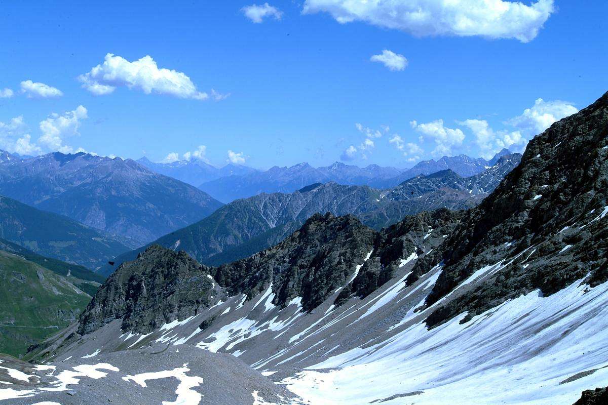
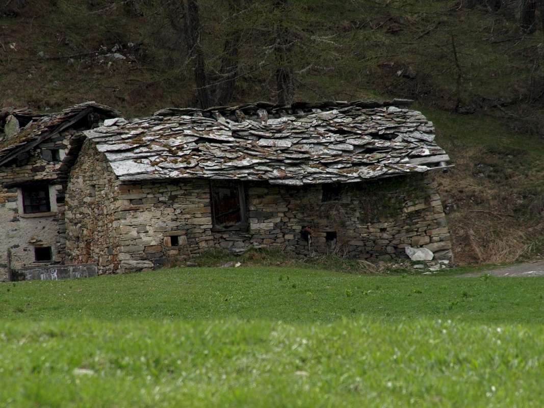
Gran San Bernardo Valley-Basin. This large valley shaped foam basin looming over the Municipalities of Gignod, Etroubles, St. Oyen and St. Rhémy-en-Bosses, it extends first to the North and then North-northwest for 34 km. from the City of Aosta (583m) to the Great St. Bernard Lake (2.449m), now completely in Switzerland. But the "real" Valley begins just before the Municipality of Saint Rhémy-en-Bosses (1.619m; at Km. 23, after the unification of the two Communes), while at the bottom we have the stretch with Shared Basin By, the Valpelline and the subsequent diversion to the Ollomont Valley, the latter like a bridge between the other two. At Km. 18.2 the SS.27, after the Municipality of St.-Oyen (1.373m), leaving to the West entrance to the Motorway of the Gran San Bernardo and the surroundings of the former Common of Bosses at the entrance of 'the same name that Comba, followed by the subsequent "Combe du Merdeux or des Merdeux", reaches Col Malatrà (2.928m), on the border with the Italian Val Ferret. From Saint Rhémy-en-Bosses valley completes its sinuous form topographically returning permanently to the North until you reach the Great Saint Bernard Pass with its Hospice (2.469m), at the border with Switzerland. Accordingly a valley, just after St. Oyen, doubles with two important ramifications: the first to the North towards the "Grand" and the second to the West towards the Citrin, Serena, Malatrà, Bellecombe, Saulié or "des Ceingles" Passes. But, while the first two and the last are "external" to the real Comba du Merdeux and lead to the Combes Vertosan Planavalle to the Central Valley of Baltea and into the Comba Thoula or des Thoules at the slopes of Petit and Grand Golliat the two intermediate stands at the apex of Comba du Merdeux, bordering Lavachey, Greuvetta and Arnouva or Arp Nouva in Italian Val Ferret. A circle of not very high mountains and neither famous, but unusual for their age, surround this fairly long valley that draws its origins by Bosses-Mottes or, more precisely, amongst the Pastures Farettes, Ponty, Eteley, St. Michel, By, Limassey, Chesalet, Merdeux Dèsott Damon, Cotes, Sèz or Potz-Ardusi, Manda, Muenda also Moindaz. In foreground it stretches in a semicircle starting from Colle di Serena Costa Serena, Crêton du Midi, Grand Crêton, Aiguille d'Artanavaz, Mont du Tapier, Aiguille de Bellecombe, Petit Golliaz in a crescendo that finds its vertex with this latest (3.234m) before finally declining to the East over Aiguille de Saulié and Crête des Ceingles.
La Valle del Gran San Bernardo risultante quale grande vallata a forma d'espanso bacino sopra i Comuni di Gignod, Etroubles, St. Oyen e St. Rhémy-en-Bosses, si estende dapprima verso Nord e poi Nord-nordovest per 34 Km. dalla Città di Aosta (583 m) fino al Lago del Gran San Bernardo (2.449 m), ormai completamente in territorio svizzero. Ma la "vera" valle inizia appena prima del Comune di Saint Rhémy-en-Bosses (1.619 m; al Km. 23, dopo l'unificazione dei due Comuni), mentre nella parte inferiore abbiamo il tratto in Comune con la Conca di By, la Valpelline e la successiva deviazione verso la Valle di Ollomont, quest'ultima a guisa di trait d'union tra le altre due. Al Km. 18,2 la Strada Statale n°27, dopo il Comune di St.-Oyen (1.373 m), lascia verso Ovest l'ingresso per il Traforo con Autostrada del Gran San Bernardo, nonché le frazioni dell'ex Comune di Bosses all'ingresso dell'omonima Comba che, seguita dalla successiva "Comba du Merdeux o des Merdeux", raggiunge il Col Malatrà (2.928 m), ai confini con la Val Ferret italiana. Da Saint Rhémy-en-Bosses la valle completa la sua forma topograficamente sinuosa ritornando definitivamente verso Settentrione fino a raggiungere il Colle del Gran San Bernardo con il suo Ospizio (2.469 m), al confine con la Svizzera. Quindi una valle che, subito dopo St. Oyen, si sdoppia con due importanti ramificazioni: la prima a settentrione verso il "Grande" e la seconda ad Occidente verso i Colli di Citrin, Serena, Malatrà, Bellecombe, Saulié o des "Ceingles". Ma, mentre i primi due e lo ultimo sono "esterni" alla vera e propria Comba du Merdeux e conducono alle Combe di Vertosan e Planavalle verso la Valle Centrale della Dora Baltea nonché verso la Comba Thoula o des Thoules alle pendici di Petit e Grand Golliaz, i due intermedi costituiscono il vertice della Comba du Merdeux, al confine con Lavachey, Greuvetta ed Arnouva nella Val Ferret. Una cerchia di montagne non molto alte e neppure famose, ma singolari per la loro vetustà, circondano questo abbastanza lungo vallone che trae le sue origini da Bosses-Mottes o, più precisamente, tra gli Alpeggi di Farettes, Ponty, Eteley, St. Michel, By, Limassey, Chesalet, Merdeux Dèsott Damon, Cotes, Sèz o Potz Ardusi, Muenda o Manda. Di fronte stagliansi a semicerchio partendo dal Col Serena Costa di Serena, Crêton du Midi, Grand Crêton, Aiguille d'Artanavaz, Mont du Tapier, Aiguille de Bellecombe, Petit Golliaz in un crescendo che trova il suo Vertice con quest'ultimo (3.234 m), prima di declinare definitivamente ad Oriente sopra Aiguille de Saulié e Crête des Ceingles.
 |
 |
 |
Getting There
BY CAR:
- From TORINO, MILANO, etc: Motorway A5. Exit at IVREA or Quincinetto (PIEDMONT) From IVREA Town: a) - before in West to Pont St. Martin, St. Vincent Aosta; b) - after Northwest to Gignod, Etroubles, Saint-Oyen, Saint Rhémy en Bosses Commons. From Courmayeur Resort: a) - before in East to Morgex, St. Pierre, Aosta; b) - after Northwest to Gignod, Etroubles, Saint-Oyen, Saint Rhémy-en-Bosses Municipalities.
- From Saint-Oyen or St. Rhémy-en-Bosses to Comba du Merdeux up to the Bellecombe Pass From Saint-Oyen (1.377m), with previous road to Mottes, continue West-northwest to Devies Village (1.723m) at the beginning of Merdeux Comba; from this with paths through Merdeux Dèsott (1.919m), Cotes (1.930m), Manda (1.973m), Tsa de Merdeux (2.285m) Pastures to Malatrà Pass (2.928m) by Eastern Slope. From St. Rhémy en Bosses Commune (1.619m), through Municipal Road, on Merdeux Comba to Tsa de Merdeux (2.285m) and Bellecombe Pass (2.906m) from East.
- From FRANCE: through the Mont Blanc Tunnel to Entrèves-crossroads to Vény/Ferret Valleys - Mountain Guides of Courmayeur - La Saxe Rock Gym - Courmayeur. By Little Saint Bernard Pass, closed since November until half May to La Thuile Valley - Pré Saint Didier - Courmayeur. It is not necessary to take Motorway A5: you can drive on SS.26, in the direction of AOSTA - IVREA - TURIN.
BY PLANE:
- Aeroporto "Corrado Gex" Saint Christophe (Aosta).
Some more or less easy Hikings
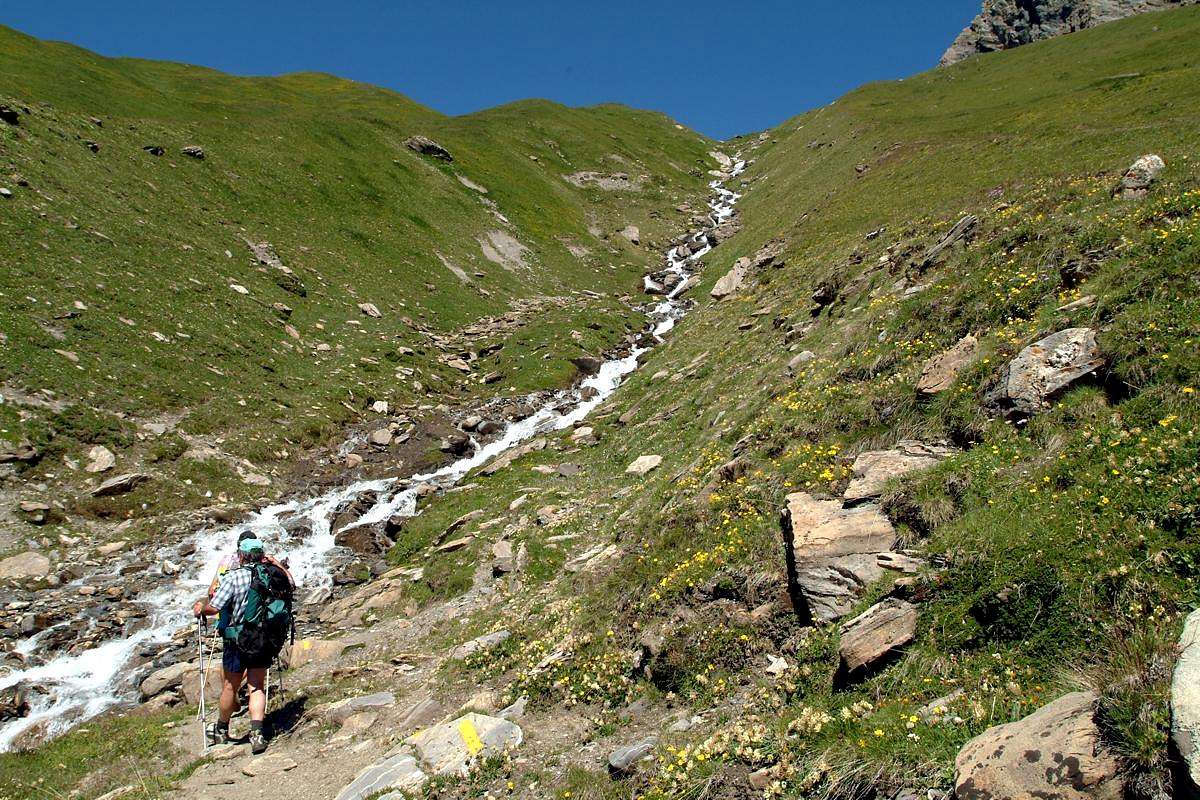
2) - Serena Hill and Testa (2.547m, 2.830m) along the Comba Serena: reached the hill from Bosses-Mottes (1.676m) through the path n° 9 continue in Southeast and by the easy Northwest Crest without path, but through enough evident traces and bypassing a serie of blocks, reach the Summit (EE/F/F+; 4h'45/5h'15).
3) - Malatrà Hill (2.922m): from Saint-Oyen, Mottes Fraction (1.660m; parking under Saint Bernard Road) also from Bosses-Cuchepache/Ronc Fractions (+; 1.648m; 1.775m) towards Comba Merdeux, Montagna Merdeux Dèsott (Low; 1.919m), Muanda or Moindaz Alp (1.973m), Tsa de Merdeux Upper Alp (2.285m), with various paths sometimes concurrent with the farm dirt road to the isolated little Villages of Devies and Maytie on Alta Via n° 1. Through the same towards the Malatrà Hill, with small path-traces alwais of or nearby the Alta Via n° 1, (2.928m), between Mont Quichette (3.043m) and Aiguille of Artanavaz (3.071m; E/F+; 4h'15/4h'30 from Mottes Fraction). "Lower" Variant 7b) - from Maytie (1676m) towards Limassey Alp (1.808m) by private road and from this, through unnumbered small path to Potz-Ardusi and Muanda Alps (1.784m, 1.973), along the Torrent de la Belle Combe, at the entrance in Merdeux Comba towards the last Alp of Merdeux Damon (2.285m; T/E; 1h'10/1h'20 by Mottes).
4) - Aiguille d'Artanavaz (3.073m): from Saint-Oyen, Mottes Fraction (1.660m; parking under Saint Bernard Road) also from Bosses-Cuchepache/Ronc Fractions (+; 1.648m; 1.775m) towards Comba Merdeux, Montagna Merdeux Dèsott (Low; 1.919m), Muanda or Moindaz Alp (1.973m), Tsa de Merdeux Upper Alp (2.285m), with various paths sometimes concurrent with the farm dirt road to the isolated little Villages of Devies and Maytie on Alta Via n° 1. Through the same towards the Malatrà Hill, with small path-traces alwais of or nearby the Alta Via n° 1, (2.928m), between Mont Quichette (3.043m) and Aiguille of Artanavaz (3.071m; E/F+; 4h'15/4h'30 from Mottes Fraction). "Lower" Variant: from Maytie (1.676m) towards Limassey Alp (1.808m) through private road and from this, through unnumbered small path to Potz-Ardusi and Muanda Alps (1.784m, 1.973), along the Torrent de la Belle Combe, at the entrance in Merdeux Comba towards the last Alp of Merdeux Damon (2.285m; T/E; 1h'10/1h'20 by Mottes). From Col Malatrà goes up through the short and quite easy Northern Crest: after a stretch more linear to reach a small shoulder followed by three little elevations presenting some passages fun and interesting, one of wich avoidable through an exposed step to Malatrà Slope (West; I°+/II°-) with, unfortunately, rotten rock, often friable. Reached a following shoulder "almost flat", more easily in terminal part to arrive on Summit (F+/PD-; 1h’00/1h’15 for the Northern Ridge from Malatrà Pass; 5h’30/6h’00 by Mottes).
 |
 |
 |
5) - Aiguille de Bellecombe (3084m) by North-northeast Face from Combe du Merdeux: from Saint-Oyen, in the locality of Mottes Fraction (1.660m; parking under Saint Bernard Road) also from Bosses-Cuchepache/Ronc Hamlets (+; 1.648m; 1.775m) towards the Comba Merdeux, Montagna Merdeux Dèsott (Low; 1.919m), Muanda or Moindaz Alp (1.973m), Tsa de Merdeux Upper Alp (2.285m), with various paths sometimes concurrent with the farm dirt road to the isolated little Villages of Devies and Maytie on Alta Via n° 1. Through the same towards the Malatrà Hill (2.928m) in West at the end of the valley, with small path-traces alwais remaining on or nearby the Alta Via n° 1. "Lower" Variant: from Maytie (1.676m) towards Limassey Alp (1.808m) through private road and from this, through unnumbered small path to Potz-Ardusi and Muanda Alps (1.784m, 1.973m), along the Torrent de la Belle Combe, at the entrance in Merdeux Comba towards the last Alp or Tsa Merdeux Damon (2.285m; T/E; 1h'10/1h'20 by Mottes). By Tsa Damon leaves the High Route for Malatrà Hill and the head of the valley; instead continue towards the North with a not numbered path towards Col de Saulié or des Ceingles. Not even achieve it, but, when it flexes in the Northeast, proceed on stony ground in the opposite direction, taking progressively below the North-northeast Slope of the Aiguille de Bellecombe. Climb the same for very broken and rotten rocks and not always easy or through residues snowfields mixed with steep stony slopes, and finally more easily in terminal part, but always fairly steep, to arrive on Summit (F+/PD-; 1h’30/1h’45 for the North-northeastern Slope from base; 5h’00/5h’30 by Mottes Hamlets).
6) - Petit Golliaz (3.234m) with approach through Combe du Merdeux : from the Tsa su Merdeux (2.285m; see the subsequent Route n° 9) towards Col de Belle Combe, before in North through not numbered small path after West on moraines, (3.000m; EE/F+; 2h'30/3h'00 from Tsa) and through quite easy Southwestern Crest, formed by rocks very broken and debris bypassing some short distance to the left (West) (EE/A/F+/PD-; 1h'00/1h'15 by Bellecombe Pass; 5h'00/5h'30 from Bosses-Mottes).
 |
 |
 |
 |
 |
7) - Aiguille de Saulié or "Aiguille des Ceingles" (2869m) and Aiguillon de Saulié (about 2.875 meters) with approach through Combe du Merdeux: From Mottes (1.670m; Hamlet of Bosses, reachable from the route SS.27 of Gran San Bernardo) toward West, descending a little to pass under the trail Highway n° 1,near the "big bend". Cross the Torrent Artanavaz on a small bridge the on to the Pastures of By (1.767m), Potz-Ardusi (1.784m) and Moindaz or Manda, even Muenda (1.973m), all at the entrance of real and long Comba's Merdeux, bordering the waterfalls of Thoules Torrent. You can arrive here also starting from the Devies car parking, just beyond the winding road, through the Pastures of Merdeux Dèsott (1.919m) and Côtes (1.930m). From Manda or Moindaz cross twice the torrent and follow the Eastern bank till the Pastures of Comba Toula and near the Saint Rhémy Hill; follow the path n° 12 coming from it, but from here not numbered, passing some dry channels toward West, up toward the moraine of the small Glacier des Bosses. Almost reach it at about 2.700 meters, where originates two small torrents, and after to follow to the left the minuscule path to Col de Sauliè. Reach the same through a progressively more small path into the moraines and with traces in terminal part (EE; 3h'30/4h'00 by Mottes Fraction). From Col de Saulié easily continue Eastward through the Ridge West-northwest; crossed a first small bumps (I °+ on the edge of the ridge) and continue on thread with rocks always very broken with debris, overcoming in progression through a continuous up and down a good dozen tiny spires. Climb on the wire with the possibility of circumvention to the South over the rocky features slabs who dive in this direction with an angle of about 50°, overlying a steep grassy slopes that are directed towards the Comba Merdeux, until reaching a square tower rocky immediately before the Summit. The path, if carried on the wire of the crest, can offer passages from the I° to the III°-, but the rock is very jagged with very broken rocks and requires special attention (from F+ to PD+, depending on the route choice; 0h'30/0h'45). Wishing to continue the traverse to the East, down through an easy inclined plate that leads to a second narrow saddle which leads to the base of the slender, especially when viewed from North or Grand St. Bernard Valley, Aiguillon de Saulié (2.875 meters about). This is climbed beyond four consecutive rocky steps that lead directly on aerial Summit (I°+/II°-/II°+).
![]()
Important informations
- REGIONE AUTONOMA VALLE D'AOSTA the official site.
- FONDAZIONE MONTAGNA SICURA Villa Cameron, località Villard de la Palud n° 1 Courmayeur (AO) Tel: 39 0165 897602 - Fax: 39 0165 897647.
- A.I.NE.VA. (Associazione Interregionale Neve e Valanghe).
Useful numbers
- Protezione Civile Valdostana località Aeroporto n° 7/A Saint Christophe (Ao) Tel. 0165-238222.
- Bollettino Meteo (weather info) Tel. 0165-44113.
- Unità Operativa di Soccorso Sanitario Tel. 118.