Unnamed Vallon below M. Mary & above Rachaou-Valtolanaz-Cérisolaz-Valcorneille-Valenzana

Unnamed Vallon below M. Mary & above Rachaou-Valtolanaz-Cérisolaz-Valcorneille-Valenzana

Page Type Page Type: Area/Range
Location Lat/Lon: 45.78560°N / 7.37099°E
Activities Activities: Hiking, Mountaineering
Seasons Season: Summer, Fall
Additional Information Elevation: 9236 ft / 2815 m
Sign the Climber's Log

Note


        La montagna chiama i suoi figli, ed essi rispondono fedelmente al suo appello…

                                                                                           Osvaldo Cardellina, Diario alpinistico, 1964-65


Page texts: @ OsvaldoCardellina "Osva", passed away on May 2, 2022. Page owners: Christian Cardellina e Osvaldo Cardellina. Any updates from September 12, 2022: Antonio Giani, page administrator, friend and climbing companion.

Testi della pagina: @ OsvaldoCardellina "Osva", scomparso il 2 maggio 2022. Proprietari pagina: Christian Cardellina e Osvaldo Cardellina. Eventuali aggiornamenti dal 12 settembre 2022: Antonio Giani, amministratore della pagina, amico e compagno di salite.


Overview

Becca di Viou...

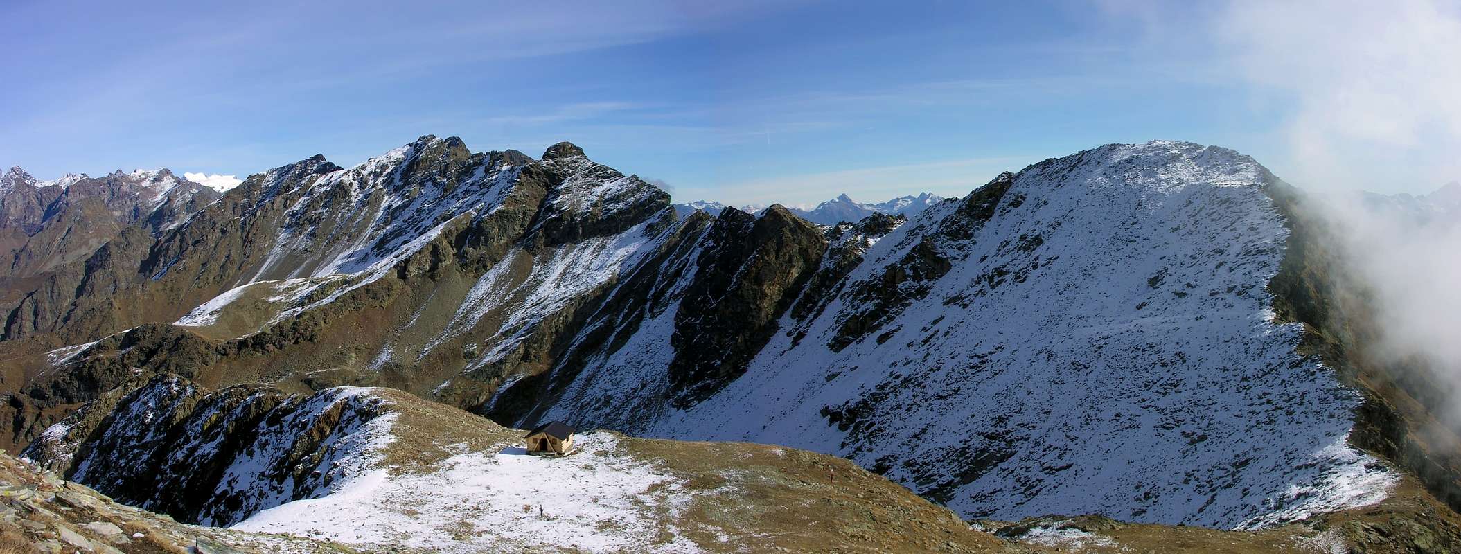
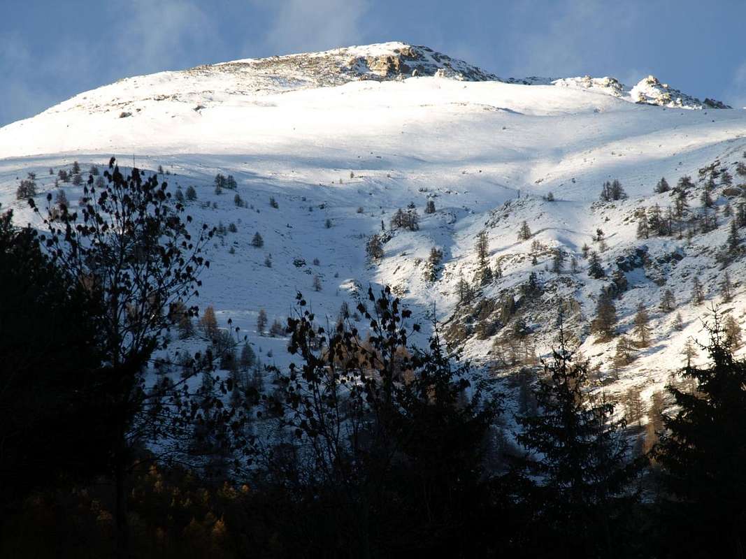
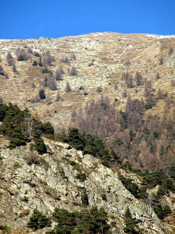
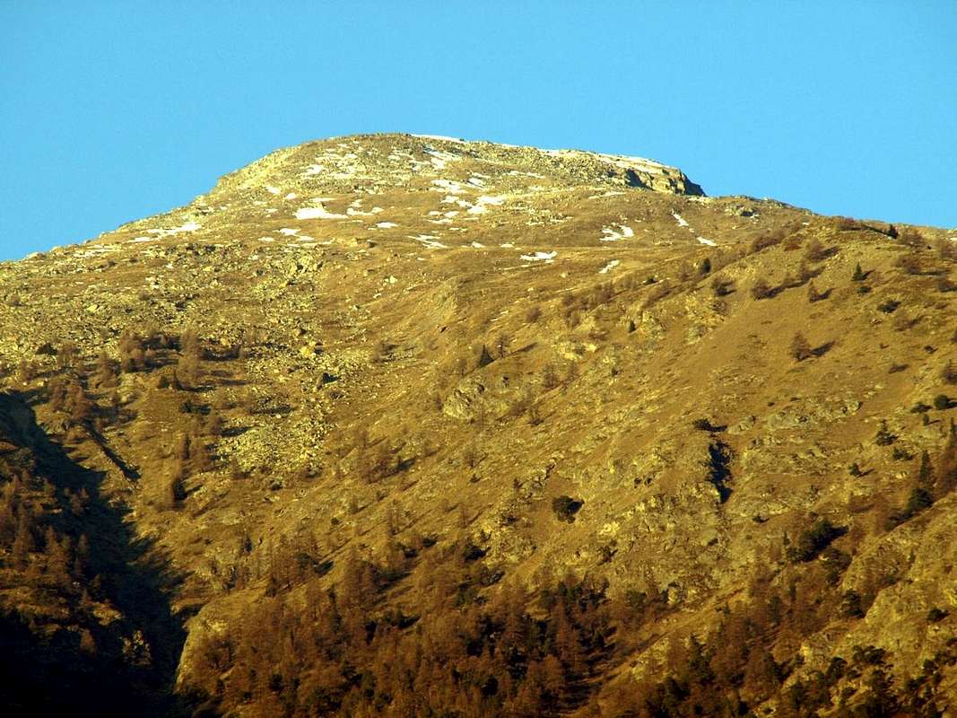
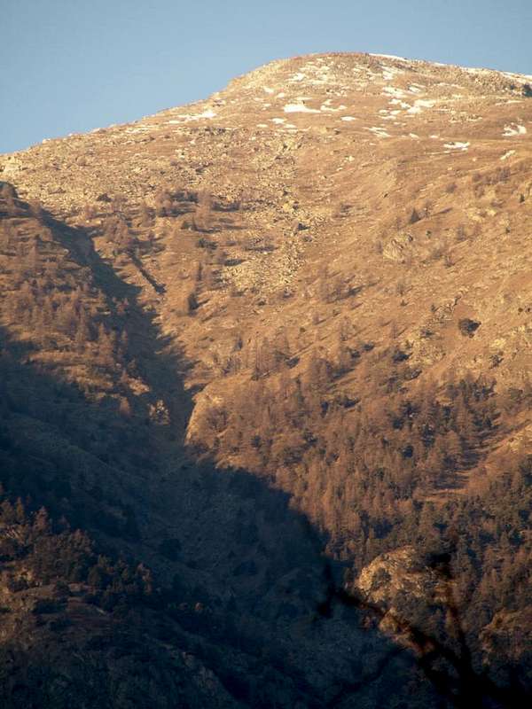
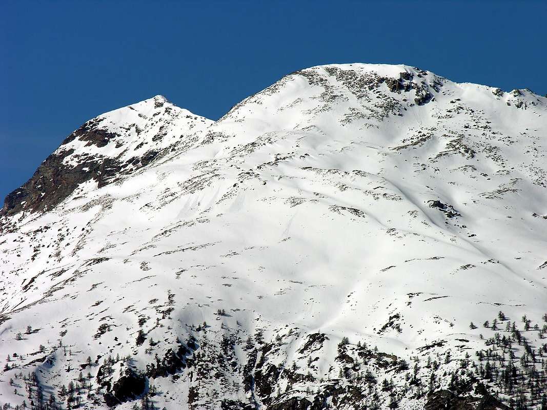
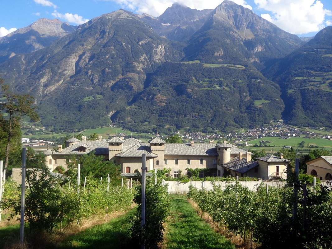
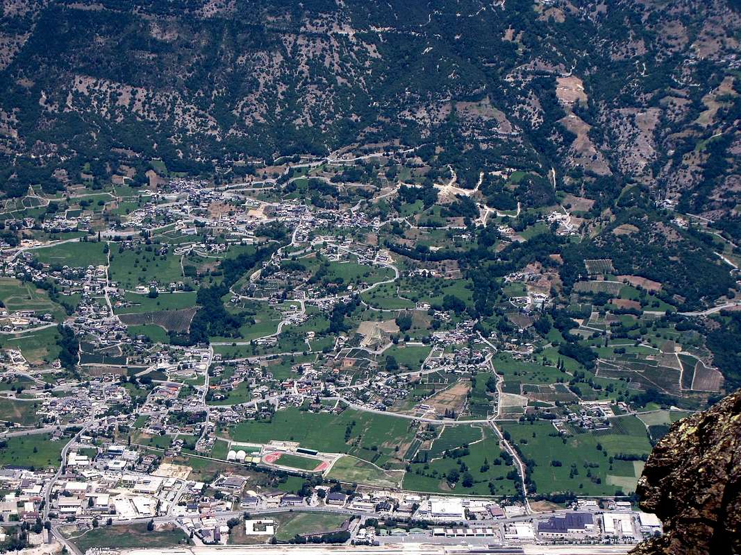
Unnamed and wild little valley? Yes. Because what it comes down from the Southern slope of Mount Mary (2.815m) is a valley very much wild as atypical because no paths or trails seemingly viable. Only the lower-middle part and its Eastern and Western shores are a sign of accessibility, while the top goes down really as a valley abandoned by God than by men. In fact this steep rocky valley is like a bridge between Basin Viou-Parléaz to the West and the Comba di Sénevé to East, these two well-known and most popular. Indeed at the higher part they go to join "giving birth" just below this vallon that descends leaving on the sides the Rachaou (to the East; 1.612m) and Valtolanaz (for West; 1.492m) isolated Alpages reaching below the small Villages of Cérisolaz and Valcorneille (1.159m, 1.014m) just above the Côte de Sorreley and at the junction 1025 metres nearby Lumian (984m) where the road asphalt has a major split. In fact from this junction (sign Montagne) the right branch continues towards the Villages of Cretallaz, Jeanceyaz, Morgonaz and Praillon at the gates of the Comba Sénevé while the opposite is directed towards those of Parléaz and Blavy in the adjacent basin of the same name.

Although from Mont Mary presents a linear development with a vertical drop of more 2.000 meters to reach St. Christophe Hill, is divided into two specific areas:
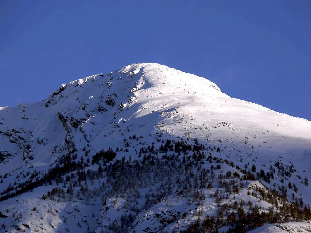
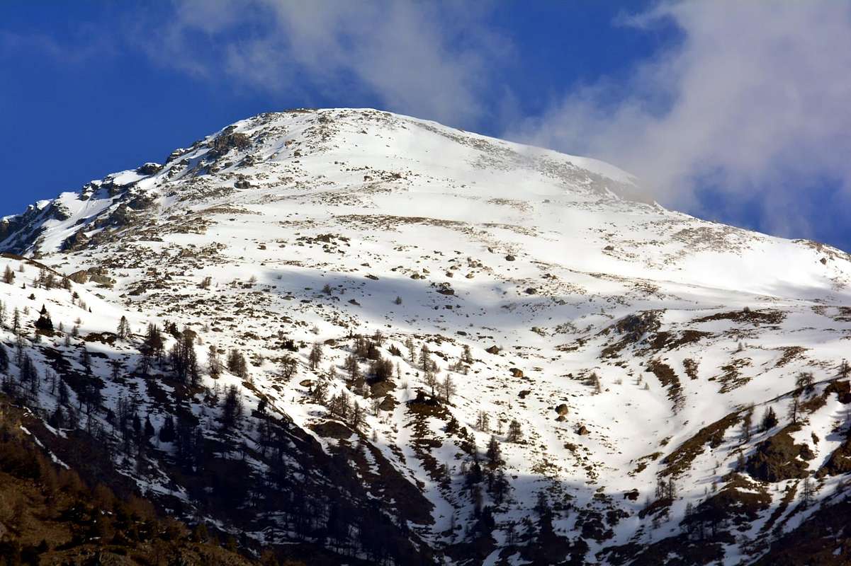
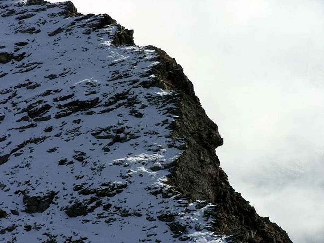
a) - a superior part that, starting from the Southern Slope of Mont Mary (2.815m) which reaches about half the valley at about the height of the Alp Rachou (1.612m), sited on the Eastern shore and now at the border with Cénevé Basin. This area looks like a large and rounded hump which is crossed at an altitude of about 2.355/65 meters from a small path that leads to allow transit between the Pastures of Viou Superiore or Upper (West; 2.202m) and Sénevé (to the East; 2.199/2.206m); just above this level the vallon it is transformed into a real funnel turning down into a gorge rather narrow and not easily passable on the foot. The holding sides of the latter are formed in the West by a large wooded buttress-rocky, with trend Southwest, that from the valley floor, near St. Christophe Quart Commons, floor goes up to Mary; Southeast toward the opposite is constituted by a parallel which is reached from the forests of Comba's Sénevé. Both are turning towards the inside with steep slopes, landslides and also very unwise.
Mont Mary
Mont Mary
Mont Mary...
Mont Mary...
Routes to Northeast Mont Mary...
b) - A deep, narrow valley, shaped funnel-hourglass, separates this from a second and lower part that, after a sinuous form, grows ever more downward splitting into small valleys that reach the paved road at the junction called as the "Montagne". On top of this, and on a promontory "stands" the little Village of Cérisolaz (1.159m), reached from the Southwest with a private farm dirt road that begins 1.105 meters from the junction of the road asphalt for Parléaz-Blavy. This, in being completely renovated and equipped with beautiful stone fountain and a beautiful votive Chapel, is located on the edge of a rocky gorge that separates it from that of Cretallaz (1.087m), now in the Municipality of Quart. More higher on the Western side is located the Pasture Valtolanaz (1.492m) at the Teppes Plan always reached by a private road that begins just below the Village Parléaz (1.274m) through the same, and here comes a small path not numbered starting from Veynes Fraction (805m). All other paths have decayed over time, "killed" by both asphalt roads that the dirt roads even if something is left starting from the locations below of Sorreley (805m), Champapon, Ollignan, Cort (810m) and Valenzana with his beautiful Monastery towards Valcorneille (1.014m), Lumian Cretallaz, where the hill expands towards the Common of Quart. The other paths have to invent it, although you have to pay attention to the choices to be made. Especially in the valley that, from the outlet of the water just above Cérisolaz, dates back to the Mont Mary.
An attractive route is instead the one that runs completely on its South Buttress dominating in the higher part this vallon more than wild and lonely. Starting from the bottom neighboring the Côte de Senin and the Côte de Sorreley or inserting on the same from Valcomeille towards Plan Teppes (1.547m) and subsequent elevations in 1.700, 1.996, 2.274, 2.422 meters. The same goes for the opposite side or the Southeast that departing from Cretallaz Hamlet locality Champ Ferrioux, after crossing the Torrent de Roveyrettaz, reaches the isolated Pasture of Rachaou and the subsequent tranches of 1.764, 2.183, 2.362 and 2.465 meters. Wild trails that require good knowledge of the area or at least the ability to know how to juggle into the same. Anyway total ban to will converge with a exposed descent into the deep and rocky valley, if not to the point 2.362 meters at the junction with the trail between Upper Alp Viou and to Sénevé into homonym basin. It is actually paths used by hunters very experienced or skilled hikers and requiring orientation ability and good training, because really very long and tiring. On the other hand there is the satisfaction of moving in very integral territories and formed from a primordial nature that forces continue to operate small choices to overcome problematic situations, that continually and inevitably arise with the progress upwardly. Finally beautiful glances in the bottom above the City of Aosta and marvelous views on the entire group of Mount Emilius (3.559m), which stands right in front of so imperious.
Old & tiny Chapel entering...
Le temps de cette vie n'est q'un instant...
Unnamed Vallon New fountain...
Unnamed Vallon Old...
Unnamed Vallon Old sled...
Un valloncello selvaggio e senza nome? Si. Poiché quello che scende dal versante Meridionale del Mont Mary (2.815 m) é un vallone veramente tanto selvaggio quanto atipico poiché non presenta sentieri o percorsi apparentemente percorribili. Solo la parte medio-inferiore nonché le sue sponde Orientali ed Occidentali presentano un segno di accessibilità, mentre nella parte superiore scende veramente come un vallone abbandonato sia da Dio che dagli uomini. In effetti questo ripido vallone roccioso risulta come un trait d'union tra il Bacino di Viou-Parléaz ad Occidente e la Comba di Senevè ad Oriente, questi ultimi due ben più conosciuti e frequentati. Anzi nella parte più elevata vanno a congiungersi "partorendo" subito sotto questo vallone, che scende lasciando sui lati gli Alpeggi isolati di Rachaou (ad Est; 1.612 m) e Valtolanaz (ad Ovest; 1.492 m) raggiungendo più in basso i Villaggetti di Cérisolaz e Valcorneille (1.159 m, 1.014m); appena al di sopra della Côte de Sorreley ed il bivio 1.025 metri presso Lumian (984 m) dove la strada in asfalto presenta un importante sdoppiamento. Infatti da questo bivio (cartello Montagne) il ramo di destra prosegue ai Villaggi di Cretallaz, Jeanceyaz, Morgonaz e Praillon alle porte della Comba di Senevé o Cénevé mentre l'opposto si indirizza verso i Villaggi di Parléaz o Parleyaz e Blavy nell'omonimo bacino sotto la Becca di Viou (2.856 m).
 
Partendo dal Mary presenta sviluppo lineare con un dislivello d'oltre 20000 metri per raggiungere la Collina di St. Christophe e dividendosi in due zone specifiche: a) - una parte superiore che, partendo dalle pendici Meridionali del Mont Mary (2.815 m), raggiunge circa le metà del vallone più o meno all'altezza dell'Alpe Rachou (1.612 m), posta sul bordo Orientale dello stesso ed ormai al confine con la Conca di Cénevé. Questo settore si presenta come grande dosso arrotondato che viene attraversato a quota 2.355/65 metri circa da un sentierino di collegamento tale da permettere il transito tra gli Alpeggi di Viou Superiore (ad Ovest; 2.202 m) e di Senevé (ad Est; 2.199/2.206 m); appena sopra di questo livello il vallone s'imbuta abbasso tramutandosi in gola piuttosto stretta e non facilmente percorribile. Le sponde di contenimento di quest'ultima sono formate ad Occidente da un grande contrafforte boschivo-roccioso che, con andamento Sudovest, dal fondovalle risale sino al Mary; verso Sudest l'opposto ne é costituito da uno parallelo raggiunto dalle foreste della Comba di Senevé. Entrambi si rivolgono verso la parte interna con pendii più che ripidi, anche franosi e quindi alquanto sconsigliabili.
Wild Unnamed Vallon...
Mont Mary South slope...
Valenzana Convent...
M. Mary above Cèrisoulaz
b) - Un profondo e stretto vallone, a forma di imbuto poi allargantesi quale clessidra, separa questa da una seconda ed inferiore parte che, dopo un andamento sinuoso, s'apre sempre di più verso il basso dividendosi in valloncelli varii che arrivano alla strada asfaltata presso il bivio "Montagne" (1.025 m) nella località di Lumian. Al di sopra di questa e su di un promontorio ben in vista si "erge" il Villaggetto di Cérisolaz (1.159 m), raggiungigibile da Sudovest con una poderale privata che inizia dal bivio 1.105 metri della strada in asfalto per i Villaggi soprastanti ma decisamente più ad Ovest di Parléaz e Blavy (1.475 m). Questo, in fase di completa ristrutturazione e dotato di bella fontana in pietra e con una bella Cappella votiva, é collocato al limite d'una gola rocciosa separantelo da un altro soprastante il Villaggio di Cretallaz (1.087 m), ormai completamente nel Comune di Quart. Più in alto e sul fianco Occidentale é collocato l'Alpeggio di Valtolanaz (1.492 m) presso il Plan Teppes ed anch'esso raggiungibile da una poderale che inizia, volgendo poi ad Oriente, subito al di sotto del Villaggio di Parléaz o Parleyaz (1.274 m) che attraversa il medesimo, mentre qui arriva anche un piccolo sentiero non numerato con partenza da Veynes (805 m). Tutti gli altri sentieri sono decaduti progressivamente nel tempo, "uccisi" sia dalle strade in asfalto che dalle poderali anche se qualche cosa é rimasto partendo dalle località sottostanti di Sorreley (805 m), Champapon, Ollignan, Cort (810 m) e da Valenzana con il suo bel Monastero in direzione di Valcorneille (1.014 m), la località Lumian ed il Villaggio di Cretallaz ove la collina và sempre più espandendosi verso il limitrofo Comune di Quart. Gli altri percorsi bisogna un pò inventarseli, anche se risulta necessario prestare attenzione alle scelte da effettuarsi. Soprattutto all'interno del selvaggio vallone che, dalla presa dell'acqua (raggiungibile con stretta e ripida poderale protetta da staccionata) appena al di sopra Cérisolaz, risale l'incassato vallone roccioso insino a raggiungere nella parte terminale il Mont Mary (2.815 m).
Un percorso attraente risulta invece quello che percorre completamente il suo Contrafforte Meridionale dominando nella parte più elevata questo vallone più che selvaggio e solitario. Partendo dal fondovalle dalle Côtes de Senin e Sorreley oppure inserendosi sul medesimo da Valcomeille verso Plan Teppes (1.547 m) e le successive altitudini di 1.700, 1.996, 2.274, 2.422 metri. Analogo discorso vale per il lato opposto o Sudest che con partenza da Cretallaz-Champ Ferrioux, dopo aver attraversato il Torrent de Roveyrettaz, raggiunge l'Alpeggio isolato di Rachaou e le quote successive di 1.764, 2.183, 2.362 e 2.465 metri. Percorsi selvaggi che richiedono buona conoscenza del territorio o almeno la capacità di sapersi destreggiare sul medesimo. In ogni caso divieto assoluto di voler convergere con una discesa dentro al vallone stesso, se non al punto 2.362 metri all'incrocio con il sentiero tra l'Alpe di Viou Superiore e quella di Senevé nell'omonima comba. Si tratta infatti di percorsi utilizzati da cacciatori molto esperti o da abili escursionisti e tali da richiedere capacità di orientamento ed un buon allenamente di base, poiché realmente molto lunghi nonché faticosi. Per contro esiste la soddisfazione di muoversi in ambienti molto integri e formati da una natura primordiale e tal da costringere ad operare continue scelte per superare piccole situazioni problematiche nel comporre l'itinerario prescelto. Infine bei colpi di occhio sulla sottostante Città d'Aosta e meravigliose panoramiche sull'intero Gruppo dell'Emilius (3.559 m), stagliantesi in modo imperioso proprio affronte.

Getting There

BY CAR:

  • From TORINO, MILANO, etc: Motorway A5. Exit at IVREA or Quincinetto (PIEDMONT) From IVREA Town: in West to Pont Saint Martin, Donnas, Bard, Verrès, St. Vincent, Châtillon, Nus, Quart and St. Christophe Municipalities. From Courmayeur Resort: in East to Morgex, La Salle, Saint Pierre, Sarre, Aosta and Saint Chistophe Municipalities. From Aosta Town towards St. Christophe Municipality From Aosta towards Saint Christophe-Prevot (about 640m), reached by Regional Road and to "Chief-town" Sorreley Village; from this, with Municipal, towards Veynes Fraction up to the junction 1.025 meters "Montagne" near Lumian. By the crossroads to the West reaching Parléaz or Parleyaz (1.274m) Blavy (1.475m) small Villages.
  • From FRANCE: through the Mont Blanc Tunnel to Entrèves-crossroads to Vény/Ferret Valleys - Mountain Guides of Courmayeur - La Saxe Rock Gym - Courmayeur. By Little Saint Bernard Pass, closed since November until half May to La Thuile Valley - Pré Saint Didier - Courmayeur. It is not necessary to take Motorway A5: you can drive on SS.26, in the direction of AOSTA - IVREA - TURIN.

BY PLANE:

  • Aeroporto "Corrado Gex" Saint Christophe (Aosta).
Il Mont Mary...
Unnamed Vallon By Cèrisolaz...
St. Christophe Monument to Partisan...
St. Christophe Castle...
B.di Nona from SUMMIT to AOSTA TOWN...

Mountain Condition

  • Meteo: you can find all the needed informations at the official site of the Valle d'Aosta Region:
  • Valle d'Aosta Meteo

Books and Maps

BOOKS:

  • "Guida della Valpelline" de l'Abbè Joseph-Marie Henry - Societè Editrice Valdotaine 1925 II Edition e Collana Reprint Musumeci (1986).
  • "Guida dei Monti d'Italia - Alpi Pennine (Vol. 2)" di Gino Buscaini - Club Alpino Italiano/Turing Club Italiano, Luglio 1970 (In Italian).
  • "80 itinerari di Escursionismo Alpinismo e Sci Alpinismo in Valle d'Aosta", di Osvaldo Cardellina, Ed. Musumeci, Giugno 1977 (in Italian); seconda Ed. Luglio 1981; terza Ed. Luglio 1984; (in French), prima Ed. Febbraio 1978; seconda Ed. Marzo 1980.

MAPS:

  • Kompass "Breuil/Cervinia-Zermatt" Carta turistica 1:50.000.
  • I.G.C. Istituto Geografico Centrale "La Valpelline" (carta n° 115) Map1:30.000.
  • I.G.M. Istituto Geografico Militare - Map1:25.000.
  • L'Escursionista Ed. Rimini "Gran San Bernardo-Ollomont" (carta n° 5) 1: 25.000.

Important Information

Useful numbers

  • Protezione Civile Valdostana località Aeroporto n° 7/A Saint Christophe (Ao) Tel. 0165-238222.
  • Bollettino Meteo (weather info) Tel. 0165-44113.
  • Bollettino Valanghe Tel. 0165-776300.
  • Unità Operativa di Soccorso Sanitario Tel. 118.