La montagna chiama i suoi figli, ed essi rispondono fedelmente al suo appello…
Osvaldo Cardellina, Diario alpinistico, 1964-65
Page texts: @ OsvaldoCardellina"Osva", passed away on May 2, 2022. Page owners: Christian Cardellina e Osvaldo Cardellina. Any updates from September 12, 2022: Antonio Giani, page administrator, friend and climbing companion.
Testi della pagina: @ OsvaldoCardellina "Osva", scomparso il 2 maggio 2022. Proprietari pagina:Christian Cardellina e Osvaldo Cardellina. Eventuali aggiornamenti dal 12 settembre 2022: Antonio Giani, amministratore della pagina, amico e compagno di salite.
Overview
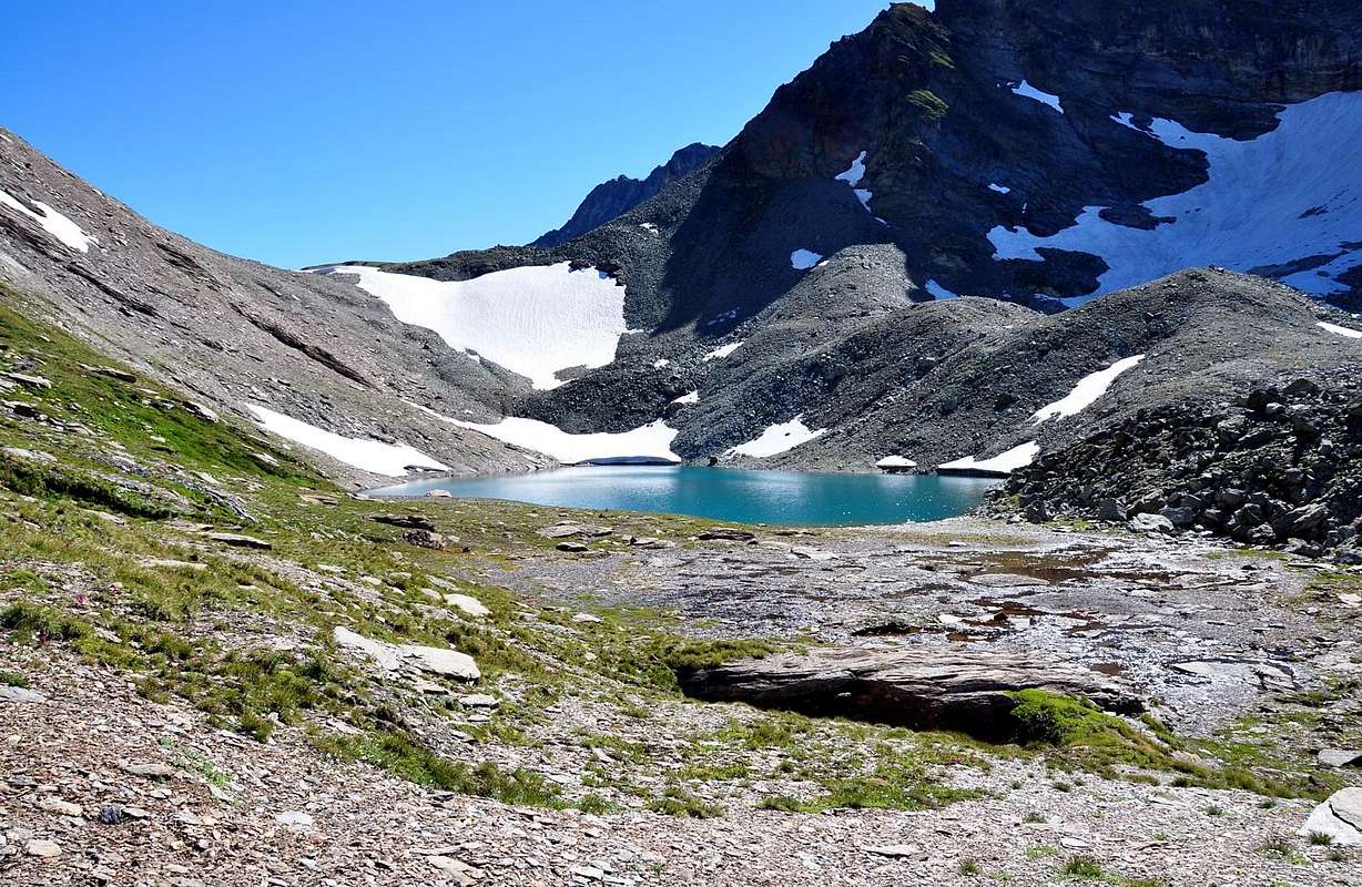
Valpelline Valley open, from West to the East, above the Commons of Valpelline, Oyace and Bionaz, reaching the Petites and Grandes Murailles at the end of which stands the beautiful pyramid of the Dent d'Hérens (4.172m), a true servant of His Majesty the Matterhorn (4.478m). This long and wild valley bordered it to the North with the Valais, in the South with the Central Valley of Baltea and the East with the Valtournanche (Valtornenche and not, as now you want to plan with the only similarity "flappers" for all the valleys Valley of Aosta). At its end the Col de Valpelline (3.559m) separates it from the Glacier Tiefenmatten above the Valley of Zermatt, which also passes the famous Haute Route Ski-Mountaineering. It relaxes, starting with the Municipality of Roisan above Aosta, from the South-southwest to North-northeast and then North decidedly flex reaching the hill, located between the Dent d'Hérens and Tête de Valpelline. From Aosta Valpelline, leaving left (Northwest) Gran San Bernardo Valley, you travel 13 Km., Then the Regional Road, left again after leaving the branch towards the Common of Doues, it reaches, always skirting the Torrent Buthier of Valpelline, the Municipality of Oyace (1.377m, 6 km) with its "Tour" of 1300, with the last stretch, always leaving left the short branch to the Villages Dzovenno and Ru or Ruz, reaches Bionaz (1.606m, 6 km.), at the foot of legendary Becca's Luseney South and East of the Dam Artificial (1.950m, 7.3 km.), where the road ends. And there's the valley that, after the over 2.5 Km. of the invaded, Alp Prarayer (1.961m, 2.005m; shelter) opens in all directions, but especially in the North to the great Glaciers of Tsa de Tsan and the Grandes Murailles. Further Est-Southeast open instead of secondary vallons, through small glaciers, reach the Petites Murailles with Tour and Mont Blanc de Creton, Château des Dames (3.585m, 3.409m, 3.489m), the Punta Cian and the Dôme (3.322m, 3.349m), always bordering the Valtournanche, while the Luseney and Becca del Merlo (3.503m, 3.237m) and up to Monte Faroma (3.073m) this is done with the Valley of St. Barthélemy. In addition, and to complete the ride to 360°, is the same partition with the Central Valley of Baltea down to Becca Viou and the tiny Becca of Roisan (2.856m, 2.546m), above St. Christophe, the City of Aosta and Roisan. It turns out, despite the construction of the dam, a valley always fascinating and wild. Because to "destroy" a valley and it takes a while to rebuild his "humus" maybe never. As Marcel Kurz says: "Mais il sera trop tard alors pour regretter: une vallée gâchée ne se repare pas, surtout la Valpelline ...", cet à dire But then it is too late to regret: a botched, wasted and spoiled valley is not repaired, especially Valpelline ...".
La Valpelline s'apre, da Ovest ad Est, sopra i Comuni di Valpelline, Oyace e Bionaz, raggiungendo le Petites e le Grandes Murailles al termine delle quali s'erge la bella piramide della Dent d'Hèrens (4.172 m), vera e propria ancella di Sua Maestà il Cervino (4.478 m). Questa, lunga e selvaggia, confina infatti a Settentrione con il Vallese, a Meridione con la Valle Centrale della Dora ed ad Oriente con la Valtournanche (e non Valtornenche, come adesso si vuole pianificare con l'unica assonanza "enche" per tutte le vallate della Valle d'Aosta). Al suo termine il Col de Valpelline (3.559 m) la separa dal Ghiacciaio di Tiefenmatten soprastante la Valle di Zermatt, dove passa anche la famosa Haute Route Sci-Alpinistica. Si distende, iniziando dal Comune di Roisan sopra Aosta, da Sud-sudovest a Nord-nordest per poi decisamente flettere a Nord raggiungendo il colle, posto tra la Dent d'Hérens e la Tête de Valpelline. Da Aosta a Valpelline, lasciando a sinistra (Nordovest) la Valle del Gran San Bernardo, si percorrono 13 Km. circa, poi la Strada Regionale, dopo avere lasciato ancora a sinistra la diramazione versom il Comune di Doues, raggiunge, sempre costeggiando il Torrent Buthier de Valpelline, il Comune di Oyace (1.377 m; 6 Km) con la sua Tour" del 1300; con l'ultimo tratto, lasciando sempre a sinistra la corta diramazione per i Villaggi di Dzovenno e Ru o Ruz, raggiunge il Comune di Bionaz (1.606 m; 6 Km.), ai piedi della leggendaria Becca di Luseney a Sud e della Diga Artificiale ad Est (1.950 m; 7,3 Km.), dove la strada ha termine. Ma non finisce la valle che, dopo gli oltre 2,5 Km. dell'invaso, all'Alpeggio di Prarayer (1.961 m, 2.005 m; rifugio) si allarga in tutte le direzioni, ma soprattutto a Settentrione verso i grandi Ghiacciai di Tsa de Tsan e delle Grandes Murailles. Più a Est-sudest si aprono invece dei valloni secondari che, tramite piccoli ghiacciai, raggiungono le Petites Murailles con Tour e Mont Blanc de Creton, Château des Dames (3.585 m, 3.409 m, 3.489 m), la Punta Cian ed il Dôme (3.322 m, 3.349 m), sempre al confine con la Valtournanche, mentre dalla Luseney e Becca del Merlo (3.503 m, 3.237 m) e sino al Monte Faroma (3.073 m) questo avviene con la Valle di Saint Barthélemy. Oltre, e per completare il giro a 360°, lo stesso é divisorio con la Valle Centrale della Dora Baltea giù fino alla Becca di Viou ed alla minuscola Becca di Roisan (2.856 m, 2.546 m), al di sopra del Comune di Saint Christophe, la Città di Aosta e quello di Roisan. Risulta, nonostante la costruzione della diga, una valle sempre affascinante nonché selvaggia, perché per "distruggere" una valle ci vuole un attimo e per ricostruirne l'"humus" forse mai più. Come afferma Marcel Kurz: "Mais il sera trop tard alors pour regretter: une vallée gâchée ne se repare pas, surtout la Valpelline ...".
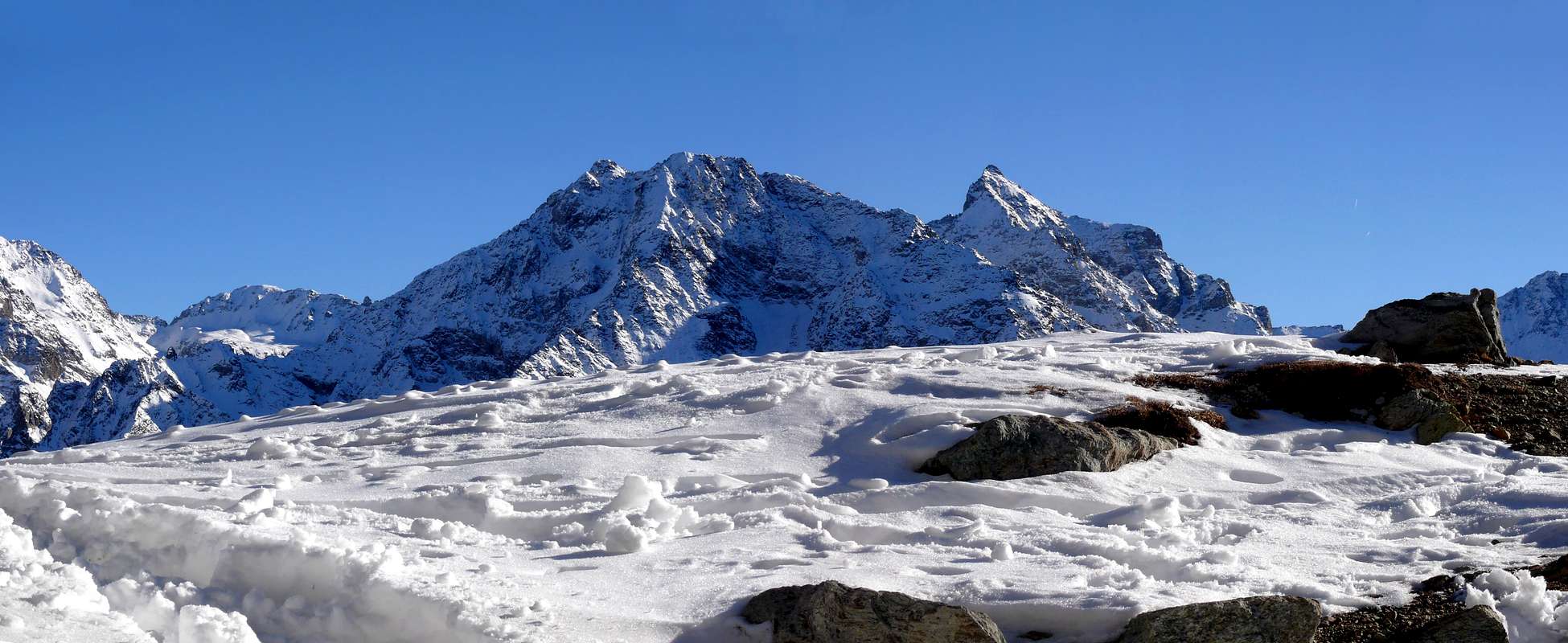
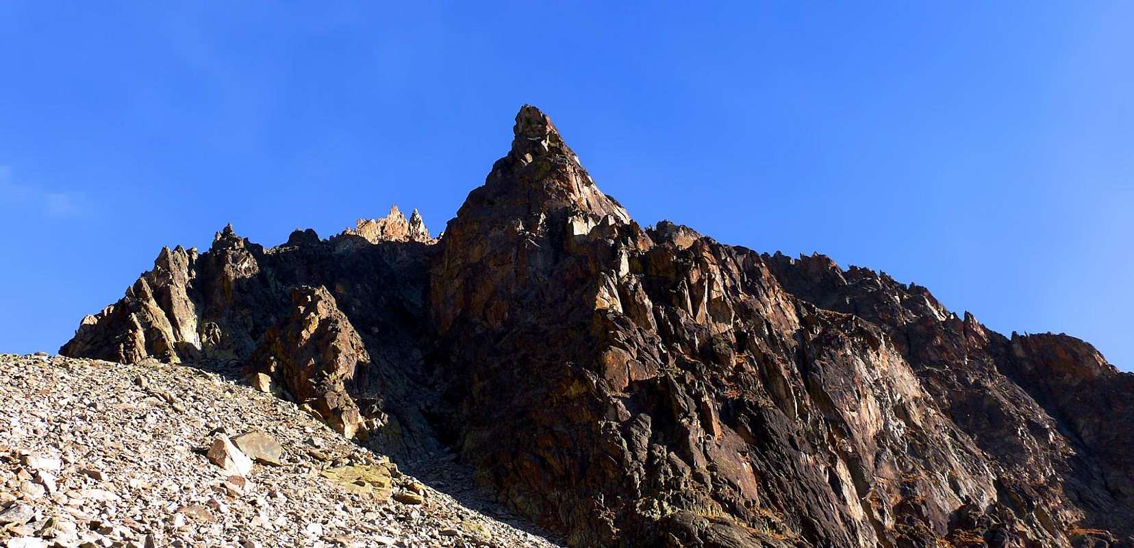
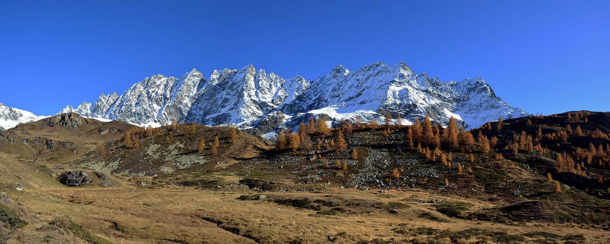
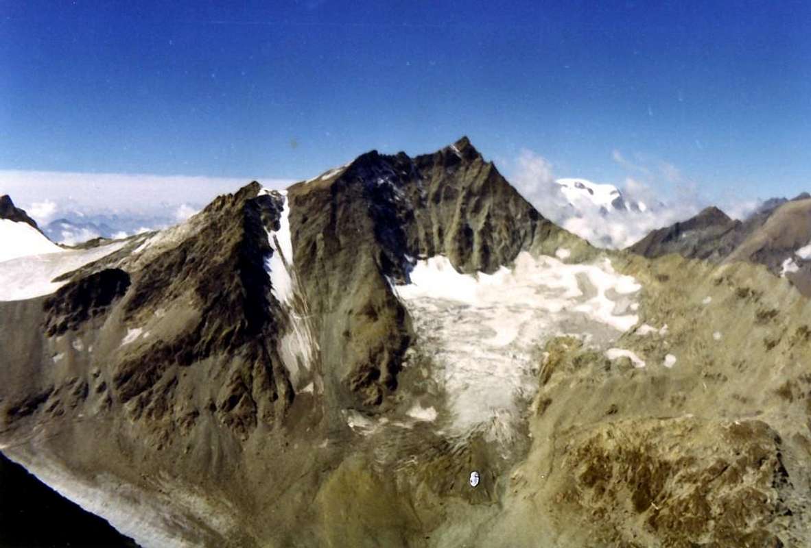
But, in our opinion, it is the Mont Morion with its indented ridges that characterizes this valley. Because who does not see the Becca of Luseney reach Valpelline, the Mont Braoulé, the Grand Becca Blanchen, the Aouille Tseucca, the Dent d'Hèrens and that des Bouquetins and even the Tête de Valpelline. On his head, however, he stands the Chain of Morions from the pyramid of Punta Cesare Fiorio, the slender Punta Aimé Gorret, Mont Clapier and the more that wild Eastern Wall of the three Morions, threatening with their walls above the valley floor. This is the impact for people who are in Valpelline, while in the South close the horizon of the sun peaks less pretentious as the minuscule Becca of Roisan, Becca of Viou, the nearby Mont Mary, the Tête d'Arpisson and Punta di Sénevé, all the limit of the watershed that comes from Becca Conge, bypassing the two twins heads of Tsaat a l'Etsena and above the Vallons of Vofrède, Arpisson and Verdzignola. After, stretches over the ridge from Monte Faroma first reach Becca di Luseney and Punta Cian and then Petites Murailles. This area very "dear" to Abbé Joseph Marie Henry, as well as those published in the "RM C.A.I." , reported the first news of this small and neglected mountain range in "Guide du Valpelline, 1921, 1925" . A fundamental work for the understanding of this valley that for him, a native of Courmayeur but Pastor of Valpelline since 1903 uttil 1947, until the day of death, has no secrets and whom he studied the flora and toponymy. At this before "L' Alpinisme et le Clergé valdôtain, 1905" , regarding "Alpinisme, 1908", the key to the reconstruction of the history of the Valley of Aosta "Histoire de la Vallée d'Aoste, 1905" , as well as the ' last "more poetic" "La Raye du Soleil, 1935" , ie "The Pastures of the Sun". All basic work to rebuild the History of Mountaineering in the Valley and not only that. Also we like to remember the figure of some of the Valpelline Guides: Ettore Bionaz, Mountain Guide and Woodcarvers of Bionaz fell to Monte Cervo (Mount Deer), Alberto Chéraz Vaud-Ollomont to "Pilier Barnazat" on the Tour Ronde, Ferdinando Rollando disappeared with the young customer in July 2014 Mont Blanc and Pietro "Piero" Rosset died in October 2014; they must be added Angelo "Angelino" Bozzetti of Aosta but very great Mountain Guide Valpelline, land to which he was very fond, fell down in 1967 to the Aiguille of Péuterey after winning in the first winter ascent of the West Wall "Via Ratti-Vitale". Among the living, we like to quote Pietro "Piero" Giglio, Mountain Guide and Journalist Writer Manuals & Mountain. All belonging to the "Compagnie des Guides de Valpelline et du Grand-Saint-Bernard" , which operates in this vast area between Val Ferret (Mont Blanc) and Valtournanche (Matterhorn). But above everything and everyone dominate Combins Valsorey, Grafeneire (4.314m) and Tsassette which, although now completely on Swiss territory, represent these valleys are called "Communautée du Grand Combin", in the "Coumba Freida" or "Cold Basin" from Aosta and up to circle of the Pennine Alps. An entourage as wild as magnificent and so far, fortunately, pristine and well protected and preserved. In spite of the Artificial Lake "Places des Moulins".
Ma, a nostro avviso, é il Mont Morion con la sua cresta frastagliata che contraddistingue questa vallata. Perché chi raggiunge Valpelline non vede la Becca di Luseney, il Mont Braoulé, la Grand Becca Blanchen, l'Aouille Tseucca, la Dent d'Hèrens e quella des Bouquetins e neppure la Tête de Valpelline. Sulla sua testa, invece, troneggia la Catena dei Morions dalla piramide della Punta Cesare Fiorio, alla slanciata Punta Aimé Gorret, al Mont Clapier ed alla più che selvaggia Parete Orientale dei tre Mont Morions, minacciosi con i loro versanti sopra il fondovalle. Questo risulta l'impatto per chi s'affaccia in Valpelline, mentre a Mezzogiorno chiudono l'orizzonte del sole cime meno pretenziose come la minuscola Becca di Roisan, la Becca di Viou, il vicino Mont Mary, la Tête d'Arpisson e la Punta di Senevé, tutte al limite dello spartiacque proveniente dalla Becca Conge, scavalcando le due teste gemelle della Tsaat a l'Etsena e sopra i Valloni di Vofrède, Arpisson e Verdzignola. Oltre si allunga la cresta che dal Monte Faroma raggiunge dapprima la Becca di Luseney e la Punta Cian e poi le Petites Murailles. Un'area questa molto "cara" all'Abbé Joseph Marie Henry che, oltre a quelle pubblicate nella "RM C.A.I.", riporta le prime notizie di questa piccola e negletta catena montuosa in "Guide du Valpelline, 1921, 1925". Un'opera fondamentale per la conoscenza di questa valle che per lui, nativo di Courmayeur ma Parroco di Valpelline dal 1903 al 1947 e fino al giorno della morte, non ha segreti e della quale studia la flora e la toponomastica. A questa precedono "L'Alpinisme et le Clergé valdôtain, 1905", sullo stesso tema "Alpinisme, 1908", la fondamentale per la ricostruzione della Storia della Valle di Aosta "Histoire de la Vallée d'Aoste, 1905", nonché l'ultima "più poetica" "La Ràye du Soleil, 1935", cioé "I Pascoli del Sole". Tutti lavori basilari per ricostruire la Storia dell'Alpinismo in Valle e non soltanto quella. Inoltre da ricordare la figura di alcune Guide della Valpelline: Ettore Bionaz, Guida e Scultore del legno di Bionaz caduto al Monte Cervo, Alberto Chéraz di Vaud-Ollomont al "Pilier Barnazat" alla Tour Ronde, Ferdinando Rollando scomparso con il giovane cliente nel Luglio 2014 al Bianco e Pietro "Piero" Rosset deceduto ad Ottobre 2014. A loro si deve aggiungere Angelo "Angelino" Bozzetti di Aosta ma Guida della Valpelline, terra alla quale era molto affezionato, caduto in discesa nel 1967 all'Aiguille di Péuterey dopo averne vinto in prima invernale la Parete Ovest "Via Ratti-Vitale". Tra i viventi ci piace citare Pietro "Piero" Giglio, Guida Alpina e Giornalista Scrittore di Guide e Manuali di Montagna. Tutti appartenenti alla "Compagnie des Guides de la Valpelline et du Grand-Saint-Bernard", operante in questa vasta area tra la Catena del Bianco (Val Ferret) ed il Cervino (Valtournanche). Ma sopra tutto e tutti dominano i Combins di Valsorey, Grafeneire (4.314 m) e Tsassette che, pur essendo ormai completamente in territorio isvizzero, rappresentano queste vallate che prendono il nome di "Communautée du Grand Combin", nella cosiddetta "Coumba Freida" cioé "Valle Gelida" da Aosta e fino alla cerchia delle Alpi Pennine. Un entourage tanto selvaggio quanto maestoso e fino ad ora, fortunatamente, incontaminato e ben conservato.
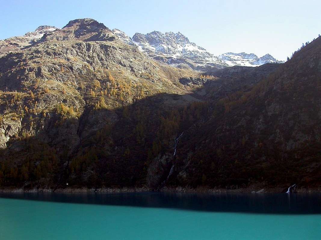
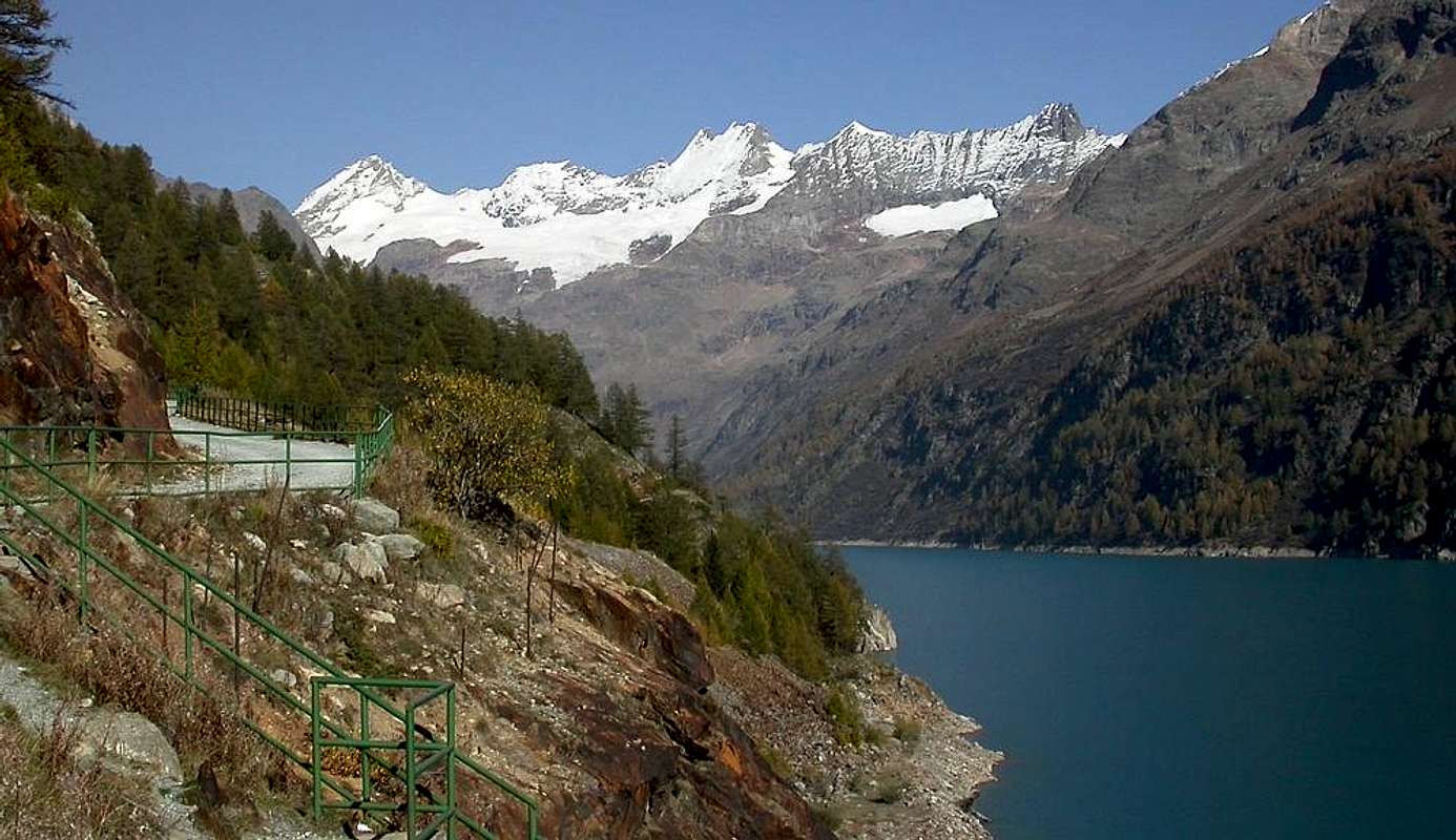
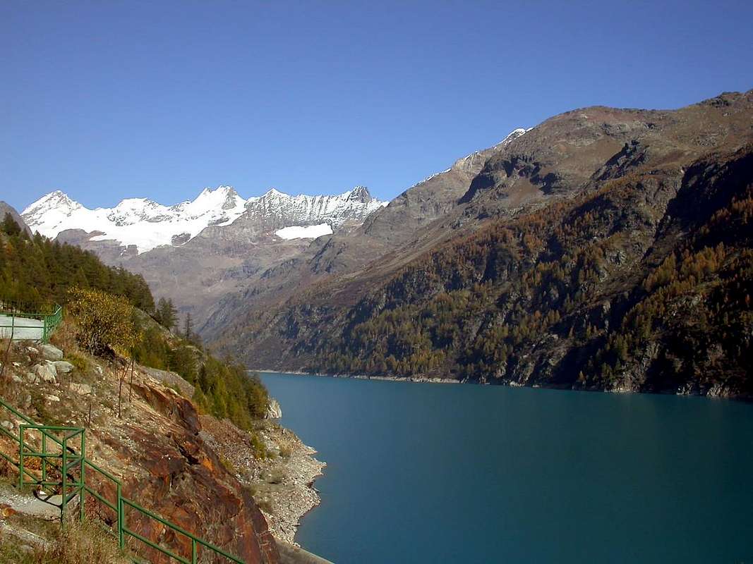
The Artificial Dam of Bionaz at Place Moulin
After the valley floor of Ollomont a high terrace rocky-grass stands up to the semi-flat Conca di By. This artificial barrier was built at the edge of a pond (1.987m) below just above the Lac de By (2.165m) at the so-called "House Farinet", located immediately to the East of the same and at the Alpage Cheval Blanc (1.962m) and below the long farm dirt and private road which, starting at the beginning from the Alps Champillon (2.060m), with a wide circle first North and then to the Northeast connects almost all the pastures of the broad valley to the extreme of Thoules Alp (2.381m), below the Southwest Slope of Mont Gelé and Fenêtre Durand. Collects all the water below the peak section between Les Trois Frères and the Tête du Filon in the North and those that descend from "Arête de la Bonne Mort" or "Crest of the Good Death" (see above) in the East, that is between the overhanging Comba Farinet to the West and Comba de la Grande Maison in the opposite (Torrents de Clavette, Amiante and de la Grande Maison).
La Diga Artificiale di Bionaz a Place Moulin"
Dopo il fondovalle di Ollomont un alto gradone roccioso-erboso si rialza fino alla semi pianeggiante Conca di By. Questo sbarramento artificiale é stato costruito al limite d'un laghetto (1.987 m) sottostante l'appena superiore Lac de By (2.165 m) presso la cosiddetta "Casa Farinet", sita subito ad Oriente del medesimo e presso l'Alpe Cheval Blanc (1.962 m) nonché al di sotto della lunga strada poderale che, partendo dall'Alpe Champillon (2.060 m), con un largo giro prima a Nord poi a Nordest collega quasi tutti gli alpeggi dell' ampia conca fino all'estrema Alpe di Thoules (2.381 m), al di sotto del Versante Sudoccidentale del Mont Gelé e della Fenêtre Durand. Raccoglie tutte le acque sottostanti il tratto di cresta compreso tra Les Trois Frères e la Tête du Filon a Settentrione e quelle che scendono dalla "Arête de la Bonne Mort" ovvero "Cresta della Buona Morte" (vedi sopra) ad Oriente, cioé tra la Comba Farinet ad Ovest e la Comba de la Grande Maison all'opposto (Torrents de Clavette, Amiante e de la Grande Maison).
Getting There
BY CAR:
From TORINO, MILANO, etc: Motorway A5. Exit at IVREA or Quincinetto (PIEDMONT).
From IVREA Town: before in West to Aosta, after in Northwest to Gignod, Etroubles, Saint-Oyen, Saint Rhémy en Bosses, (Southwestern and Northwestern Sides) and in North to Allein, Doues, Valpelline (Northeastern Side) Municipalities.From Courmayeur Resort: before in East to Aosta, after in Northwest to Gignod and in North to Allain, Doues, Valpelline and Ollomont Municipalities. From Aosta Town to Allein and Doues Common in By Basin From Aosta City towards Variney Fraction and Gignod Commune(988m) with Great Saint Bernard State Road n°27 up to the alternative 1.074 meters, just before Condemine Hamlet (1.137m). Before crossing North the Artanavaz Torrent or Buthier de Bosses after in the Northwest towards Allein Municipality; from the fork 1.253 meters nearby this last, always with the Regional Road in Northeast, towards Doues Commune under Champillon Alp and at the beginning of By "Conca" or Basin.
From Allain/Doues to Ollomont/Valpelline Communes with By Basin From Allein Commune (1.251m), with Regional and Municipal Roads, to By Basin; from the entrance of this (various alpages reached by private dirt farms roads), through paths, up to the Mont Saron Southern Antesummit, Summit (2.681m) and traverse on crest to Tête de la Praz (2.751m), Crou de Bleintse (2.824m) and Champillon Hill. From Doues Commune(1.176m), with in asphalt Municipal Road, to By Basin; from this, with paths or dirt roads, to Mont Saron (2.681m), Crou de Bleintse (2.824m), Letey Refuge below Champillon Pass (2.430), Mont Chenaille two Summits (3.144m), Tsa d'Ansermin (2.388m) and Monte Rotondo (2.572m) below La Salliousa (3.322m). From Ollomont Commune(1.356m), trhough noumerous paths and variaous upper dirt farms roads, towards By Conca; from this various routes in all directions up to the Maria Cristina Rosazza at Savoie Bivouac (2.674m) nearby Col du Bègno Bà and under Valsorey Pass and Trois Frères with the five Valsorey's Molaires Range.
From Aosta Town to Ollomont Common in the homonym Valley From Aosta City towards Variney Fraction up to the alternative 786 meters (Savin Hamlet); continue North with the Regional Road towards Moulins between the two Torrents Rio Artanavaz also called Buthier de Bosses and Buthier de Valpelline, Rhins, Collin, Creusevy, Chanodaz, Liarey, Fabrique, Chez-les-Chuc Villages reaching in the Northeast Valpelline-Les Ansermins Municipality (996m). At the subsequent crossroads 1.059 meters (Chez-Cailleur Hamlet) turn left (North-northwest) reaching Chez-Collet, Clapet, Vesey Villages and Ollomont-Cognen Common (1.356m); continue North along the Buthier d'Ollomont towards Rey, Vaud, Glacier or Glassier(1.562m) Villages. From this towards the Refuge Franco Chiarella-Amiante (2.979m), Filon Alp (2.478m), Bonne Mort Pass (2.646m), Fenêtre Durand Hill (2.797m), Nino Regondi Bivouac (2.599m) and Lakes below Morions-Clapier-Fiorio Chain, Tsa de Berrio Alp (2.165m), Cormet Hill (2.354m) and Breuson Hill (2.194m).
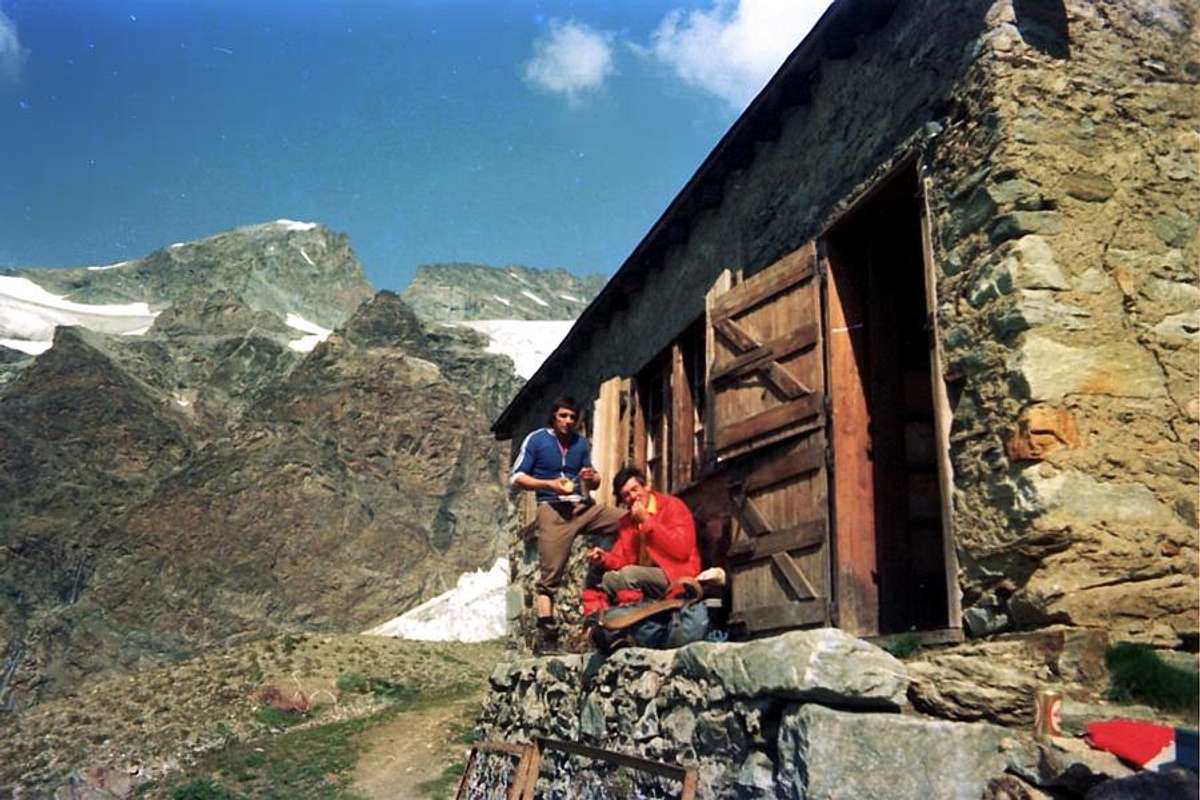
From Valpelline towards Oyace and Bionaz Communes in Valpelline Valley From Valpelline(580m), with Regional, to Oyace Common (1.316-1.377m); this to North and South Vallons (Brison, Crête Sèche, Vertsan, Tsa Comba, Grand Chamin Comba, Comba des Lacs and d'Orein up to the entrance into the vallon between Gran Vanna-Braoulé-Bouquetins and Petite/Grande Murailles, below Valpelline Pass. From Oyace(1.377m), with Regional Road, to Bionaz Commune (1.612m) and Places Moulin artificial Dam (1.970/80m) and Northern and Southern Vallons (Bella Tsa, Combes de Valcornière, Livourneaz, Montagnayes; Vessonaz, Verdonaz, Vieille, Verdzignolaz, Arpisson, Gran Comba and Roisan-Praperiaz Basin. In North: above Ruz Crêtes Sèches Refuge (2.389m) under Arolletta small crest and Mont Berlon and Franco Spataro Bivouac (2.600m); above Chamen or Chamin Sassa's Bivouac (2.973m). From Praz Raye with the Prarayer Refuge (2.005m) in Comba d'Orein Nacamouli Refuge (2.828m) and Col Collon Bivouac (2.818m) at Collon Pass. Towards North: "Capanna" Aosta(2.788m) at Dent d'Hèrens; North-northeast: Perelli Bivouac(3.831m) on Col des Grandes Murailles. East-northeast: Bivouac de la Tête des Roèses (3.170m) below the Grandes Murailles and over Paoluccio Bivouac (3.582m). East: Fiorio Bivouac (3.307m) at Col de Creton. From Oyace or from Valpelline In South or Southeast: Lière Bivouac (2.423m) nearby the Arpeyssaou Hill. Valpelline in South-southeast: "Penne Nere" Bivouac(2.730m) near Viou Hill and Becca.
From FRANCE: through the Mont Blanc Tunnel to Entrèves-crossroads to Vény/Ferret Valleys - Mountain Guides of Courmayeur - La Saxe Rock Gym - Courmayeur. By Little Saint Bernard Pass, closed since November until half May to La Thuile Valley - Pré Saint Didier - Courmayeur. It is not necessary to take Motorway A5: you can drive on SS.26, in the direction of AOSTA - IVREA - TURIN.
BY PLANE:
Aeroporto "Corrado Gex" Saint Christophe (Aosta).
Some Stories of work & Job amongst Aosta Ollomont Valpelline and Valais
The Battles between the locals by Ollomont & Valpelline with those of Val de Bagnes in Valais
In the By Basin major battles took place. In fact, they were bitterly disputed pastures among the locals of the Valley of Aosta and the inhabitants of the neighboring Valais in Switzerland, who often came from the Fenêtre Durand (also Fenêtre de Calvin, because through this hill took the flight to Switzerland of Jean Calvin in March 1536) to make shipments with the aim of appropriating the territories. It remains the testimony by the Abbot and Historian of Aosta Valley Marie Joseph Henry: "A ce Plan de Bonamort (or Tableland of the Good Death) s'est livré, dans le Haut Moyen Age, une bataille entre les Valaisans et les Bioneins, à l'avantage de ceux-ci". Also in 1540 we record the clashes between the villagers of Ollomont and those of Bagnes for properties Alp Chermotane; the traces with "Bois-de-la-Bataille" also "Wood of the Battle" near Glassier Village and the "Plan de la Bataille" or Ground of the Battle at By Conca or Basin. It was later manned by Valaisans until 1690, favored by progressive glacial retreat. This large hill, between Mont Gelé and Avril, was known in the Middle Ages as "Vy Durand", he attended secularly for transit Ollomont, Doues Commons and the Alps Champillon, By and Thoules to Valais (Chermotane, Chanrion, Mauvoisin and Bagnes), but also as Fenêtre de Durand, Fenestre de Durant, Fenêtre de Bagnes or simply Col Fenrêtre by radical Celtic "dur", similar to Dora, Drance, Durance and always connected to a water course. As is clear from documents of 1691 (by Historian Arnod) and of 1785 (by the Traveler Bourrit) the glacial retreat favored greatly crossings with related commercial and cultural exchanges, while in the '800 the peremptory return of the ice almost completely destroyed the old routes making the hill impractical both for men that livestock. Nowadays the paths have been restored and the window goes the beautiful path N° 5/TdC (Tour du Grand Combin), on the Swiss side that goes to the West of Glacier de Fenrêtre. During World War II° many Politicians, often accompanied by the Partisans or by local Hunters, were here the way out, as was for the future President of the Italian Republic Luigi Einaudi, in 23th September 1943.
Le Battaglie tra gli abitanti d'Ollomont e Valpelline con quelli della Val de Bagnes nel Vallese
Nella Conca di By avvenivano grandi battaglie. Infatti erano aspramente contesi i pascoli tra gli abitanti della Valle di Aosta e quelli del vicino Vallese, che spesso entravano dalla Fenêtre Durand (o Fenêtre di Calvin, perché tramite questo colle avvenne la fuga in Svizzera di Giovanni Calvino nel marzo 1536) per effettuare delle spedizioni con lo scopo di appropriarsi dei territori. Rimane la testimonianza da parte dell'Abbé Joseph Henry: "A ce Plan de Bonamort s'est livré, dans le haut moyen âge, une bataille entre les Valaisans et les Bioneins, à l'avantage de ceux-ci". Inoltre nel 1540 registriamo degli scontri tra i valligiani d'Ollomont e quelli di Bagnes per la proprietà dell'Alpe Chermotane; rimangono le tracce con il "Bois-de-la-bataille" a Glacier ed il "Plan de la Bataille" presso By. In seguito venne presidiato dai Vallesani fino al 1690.Questo largo colle, tra Mont Avril e Gelé, era conosciuto nel Medioevo col nome di "Vy Durand", frequentato secolarmente per il transito da Ollomont, Doues e dalle Alpi di Champillon, By e Thoules verso il Vallese (Chermotane, Chanrion, Mauvoisin e Bagnes), ma anche come Fenêtre de Durand, Fenestre de Durant, Fenrêtre de Bagnes o semplicemente Col Fenrêtre dal radicale celtico "dur", similare a Dora, Drance, Durance e sempre connesso ad un corso d'acqua. Come risulta da documenti del 1691 (Arnod) e del 1785 (Bourrit) il ritiro dei ghiacciai favoriva notevolmente le traversate con relativi scambi sia commerciali che culturali, mentre nello '800 il ritorno perentorio dei ghiacci distrusse quasi completamente le antiche mulattiere rendendolo impraticabile sia per gli uomini che per il bestiame. Oggigiorno i sentieri sono stati ripristinati ed alla Finestra passa il bel sentiero N° 5/TdC (Tour du Grand Combin), che sul versante svizzero passa ad Occidente del Glacier de Fenrêtre. Durante la Seconda Guerra Mondiale molti Politici, spesso accompagnati dai Partigiani o da Cacciatori locali, trovavano qui via di fuga, come avvenne per Luigi Einaudi il 23 di Settembre del 1943.
The ancient Ollomont Coppermines
The Economy of the town was not only responsible for Agriculture and the Pasture. Already since 1700 and until the early 1900s was used a copper deposit in the three sectors of Vaux, Balme and Saint Jean, located between the Hamlet of Vaux in the North and the Municipality of Ollomont at midday. The veins consist of modest power (tens of meters about) with pyrite and chalcopyrite with this last that gave rise, in the gangue of quartz, with native gold. This production lasted until the First World War by donating labor, with the mines of Ollomont and blast furnaces down to Valpelline, to more than 1.000 between Miners and Workers. One of the wells was equipped with over 1000 steps reaching a depth of around 300 metres. This field was discovered in 1699 by Jean Antoine Campier Rechoz at the place called "Les Bétendes" ; the first (1700/1720) fù exploited with great profit by Baron Ferrod; after successive difficulty was sold to Captain Ansermin Valpelline (1730/1750), then it became property to the Lords Centurion and Constantine Rosset, who, in turn, sold it to the Industrial Argentier and Nigra. In 1787 they were bought by the Noble Family Perrone of San Martino di Quart who took the famous Engineer Di Robilant, inventor of a water wheel for water extraction from the mines, where is even today buried under the ceiling of the main gallery. Later, after the death of Count Perrone at the Battle of Novara in 1849, some speculation forced the mine to the gradual decline: by Count Valerio in 1855 was sold to the Count of Belgium Victor Seyssel d'Aix, then to the Marquis Cornelissen for inheritance; founded this with the huge amounts of capital "Cornelissen & Simons" which in 1880 passed the "Wellens" and in 1904 the "Elzear Alda" and in 1905 the "Company Ollomont", whence the former "Ansaldo" of Genoa, then "National Society Cogne" Aosta.
The mine, which had a high content of this valley, was abandoned during the Second World War and, with its decline before then fully closed, many of these miners and workers were re-used in the latter. The two World Wars in fact demanded more iron and steel that not copper and this was one of many factors that led to the closure of the Mine of Ollomont, while the "Cogne" expanded to a total of miners Cogne and La Thuile and factory workers to Aosta to nearly 10.000 people. This factor, concomitant with the need to build housing for themselves, favored a large emigration from Veneto and Calabria with considerable expansion to the building. In the span of two World Wars, the population went from 9.800 units in 1917 to 39.000 in 1941 and on the western half of the town was built from scratch a "Workers Neighbourhood". The population of Ollomont (16.5 km from Aosta), but also that of the underlying Valpelline (Km 12.8) and up to Oyace (Km 19) Municipalities, moved to work in the city while continuing to live in the same localities for play the second job that consisted agriculture (hays), intimately connected with the raising of livestock. It was not unusual to find workers who came down for all these Kilometres by bicycle and then, finished the round at the factory, painstakingly traced back to perform the second task. Even today, along with tourism that goes slowly expanding, this is the main resource has become famous for its local cheese known as the "Fontina", but above all for the famous butter of the Conca di By.
Le antiche Miniere di rame di Ollomont
L'Economia di questa località non era soltanto affidata all'Agricoltura ed alla Pastorizia.Già sin dal 1700 e fino agli inizi del 1900 veniva sfruttato un giacimento di rame nei tre settori di Vaux (oggi Vaud), Balme e Saint Jean, collocati tra il Villaggio di Vaux a Settentrione ed il Comune di Ollomont a Mezzogiorno. I Filoni composti da vene di modesta potenza (qualche decina di metri) con pirite e calcopirite con quest'ultima che dava origine, nella ganga di quarzo, ad oro nativo. Questa produzione durò fino alla Prima Guerra Mondiale donando lavoro, con le miniere di Ollomont e gli altiforni giù a Valpelline, a più di 1000 tra Minatori ed Operai. Uno dei pozzi era attrezzato con più di 1000 gradini raggiungendo una profondità di all'incirca 300 metri. Questo giacimento venne scoperto nel 1699 da un certo Signor Jean Antoine Campier Rechoz presso il luogo chiamato "Les Bétendes". Lo stesso inizialmente (1700/1720) fù sfruttato con ottimo profitto dal Barone Ferrod; in seguito a successive difficoltà venne ceduto al Capitano Ansermin di Valpelline (1730/1750), dopodiché passò di proprietà ai Signori Centurion e Costantino Rosset, che, a loro volta, lo cedettero agli Industriali Argentier e Nigra. Nel 1787 le miniere vennero acquistate dalla Nobile Famiglia Perrone di San Martino di Quart che assunse il famoso Ingegnere Di Robilant, inventore di una ingegnosa e famosa ruota idraulica per l'estrazione dell'acqua dalle miniere, dove é ancora oggidì rimasta sepolta sotto la volta della galleria principale. Successivamente, dopo la morte cruenta del Conte Perrone nella Battaglia di Novara del 1849, alcune malfatte speculazioni costrinsero la Miniera al progressivo declino: dal Conte Valerio nel 1855 venne ceduta al Conte del Belgio Victor Seyssel d'Aix, poi al Marchese Cornelissen per eredità; questi fondò con ingenti capitali profusi la "Cornelissen & Simons", che nel 1880 passò alla "Wellens e nel 1904 alla "Elzear Alda" ed ancora nel 1905 alla "Ditta Ollomont" donde all'ex "Ansaldo" di Genova, poi sin alla conversione nel 1916 nell'attuale "Società Nazionale Cogne" di Aosta. La Miniera, che aveva notevolmente elevato il tenore di vita dentro questa vallata, venne abbandonata durante la Seconda Guerra Mondiale (1940/45) e, prima con il suo declino poi la chiusura completa, molti di questi minatori ed operai furono reimpiegati in quest'ultima. Le due Guerre Mondiali richiedevano infatti più ferro ed acciaio che non rame e questo fù uno tra i tanti fattori che condussero alla chiusura della Miniera d'Ollomont, mentre la "Cogne" si espandeva complessivamente tra minatori a Cogne (Magnetite) e La Thuile (carbone per gli altoforni) ed operai in fabbrica ad Aosta a quasi 10.000 persone. Questo fattore, concomitante con la necessità di costruire alloggi per gli stessi, favorì una grande emigrazione dal Veneto e dalla Calabria con notevole espansione per l'edilizia. Nell'arco di due Guerre Mondiali la popolazione passò da 9800 unità nel 1917 a 39.000 nel 1941 e nel lato Ovest della Città sorse ex-novo un "Quartiere Operaio". La popolazione di Ollomont (Km 16,5 da Aosta), ma anche quella della sottostante Valpelline (Km 12,8) e fino al Comune di Oyace (Km 19), si trasferì nel lavoro in città pur continuando ad abitare nelle stesse località, onde svolgere il secondo lavoro che consisteva nell'agricoltura (fieni) intimamente connessa con l'allevamento del bestiame. Non era inusuale trovare operai che scendevano per tutti questi Km. (pure d'inverno) tramite la bicicletta per poi, finito il turno in fabbrica, faticosamente risalire per svolgere la seconda mansione. Oggi, insieme ad un turismo che pian piano và espandendosi, questa risulta la principale risorsa della vallata divenuta famosa per il locale formaggio conosciuto come la "Fontina", ma soprattutto per il rinomato burro della Conca di By.
Campings
Remember that free camping is forbidden (except for emergency reasons, over 2.500m, from darkness until dawn).
Mountain Condition
Meteo: you can find all the needed informations at the official site of the Valle d'Aosta Region:
"Guida della Valpelline" de l'Abbè Joseph-Marie Henry - Societè Editrice Valdotaine 1925 II Edition e Collana Reprint Musumeci (1986).
"Guida dei Monti d'Italia" Alpi Pennine (Vol. 2) di Gino Buscaini - Club Alpino Italiano/Turing Club Italiano, Luglio 1970 (In Italian).
"Dove andiamo in montagna? in Valle d'Aosta" di Domenico Caresio Edit. Tipografia Ferraro Ivrea, Marzo 1996.
"80 itinerari di Escursionismo Alpinismo e Sci Alpinismo in Valle d'Aosta", di Osvaldo Cardellina, Ed. Musumeci, Giugno 1977 (in Italian); seconda Ed. Luglio 1981; terza Ed. Luglio 1984; (in French), prima Ed. Febbraio 1978; seconda Ed. Marzo 1980.
Children refers to the set of objects that logically fall under a given object. For example, the
Aconcagua mountain page is a child of the 'Aconcagua Group' and the 'Seven Summits.' The
Aconcagua mountain itself has many routes, photos, and trip reports as children.
Parents refers to a larger category under which an object falls. For example, theAconcagua mountain page has the 'Aconcagua Group' and the 'Seven Summits' asparents and is a parent itself to many routes, photos, and Trip Reports.


 6066 Hits
 82.48% Score
 15 Votes