-
 1305 Hits
-
 77.48% Score
-
 8 Votes
|
|
Mountain/Rock |
|---|---|
|
|
Hiking, Trad Climbing, Sport Climbing, Skiing |
|
|
Spring, Summer, Fall, Winter |
|
|
5525 ft / 1684 m |
|
|
Overview

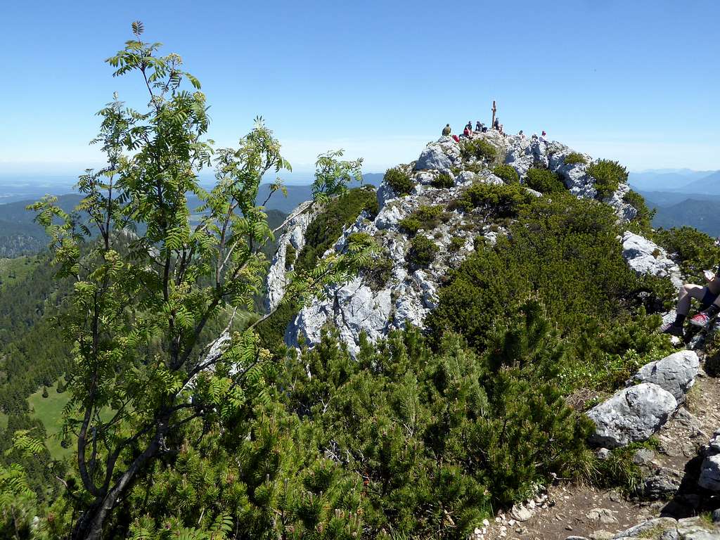
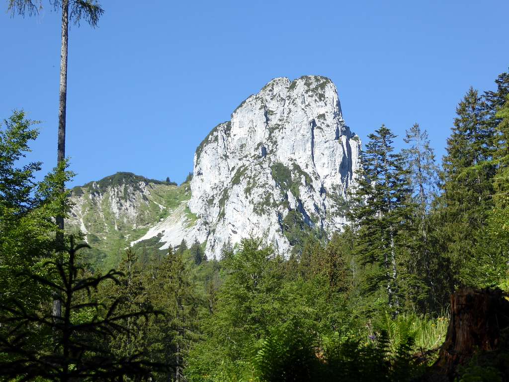
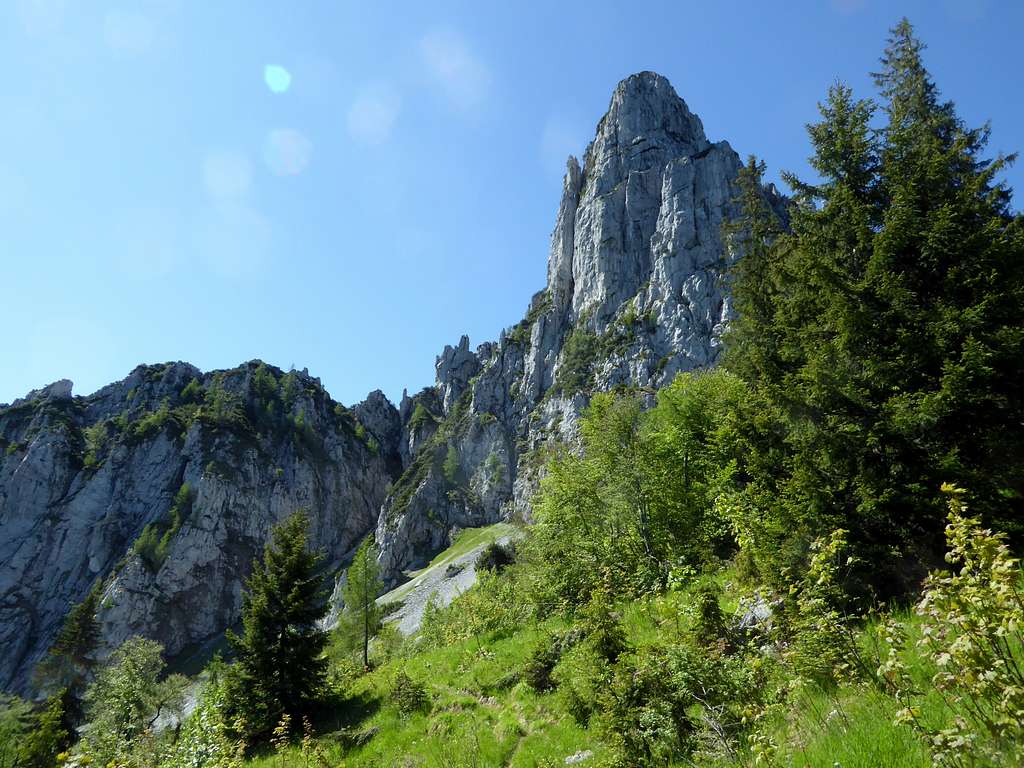
Hörndlwand is located in the central Chiemgauer Berge subrange of Chiemgau Alps as an immediate neighbour of Gurnwandkopf. It is a steep and rocky summit, showing a steep and impressive rockface to the east and northeast. These walls have good and firm rock. So Hörndlwand is, together with Kampenwand, a prime target for climbers within Chiemgau Alps.
South of the summit, which in fact cosists of two summits, linked together with a short rock ridge, there is a beautiful meadow zone which stretches west to the south side of Gurnwandkopf. This broad and nearly level meadow is a real sundeck with an impressive view and merits a walk to the top of these two mountains.
Hörndlwand is bordered by the Weitsee -, Mittersee – and Lödensee valley to the south, Urschlauer Achen valley to the north, Wappbach valley to the west and Ostertal with its huge cirque to the east. Important neighbour summits are Dürrnbachhorn to the south and Hochfelln with its many secondary summits to the north. The peaks east and west of Hörndlwand are less high and less important.
The summit rocks and rockfaces of Gurnwandkopf and Hörndlwand are built of a middle triassic limestone algae reef, the so called Wettersteinkalk.
Thanks to much softer marlstones of the so called Raibler Schichten, a younger geological unit of the upper Triassic times, erosion built the beautiful sundeck on the south side of the summit Wetterstein rocks.
The steep northern rock faces mark an important tectonic structure of the Northern Limestone Alps: the so called “Staufen-Höllengebirgs nappe” is thrusted over the northern Bavarian Lechtal nappe. This tectonic structure can be seen across the whole of Chiemgau Alps from Bad Reichenhall to the east to Reit im Winkl and to Inntal valley to the west. You cross this structure at the north side of Hörndlwand on the route from Urschlau.
Getting There
Trailheads are:
Seehaus (hikers parking area) at road B 305 between Ruhpolding and Reit im Winkl
Lödensee parking area on the same road
Weitsee parking areas on the same route
Urschlau north of Gurnwandkopf
By car:
From Munich on highway A8 to exit Bernau am Chiemsee. Follow road number B305 to Grassau, Marquartstein, Reit im Winkl and to the trailheads.
From Salzburg likewise on highway A 8 to exit Traunstein/Siegsdorf. Follow first road B 306 and then to the right on road ST2098 to Ruhpolding. Go to road number B 305 and follow this road to the trailheads.
From Inntal and Kufstein directions exit the Inntal highway at Kufstein Nord and follow road number 175 and then 172 to Kössen and Reit im Winkl. From there follow road number B 305 to the trailheads.
The Seehaus, Lödensee and Weitsee trailheads are north of road B 305. From west to east:
- Parking area “Röthelmoos” for the Weitsee route
- Parking area “Weitsee” for the Lödensee routes
- Parking area “Langer Sand” for the Lödensee routes
- Parking area “Seehaus Ruhpolding” for the Seehaus routes
The Urschlau trailhead is at the end of road from Ruhpolding to Brand and Urschlau.
Public transportation:
The nearest railroad station is Ruhpolding. Bus number 9506 goes from the railway station to the trailhead “Seehaus”, to a bus stop at Lödensee for Lödensee routes and to a bus stop at Weitsee for the Lödensee and the Weitsee route.
Routes
Hörndlwand and Gurnwandkopf routes
Seehaus route:
Take the left hand forest road up to Branderalm.
Alternatively take the right hand forest road up to its second switchback and follow the trail, branching off to the left, up to Branderalm.
At Branderalm take the trail in western direction into the woods. At a trail junction:
- go left and follow the trail up Ostertal to the summit meadow. Follow the trail in western and northern direction up tot he col between Hörndlwand and Gurnwandkopf. Take the right hand trail tot he summit.
- alternatively go right and climb up to beautiful Hörndlalm. Follow Jägersteig up the north slope to a col between Hörndlwand and Gurnwandkopf. Take the left hand trail which leads easily up to Hörndlwand summit.
Both routes form a loop route.
Lödensee route:
From Lödensee parking area follow the forest road north of Lödensee westbound. At the western end of Lödensee look out for a trail branching off to the right. Follow this trail up to a trail junction. Both, left and right hand trail go up to abandoned Hochkienbergalm, they unite there. Cross the summit meadows on the path, running to the east, climb the col between Grundwandkopf and Hörndlwand and climb the latter on the good and marked trail.
There is an alternative trailhead / parking area between Mittersee and Weitsee. Shortly follow a forest road up; after the first switchback a trail branches off to the right and zigzags up to the above mentioned trail junction with Lödensee trail. Follow this route up to the summit as described above.
The trailheads are linked with a forest road along the shores of Mittersee and Lödensee and form a nice route loop.
Weitsee route:
From the parking area “Röthelmoos” follow the forest road along Wappbach valley and creek to Rötelmoosalm. There is a forest road junction before you reach the Alm. Take the second one to the right till its end and follow the trail up to ex Hochkienberg Alm and the summit meadows. Cross the summit meadows on the path, running to the east, climb the col between Grundwandkopf and Hörndlwand and climb the latter on the good and marked trail.
Urschlau route:
From Urschlau follow the road to the west and cross the Urschlauer Achen creek on the first bridge. Follow the trail first alongside the creek then up the north slopes to another forest road. Follow this road to the east and north until you reach a switchback. Go on the trail branching off from the road and follow it up to Hörndlalm. Go on Jägersteig as described above (Seehaus route).
Summit zone entertainment:
Hörndlwand can easily combined with neighbouring Gurnwandkopf as a full traverse of all four peaks (Hörndlwand main summit and Hörndlwand east summit, Grunwandkopf main summit and Gurnwandkopf east summit).
Ski Route:
The ski route follows the Seehaus route and uses Ostertal to gain the meadow summit plateau. Depending on the snow cover the ascent to Brandner Alm can be done along the forest road or through the woods.
Downhill likewise. Hörndlwand is not a very crowded ski tour, nevertheless the ascent and downhill via Ostertal is nice.
The upper part of that route, however, touches the winter wildlife protection area, which is located on the south side of Gurnwandkopf and Hörndlwand along the summit meadows. Stay north oft hat meadow and climb immediately the summit.

Climbing routes:
The north and southeast face of Hörndlwand hosts a bunch of interesting trad climbing routes. Besides Kampenwand, Hörndlwand is the most attractice climbing mountain within Chiemgau Alps.
The north face can be reaches best via Seehaus route. Go in the direction of Ostertal or Hörndlalm to reach the different routes.
There are about 30 different routes with different difficulty from grade III to grade IX and length up to 200 meters.
Most known is the route “Schmidkunzweg” along the northwest arete whitch is a grade III+ climb and has four pitches.
Other wellknown routes are:
- Nordwestsockel (grade IV)
- Merklriß (grade V)
- Mittlere Nordwand (grade IV+)
- Vorbaukamin (grade IV+)
An overview gives the guide book mentioned in the section below.
Red Tape & Accommodation
Red Tape:
Hörndlwand is part of the nature protection area “Naturschutzgebiet Östliche Chiemgauer Alpen”.
There are no entrance regulations or fees. Protected are mainly very rare birds which still live in the mountain woods.
Their protection time is march through july of each year.
There is a winter wildlife protection area which covers the south side of Gurnwandkopf, the summit meadows south of Hörndlwand summit slope and the whole upper part of the southeastern ridge of Hörndlwand during snowcover times. No skiing or snow shoe tour is allowed during this time within the zone. The ski route does not cross this zone, if you stay north oft he summit meadows.

Accommodation:
Mountain huts:
Branderalm (only food and drinks)
Gear & Mountain Condition
Hörndlwand is an easy hike in late spring, summer and autumn on good trails and on narrow, nearly forgotten trails, depending on your route choice.
You need hiking gear and good boots.
The ski route in winter and spring needs a good amount of snow, the lower part is within woods. You need full ski tout gear. Avalanche danger hast o be checked especially for the route part of Ostertal; don´t forget your avalanche gear. Check the Bavarian avalanche bulletin here.
Climbing gear is required for all climbing routes, however Schmidkunzweg is often done only with a helmet and with no belay and rope.
Weather condition on Hörndlwand:
Map & Climbing Guide Book
Alpenvereinskarte scale 1 : 25000
number BY 18, Chiemgauer Alpen Mitte
with trails and ski routes and UTM-grid; edition 2020
for climbing routes:
Markus Stadler: Kletterführer Bayerische Alpen Band 1 - Berchtesgaden bis Aschau
Panico Alpinverlag, 2nd edition, 2019


